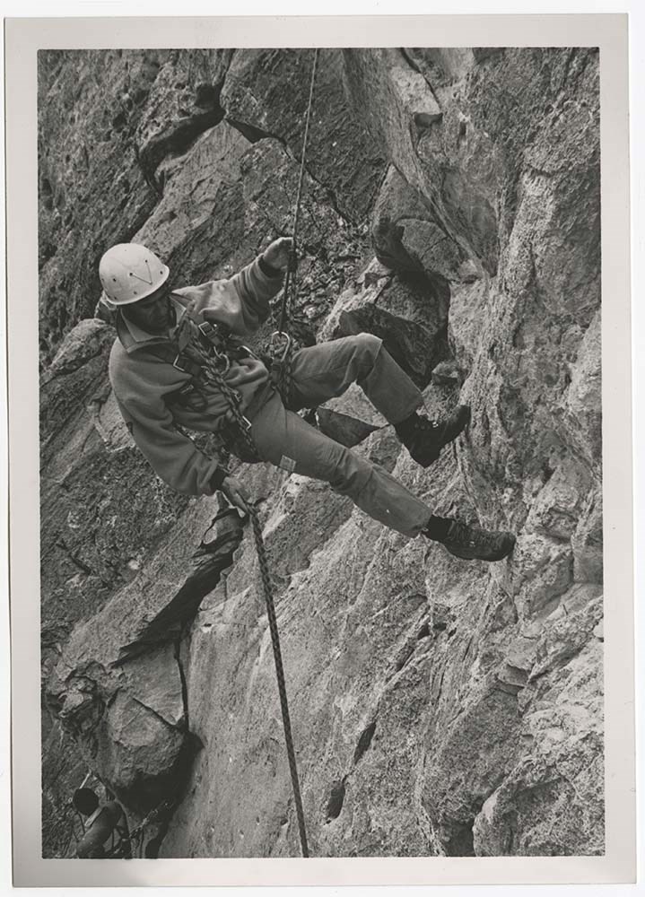
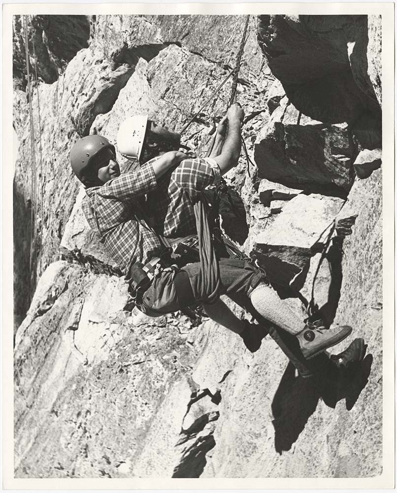
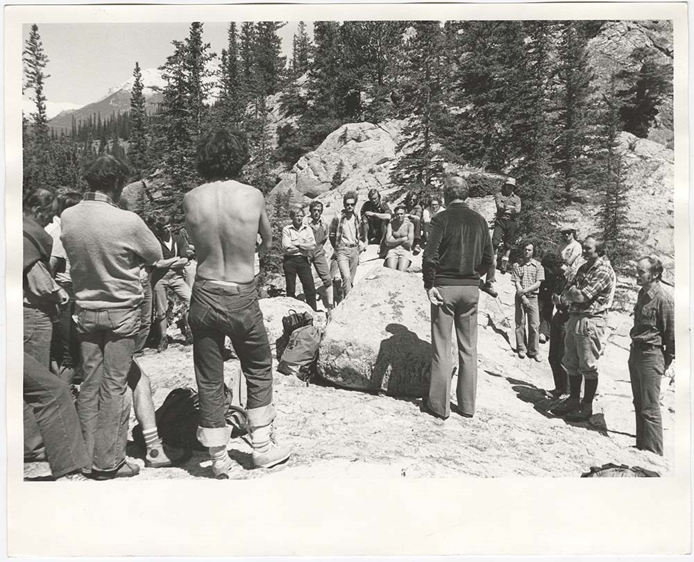
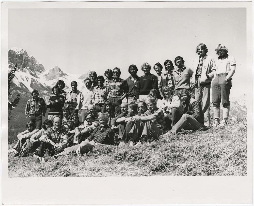
File pertains to 34 b&w prints of the Association of Canadian Mountain Guides training courses and members. Includes shots of potential members participating in training courses [usually on Tunnel Mountain] as well as posed group shots of ACMG members.
34 photographs : col. & b&w ; 25.5 x 20.5 cm or smaller
History / Biographical
See fonds level description
Scope & Content
File pertains to 34 b&w prints of the Association of Canadian Mountain Guides training courses and members. Includes shots of potential members participating in training courses [usually on Tunnel Mountain] as well as posed group shots of ACMG members.
Notes
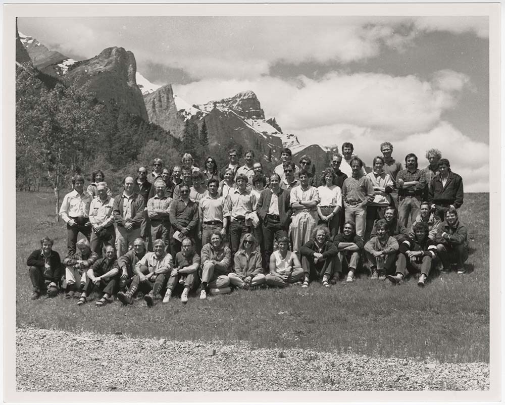
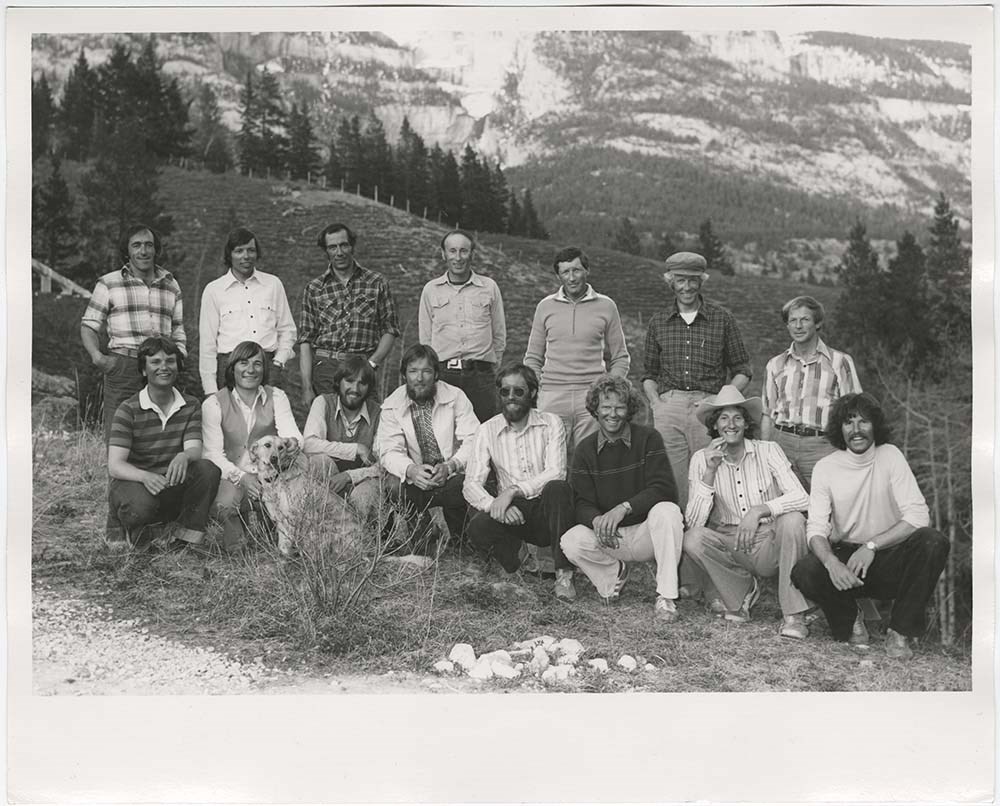
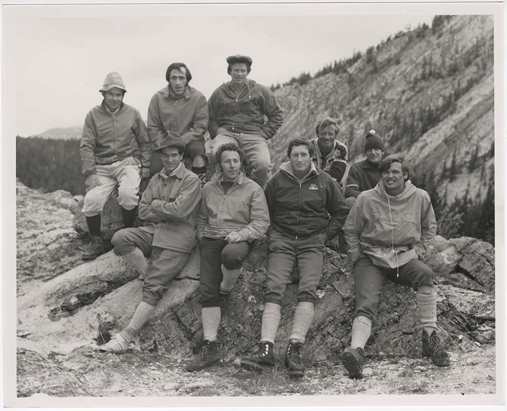
Identities of people in PA - 27 from left to right [back row]: Rüdi Geitsch, Tim Auger, Peter Schlunegger, Bernie Schiesser, Hans Gmoser, [unidentified], Lloyd "Kiwi" Gallagher ; [front row]: [unidentified], [unidentified], Scott Flavelle, Clair Israelson, Dave Cochrane?, [unidentified], Phil Heim, Dan Griffith.
Identities of people in PA - 29, from left to right [back row]: Frank Stark, Rüdi Geitsch, Lloyd "Kiwi" Gallagher ; [front row]: Leo Gullmair, [unidentified], Hans Gmoser, [unidentified], Pierre Lentire?, Sepp Renner.
Identifications provided by Chic Scott
File pertains to 33 b&w negatives of the Association of Canadian Mountain Guides training courses and members. Includes shots of potential members participating in training courses [usually on Tunnel Mountain] as well as posed group shots of ACMG members.
33 photographs : b&w negatives ; 15.2 x 5.8 cm or smaller
History / Biographical
See fonds level description
Scope & Content
File pertains to 33 b&w negatives of the Association of Canadian Mountain Guides training courses and members. Includes shots of potential members participating in training courses [usually on Tunnel Mountain] as well as posed group shots of ACMG members.
File consists of aerial photographs of terrain in British Columbia and Alberta. Includes locations such as Banff National Park and Yoho National Park with images of Glaciers, Lakes, Mountain ranges and tree lines.
File consists of aerial photographs of terrain in British Columbia and Alberta. Includes locations such as Banff National Park and Yoho National Park with images of Glaciers, Lakes, Mountain ranges and tree lines.
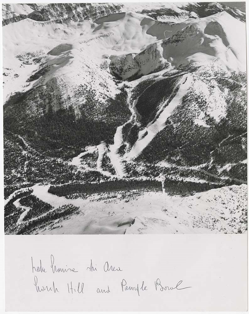
File consists of aerial photographs of terrain in British Columbia and Alberta. Including Banff National Park, Canmore, Kananaskis, Kootenay National Park and Jasper National Park. Images include glaciers, lakes, mountain ranges, forest, highways, and trails.
File consists of aerial photographs of terrain in British Columbia and Alberta. Including Banff National Park, Canmore, Kananaskis, Kootenay National Park and Jasper National Park. Images include glaciers, lakes, mountain ranges, forest, highways, and trails.
File consists of aerial photographs of terrain in British Columbia and Alberta. Includes photographs of Jasper National Park and Banff National Park. Images include glaciers, lakes, mountain ranges, forest, highways, and trails.
File consists of aerial photographs of terrain in British Columbia and Alberta. Includes photographs of Jasper National Park and Banff National Park. Images include glaciers, lakes, mountain ranges, forest, highways, and trails.
File consists of aerial photographs of terrain in Banff National Park, Yoho National Park, Jasper National Park. Images include glaciers, lakes, mountain ranges, forest, highways, and trails.
File consists of aerial photographs of terrain in Banff National Park, Yoho National Park, Jasper National Park. Images include glaciers, lakes, mountain ranges, forest, highways, and trails.
File consists of aerial photographs of terrain in British Columbia and Alberta. Including photographs of Kananaskis, Canmore, Invermere, Yoho National Park.
File consists of aerial photographs of terrain in British Columbia and Alberta. Including photographs of Kananaskis, Canmore, Invermere, Yoho National Park.
File consists of aerial photographs of terrain in British Columbia and Alberta. Including photographs of Mt. Assiniboine Provincial Park, Bugaboos Mountains, Kootenay National Park, Banff National Park, and the Purcell Mountains.
File consists of aerial photographs of terrain in British Columbia and Alberta. Including photographs of Mt. Assiniboine Provincial Park, Bugaboos Mountains, Kootenay National Park, Banff National Park, and the Purcell Mountains.
File consists of photographs compiled by Douglas Leighton for publication. Includes photographs of landscapes, cityscapes, lakes, mountains, hotel, tourists, plants, flowers, waterfalls and glaciers.
File consists of photographs compiled by Douglas Leighton for publication. Includes photographs of landscapes, cityscapes, lakes, mountains, hotel, tourists, plants, flowers, waterfalls and glaciers.
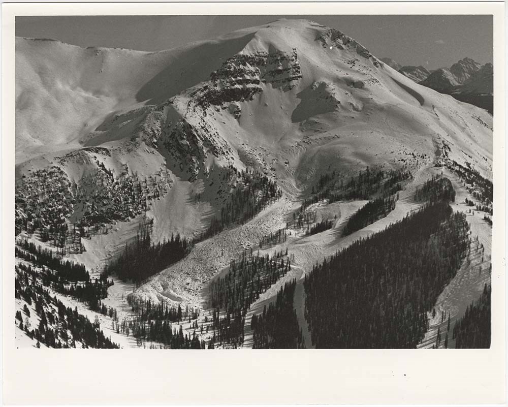
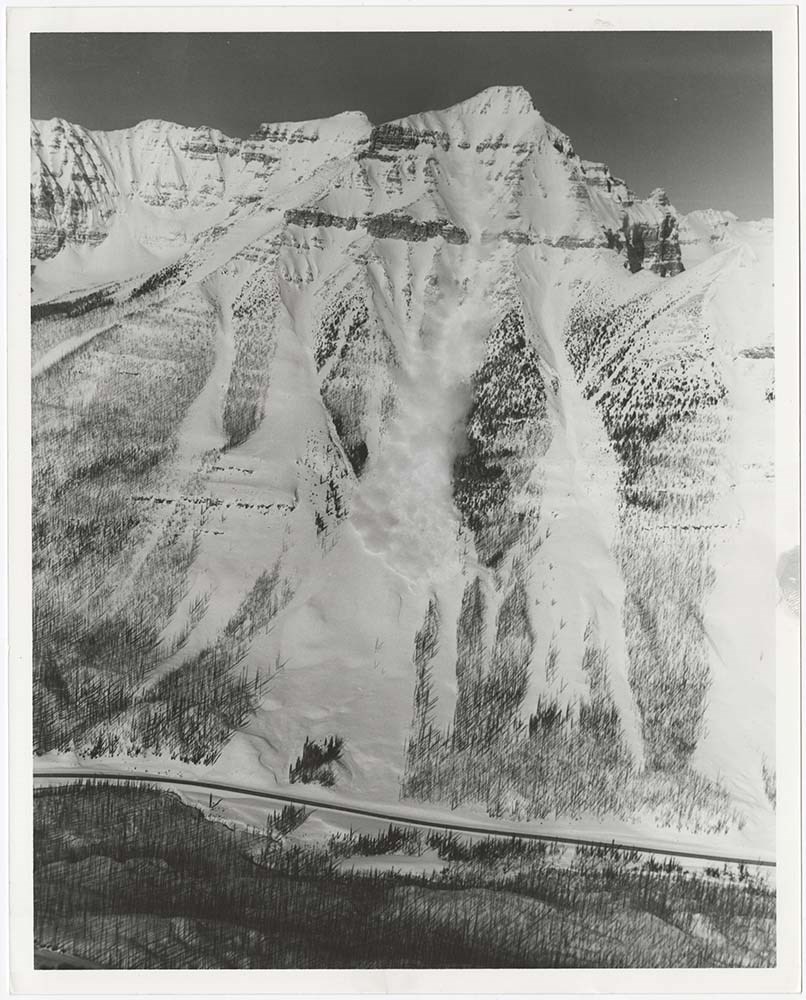
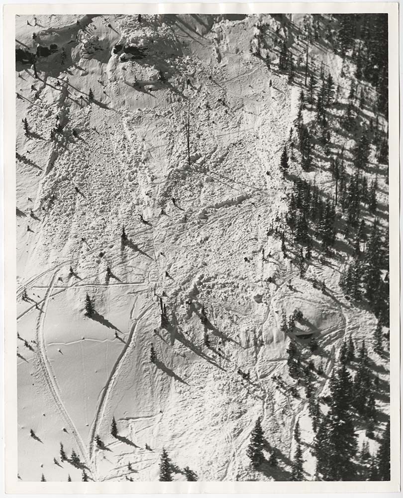
File pertains to 58 b&w prints of various avalanche areas and slides around Banff National Park, mostly focussed along stretches of highways and in and around ski areas, including backcountry ski areas like Assiniboine.
File pertains to 58 b&w prints of various avalanche areas and slides around Banff National Park, mostly focussed along stretches of highways and in and around ski areas, including backcountry ski areas like Assiniboine.
Sub-series of hut registers from the Balfour (Rob Ritchie) Hut produced by the Alpine Club of Canada between 1966 and 2019. Registers include entries from visitors to the huts which pertain to individuals' hiking and climbing trips; details of specific events which occurred while staying at the hut…
According to the Alpine Club of Canada's website:
"The Rob Ritchie Hut, also known as the Balfour Hut, is found on low, rocky hills at the toe of the Vulture Glacier, approximately 28 km northwest of the town of Lake Louise, AB. It is east of Balfour Pass and the Continental divide, just inside the Banff National Park boundary.[...]
The Rob Ritchie Hut, also known as the Balfour Hut, is found on low, rocky hills at the toe of the Vulture Glacier, approximately 28 km northwest of the town of Lake Louise, AB. It is east of Balfour Pass and the Continental divide, just inside the Banff National Park boundary.
This is the half-way mark for the Wapta Traverse and is usually used in conjunction with the other huts in this chain while attempting this classic cross-glacier ski trip. Usual approach is from Bow Hut through the Olive/St. Nicholas Col then down the gentle and pleasant Vulture Glacier to Balfour Pass, where the hut sits on a section of moraine beneath the impressive bulk of Mt. Balfour.
Though most people will spend one night at the R.J. Ritchie (Balfour) Hut before continuing on to Scott Duncan, there is potential for good skiing here, especially on the Diableret Glacier which sits northwest of Mt. Balfour and makes for a fantastic run on a clear day! There is also an optional route to the summit of Mt. Gordon from this hut, which would be an excellent loop trip if combined with the normal route back towards Bow Hut. Use your imagination and some neat trip ideas will present themselves!"
Scope & Content
Sub-series of hut registers from the Balfour (Rob Ritchie) Hut produced by the Alpine Club of Canada between 1966 and 2019. Registers include entries from visitors to the huts which pertain to individuals' hiking and climbing trips; details of specific events which occurred while staying at the hut, wildlife sightings, custodial issues and updates, and related topics.
The sub-series is separated into individual hut registers, arranged by date:
M200 / IV / I / 1: Balfour Hut [Register] [1966-1971]
M200 / IV / I / 2: Balfour Pass Hut [1971-1972]
M200 / IV / I / 3: Balfour Pass Hut Register [1973-1974]
M200 / IV / I / 4: Balfour Pass Hut [register 1974-1982]
M200 / IV / I / 5: "Balfour Hut" [register] Sept. 2, 1982 - Nov. 17, 1989
M200 / IV / I / 6: Balfour Hut Journal Nov. 22, 1989 - Apr. 25, 1997
M200 / IV / I / 7: Balfour Hut Register [1997 -2001]
M200 / IV / I / 8: Balfour Hut Register 2007 - 2015
M200 / IV / I / 9: Balfour Hut register 2011 - 2019
File consists of photographs compiled by Douglas Leighton for publication. Includes photographs of landscapes, lakes, mountains, hotel, tourists, waterfalls and glaciers.
File consists of photographs compiled by Douglas Leighton for publication. Includes photographs of landscapes, lakes, mountains, hotel, tourists, waterfalls and glaciers.
File consists of 90 colour photographs, 15 x 10 cm and 12.5 x 9 cm. File pertains to photographs taken by Dorothy Wardle of places, events, and scenery around Banff and Canmore. For Banff, file documents winter and fall scenery (mountains like Rundle and Cascade, the Bow River, Banff Avenue), wildl…
90 photographs : col. ; 15 x 10 cm and 12.5 x 9 cm
Scope & Content
File consists of 90 colour photographs, 15 x 10 cm and 12.5 x 9 cm. File pertains to photographs taken by Dorothy Wardle of places, events, and scenery around Banff and Canmore. For Banff, file documents winter and fall scenery (mountains like Rundle and Cascade, the Bow River, Banff Avenue), wildlife (elk and a bear), war memorial, Warren house, Baine house, Louis Trono concert in the park in 1995, and the Old Banff Cemetery. For Canmore, file documents the Highland Games in 1994, winter activities (ice sculptures, dog sled races at the Nordic Centre), St. Michael's Place, and a photograph of the valley. File also documents the Whyte Museum of the Canadian Rockies and the cabins (Bill Peyto, Jack Sinclair, and Mather Family) located on the museum's property.
Notes
Old Banff Cemetery photographs include the headstones of: Wardle family, Stephen family, Mary Schaffer Warren, J. Murray Gibbon, and Peter Whyte and Catharine Robb Whyte.
File consists of photographs of the Banff National Park including photographs of Lake Louise, Moraine Lake and area. also included are photographs of Jasper National Park
File consists of photographs of the Banff National Park including photographs of Lake Louise, Moraine Lake and area. also included are photographs of Jasper National Park
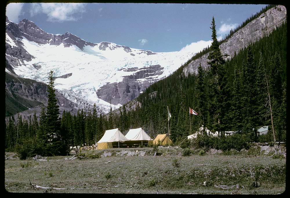
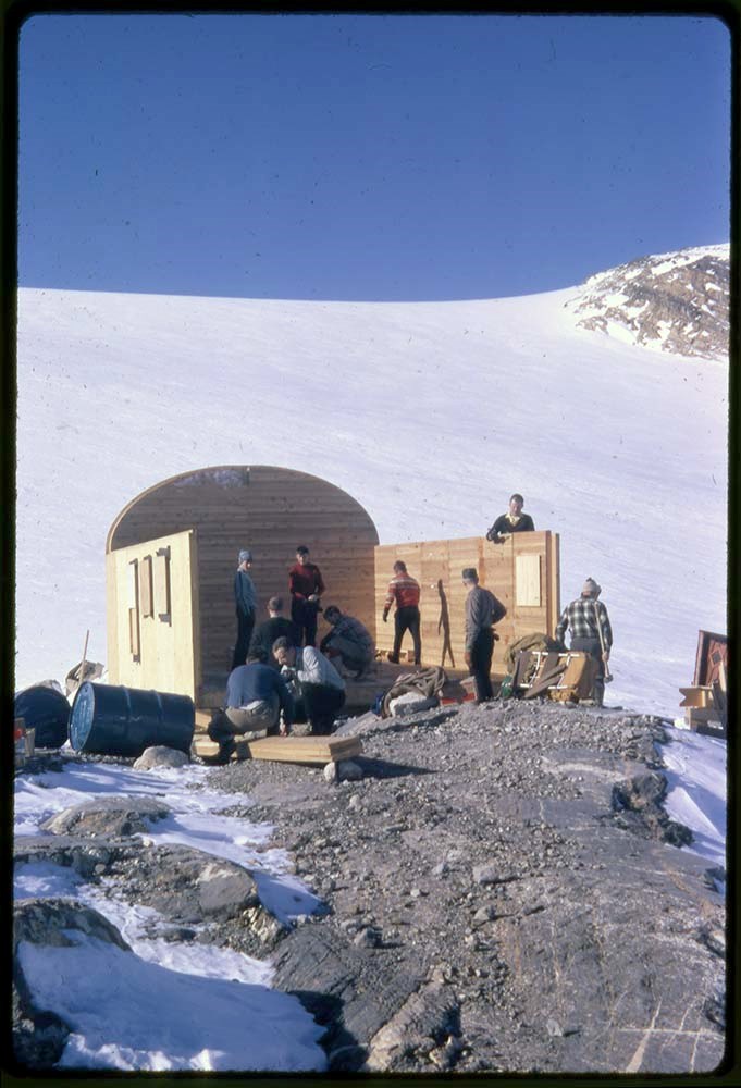
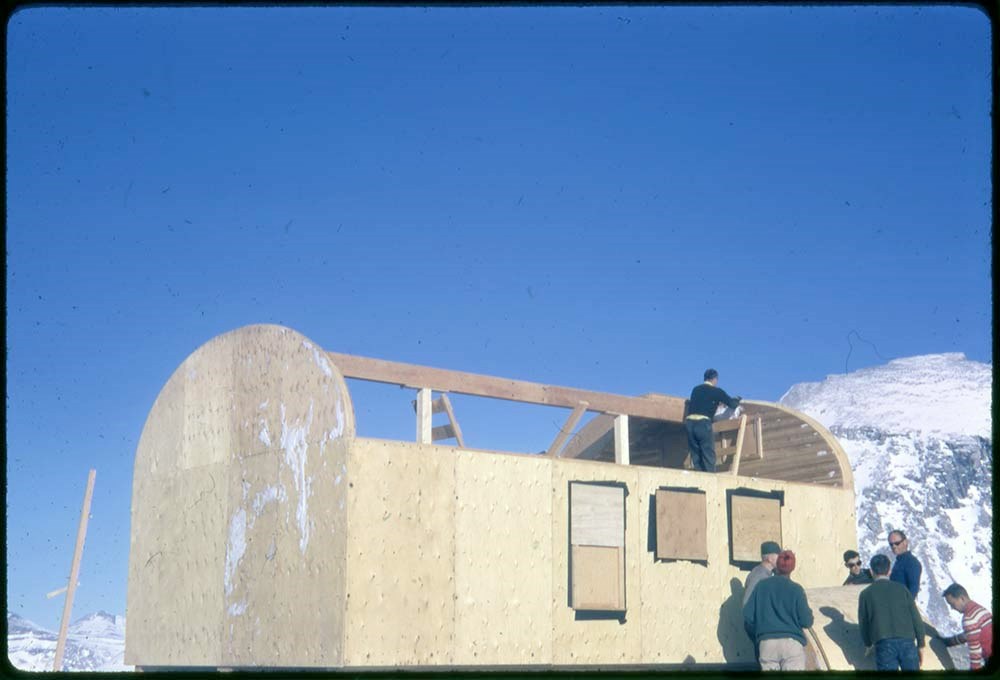
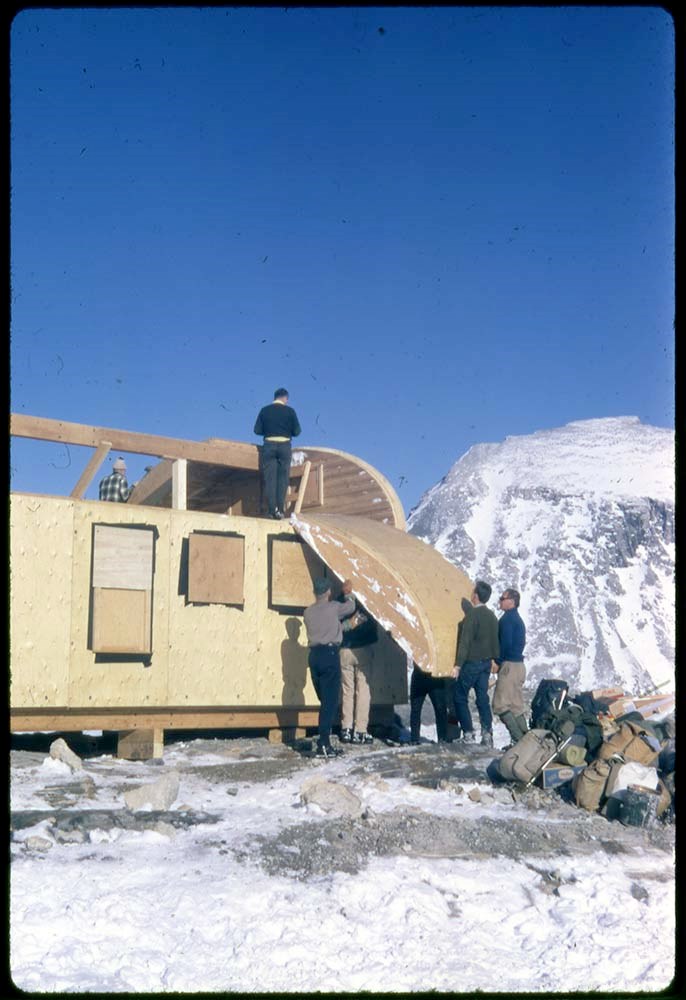
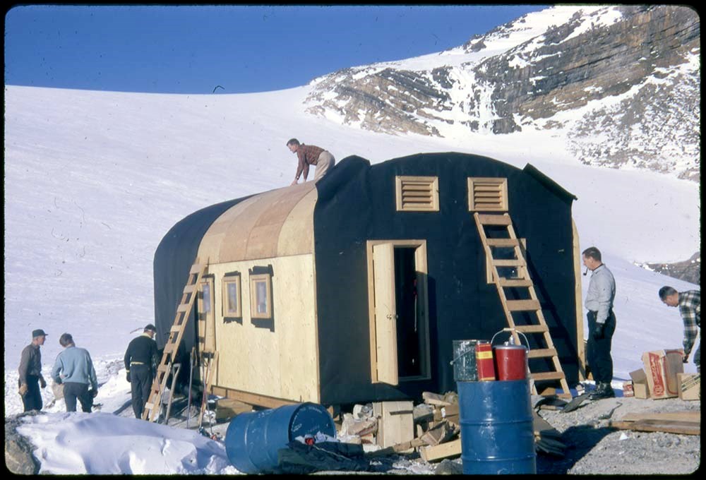
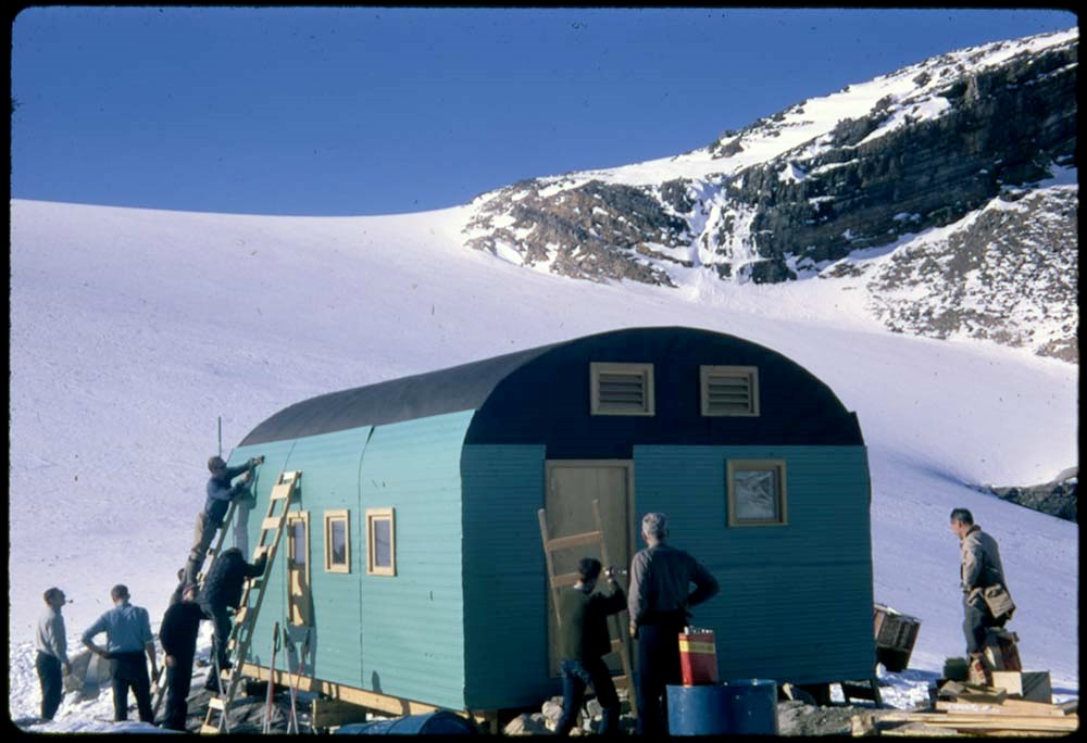
File pertains to climbing, skiing, ski touring, camps, facilities and landscape views in Banff and Yoho National Parks. Includes the construction of Bow Hut.
Alternate title: Banff, Yoho etc from 1950, Gl lake
Date Range
1944-1990
Physical Description
493 photographs : transparencies, 35mm, col
History / Biographical
See fonds level description
Scope & Content
File pertains to climbing, skiing, ski touring, camps, facilities and landscape views in Banff and Yoho National Parks. Includes the construction of Bow Hut.
* Banff climbing, landscape views, Lake Louise area, camps, Skoki area, Mount Whyte - 1954
* Climbing, Skoki Lodge, landscape views - 1955
* Ski touring, Sunshine area, Mount Temple and Skoki areas, landscape views, Skoki Lodge. Includes label: Class III, Marj Bugler - 1956
* Mount Cory, climbing and landscape views - 1957
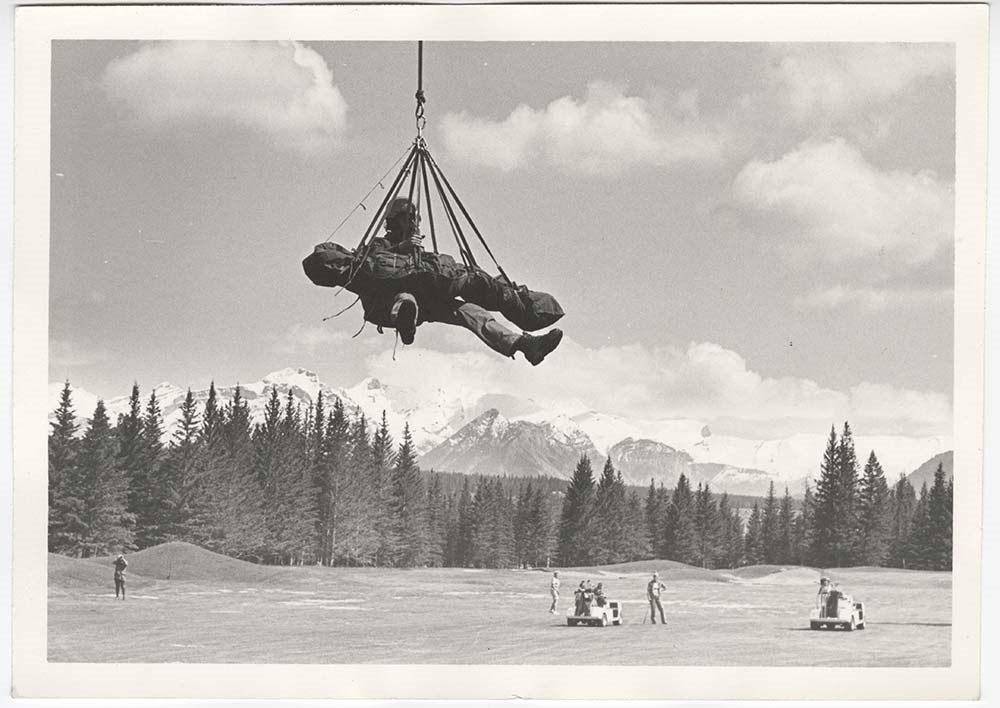
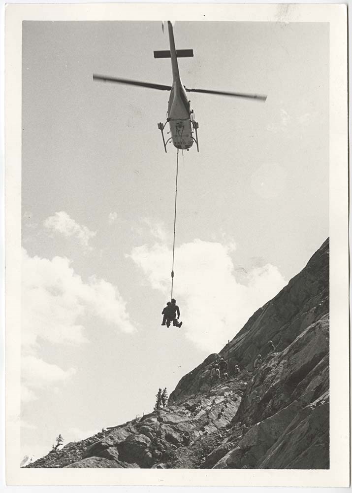
* Mountain rescue - 1957
* Banff area, climbing and landscape views - 1958
* Mount Ishbel, Pilot Mountain, climbing - 1959
* Ice school, snow school, Banff townsite, Yoho area, climbing Mount Cory, Mount Edith, Mount Ishbel, St. Nic - 1960
* Skoki : includes Skoki Lodge, ski touring - [1960?]
* Banff : Vermilion Lakes, Bow Falls, wildlife, Mount Norquay - [1960?]
* Banff : Banff area, Mount Norquay, chairlift - [ca.1960]
* Yoho : group at Stanley Mitchell Hut - [ca.1960]
* Lake Louise - [ca.1960]
* Emerald : Mount Burgess, Kicking Horse River, ski touring at Sunshine
and Mount Temple areas, Mount Norquay ski area, landscape views and people, Peyto Lake, Emerald Lake, Banff-Jasper Highway - [ca.1960]
* Yoho area, Stanley Mitchell Hut, climber, snowman, climbing Mount Cory, Banff views - 1961
* Bow Lake - 1962
* Mount Temple, Banff area - 1963
* GL recce : Glacier Lake area reconnaissance views, horses and ski touring - 1964
* Glacier Lake, Alpine Club of Canada camp, botany, glacier climbing - 1965
* Larch Valley, Moraine Lake, Mount Inglismaldie, Dolomite Peak - 1966
File consists of photographs of the Banff National Park including photographs of Vermillion Lakes, Mount Rundle, Hotels, downtown Banff, Lake Louise, and Cascade Mountain.
File consists of photographs of the Banff National Park including photographs of Vermillion Lakes, Mount Rundle, Hotels, downtown Banff, Lake Louise, and Cascade Mountain.
File consists of photographs of Banff National Park, photographs are of animals in the park, tourists, landscapes, mountains, trains, Bow Falls and the gondola.
File consists of photographs of Banff National Park, photographs are of animals in the park, tourists, landscapes, mountains, trains, Bow Falls and the gondola.