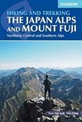
Guidebook to the magnificent Japan Alps, which stretch across the middle of the main island of Honshu, and iconic Mount Fuji. The guide describes nine day-walks and thirteen treks of 2-8 days covering the North, Central and South Alps, as well as the four main routes up Mount Fuji - Japan's highest mountain at 3776m - and a further route on neighbouring Mount Kurodake. The routes visit many of the region's key summits, including several over 3000m. They are graded according to difficulty, although several entail steep ascents and difficult terrain and a few include scrambling and exposure, calling for a sure foot and a good head for heights. Comprehensive step-by-step route descriptions are accompanied by clear mapping. The Japan Alps and Mount Fuji boast a well-developed walking infrastructure, and the routes make use of the many mountain huts and campgrounds, full details of which are given in the guide. Some also include the opportunity to visit a traditional hot-spring bath for a refreshing soak after your hike. You will find all the information you will need to plan a successful walking or trekking holiday, with a wealth of advice on travel, bases, accommodation and facilities. There are additional notes on plants and wildlife, the history of hiking in Japan and safety in the mountains, as well as full mountain-hut listings and a helpful glossary. Inspirational colour photography completes the package, offering a taste of the breathtaking mountain vistas to whet your appetite.
Contents
Introduction
Preparations and practicalities
All about the Japan Alps and Mt. Fuji
The North (Kita) Alps:
Hakuba Area
Tateyama Area
Hotaka Area
Norikura Area
The Central (Chuo) Alps
The South (Minami) Alps:
North Area
South Area
Mt. Fuji
Appendix A - route summary table - walks
Appendix B - route summary table - treks
Appendix C - mountain huts
Appendix D - glossary
Appendix E - useful contacts and further resources
Here, at last, is the essential companion to the eastern part of Canada's national trail. Profiling 30 separate sections, crossing 6 provinces, and traversing more than 900 km of trail, this guide for the adventurous offers a connoisseur's sampling of the finest components of eastern Canada's Trans Canada Trail. (from publisher's website)
What is the longest, most exciting hiking and cycling trail in the world? It can only be The Great Trail. Spanning the entirety of Canada, from the Atlantic to the Pacific to the Arctic Oceans, this improbable route covers 24,000 kilometres.The Best of The Great Trail is the essential companion to this national trail. In volume 2, Michael Haynes completes his two-book set on The Great Trail, leading hikers and cyclists through thirty "must-see" trails of Western Canada in five provinces. (from publisher's website)
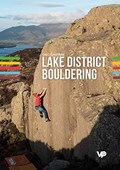
Lake District Bouldering is the long-awaited guide to bouldering in the Lake District National Park. Written by Greg Chapman, one of the pioneers of bouldering in the Lakes, it features almost 3,000 individually numbered problems and dozens of variations and linkups at over 70 venues.Greg created the LakesBloc website in 2003 with the sole aim of providing the very best online information relating to bouldering in the Lakes and surrounding areas. Lake District Bouldering builds on LakesBloc and brings together this huge amount of information in a comprehensive guidebook for the very first time. This guide is split into five sections: South-East, South-West, North-East, North-West and South Lakes Limestone. Featured crags include old-school venues such as the Langdale Boulders, the Bowderstone, Woodwell and Armathwaite; recently developed areas such as the Harter Gold Boulders in Dunnerdale and the Stirrup Stones in Wasdale, and nationally significant spots including Carrock Fell, Kentmere and St Bees Head. Each crag features detailed access and approach information, including GPS coordinates for parking and crag grid references, together with conditions information and local knowledge. Alongside superb action photography, there are over 700 colour photo topos, plus overview and topo maps. A reference section with Ordnance Survey maps is included for selected mountain crags, and a detailed appendix includes everything you need to plan a visit: tourist information centres, cafes and pubs, campsites and accommodation, gear shops, climbing walls, and useful websites. (from Vertebrate Publishing website)
Contents
Introduction -- A legal bit -- Acknowledgements -- What's in and what's not -- Names and first ascents -- Safety statement -- Mountain rescue -- Access -- Behaviour -- Respecting the rocks -- The countryside code -- Stars -- Grades -- Map key -- Useful information -- South Lakes Limestone: Silverdale area; Farleton area; Kendal area; Minor areas -- South-East: Kentmere area; Langdale; Little Langdale & Wrynose; Coniston; Minor areas -- South-West: Furness; Duddon Valley; Eskdale; Wasdale; Minor areas -- North-West: Borrowdale; Ennerdale; West Coast; Minor area -- North-East: Haweswater; Thirlmere; Penrith area; Eden Valley; Minor areas -- Ordnance of survey maps -- Graded list -- Problem index.
Notes
Banff Mountain Film and Book Festival 2019 finalist - long list for "Guidebooks"
Northwestern Ontario hosts some of the oldest and hardest granite cliffs in North America, surrounded by beautiful clean lakes. KENORA ROCK CLIMBS is the most complete guide to this pristine region stretching from the Whiteshell Provincial Park to just east of Kenora, Ontario. Most of the climbing is located less than three hours from Winnipeg and is frequented by climbers for day trips and weekend adventures.This book covers eight main popular areas, over 400 sport, trad, aid, and bouldering routes, useful tips (and less useful tips), original writing, drawings, and maps, sweet photos of a few people who love this as much as we do. This one’s for the gear heads, the noobs, the pebble wrestlers, the crushers, and the dirtbags. (Kenora Rock Climbs website)
You might know about the oppurtunities for skiing in and around the Narvik and Ofoten area. This is the home of Narvik, Riksgränsen, Björkliden and Abisko. The ski resort of Narvik has the best lift-accessed skiing in Scandinavia, while Riksgränsen, right at the border is an international favourite for spring skiing. Around these ski resorts there is a fantastic mountain landscape with a lot of variation in the character of the ski terrain. Many spectacular mountains are only accessible by ski touring, and this is the definitive guide to those. Ski Touring Around Narvik covers 82 mountains and six traverses in Narvik, Skjomen, Ballangen, Efjorden-Tysfjorden, Bogen-Grovfjorden, Gratangen-Lavangen, Hunddalen, Riksgränsen, Björkliden and Abisko. This comprehensive guidebook is written by Mikael Af Ekenstam, resident of Narvik and experienced mountaineer. When Powder Magazine visited Narvik to write this piece about Scandinavia's most spectacular powder paradise, Mikael served as their guide. Several world class photographers have contributed to the book. Ski Touring Around Narvik describes a wealth of routes in a spectacular landscape for ski enthusiasts on both sides of the Norwegian-Swedish border in Northern Scandinavia.The first edition of this guide book was originally published in 2004 in norwegian as Toppturer rundt Narvik - see the norwegian version here. This new and updated version includes aerial photos and customised maps to supplement the route descriptions. (from Fri Flyt website).
Tony Howard rose to fame in 1965 as a member of a group of young climbers from northern England who made the first British ascent of Norway’s Troll Wall; a climb described by Joe Brown as, ‘One of the greatest ever achievements by British rock climbers’. Tony went on to design the modern sit harness, now used universally by every climber in the world. He founded the company Troll Climbing Equipment but never stopped exploring. Quest into the Unknown is his story. Tony has dedicated his life to travelling the world in search of unclimbed rock faces and remote trekking adventures. The scale of his travels is vast: he has visited all of the North African countries, much of the Arab land of the Middle East, the mountainous regions of Scandinavia, Canada and the rocky spine of the Americas, the Himalaya, remote Indian provinces, South East Asia, Madagascar, South Georgia and Antarctica. This book, the last word in adventure travel, takes the reader from Tony’s youth spent developing the crags of the English Peak District, via whaling ships in the Southern Ocean, thousand-mile canoe trips in the Canadian Arctic, living amongst the Bedouin in the rocky mountains of Jordan, to the isolated opium tribes of Thailand. Tony Howard’s Quest into the Unknown is the jaw-dropping account of a life of adventure that is the very definition of true exploration. (from Vertebrate Publishing website)
This collection of stories, articles, reflections and more offers insight into the life of an iconoclastic business leader and itinerant adventurer. Like sitting around the campfire, sharing a bottle of wine while telling stories, Some Stories is an eclectic portrait of a unique life well lived. (from Patagonia website)
Contents
North America Wall, Yosemite Valley -- Cathedral Rocks, Yosemite Valley -- Yosemite Valley, California -- Patagonia -- Doug Tompkins -- Flamingos, Patagonia -- Sandhill cranes, Nebraska -- Fiordo de las Montan~as, Chile -- Headwaters of Lago Inexplorado, Chile -- Bonefishing in the Bahamas -- Hatchery fish being released into San Francisco Bay -- Coastal wolves, British Columbia -- 12,000 young voters, Washington, DC.
Okanagan Bouldering is the comprehensive bouldering guidebook to 1800 problems in 9 locations throughout BC's beautiful Okanagan Valley. From lakeside granite to high elevation gneiss boulder fields, this book is loaded with quality problems to blow the lid off the bouldering in the Okanagan. (from Gneiss Guy Publishing website)