Section I: Maps ; Section II: Descriptive and Statistical Notes and Index
Notes
The HANDY VOLUME ATLAS OF THE WORLD has long enjoyed a large measure of popularity as the most complete and accurate Compendium of Geographical Information of its size published. The evidence of this continued popularity lies in the fact that, since it was first produced under the Editorship of the eminent Geographer, the late Dr. E. G. Ravenstein, no fewer than fourteen large editions have been issued.
In this, the FIFTEENTH EDITION, the present Editor has endeavoured to deserve a continuance of that popularity, by making the new issue of the Atlas a complete SURVEY of POST-WAR GEOGRAPHY, exhibiting, in their natural order, the territorial changes and political changes throughout the World effected by the Peace Treaties and Agreements following the Great War. -- Excerpt from Preface, p. v
This material is presented as originally created; it may contain outdated cultural descriptions and
potentially offensive content.
Read more.
Atlas of the international boundary between the United States and Canada Arctic Ocean to Mount St. Elias to accompany the report of the International Boundary Commission
Joint maps of the International Boundary between United States and Canada along the 141st meridian from the Arctic Ocean to Mt. St. Elias - surveyed and monumented 1907 - 1913 under the convention signed at Washington April 21st 1906
Atlas to accompany "Joint report upon the survey and demarcation of the international boundary between the United States and Canada along the 141st meridian from the Arctic Ocean to Mount St. Elias : in accordance with the provisions of Article IV of the Convention signed at Washington April 21, 1906"
Library - Book (including soft-cover and pamphlets)
Published Date
2018
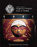
Author
Royal Canadian Geographic Society
Publisher
Ottawa, Ont. : Royal Canadian Geographical Society : National Centre for Truth and Reconciliation : Assembly of First Naitons : Inuit Tapiriit Kanatami : Me´tis National Council : Indspire
Ottawa, Ont. : Royal Canadian Geographical Society : National Centre for Truth and Reconciliation : Assembly of First Naitons : Inuit Tapiriit Kanatami : Me´tis National Council : Indspire
Published Date
2018
Physical Description
4 volumes : illustrations (chiefly color), color maps ; 32 cm
"In this atlas, you will find outstanding reference maps of Indigenous Canada, as well as a section devoted to Truth and Reconciliation, including detailed pages on many aspects of the topic with contemporary and historical photography, maps and more. There's also a glossary of common Indigenous terms."--page [4] of cover volume 1.