Colour: green, purple. Across the bottom and angling up left is grass with trees, three at left and two at right, along the river's edge. The green river comes in from the right side, goes left and then up right side to disappear into the far shore of dark trees. The right shore juts in from that s…
Colour: green, purple. Across the bottom and angling up left is grass with trees, three at left and two at right, along the river's edge. The green river comes in from the right side, goes left and then up right side to disappear into the far shore of dark trees. The right shore juts in from that side, halfway up. In the background across the top are purple mountains. Five peaks meet a green grey sky.
Fonds consists of three series, 3 cm, ca. 1938 - 1943. Series I: Photograph Albums (depicting photographs of the Skyline Hikers and Trail Riders of the Canadian Rockies trips and camps between 1938-1943 including Devil's Gap, Ghost River, Yoho Lake, Mount Assiniboine and views of the Town of Banff,…
207 photographs. -- 1 album (174 photographs : b&w ; 39 x 27.5 cm). -- 18 photographs : b&w ; 17 x 12 cm or smaller. -- 15 photographs : col. slides ; 35 mm
History / Biographical
Allan E. Crawford (1900-1989) of Calgary, Alberta and Prince Rupert, British Columbia, was a member of the Sky Line Trail Hikers from 1937 to 1946 and was the "Official Musician of the Sky Line Trail Hikers" in 1937, 1938, 1940, and 1941.
He also participated in Trail Riders of the Canadian Rockies trips from 1937, 1938, 1940, 1941 as their musician.
Allan E. Crawford appeared on Calgary radio station CFCN "The Voice of the Prairies" on a live weekly program, with the music trio "The Gamboliers" playing the accordian with Eddie Clemens on guitar and J.E. Gerke on vocals. Allan also played the organ, piano and harmonica.
Scope & Content
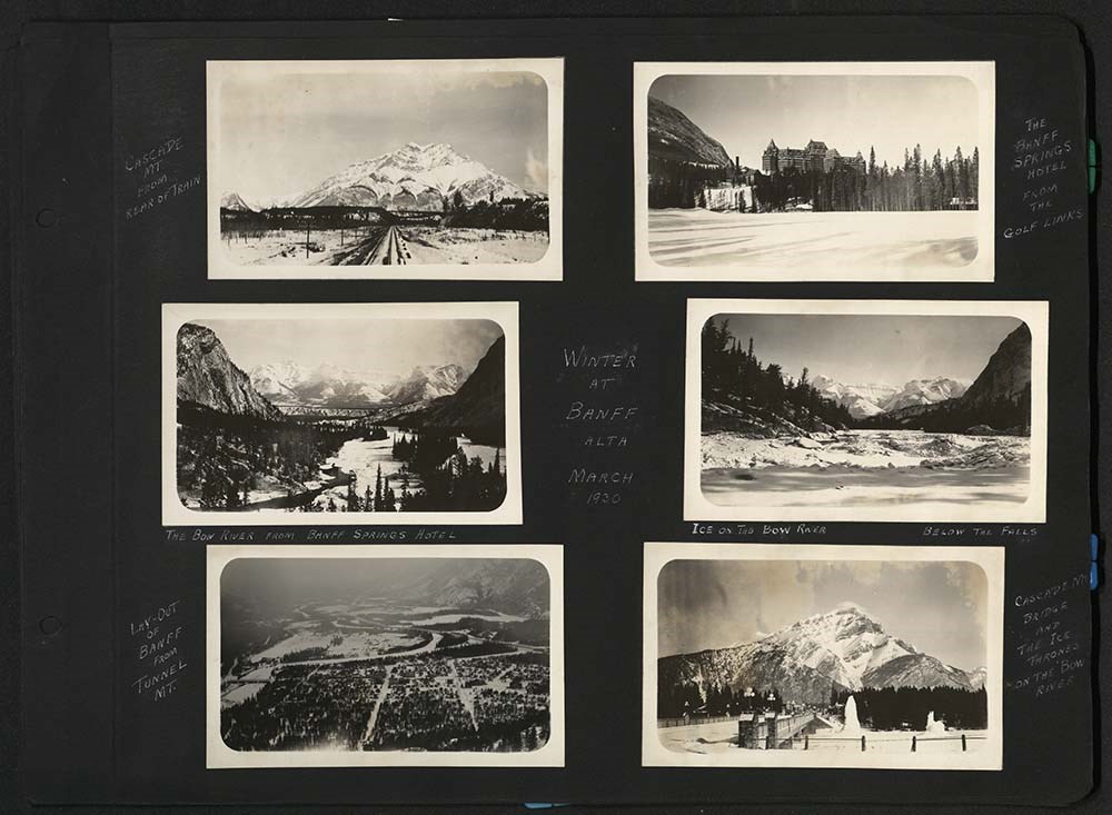
Fonds consists of three series, 3 cm, ca. 1938 - 1943. Series I: Photograph Albums (depicting photographs of the Skyline Hikers and Trail Riders of the Canadian Rockies trips and camps between 1938-1943 including Devil's Gap, Ghost River, Yoho Lake, Mount Assiniboine and views of the Town of Banff, Mount Rundle and the Banff Springs Hotel). Series II: Photograph Prints (depicting photographs of the Skyline Hikers of the Canadian Rockies trips and camps between 1938-1943 including Sunburst Lake and Mount Assiniboine with camp scenes), Series III: Transparencies (depicting the Skyline Hikers camp including Egypt Lake, Lake Louise, Pharoah Peak, Castle Mountain and Scarab Lake in 1940).
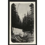
File consists of one photograph album, comprising 174 photographs. Contents pertains to the Skyline Hikers and Trail Riders of the Canadian Rockies trips and camps including 1938 trail ride to Devil's Gap and Ghost River; hike in 1938 to Yoho Lake; trail ride in 1940; hike in 1940; trail ride in 19…
File consists of one photograph album, comprising 174 photographs. Contents pertains to the Skyline Hikers and Trail Riders of the Canadian Rockies trips and camps including 1938 trail ride to Devil's Gap and Ghost River; hike in 1938 to Yoho Lake; trail ride in 1940; hike in 1940; trail ride in 1941 to Mount Assiniboine; as well as views of the Town of Banff, Mount Rundle and the Banff Springs Hotel.
File consists of 18 b&w photographs, 17 x 12 cm or smaller. Contents pertains to the Skyline Hikers of the Canadian Rockies trips and camps, 1938-1943 and specifically Sunburst Lake and Mount Assiniboine with camp scenes of singing, eating, cooking and hiking.
File consists of 18 b&w photographs, 17 x 12 cm or smaller. Contents pertains to the Skyline Hikers of the Canadian Rockies trips and camps, 1938-1943 and specifically Sunburst Lake and Mount Assiniboine with camp scenes of singing, eating, cooking and hiking.
An astounding, unique collection of some of the most stunning mountain landscapes in North America. There is a reason why the Canadian Rockies are some of the most photographed mountains in the world. Rugged peaks encircle glacier-fed lakes, rise up like protective walls around tree-filled valleys, and offer a stunning backdrop to open alpine meadows. They have been photographed from the valley bottoms, from the shores of famous lakes, and from the summits of prominent peaks. They are accessible by vehicle, boat, gondola, skis and hiking boots. But a lucky few have photographed the Rockies from the air. In the most comprehensive collection of aerial photos to date, Aloft: Canadian Rockies Aerial Photography by Paul Zizka gives the reader a unique bird's-eye view of this prized mountain range. From vast glaciers to winding rivers, animal overpasses to lakes that look like brilliant spills of turquoise paint on the landscape, these images provide a rare look at mountains that are as grandiose from the skies as they are from their better-known vantage points.
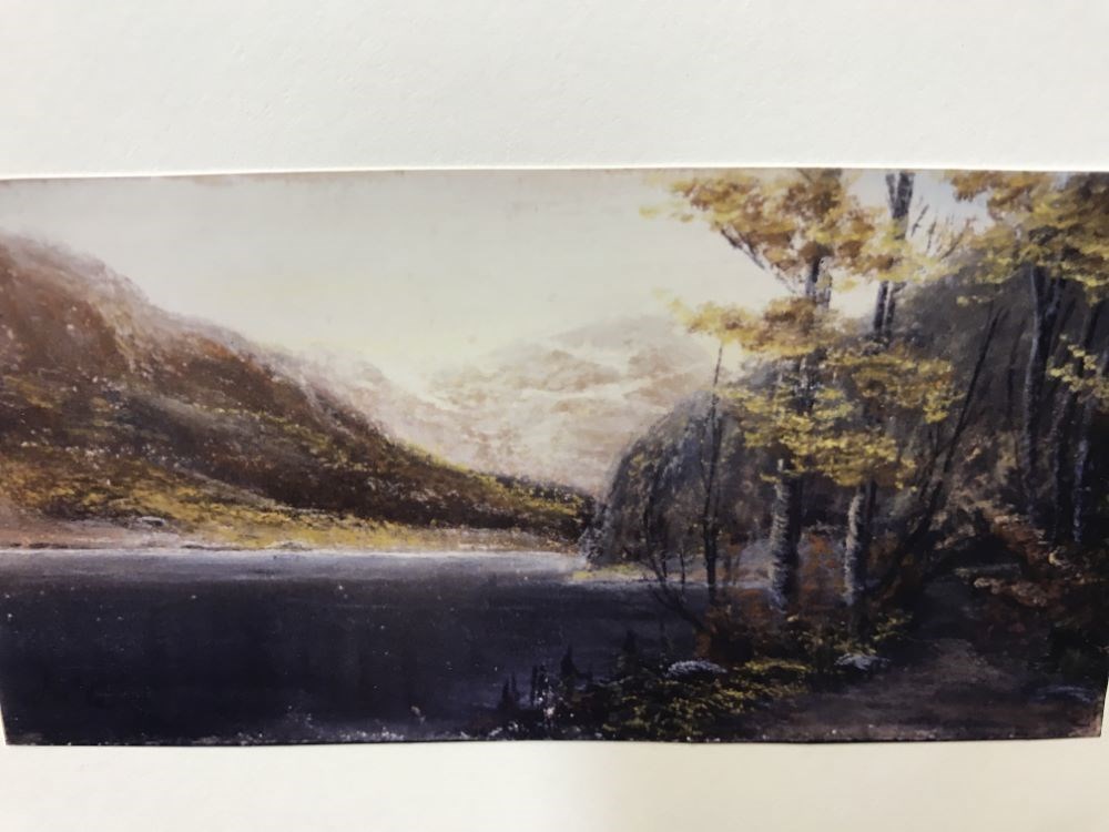
View of Lake Louise from the west side of the lake. In the bottom right corner is a path that leads to a treed area. The trees’ leaves are yellow. A rocky outcrop juts out into the lake. The east bank of the lake is visible on the left side of the image. The lake is dark grey/brown and extends…
View of Lake Louise from the west side of the lake. In the bottom right corner is a path that leads to a treed area. The trees’ leaves are yellow. A rocky outcrop juts out into the lake. The east bank of the lake is visible on the left side of the image. The lake is dark grey/brown and extends out from the bottom left corner. Mt. Lefroy is seen just past the rocky outcrop in the centre of the image. The sky is white and yellow. The entire drawing is quite dark in tones of yellow and brown.