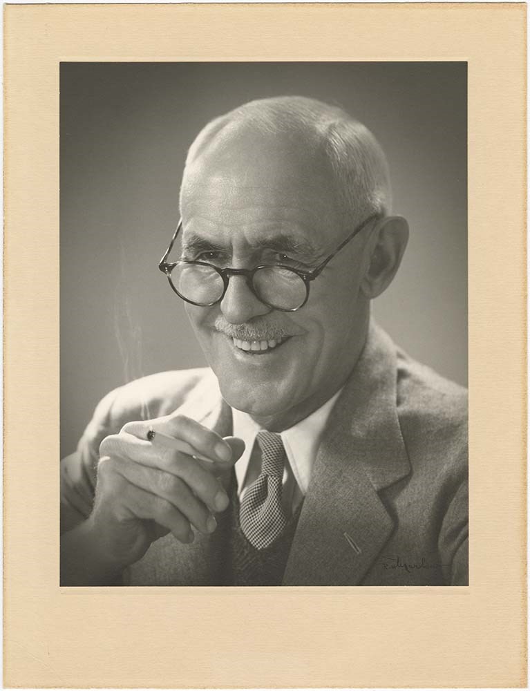
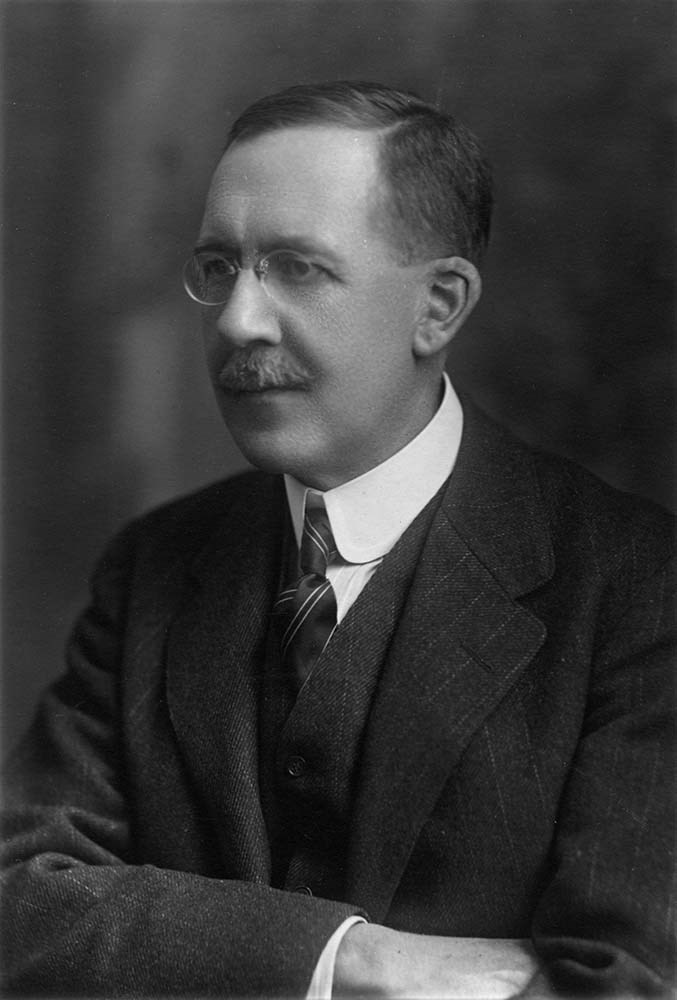
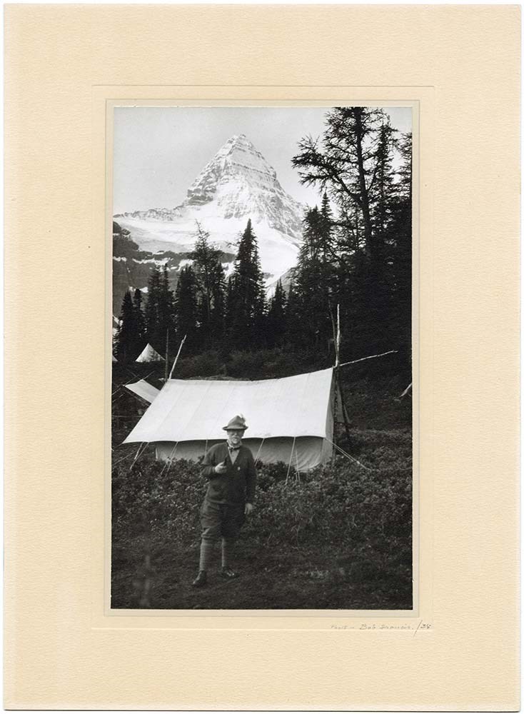
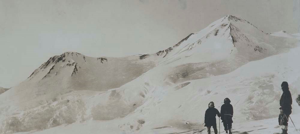
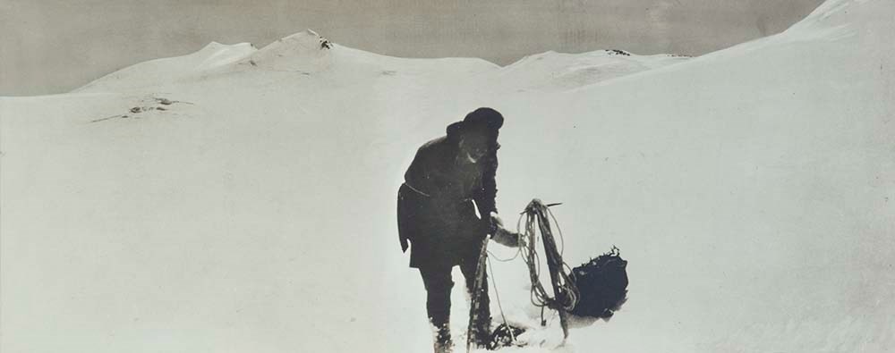
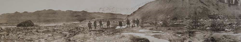
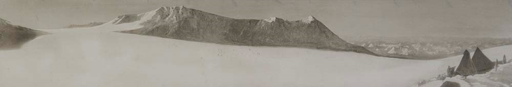
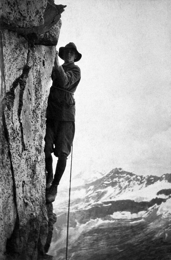
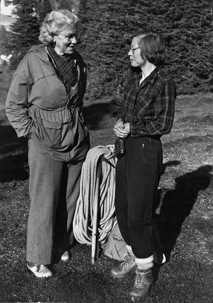
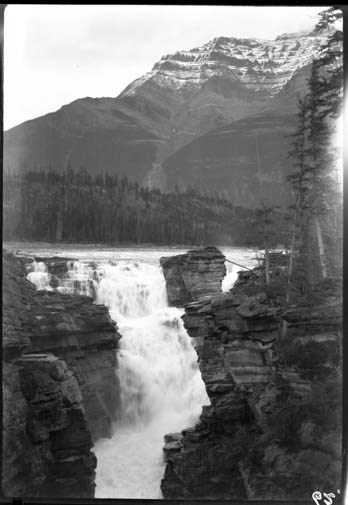
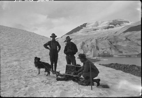
Display photographs consists of photographs selected and numbered by the ACC for display in clubhouses, huts and other locations. Photographic subjects include mountain peaks, landscapes and scenery, both regional and international; mountaineering and alpine recreation; camps and expeditions; flor…
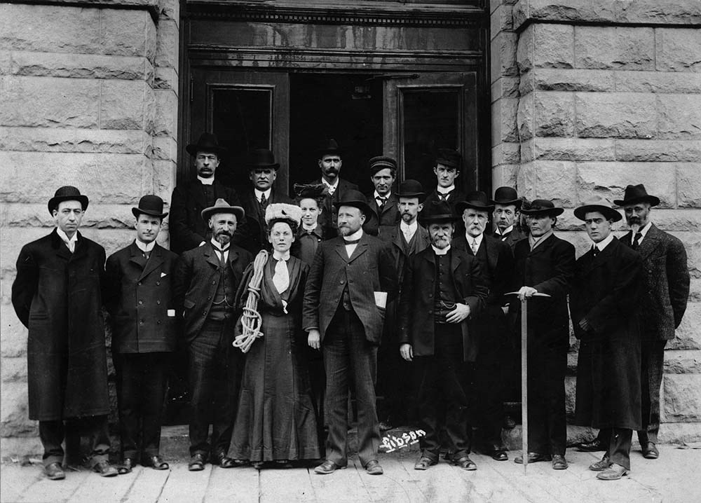
Display photographs consists of photographs selected and numbered by the ACC for display in clubhouses, huts and other locations. Photographic subjects include mountain peaks, landscapes and scenery, both regional and international; mountaineering and alpine recreation; camps and expeditions; flora and fauna; clubhouse views; and portraits of mountaineers, alpine club members, executive officers and prominent personalities. Also includes a group photograph of the 1906 founding meeting of the Alpine Club of Canada in Winnipeg (ACOOP/77)
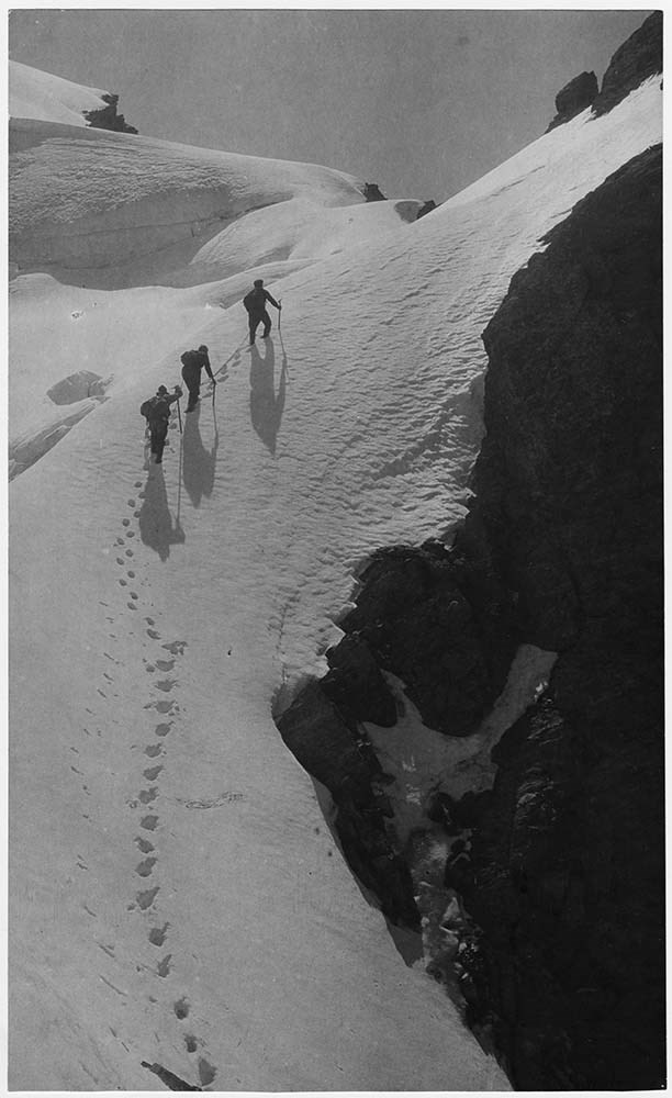
Included are ca.180 photographs which were submitted to the ACC though various photographic competitions (AC 00P / 11, 21, 29, 30, 32, 36, 41, 55 - 57, 63, 76, 109, 111, 202, 223, 230, 240, 244, 284 - 443).
A. T. Wiebrecht AC00P/223,353-366,373-379,382-387,397,400;
Walter Wilcox AC00P/20,130,136,154,255-257;
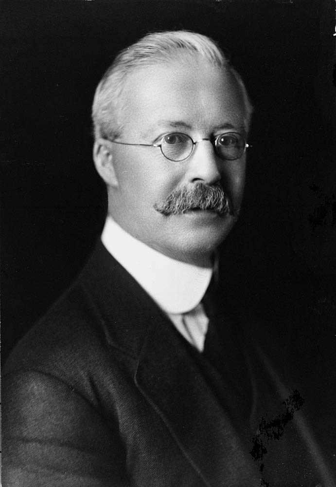
A. O. Wheeler AC00P/207,208,212,213;
LIST OF SUBJECTS :
Philip Stanley Abbot AC00P/245;
L. S. Amery AC00P/206,222;
F. C. Bell AC00P/87;
Cora Johnstone Best AC00P/104;
John F. Brett AC00P/96;
A. P. Coleman AC00P/82;
J. H. Cuntz AC00P/116;
Edward VII AC00P/203;
Charles E. Fay AC00P/69;
Sandford Fleming AC00P/250;
W. W. Foster AC00P/76,89;
Rex Gibson AC00P/75,90;
H. A. V. Green AC00P/92;
C. Hasler AC00P/134;
James Hector AC00P/93;
J. W. A. Hickson AC00P/86;
John Hunter AC00P/264;
Judas Hunter AC00P/238;
Enos Hunter AC00P/239;
Stanley L. Jones AC00P/242;
Lino Lacedelli AC00P/268;
Ben Lomond AC00P/411;
C. H. Mitchell AC00P/79;
John Muir AC00P/66;
A. H. MacCarthy AC00P/70,76;
Leonard H. Marvin;
S. H. Mitchell AC00P/84,235;
T. B. Moffat AC00P/83;
Don Munday AC00P/74;
Phyl Munday AC00P/418;
Tenzing Norgay AC00P/72;
James Outram AC00P/80;
J. D. Patterson AC00P/98;
Elfreda Pigou AC00P/418;
H. E. Sampson AC00P/97;
Benjamin Frank Seaver AC00P/110,115?,116,243;
A. S. Sibbald AC00P/95;
W. E. Stone AC00P/73;
W. R. Tweedy AC00P/81;
Sidney R. Vallance AC00P/91;
Frank N. Waterman AC00P/237;
C. G. Wates AC00P/94;
A. O. Wheeler AC00P/206;
E. O. Wheeler AC00P/71,85;
Hector Wheeler AC00P/247;
Edward Whymper AC00P/93,251;
Walter Wilcox AC00P/264;
Tom Wilson AC00P/236,264;
T. Fraser, L.O. Armstrong, Tom Martin, W. H. Bedford, Alex Gordon; Jean Parker, Stanley Wills, Stanley Mitchell, L. Q. Coleman; J. W. Kelly, W. J. Taylor, A. O. Wheeler, Elizabeth Parker, E. A. Haggan, J. C. Herdman, A. P. Coleman, Dean Paget, William Brewster ACOOP/77
Canadian Passport July 15, 1983-July 15, 1988
Canadian Passport June 30, 1988- June 30, 1993
Canadian Passport April 6, 1993-April 6, 1998
Canadian Passport Feb 18, 1998-Feb 18, 2003
Photocopy of Johann Wolfgang Gmoser’s Canadian Passport Jan 28, 2003-2008.
Photocopy of Johann Wolfgang Gmoser’s Austrian Passport February 3, 2003-2013
Photocopy of passport? From an individual born in 1880.
Folder 1
Map on heavy paper, wrapped in plastic. “A Reconnaissance Topographic Map Suveyed and edited by Bradford Washburn” printed in Bern, Switzerland. Centred on Mt. McKinley.- From 7361.
Palliser- Kananaskis Area British Columbia and Alberta- Publication No. 1962- Reprinted by the Surveys and Mapping Branch, Department of Mines and Technical Surveys, Ottawa.
Mistaya British Columbia and Alberta- Compiled, drawn and printed at the office of the Surveyor General, Ottawa, 1931. Reprinted with corrections at the Surveys and Mapping Branch, Ottawa, 1950. National Topographic Series.
Yoho British Columbia and Alberta- Compiled, drawn and printed at the office of the Surveyor General, Ottawa, 1932. Reprinted with corrections at the Surveys and Mapping Branch, Ottawa, 1952. National Topographic Series. Price 25 cents.
Invermere British Columbia Kootenay Land District- National Topographic System- First Status Edition compiled and produced by the Geographic Division, Surveys, and Mapping Branch, Dept. of Lands, Forests and Water Resources, Victoria, BC 1964-65- annotated
Beaton British Columbia Kootenay Land District- National Topographic System- First Status Edition compiled and produced by the Geographic Division, Surveys, and Mapping Branch, Dept. of Lands, Forests and Water Resources, Victoria, BC 1964-66- annotated
Lardeau British Columbia Kootenay Land District- National Topographic System- First Status Edition compiled and produced by the Geographic Division, Surveys, and Mapping Branch, Dept. of Lands, Forests and Water Resources, Victoria, BC 1963- annotated
Mount McKinley Alaska, Published by the Museum of Science, Boston, Mass, USA and the Swiss Foundation for Alpine Research, Zurich. 1960.
Centennial Range Yukon Territory- M.C.R. 7 Edition 1- Produced and printed 1967 by the Surveys and Mapping Branch, Department of Energy, Mines and Resources- maps printed in 1961-62- annotated
British Columbia Land Recording Dists.- Land Commissioner’s Offices- Department of Lands and Forests- first published 1957- Updated Nov. 1, 1960.
Master Site Plan Bugaboo Creek Lodge Project number 6844- June 18, 1973- Cohos Delesalle & Evamy.
Folder 2
Boundary Between Alberta and BC- Athabasca Pass- Sheet No. 27A – annotated- centered on Jasper Park
Boundary Between Alberta and BC-All below Wheeler Maps (by hand) used for the Great Divide as per Chic-no topographical maps used for both Hans and similar maps were used by Chic bottom rip taped- Sheet No. 20- Drawn and printed by the Topographical Survey of Canada, Ottawa - centered on Clearwater forest and Lyell Icefield at bottom right
Boundary Between Alberta and BC- Sheet No. 15- Drawn and printed at the Surveyor General’s Office, Ottawa, Canada- centered on Rocky Mountains Park
Boundary Between Alberta and BC - Sheet No. 19- Drawn and printed at the Surveyor General’s Office, Ottawa, Canada- centered on centered on Clearwater Forest with Mt. Alan Campbell at bottom
Boundary Between Alberta and BC- Sheet No. 25- annotated- Drawn and printed by the Topographical Survey of Canada, Ottawa - centered on Jasper Park with Chisel Peak at bottom
Boundary Between Alberta and BC- Sheet No. 19- dirt and annotated- revised 1925- drawn and printed by the Topographical Survey of Canada, Ottawa- centered on Clearwater and Push Pass W.
Boundary Between Alberta and BC- annotated- Sheet 16- revised 1925- drawn and printed by the Topographical Survey of Canada, Ottawa- centered on Yoho Park and Rocky Mountains Park
Steele Glacier- Topographical Survey 1967 Arial Photography 1951
Mount St. Elias Canada- United State of America- Produced and Printed by the Surveys and Mapping Branch, Department of Mines and Technical Surveys 1962 from air photographs taken in 1951 and 1956- annotated
Woolsey Glacier- Revelstoke National Park British Columbia – Printed by the Surveys and Mapping Branch Department of Energy, Mines and Resources- 1967
Windermere Kootenay District- Map 165A Issued 1918- Reprinted by the Surveys and Mapping Branch, Department of Mines and Technical Surveys, Ottawa.
Folder 3
Boundary Between Alberta and BC- Sheet No. 20- heavily annotated- revised 1925- drawn and printed by the Topographical Survey of Canada, Ottawa- centered on Clearwater Forest, Saskatchewan Glacier at top left
Boundary Between Alberta and BC- Sheet No. 18- heavily ripped- annotated - notes on back- revised 1925- drawn and printed by the Topographical Survey of Canada, Ottawa- centered on Clearwater Forest, Mt Mummery at bottom
Boundary Between Alberta and BC- Sheet No. 17 (in pencil “A and B”)- annotated - heavily ripped- drawn and printed at the Surveyor Generals’ Office- centered on Clearwater Forest and Yoho Park
Boundary Between Alberta and BC- Sheet No. 26- annotated- revised 1925- drawn and printed by the Topographical Survey of Canada, Ottawa- centered on Jasper Park and Icefields
Boundary Between Alberta and BC- Sheet No. 17- revised 1925- drawn and printed by the Topographical Survey of Canada, Ottawa- centered on Clearwater Forest and Yoho Park
Boundary Between Alberta and BC- Sheet No. 28- stained- centered on Jasper Park
Boundary Between Alberta and BC- Sheet No. 24- annotated- revised edition, 1925- drawn and printed by the Topographical Survey of Canada, Ottawa- centered on Jasper Park
Boundary Between Alberta and BC- Sheet No. 16- annotated- revised 1925- drawn and printed by the Topographical Survey of Canada, Ottawa- centered on Yoho and Rocky Mountains Park
Interprovincial Boundary Commission Boundary Between Alberta and British Columbia. Revised edition 1925 drawn and printed by the Topographical Survey of Canada, Ottawa. Sheet No. 27. Following maps are from accession 7877.
Interprovincial Boundary Commission Boundary Between Alberta and British Columbia. Surveyed 1920. Drawn and printed by the Topographical Survey of Canada, Ottawa. Sheet No. 26.
Interprovincial Boundary Commission Boundary Between Alberta and British Columbia. Surveyed 1920, 1921. Drawn and printed by the Topographical Survey of Canada, Ottawa. Sheet No. 25.
Interprovincial Boundary Commission Boundary Between Alberta and British Columbia. Surveyed 1919, 1921. Drawn and printed by the Topographical Survey of Canada, Ottawa. Sheet No. 24.
Interprovincial Boundary Commission Boundary Between Alberta and British Columbia. Revised edition 1925 drawn and printed by the Topographical Survey of Canada, Ottawa. Sheet No. 21.
Interprovincial Boundary Commission Boundary Between Alberta and British Columbia. Revised edition 1925 drawn and printed by the Topographical Survey of Canada, Ottawa. Sheet No. 18.
Interprovincial Boundary Commission Boundary Between Alberta and British Columbia. Surveyed 1913. Drawn and printed by the Topographical Survey of Canada, Ottawa. Sheet No. 13 A.
Interprovincial Boundary Commission Boundary Between Alberta and British Columbia. Surveyed 1916. Drawn and printed by the Topographical Survey of Canada, Ottawa. Sheet No. 12 A.
Interprovincial Boundary Commission Boundary Between Alberta and British Columbia. Surveyed 1916. Drawn and printed by the Topographical Survey of Canada, Ottawa. Sheet No. 11.
Interprovincial Boundary Commission Boundary Between Alberta and British Columbia. Surveyed 1916. Drawn and printed by the Topographical Survey of Canada, Ottawa. Sheet No. 10.
Interprovincial Boundary Commission Boundary Between Alberta and British Columbia. Surveyed 1916. Drawn and printed by the Topographical Survey of Canada, Ottawa. Sheet No. 9.
Interprovincial Boundary Commission Boundary Between Alberta and British Columbia. Surveyed 1916. Drawn and printed by the Topographical Survey of Canada, Ottawa. Sheet No. 8.
Interprovincial Boundary Commission Boundary Between Alberta and British Columbia. Surveyed 1916. Drawn and printed by the Topographical Survey of Canada, Ottawa. Sheet No. 6.
Interprovincial Boundary Commission Boundary Between Alberta and British Columbia. Surveyed 1915. Drawn and printed by the Topographical Survey of Canada, Ottawa. Sheet No. 5.
Interprovincial Boundary Commission Boundary Between Alberta and British Columbia. Surveyed 1914. Drawn and printed by the Topographical Survey of Canada, Ottawa. Sheet No. 4.
Interprovincial Boundary Commission Boundary Between Alberta and British Columbia. Surveyed 1922. Drawn and printed by the Topographical Survey of Canada, Ottawa. Sheet No. 31.
Interprovincial Boundary Commission Boundary Between Alberta and British Columbia. Surveyed 1922, 1924. Drawn and printed by the Topographical Survey of Canada, Ottawa. Sheet No. 30.
Interprovincial Boundary Commission Boundary Between Alberta and British Columbia. Surveyed 1917. Drawn and printed by the Topographical Survey of Canada, Ottawa. Sheet No. 29.