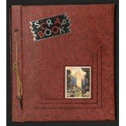
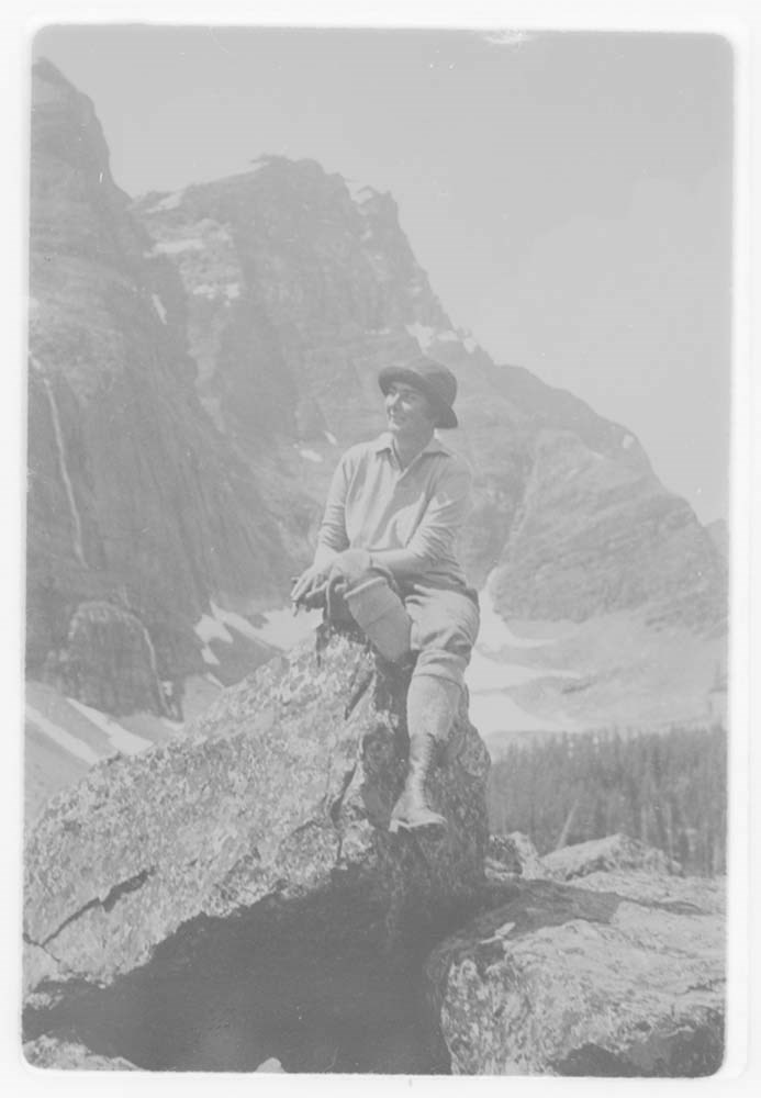
Album dates to 1947- 1951. Album measures as 35.5 x 28.5 cm, it is blue with “Photographs” embossed in gold, red stains on front. Images relate to skiing, possibly family, mountains, some postcards with writing on back, bike trips.
Album dates to 1947- 1951. Album measures as 35.5 x 28.5 cm, it is blue with “Photographs” embossed in gold, red stains on front. Images relate to skiing, possibly family, mountains, some postcards with writing on back, bike trips.
The pictures are tipped in, mounted on black construction paper, some images missing, several pages have captions and dates written in German, images of varying sizes, many 9.5 x 7 cm.
File consists of a scrapbook of newspaper clippings pertaining to the life and career of Andy Russell. Also includes an invitation presented to Russell from the Winnipeg Game and Fish Association and newspaper clippings pertaining to Cleo Mowers' career.
3 cm of textual records (28 pages ; 31.5 x 35.5 cm)
History / Biographical
See fonds level description.
Scope & Content
File consists of a scrapbook of newspaper clippings pertaining to the life and career of Andy Russell. Also includes an invitation presented to Russell from the Winnipeg Game and Fish Association and newspaper clippings pertaining to Cleo Mowers' career.
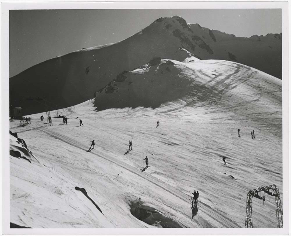
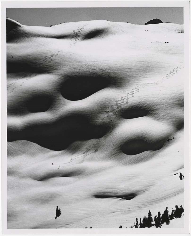
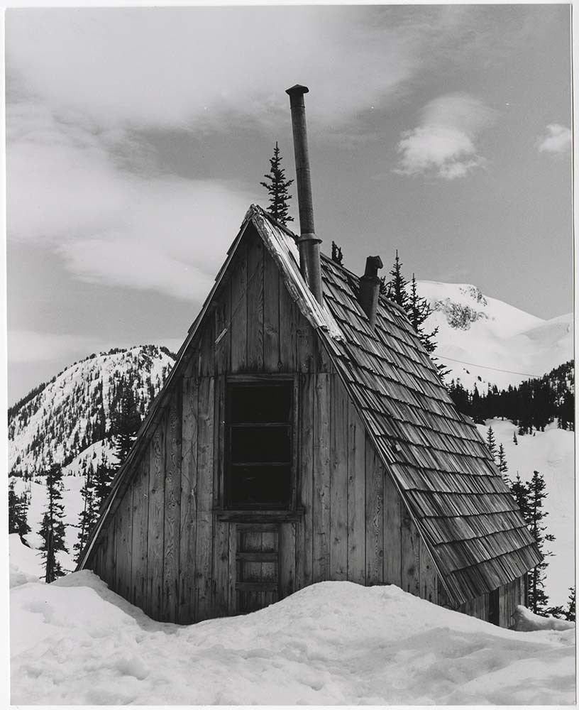
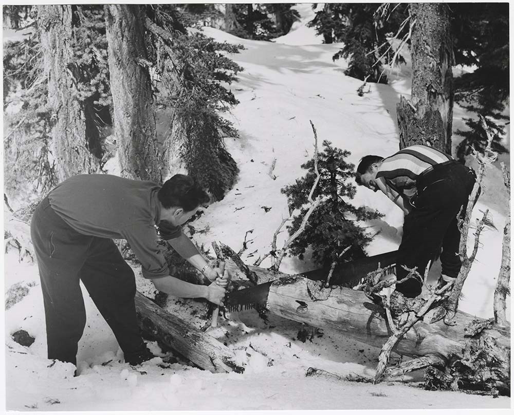
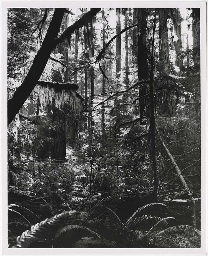
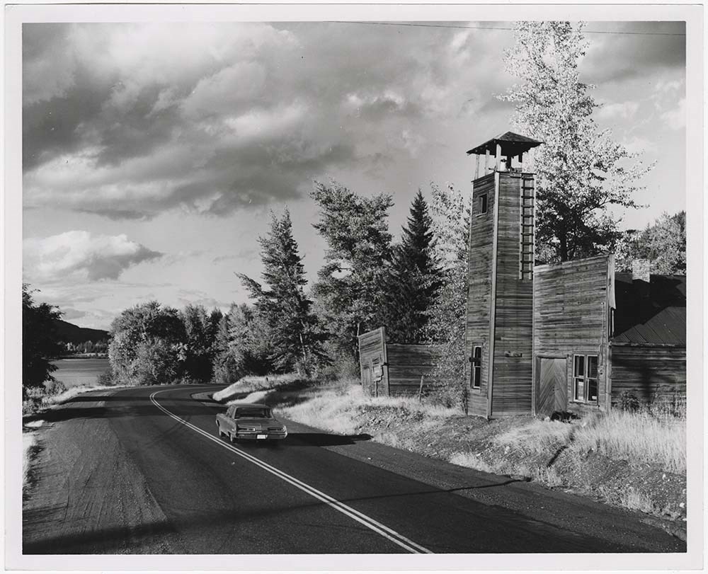
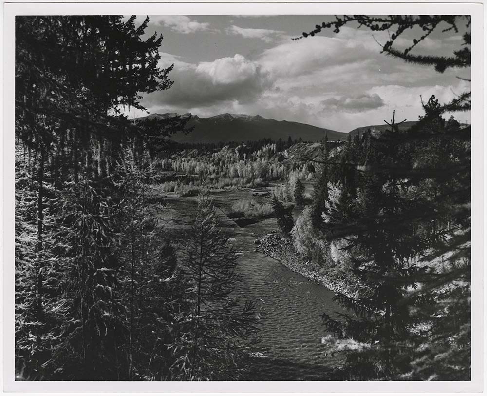
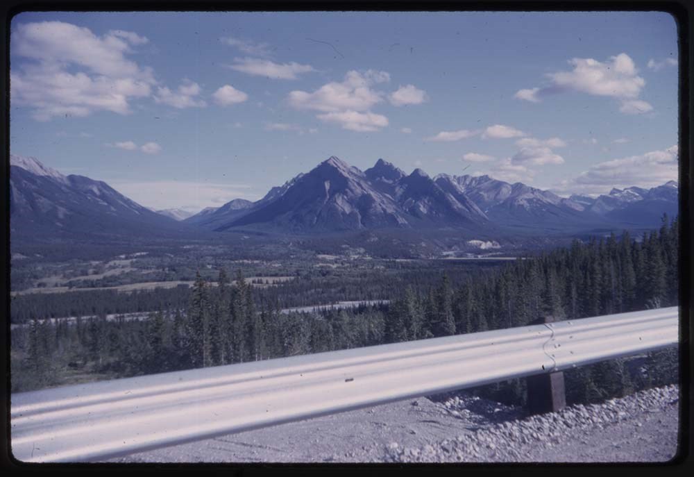
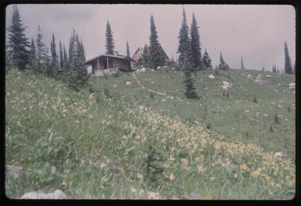
File pertains to 52 b&w prints of various scenic views around British Columbia. Includes views overlooking towns, skiing, beaches, A-frame cabins, highways, rivers, portraits, and the inner harbour & Empress Hotel in Victoria.
File pertains to 52 b&w prints of various scenic views around British Columbia. Includes views overlooking towns, skiing, beaches, A-frame cabins, highways, rivers, portraits, and the inner harbour & Empress Hotel in Victoria.
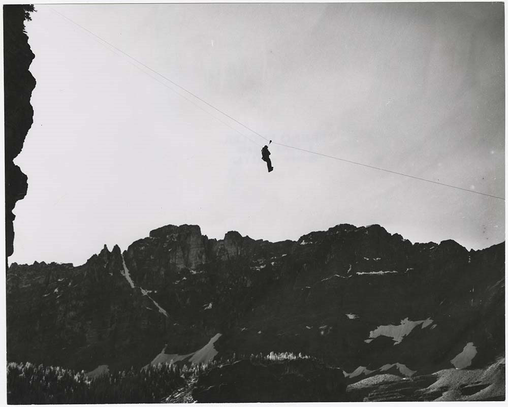
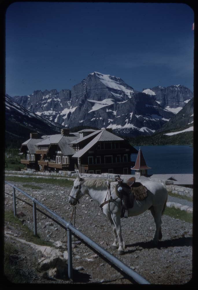
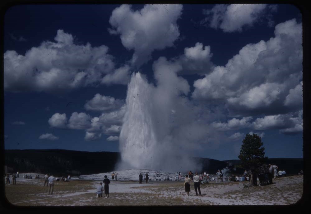
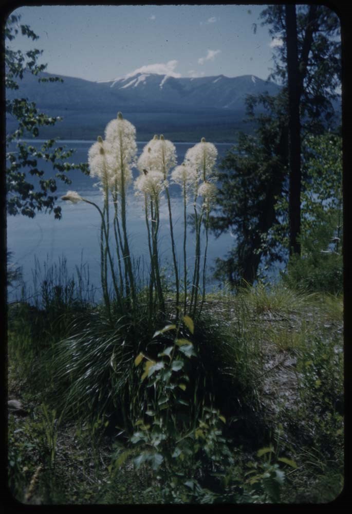
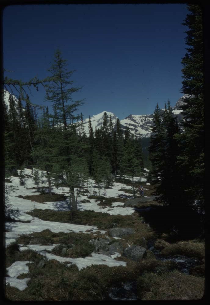
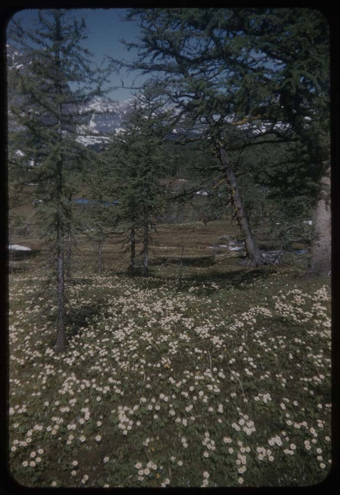
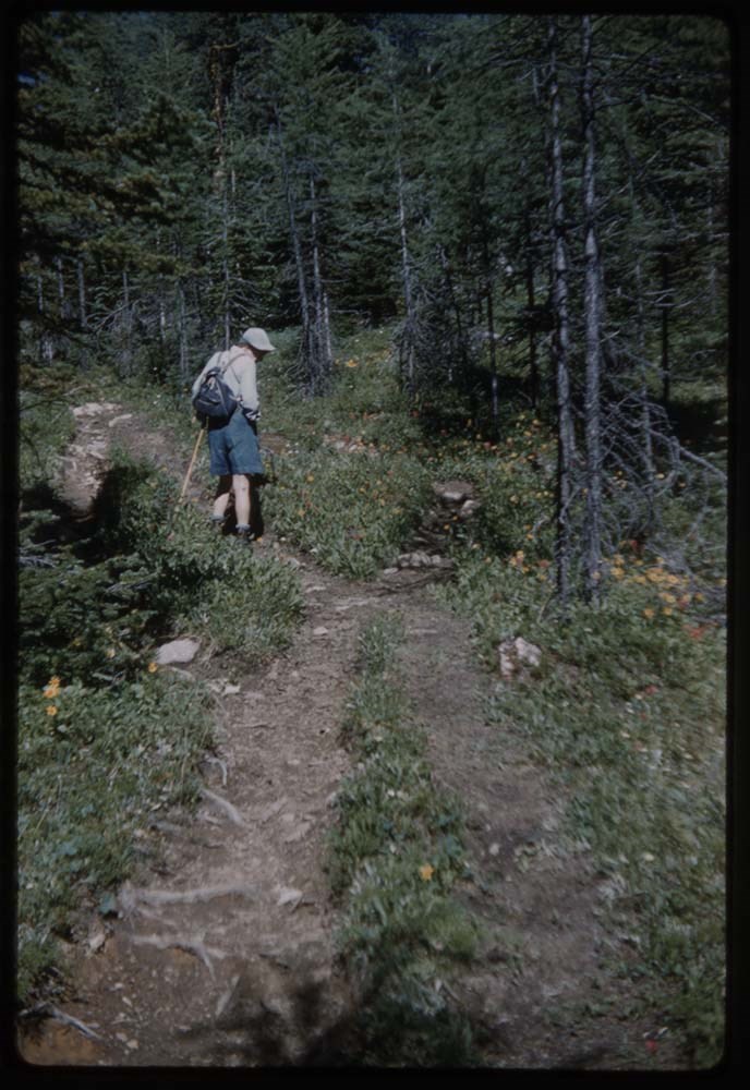
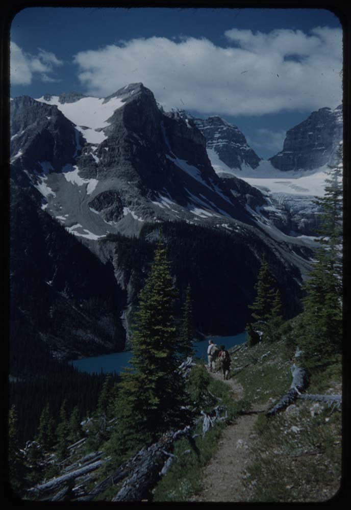
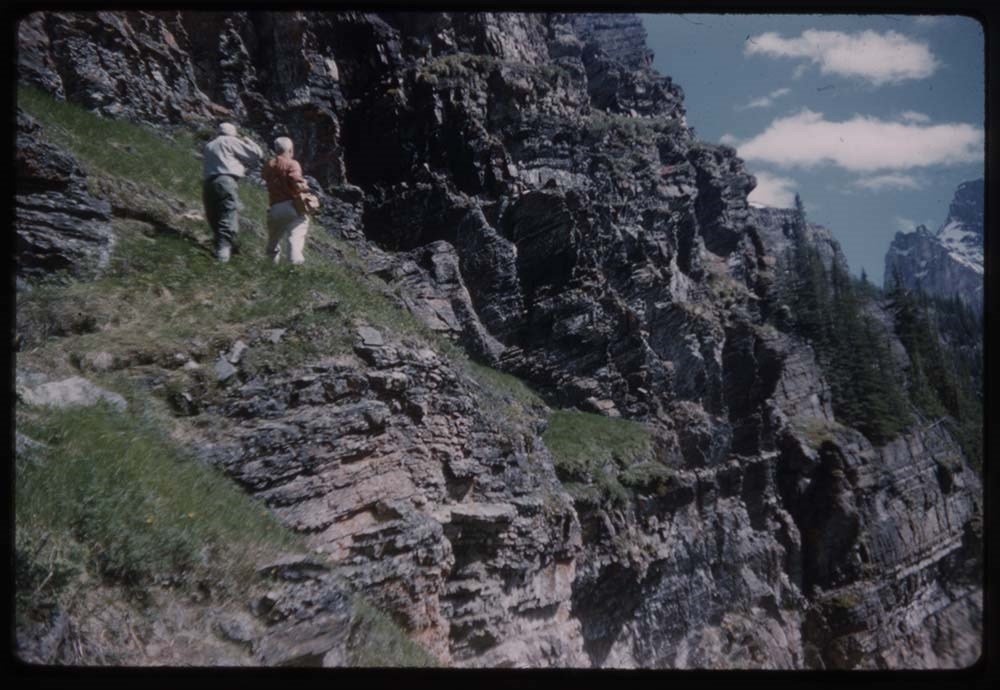
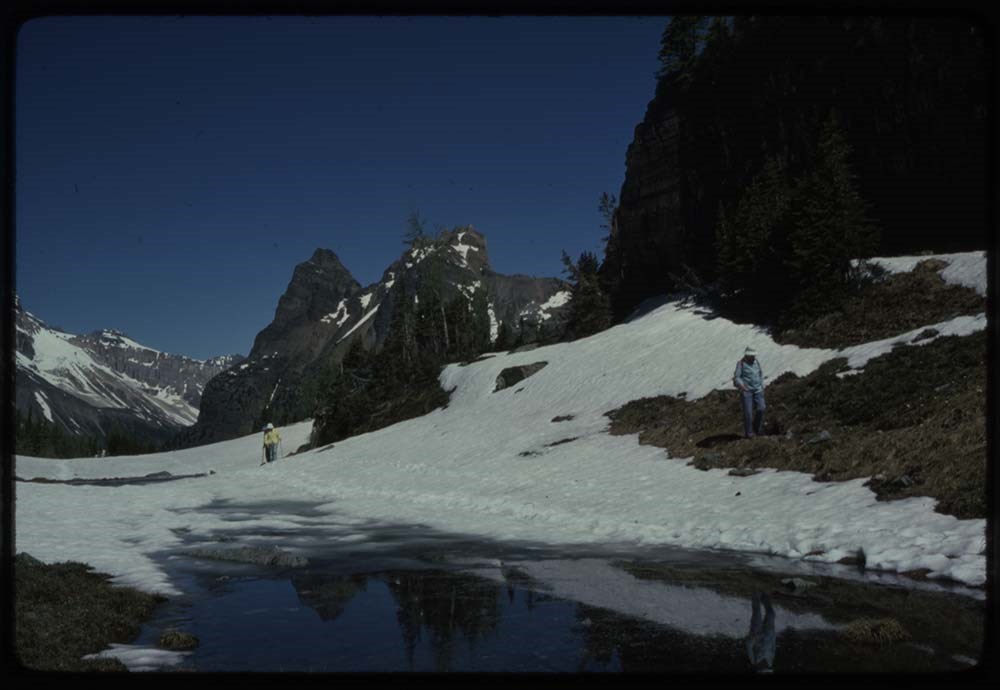
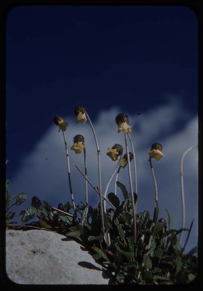
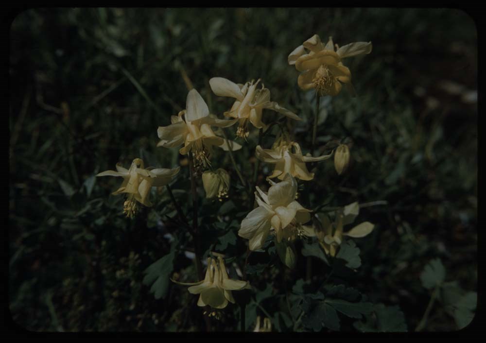
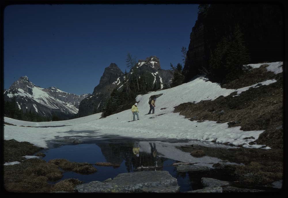
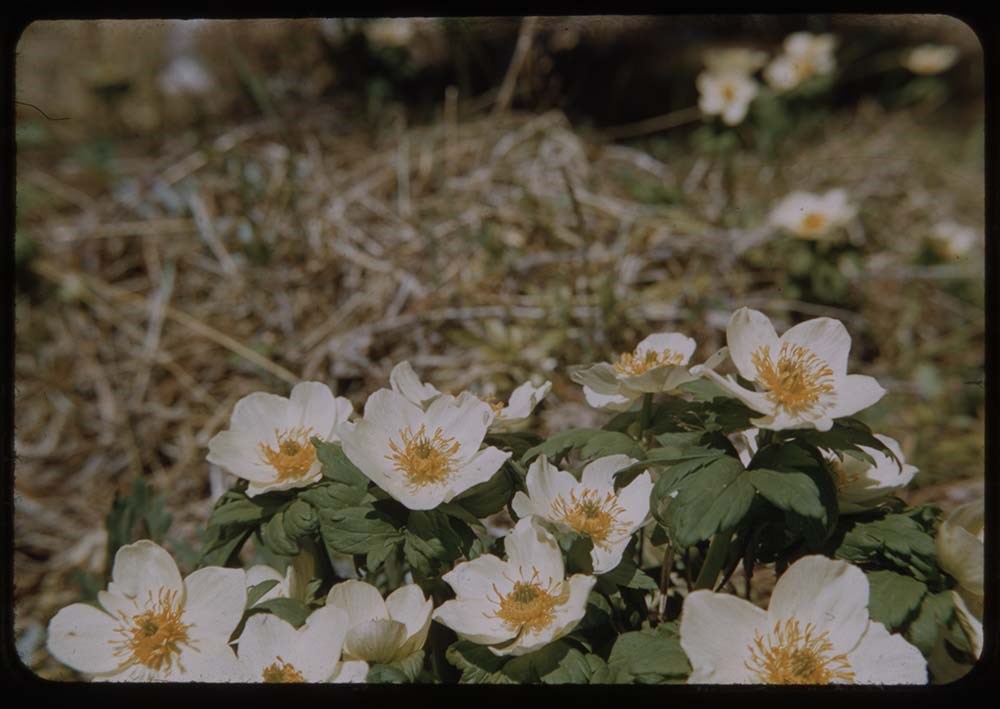
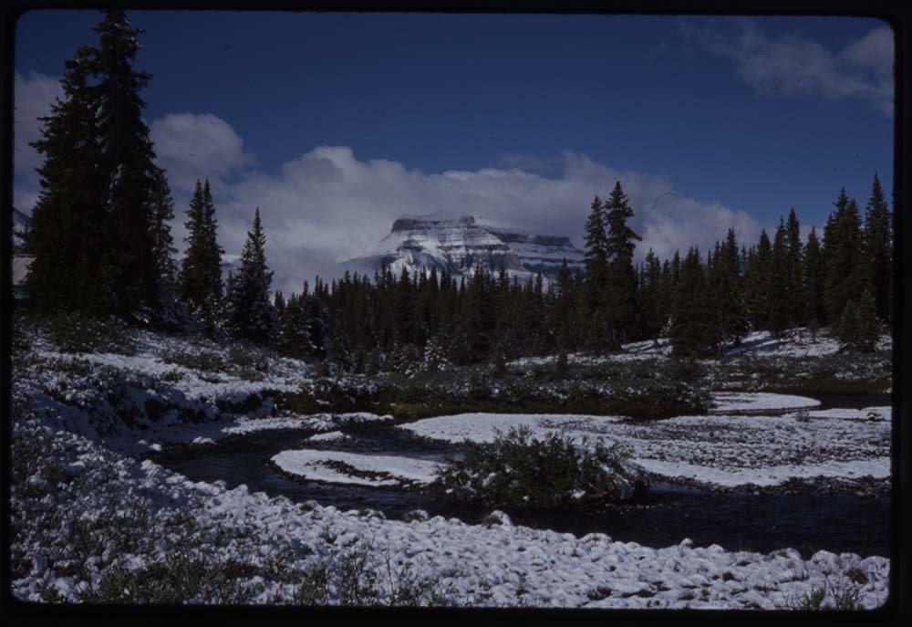
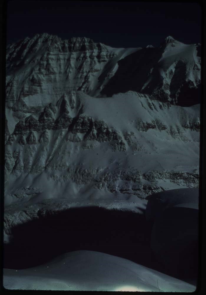
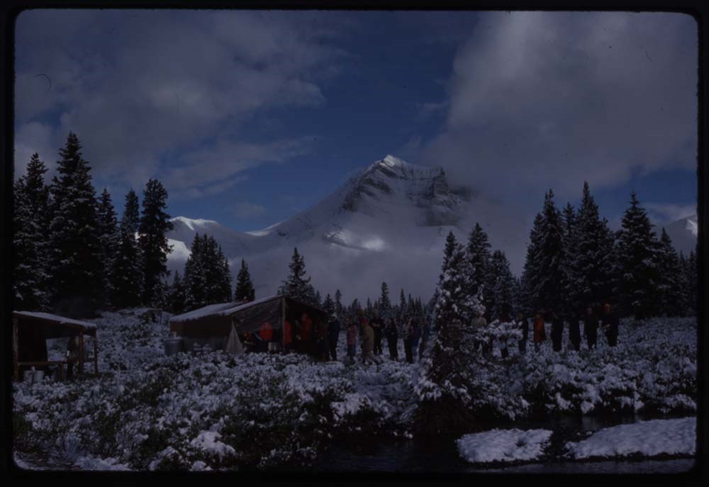
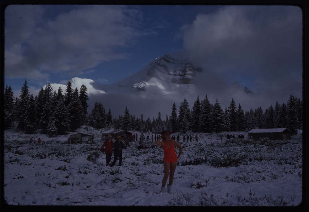
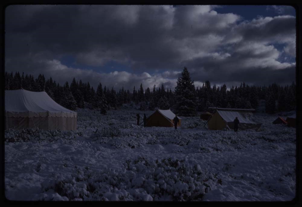
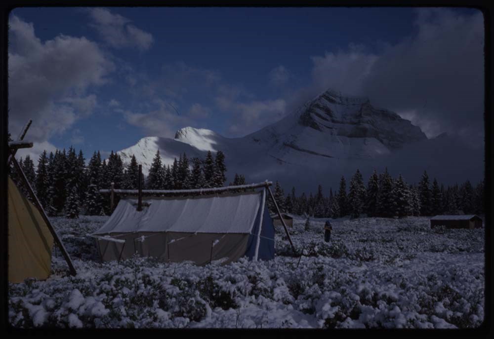
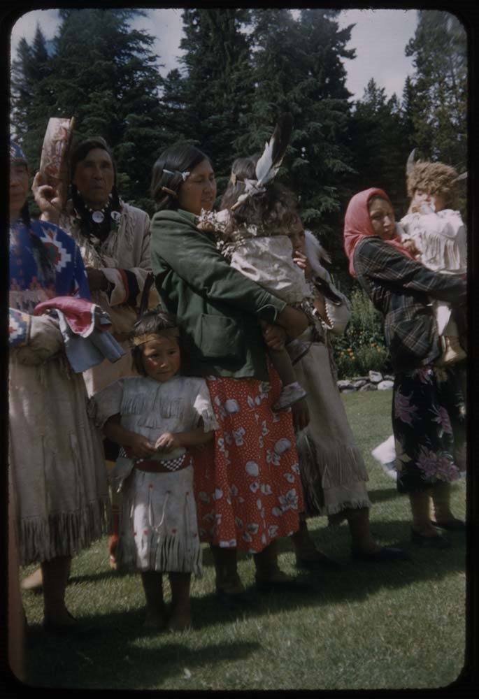
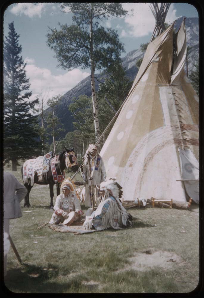
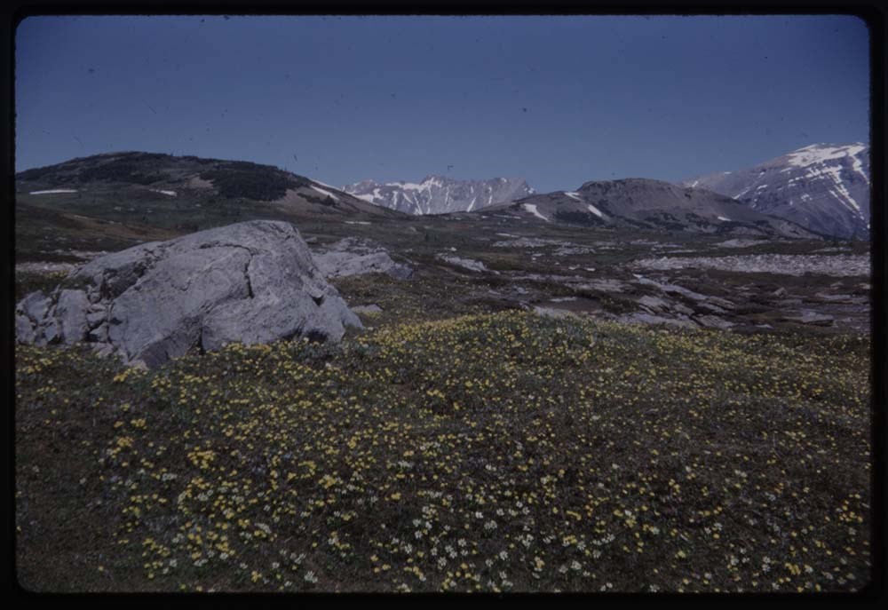
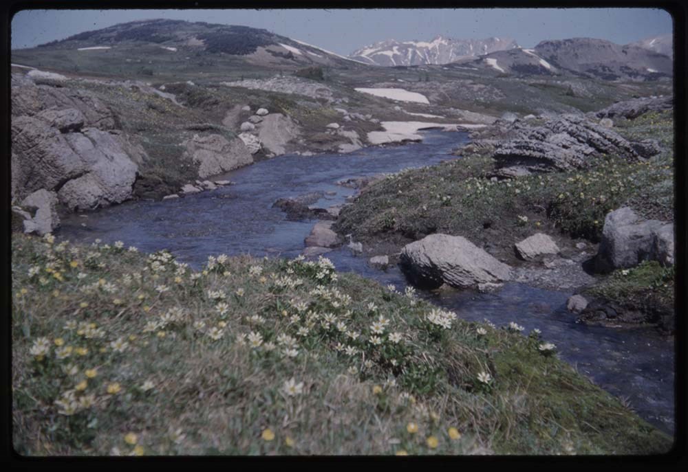
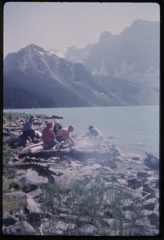
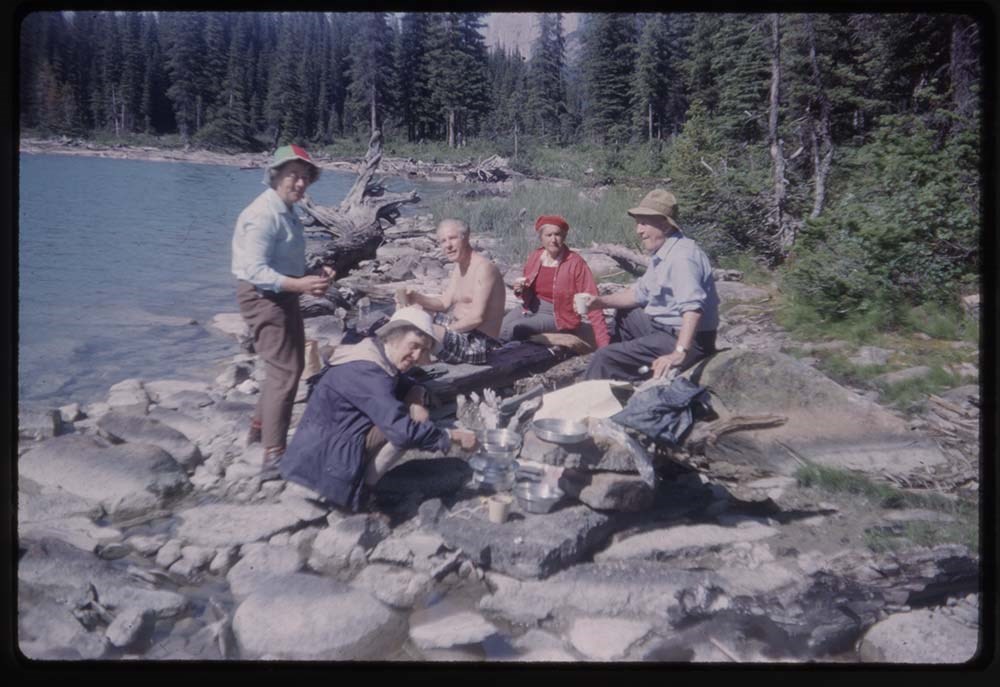
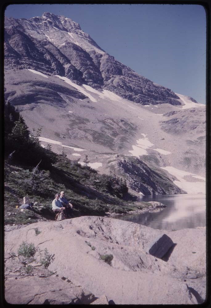
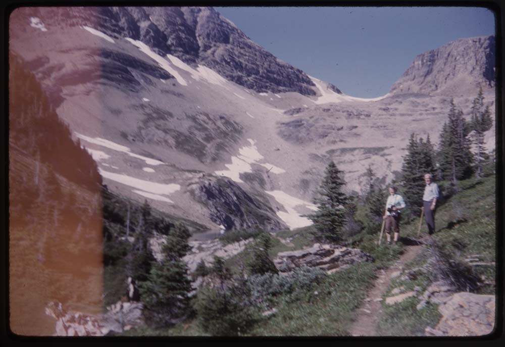
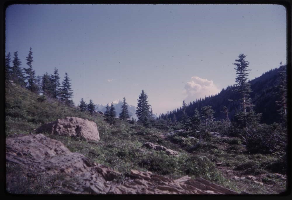
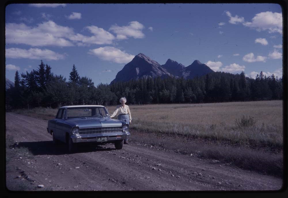
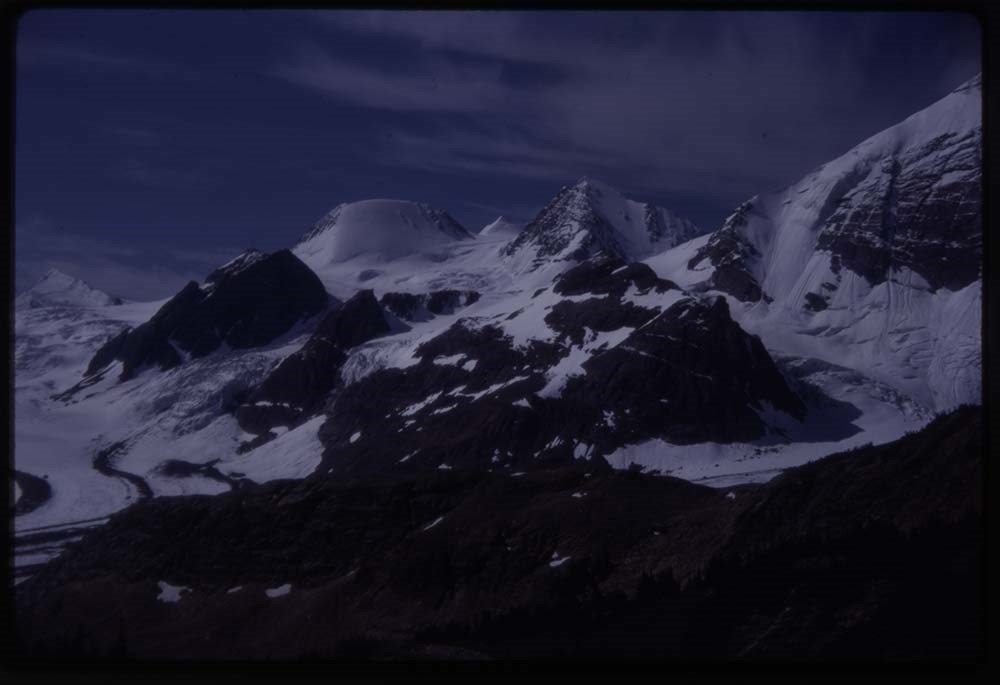
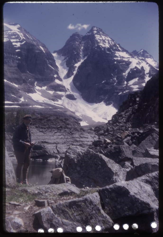
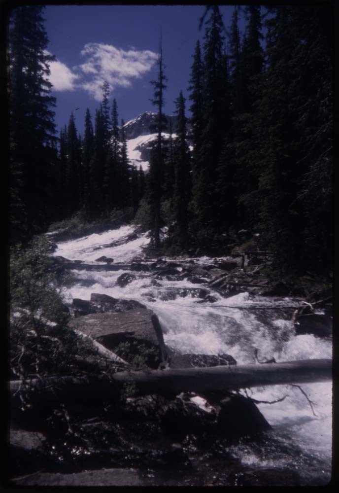
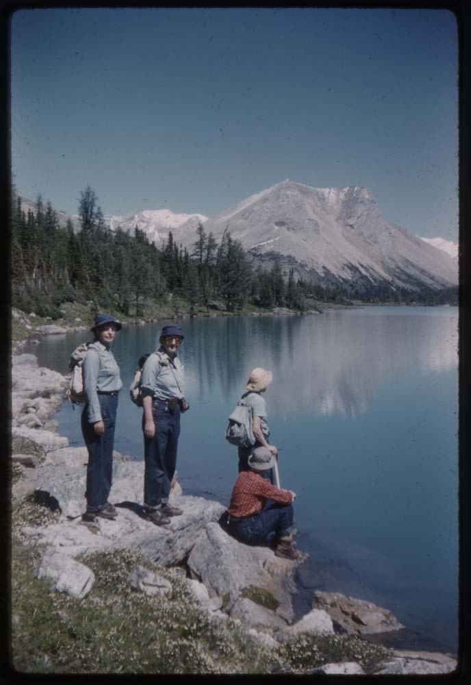
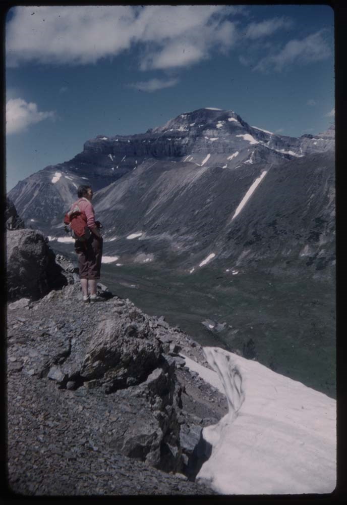
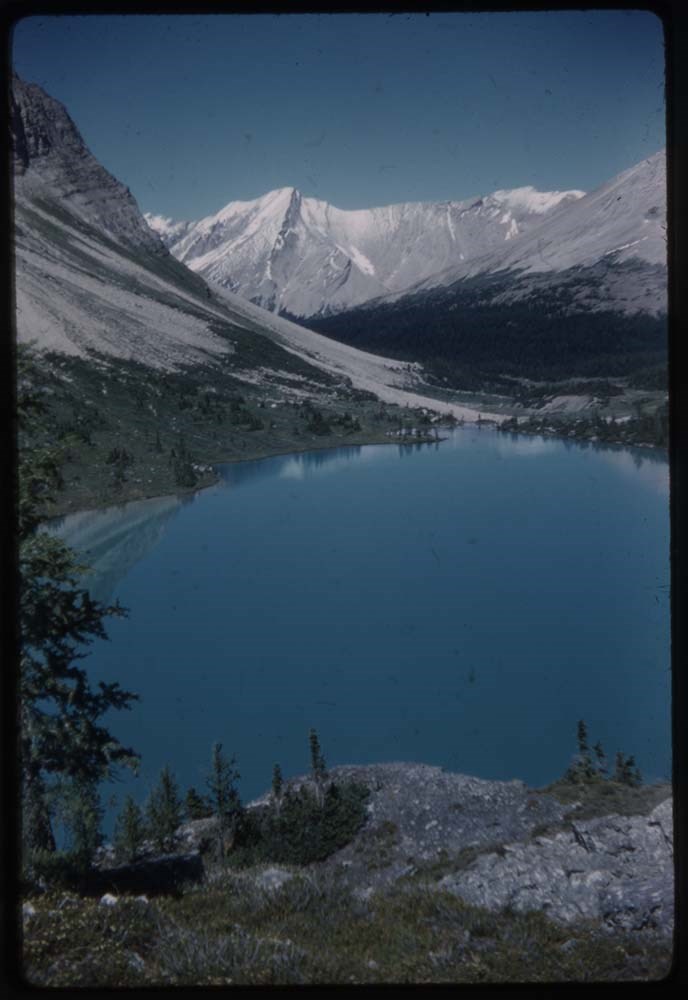
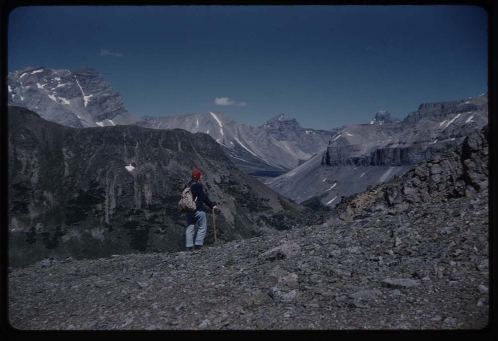
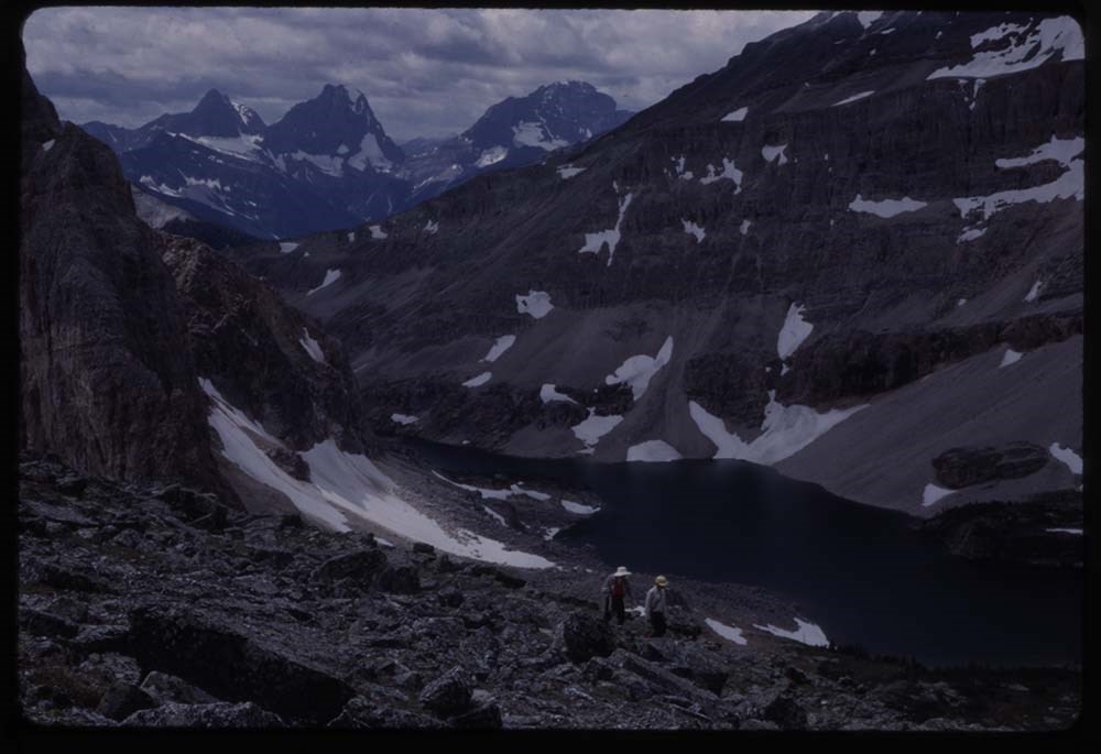
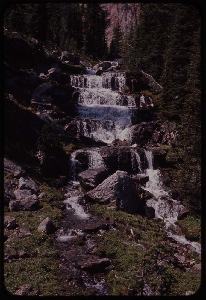
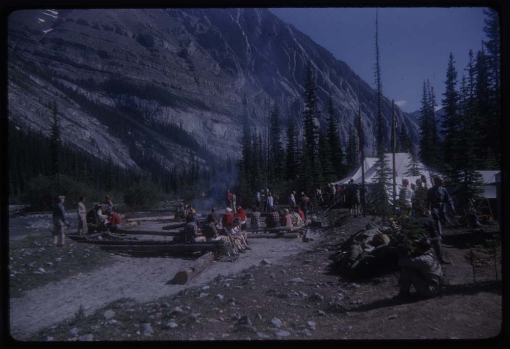
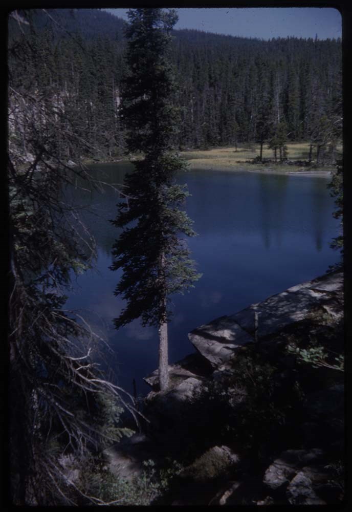
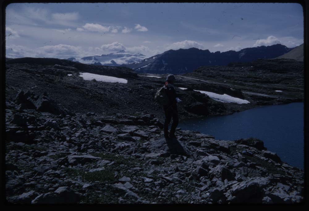
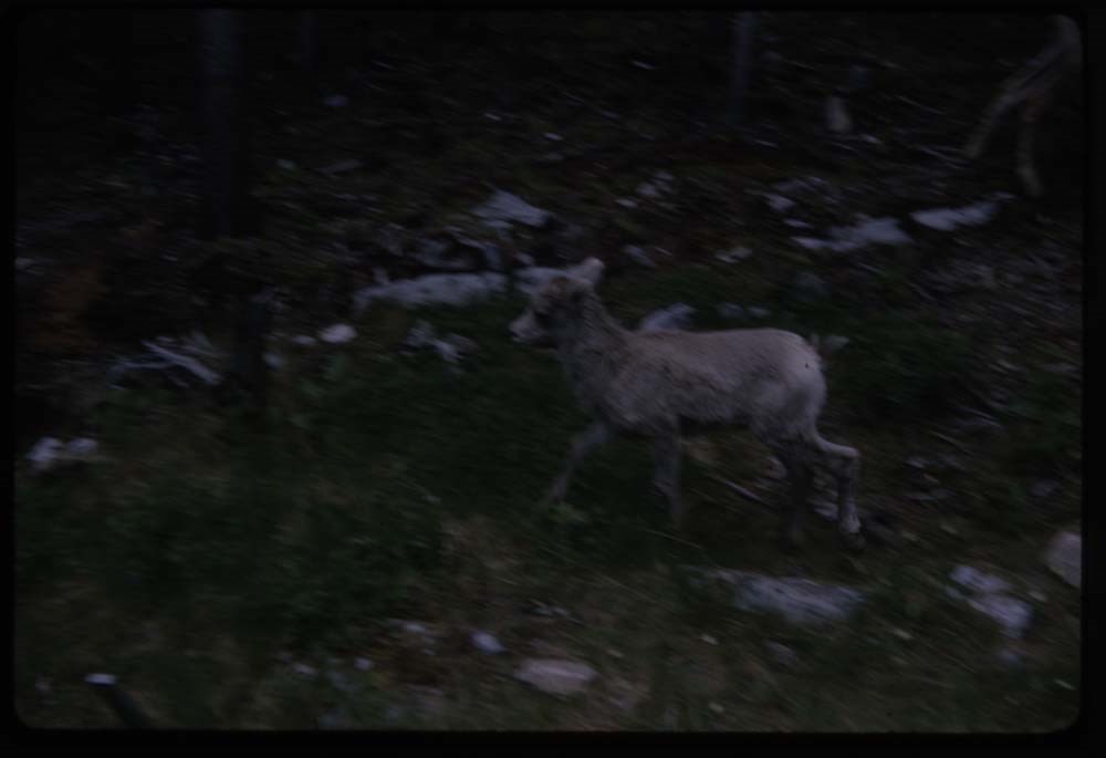
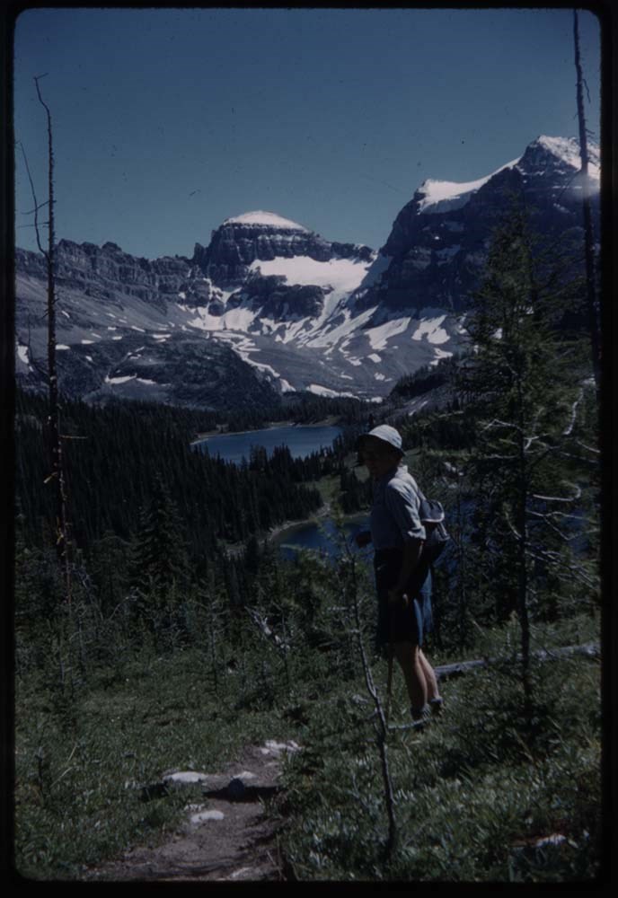
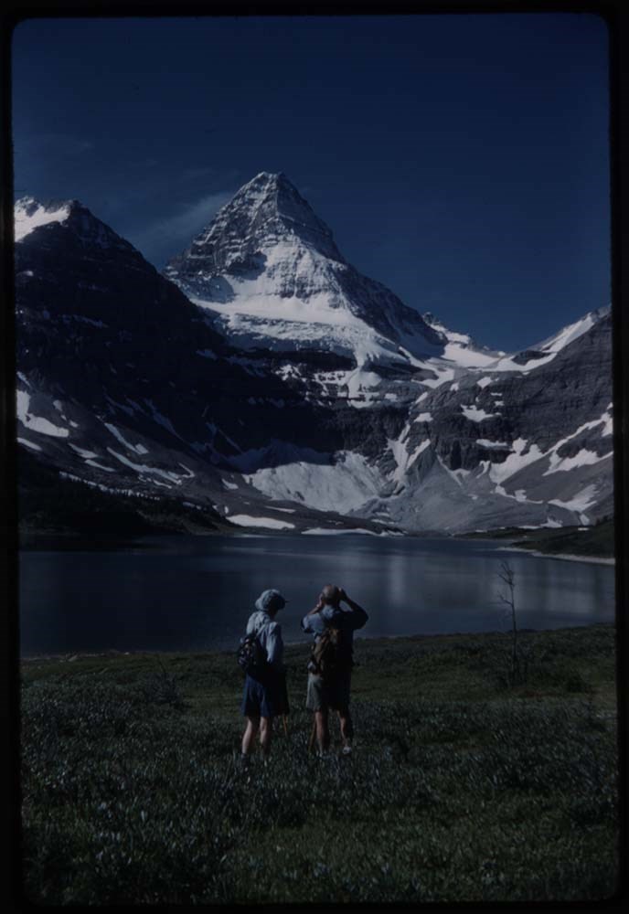
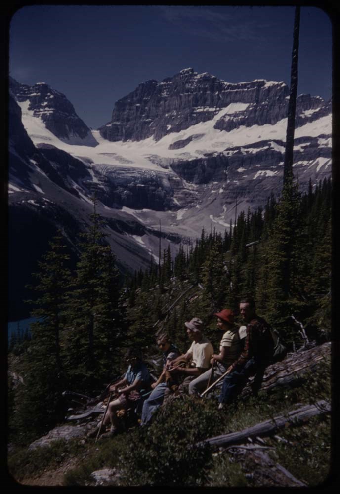
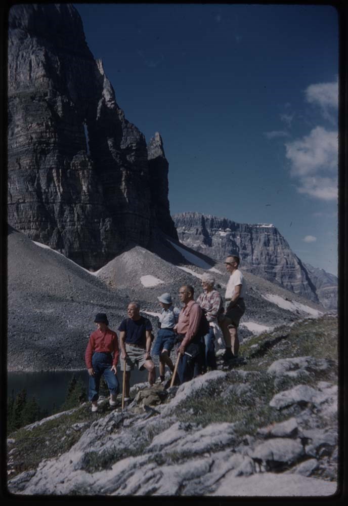
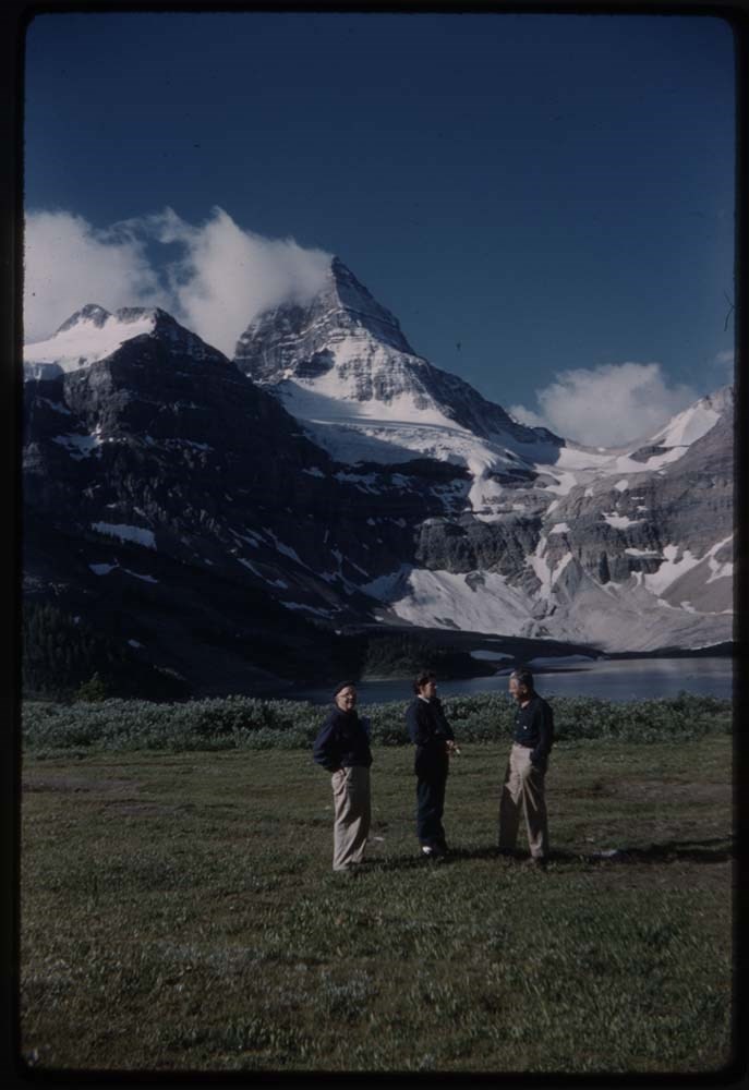
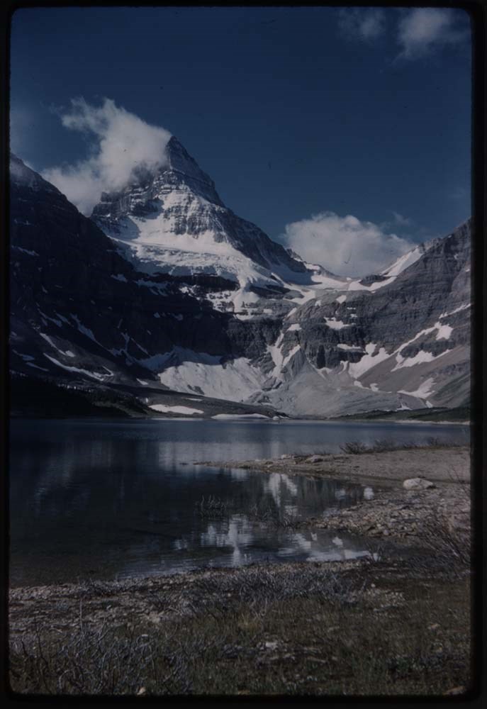
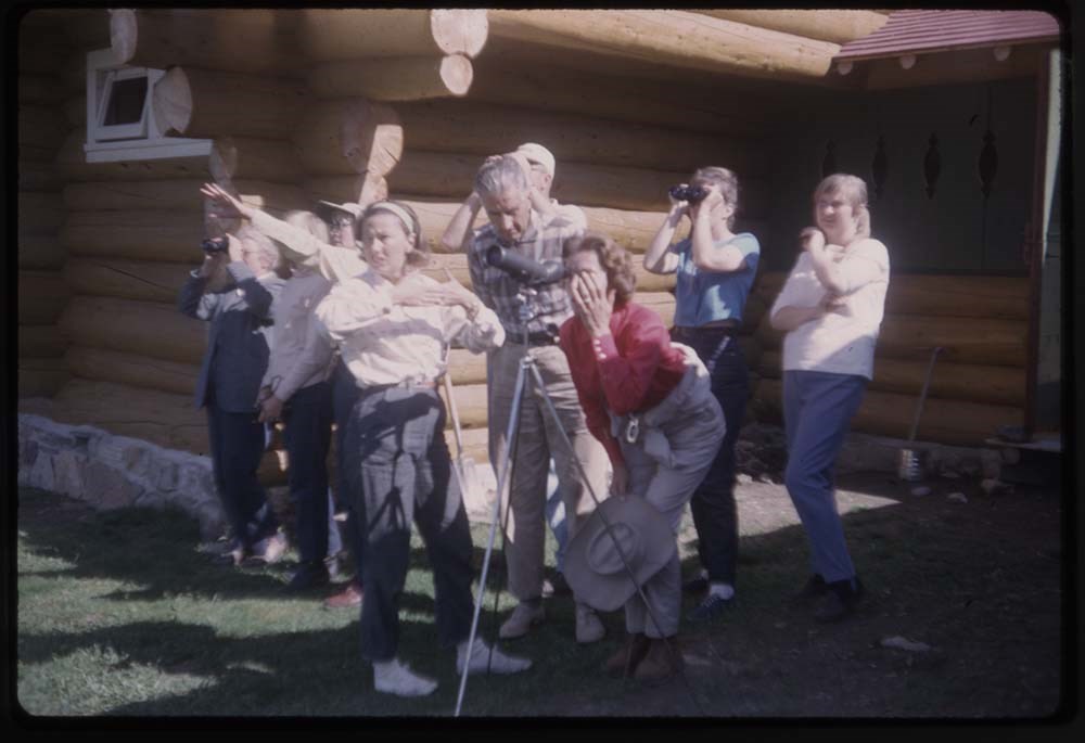
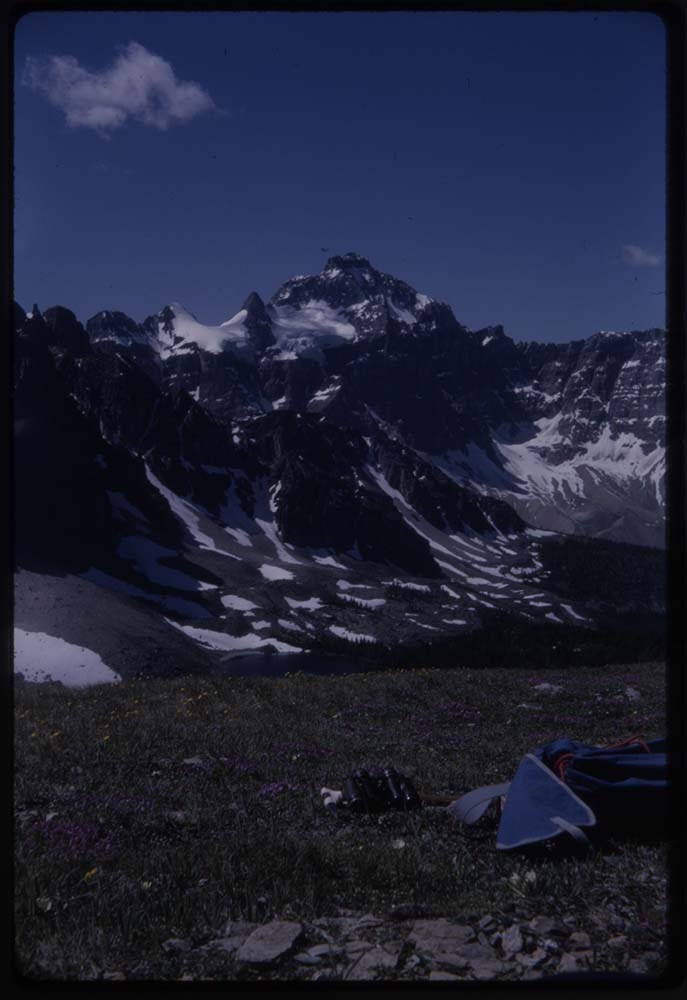
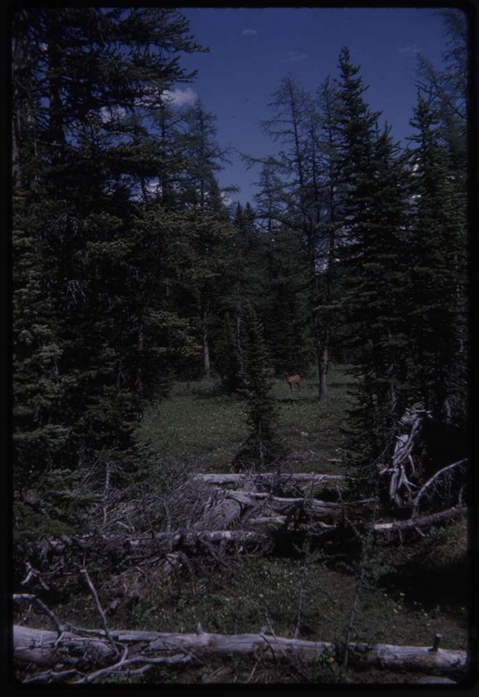
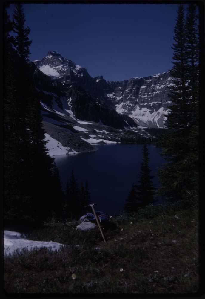
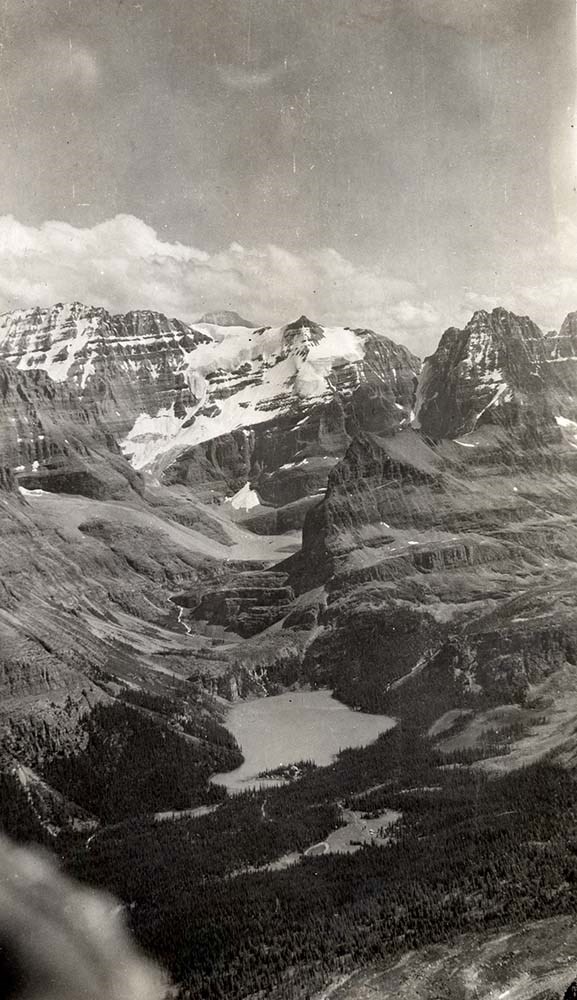
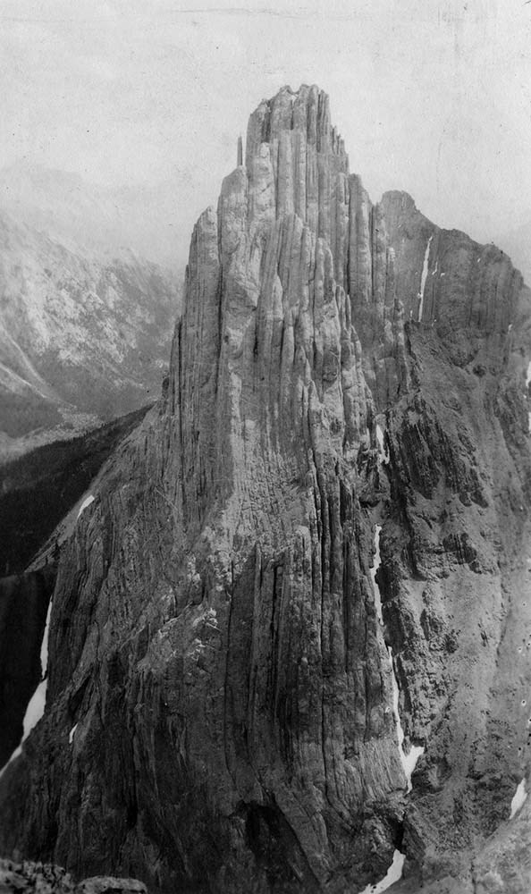
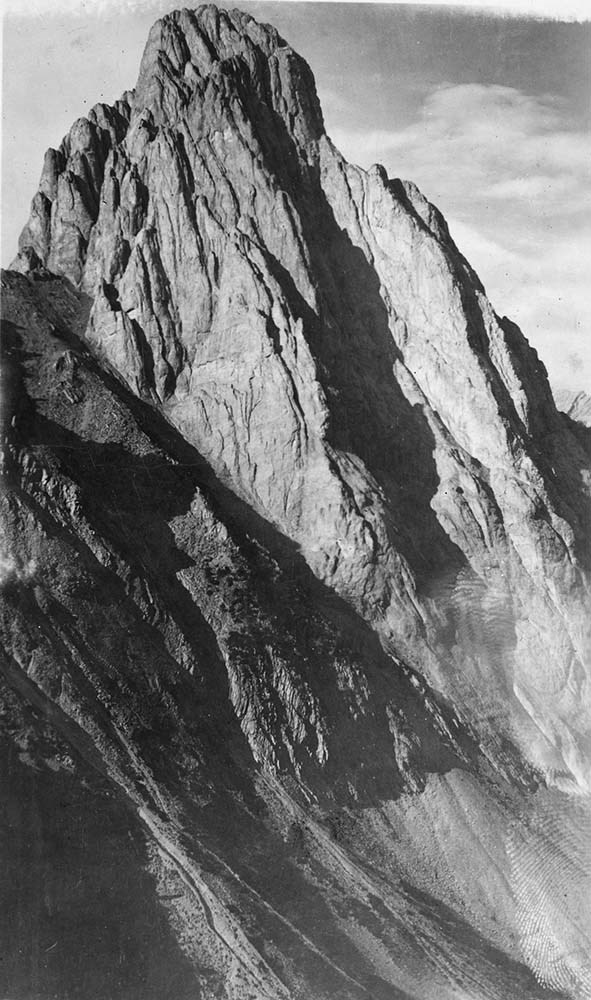
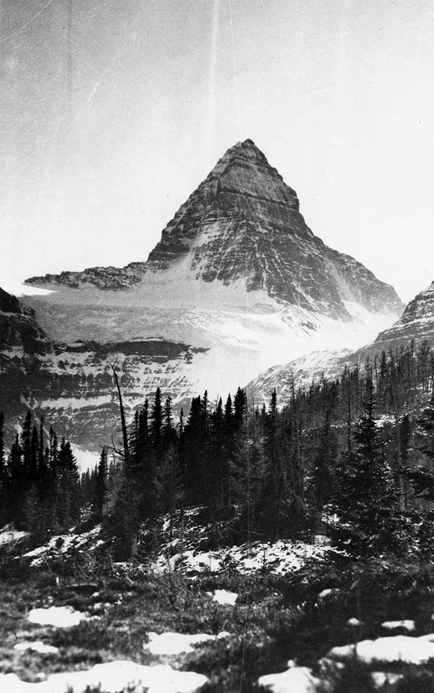
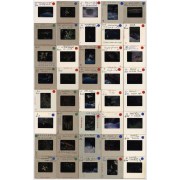
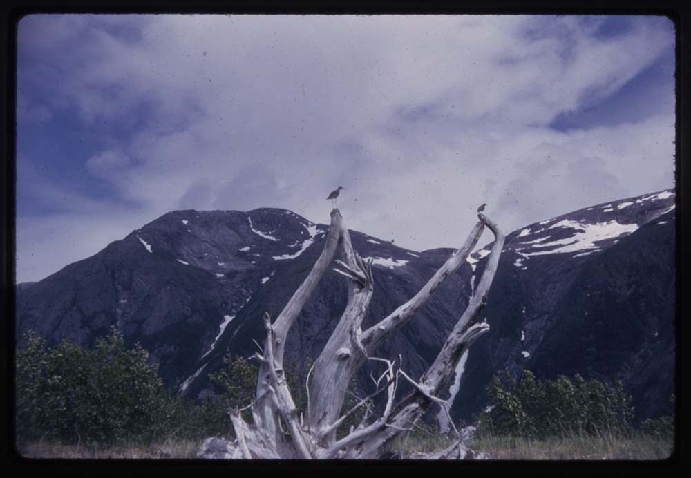
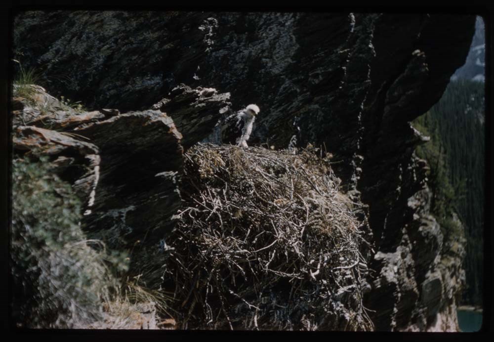
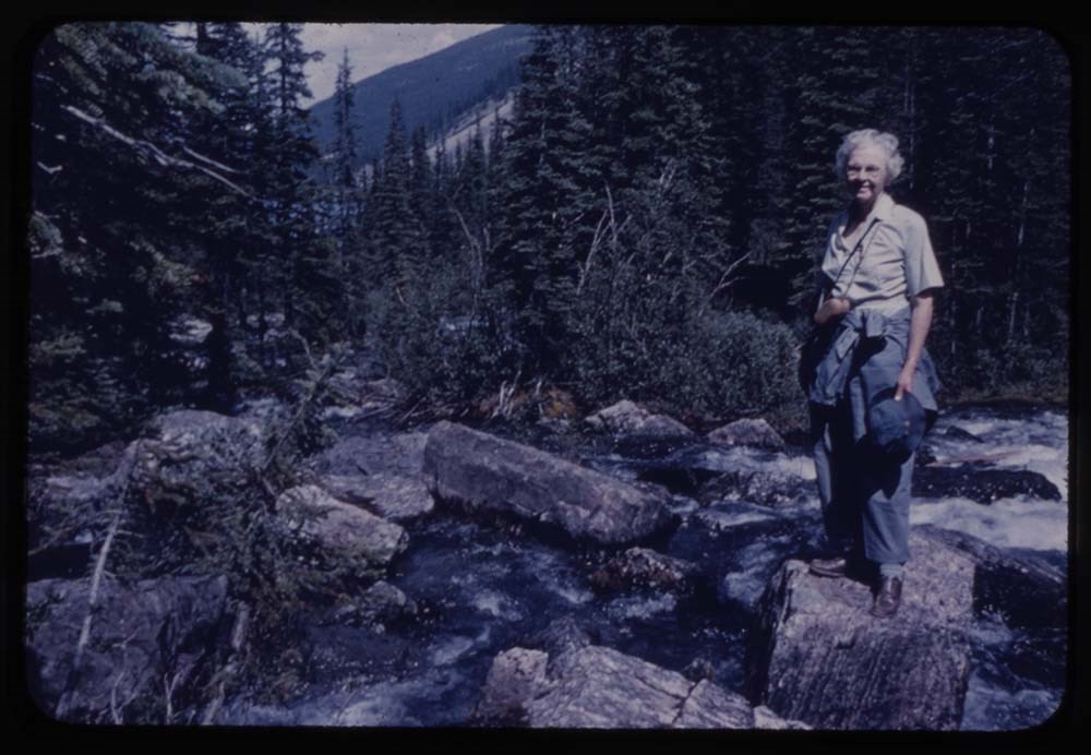
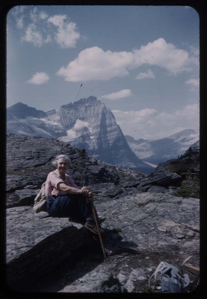
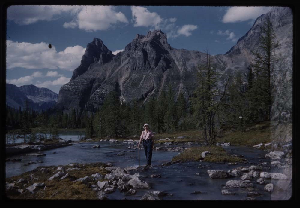
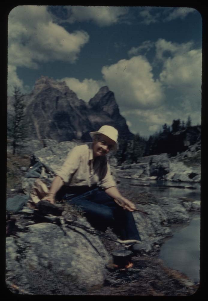
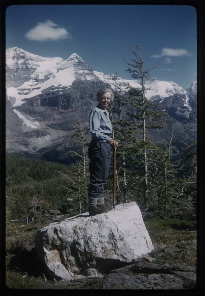
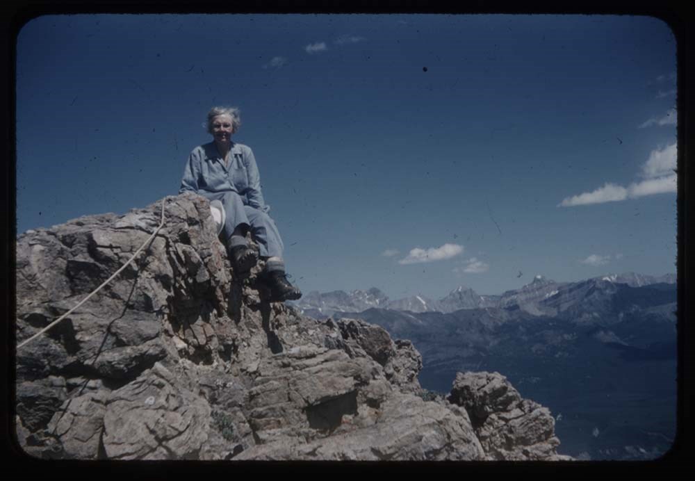
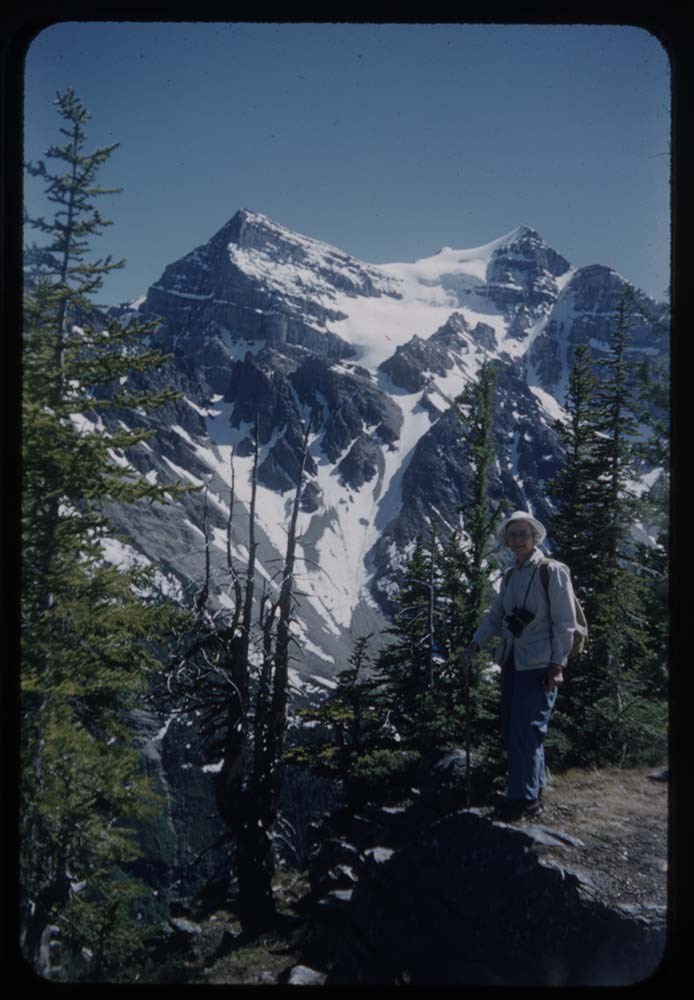
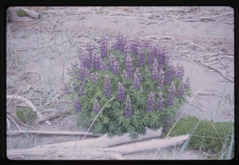
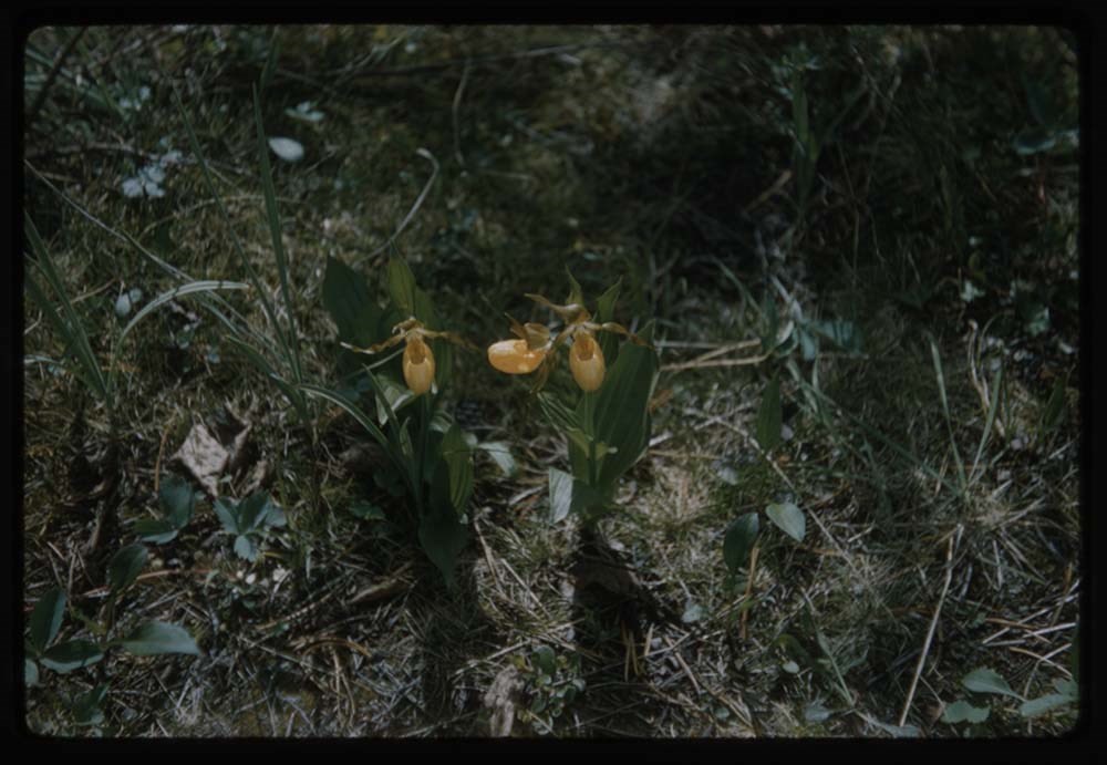
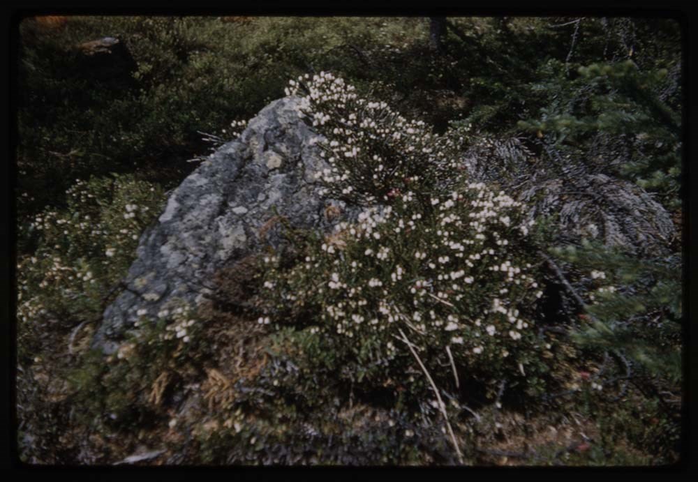
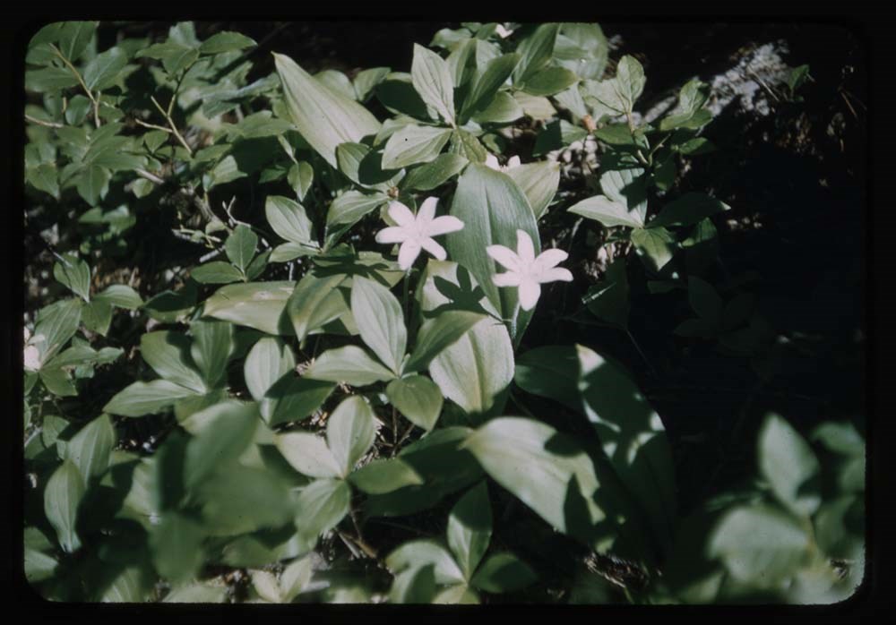
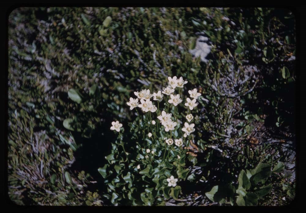
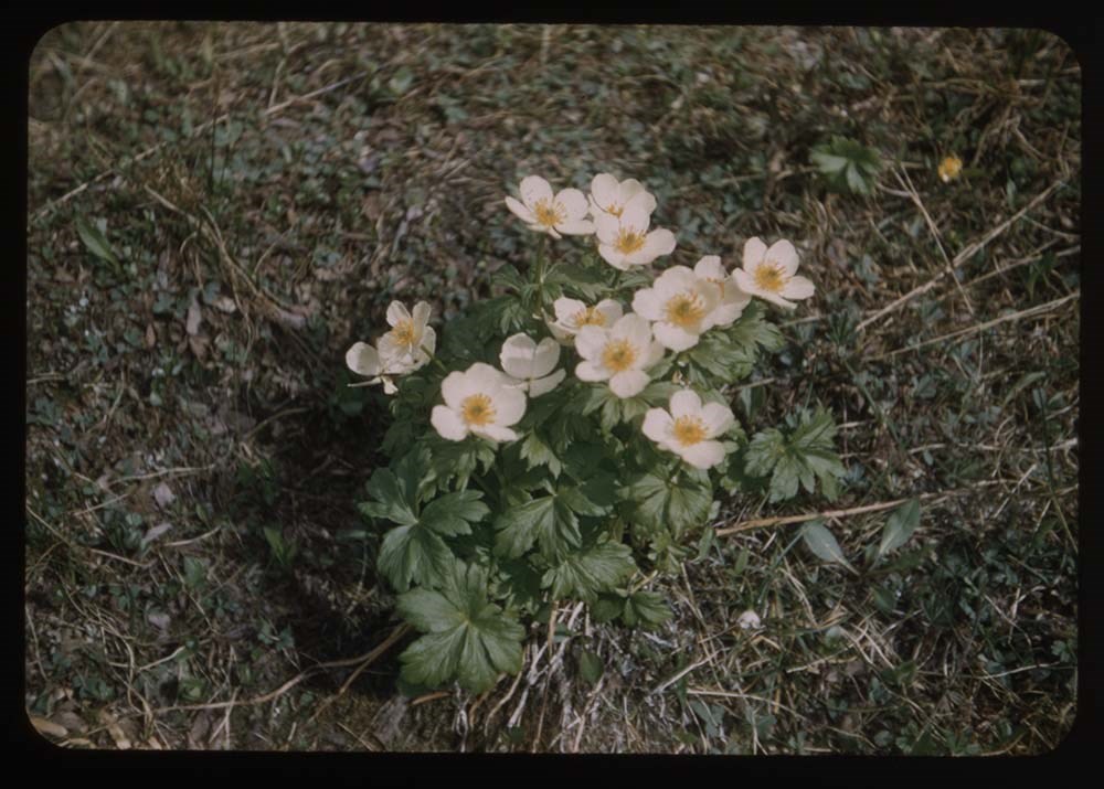
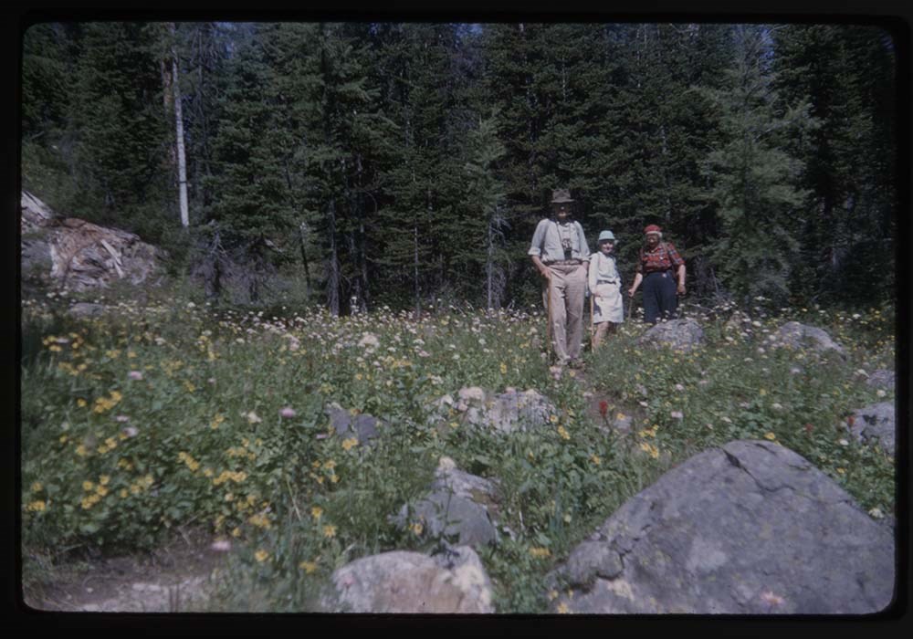
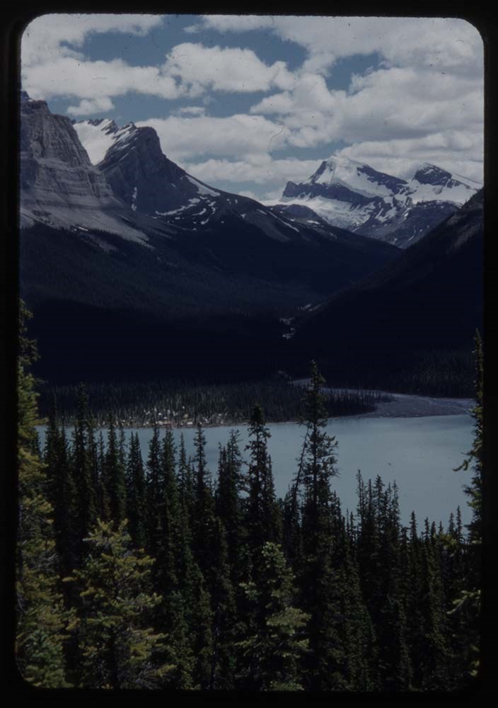
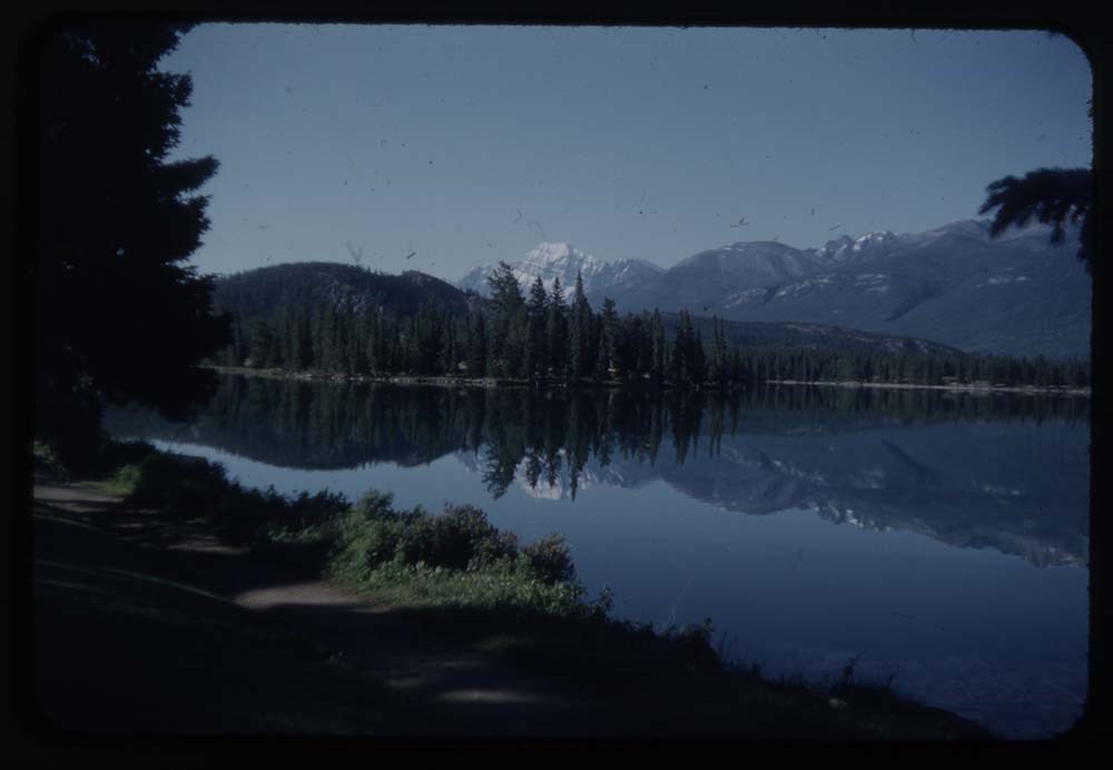
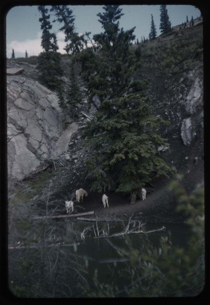
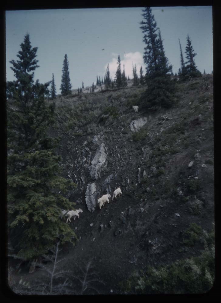
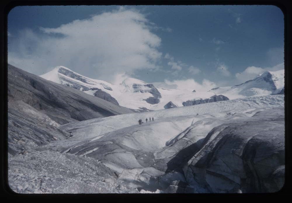
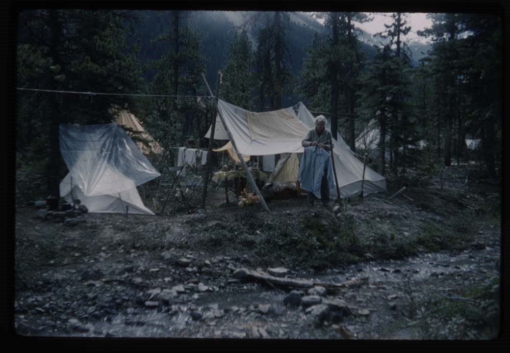
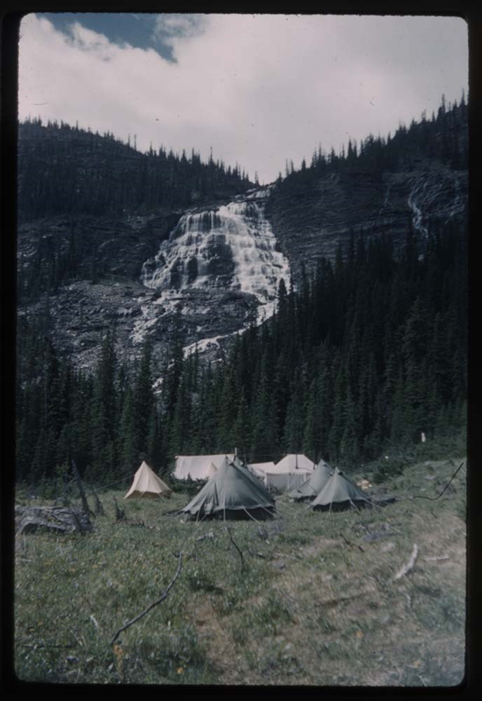
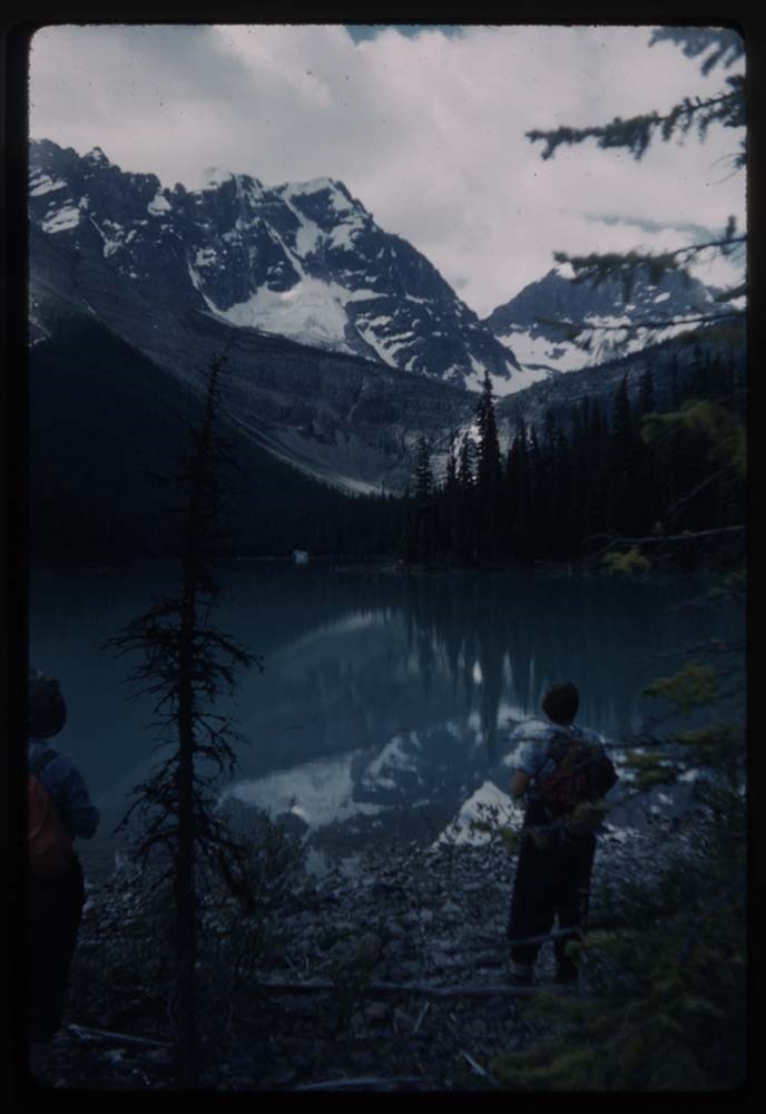
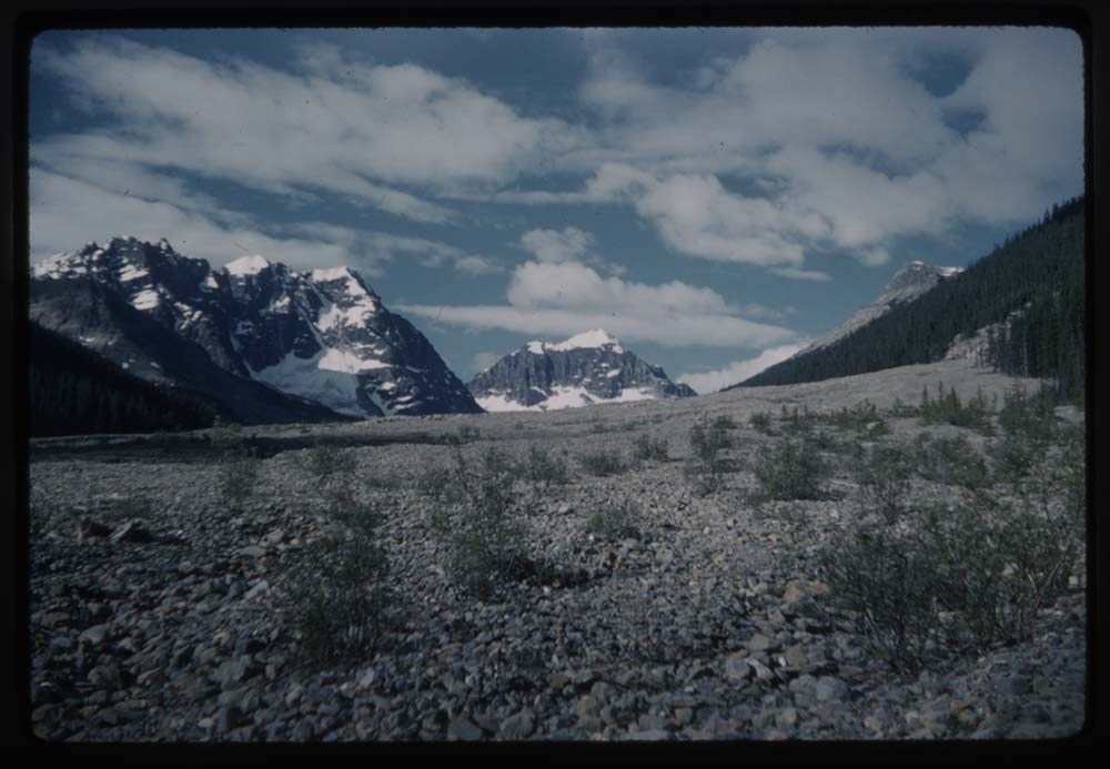
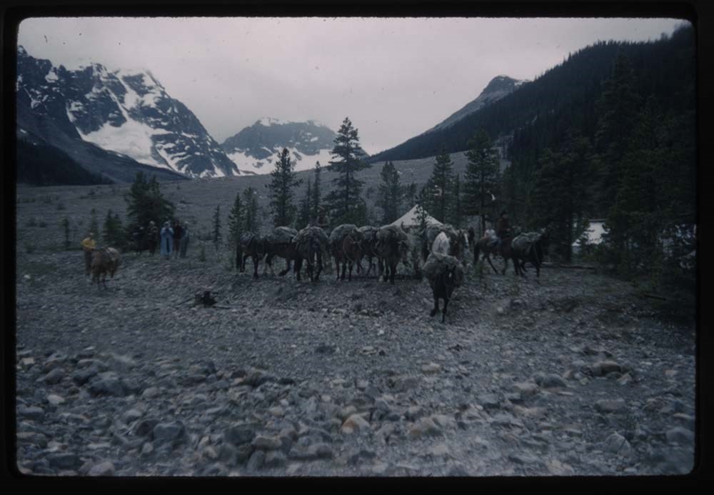
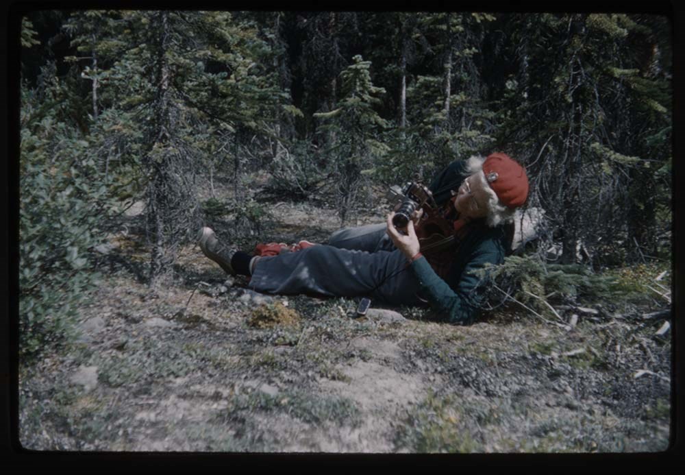
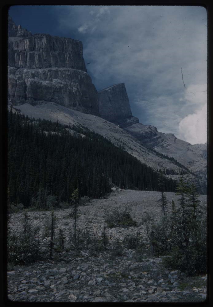
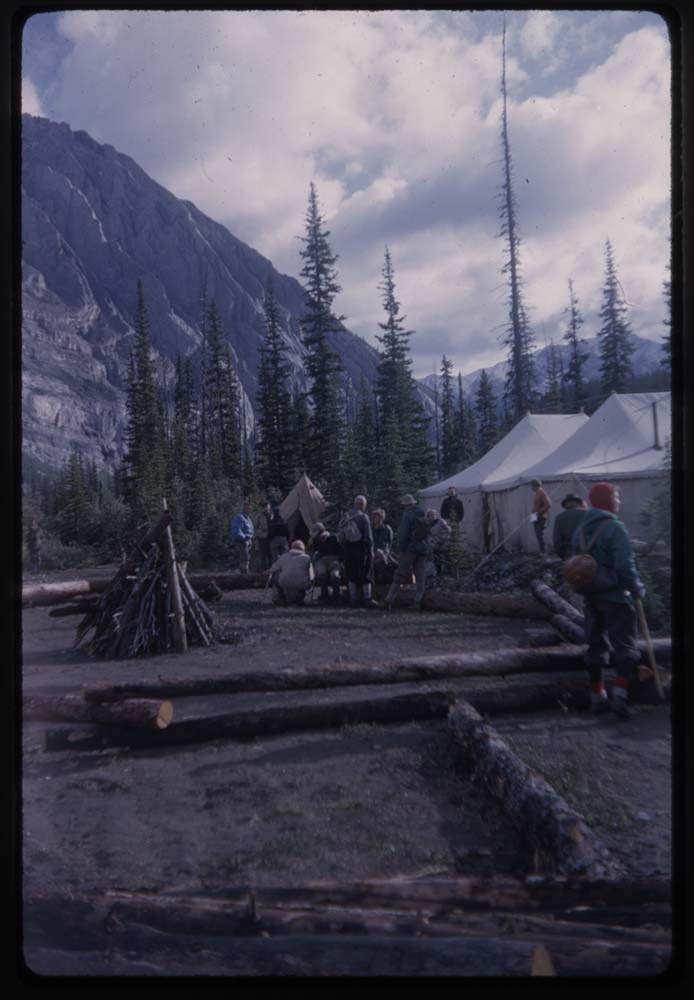
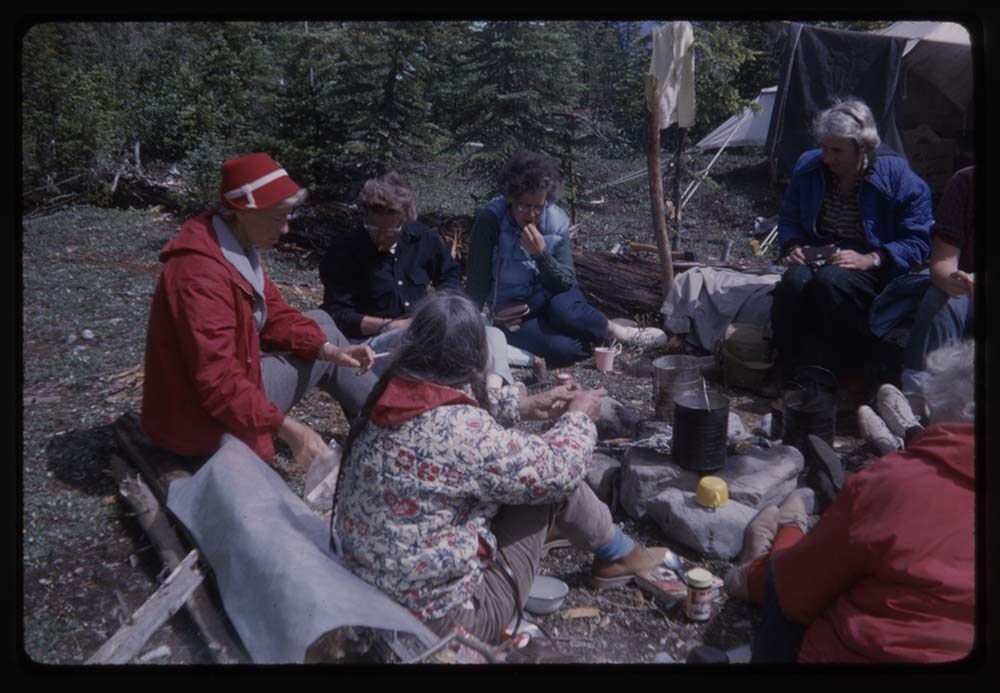
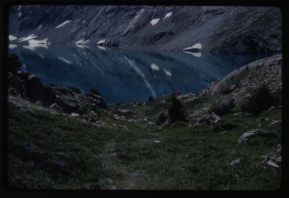
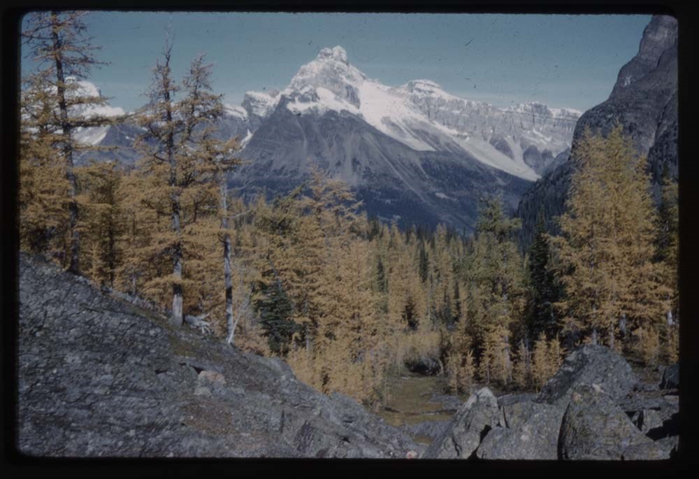
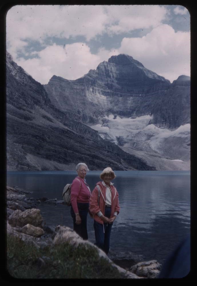
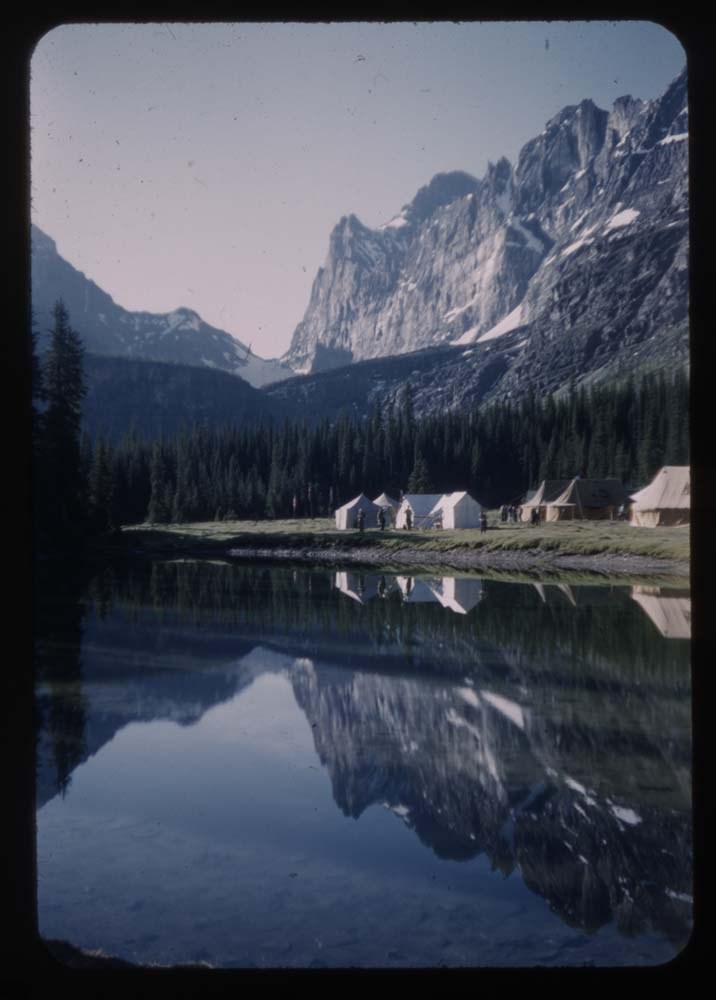
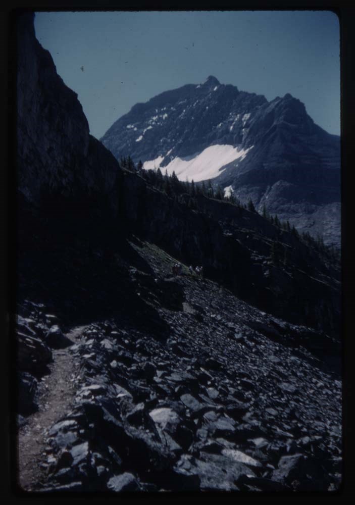
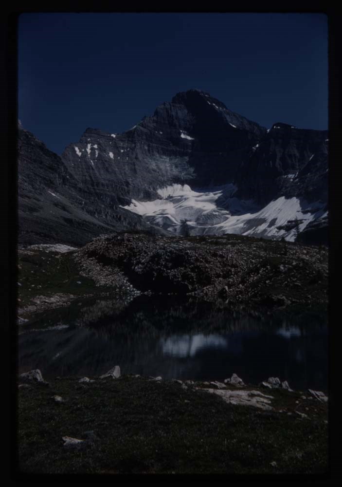
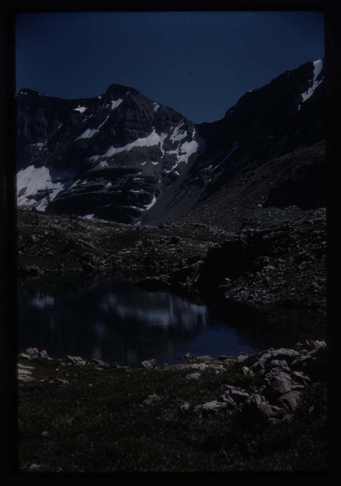
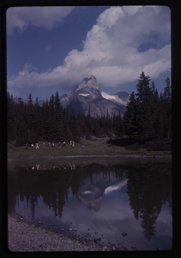
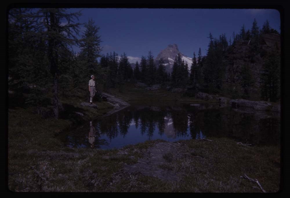
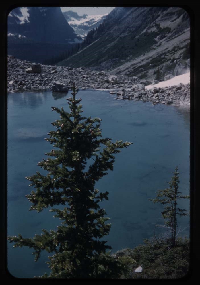
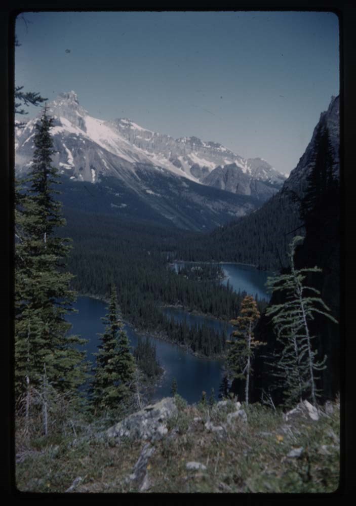
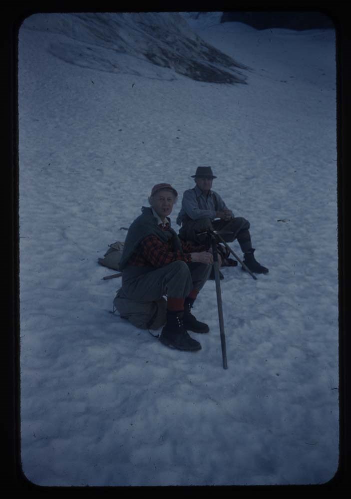
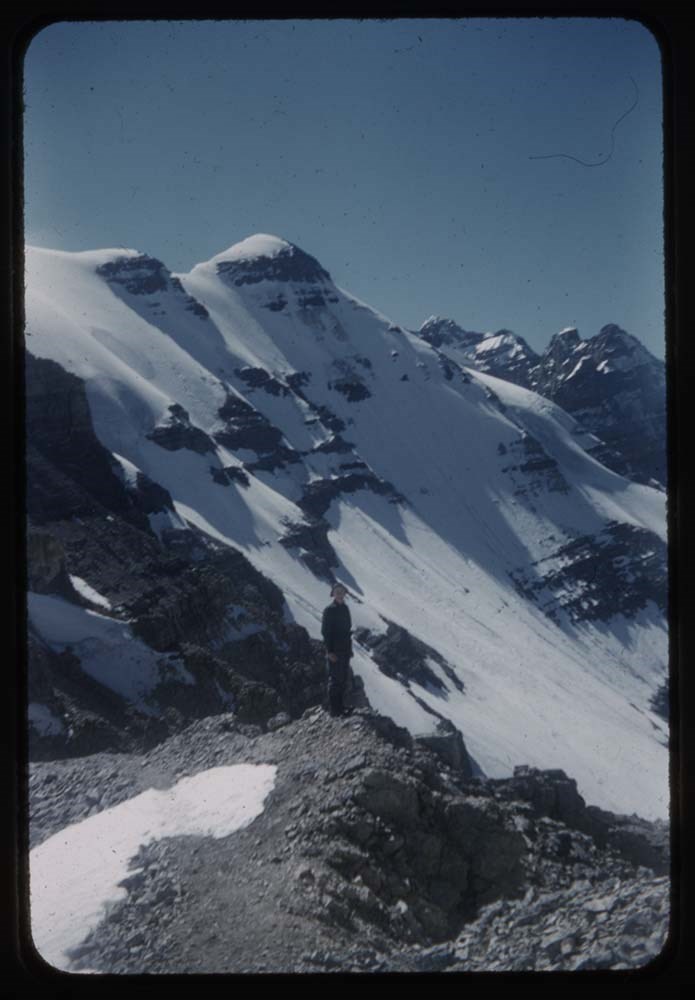
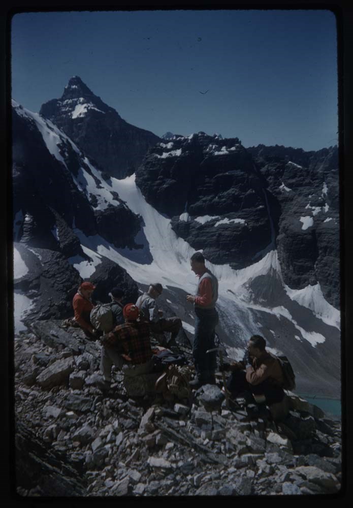
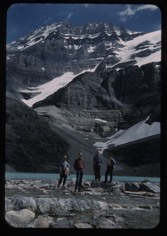
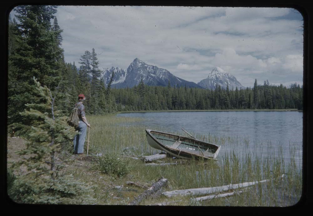
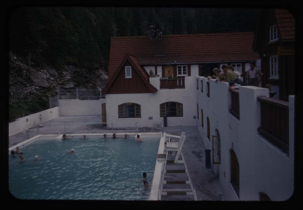
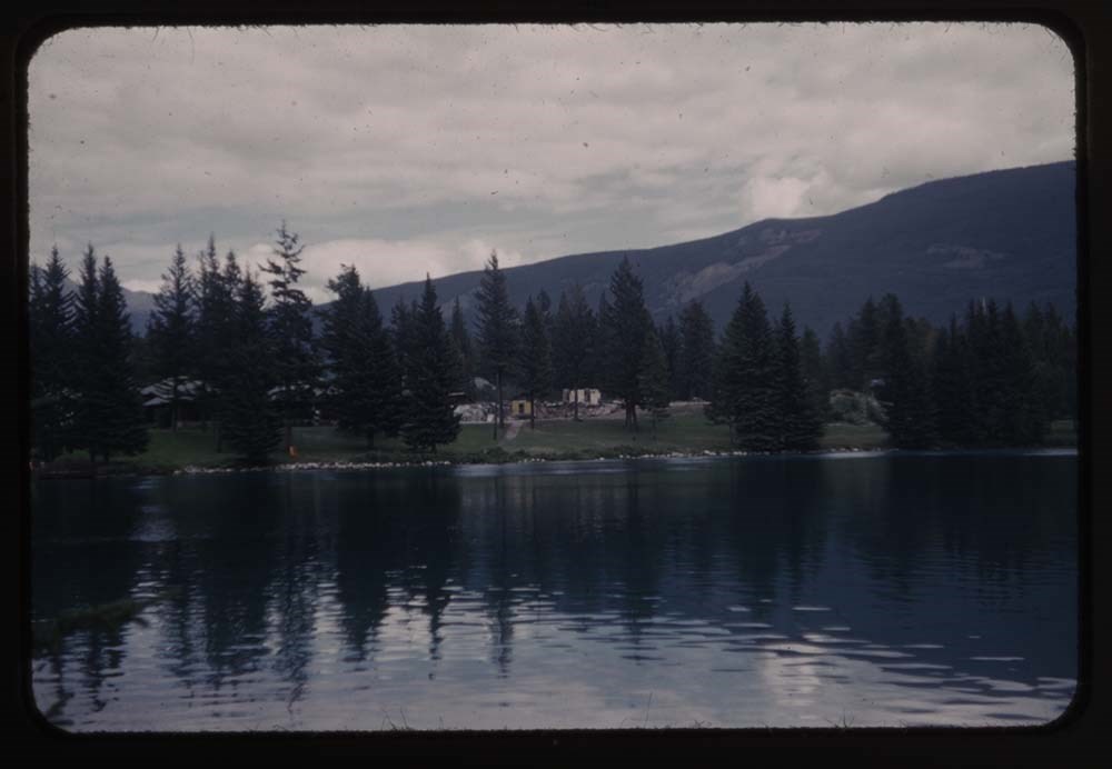
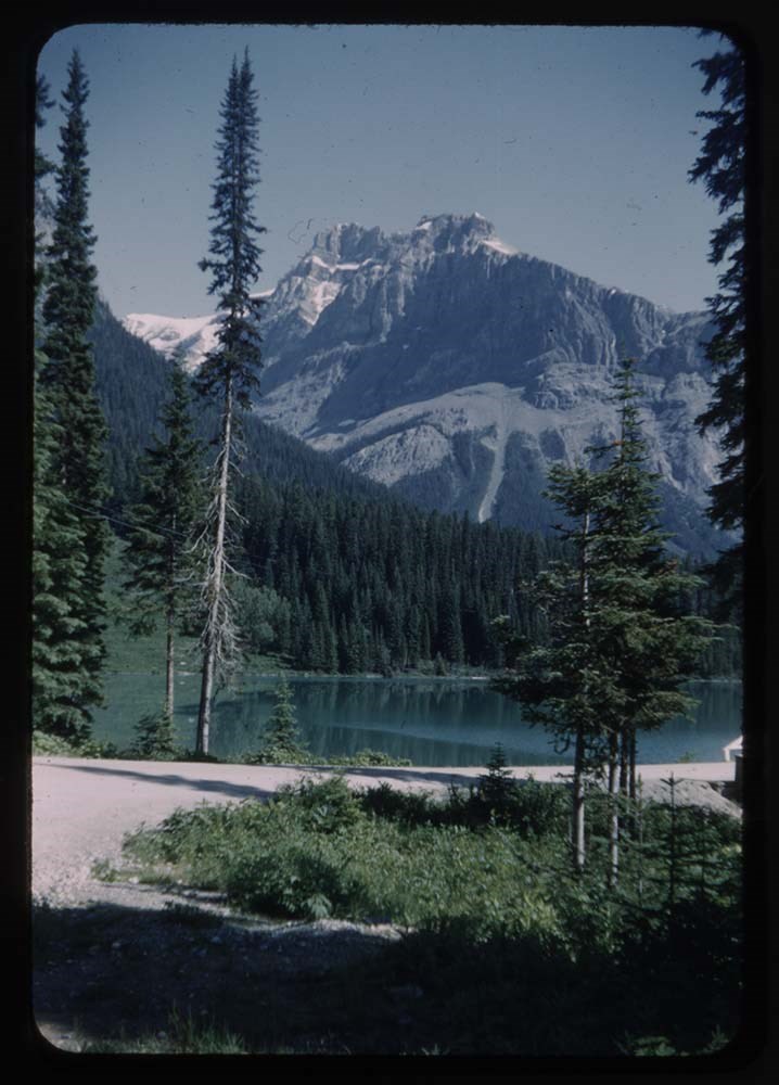
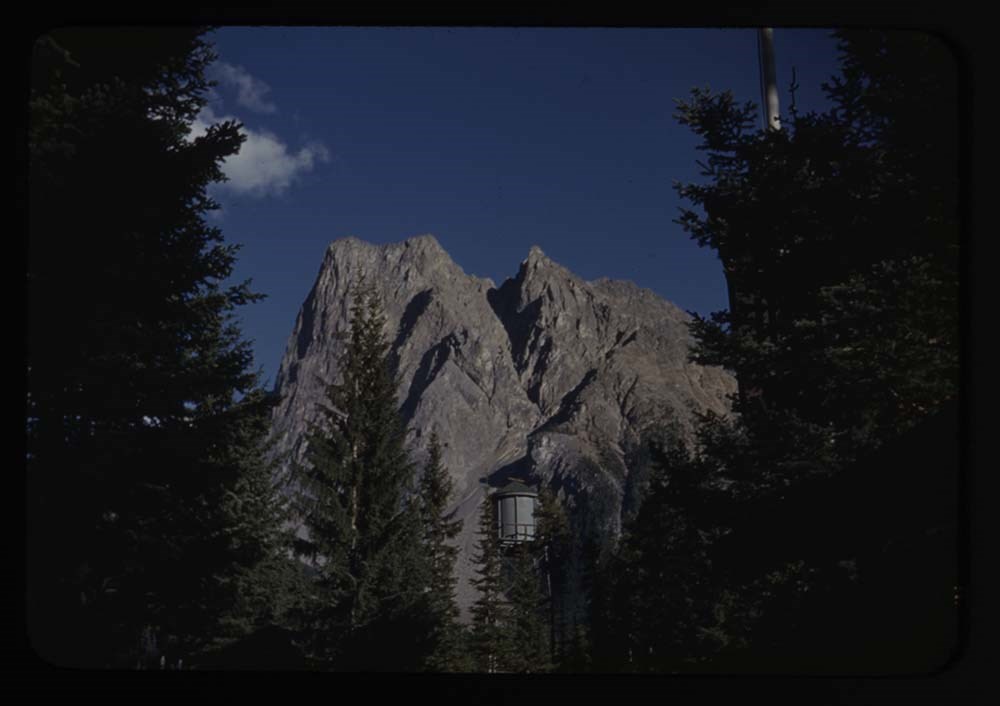
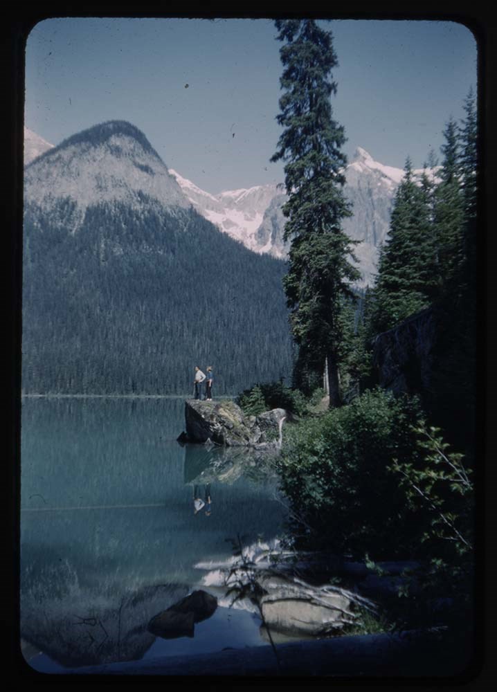
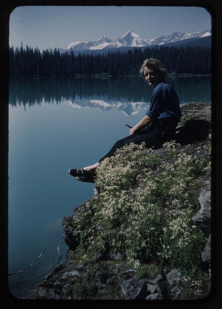
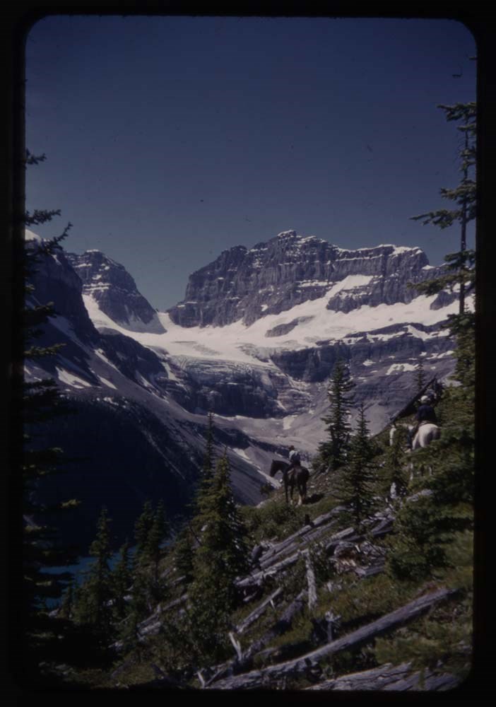
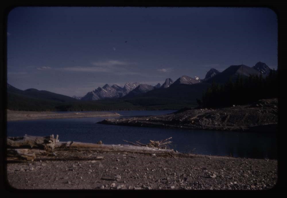
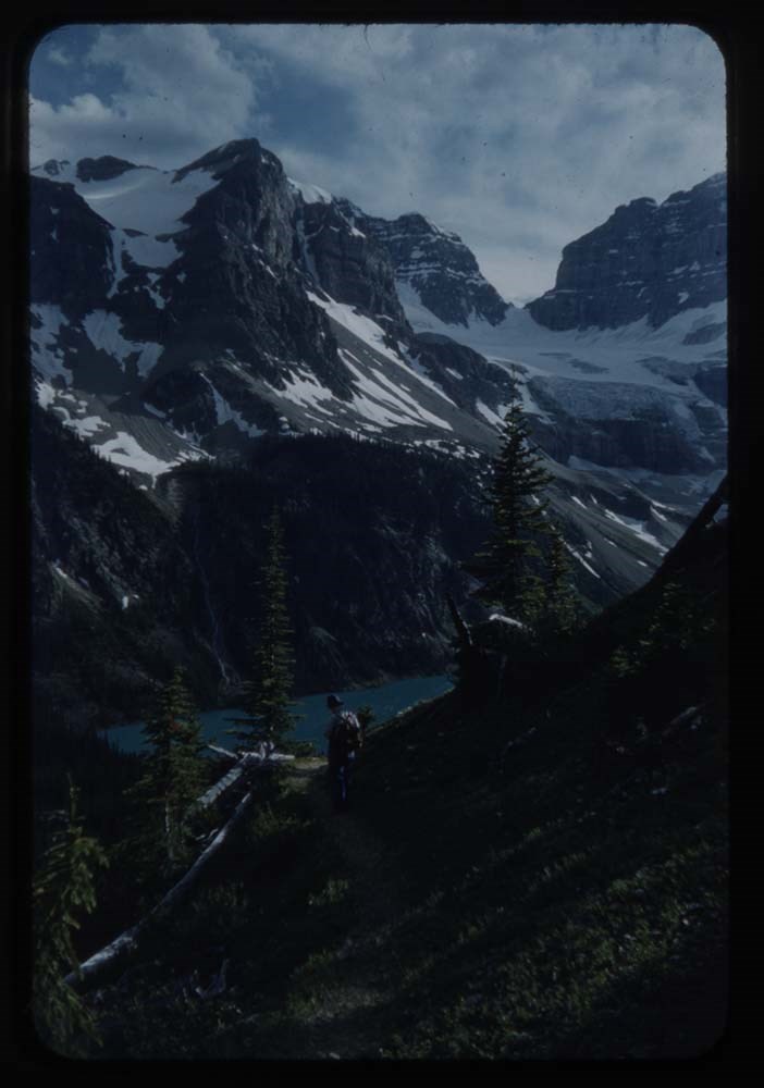
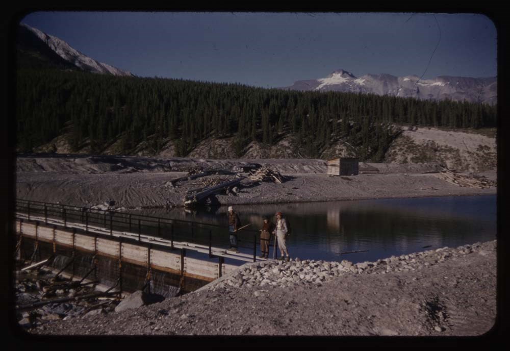
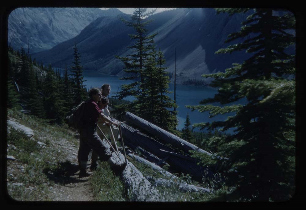
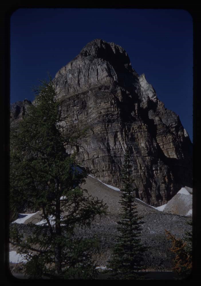
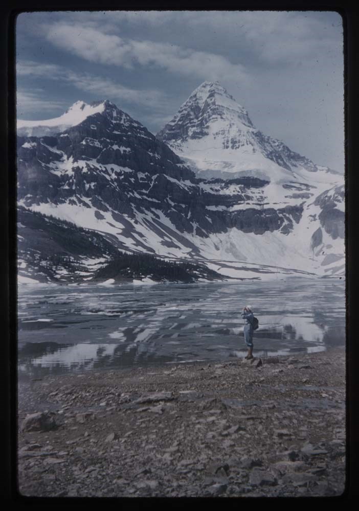
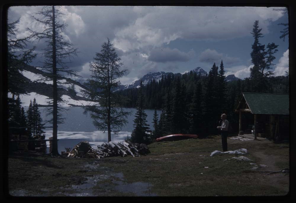
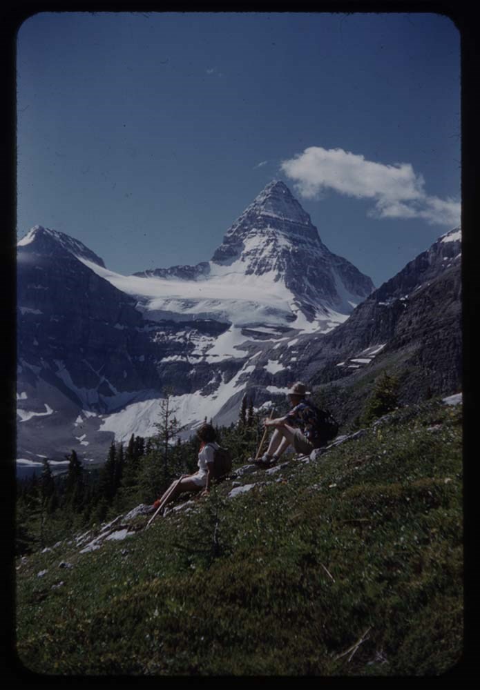
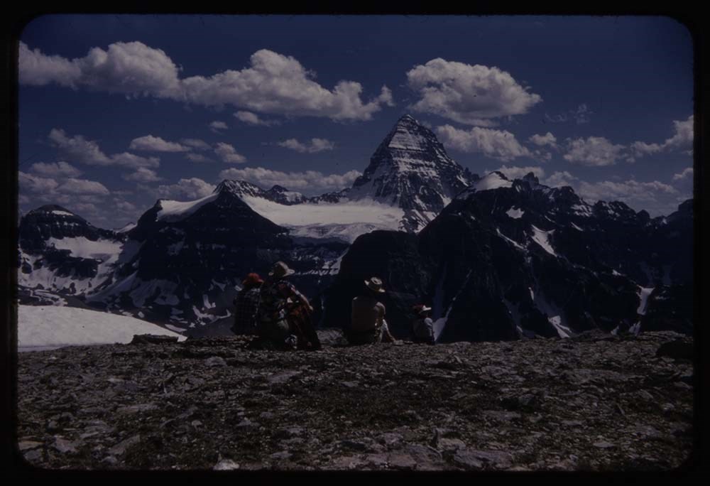
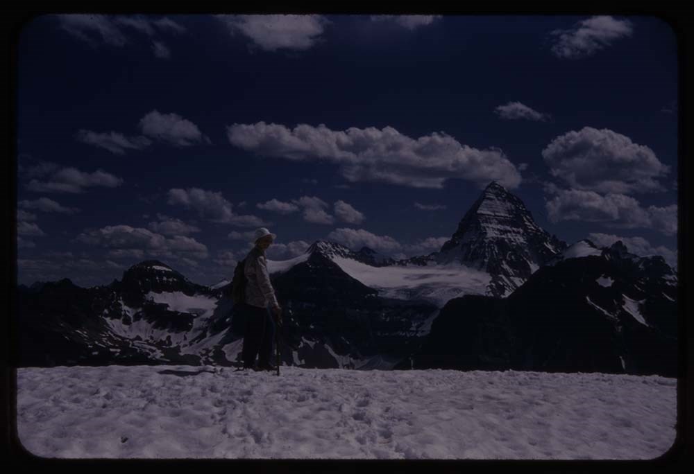
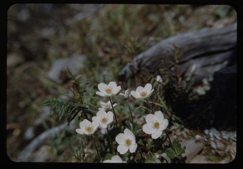
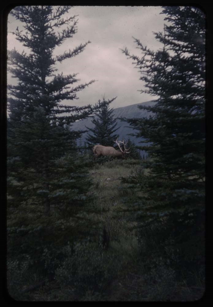
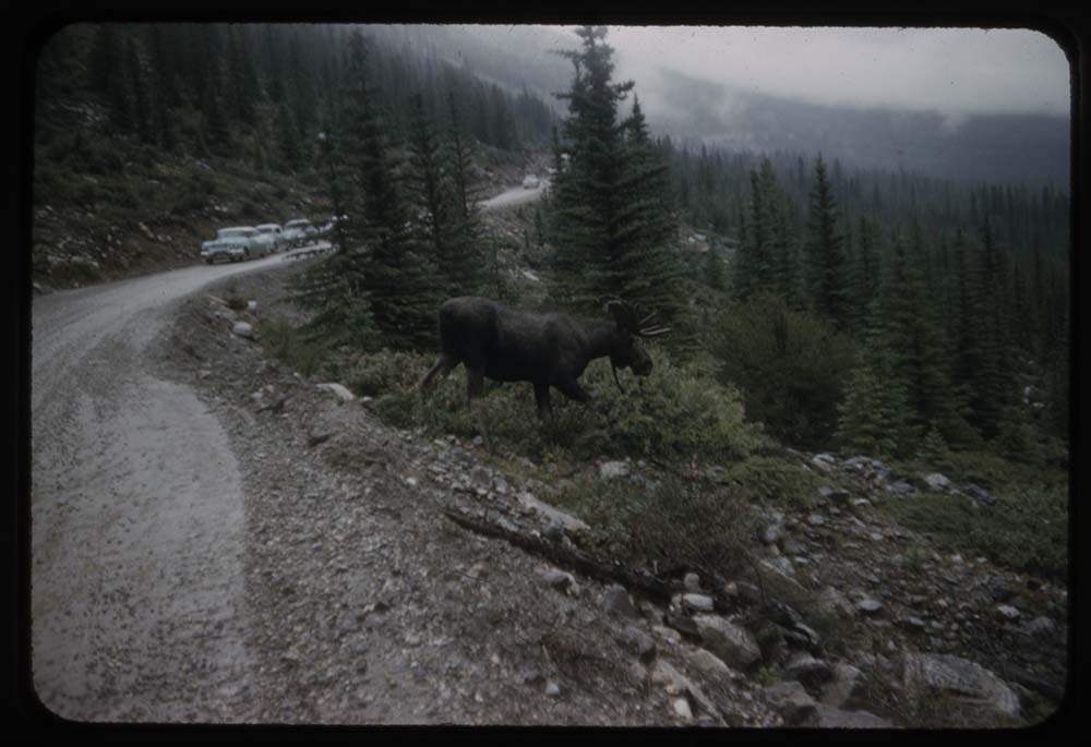
File pertains to 80 slides assembled by Lillian Gest in 1981 into a show from slides depicting various summer to the Canadian Rockies throughout the late 1950s to 1970s as well as a trip to Glacier National Park, Montana and Yellowstone National Park. Topics include mountains and mountain views, wi…
File pertains to 80 slides assembled by Lillian Gest in 1981 into a show from slides depicting various summer to the Canadian Rockies throughout the late 1950s to 1970s as well as a trip to Glacier National Park, Montana and Yellowstone National Park. Topics include mountains and mountain views, wildflowers, wildlife, various camps [mostly Alpine Club of Canada and Trail Riders of the Canadian Rockies], Lillian and her friends, lakes, boats, fishing, hiking, and various other scenic views around Banff, Lake Louise, and Lake O'Hara.
Titles:
1. Reel R195-6 Horse at Hotel Many Glacier
2. R123 21 [Blank]
3. R200 3 Old Faithful
4. R200 5 [Old Faithful] good clouds
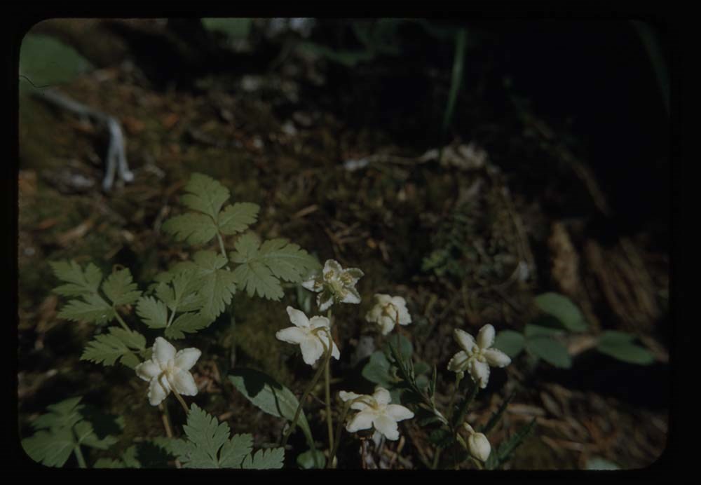
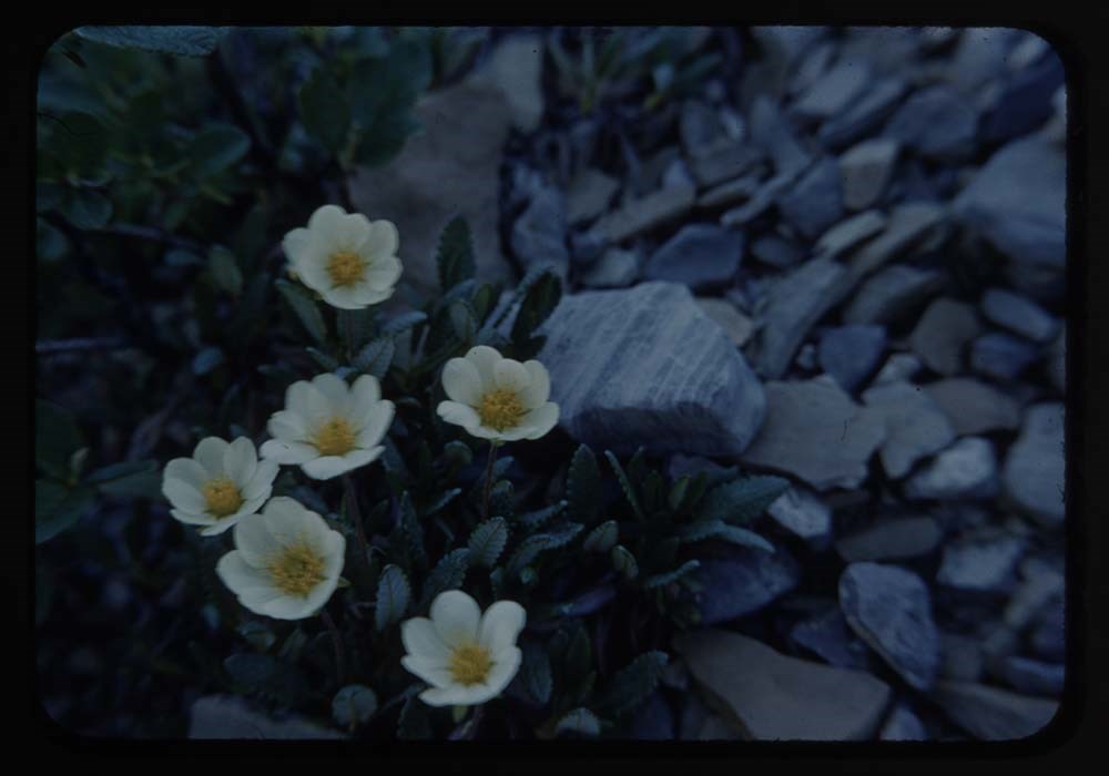
5. R195 15 Bear grass
6. R195 5 Boats ay Many [Glacier]
7. R203 30 Meadows - globe flowers
8. K8 12 Snow- grass - view down Valely
9. K8 14 2 girls coming down lake - SNow & Wiwaxy
10. B26 33 Sis on trail
11. R179 38 2 hikers on trail
12. B23 5 2 photo eagle nest
13. 0CH Columbine
14. 0CH Dryas going to seed
15. 0CH Western globe flower
16. K8 15 2 girls lake & snow - Cathedral & Wiwaxy
17. Twin wake - Snow Mt. Huber & Mt. Vic
18. K15 17 SNow & Mt. Avery
19. K15 15 "Batwing Beauty" [illegible] in b.g.
20. K15 16 Chow Line Mt. Coleman
21. K15 12 Our tent in snow
22. K15 13 Camp in snow
23. B64 4 Camp fire w. campers
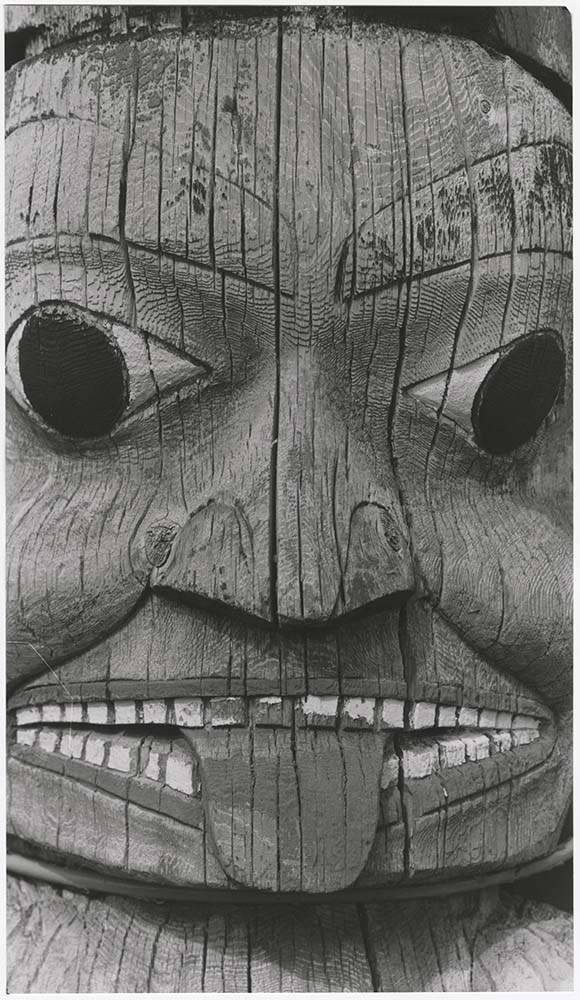
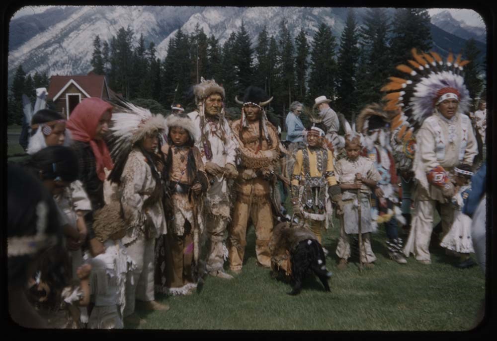
24. B10-10 Indigenous
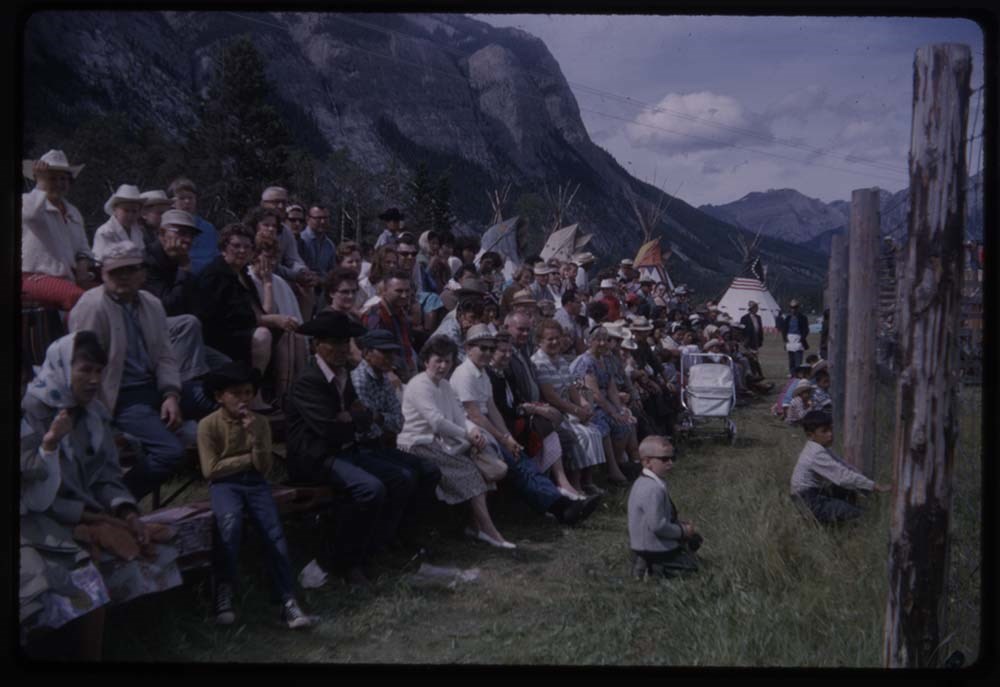
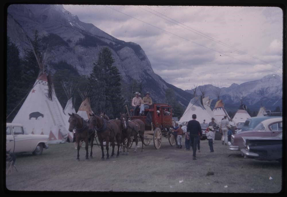
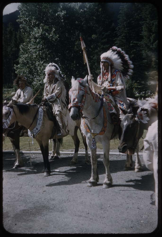
25. B67 26 Banff Indian Days carriages & tepees
26. B67 26 Rodeo audience
27. B36 26 Banff Indian Days & parade grounds
28. B10-6 Banff Indian Days
29. B11-1 Banff Indian Days & teepee
30. B10-2 Banff Indian Days
31. A8-17 Stream & flowers Sunshine 1968
32. A8-19 [Sunshine] flowers
33. A10-34 Chepron Lake
34. A10-35 [Chepron] tea
35. A11-1 Greens Hamilton Lake
36. A11-3 [Greens Hamilton Lake]
37. A11-7 [Greens Hamilton Lake]
38. A11-8 [Greens] View to Valley
39. A18-26 LG & car
40. A18 29 3 hills fr. road
41. A20-28 Fr. Mierville[?] meadows
42. A20-3 [Fr. Mierville[?] meadows]
43. A23-21 Eysa Falls
44. A24-1 Nymphs Pool[?]
45. B23-28 4 girls at Skoki 1959
46. B23-34 [4 girls at Skoki 1959]
47. B26-2 [4 girls at Skoki 1959]
48. B45-11 Above Sedan Lift
49. Reel B45-14 Above Sedan Lift
50. B51-29 Lilies & cabin in b.g.
51. B1-34 Doris on trail Miller L. 1963
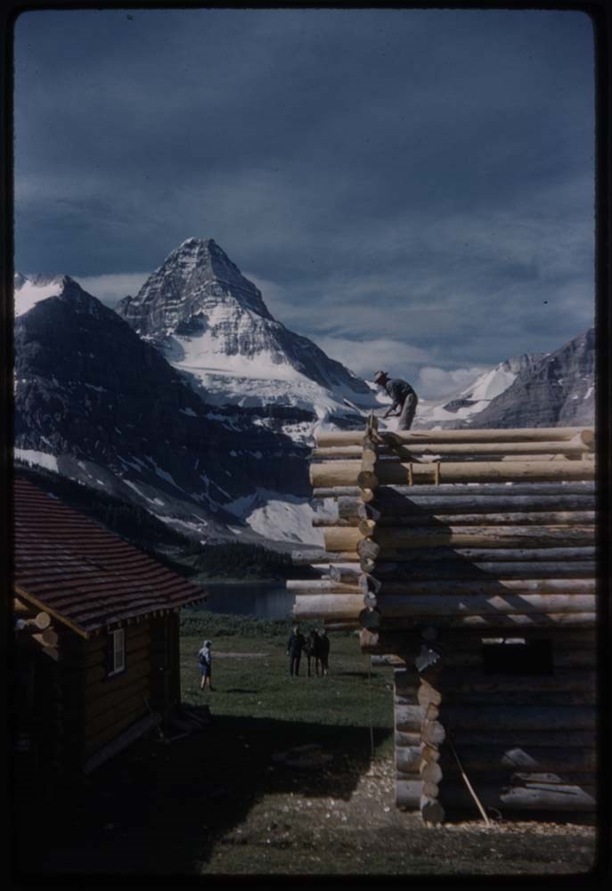
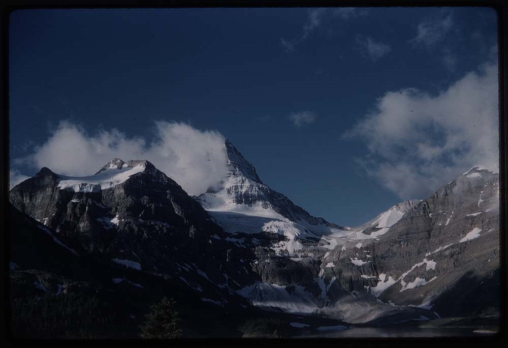
52. B52 fr. Hunt 30A Mummy Lake 1963
53. B22-38 [Hunt] Fall on Creek fr. Talc Lake
54. B52-34 View of Mummy Lake
55. B55-20 Lake & tree
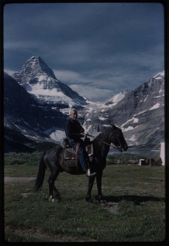
56. B68-19 ACC Camp 1964
57. B71-5 Lamb
58. B73-28 Mary by No see-um Lake 1965
59. B26 36 Sis on trail
60. B26-30 Over Allenby Pass
61. B65-28 Up Brewster Creek
62. R203-10 Horses heads
63. B65-34 Dana fixing stirrup
64. B26-32 Sis & Aubrey
65. CH. 51 Assin. east side
66. R181-25 G on log Assin
67. CH. 51 Assin & reflect.
68. B27-1 Party
69. B27-4 Horseman & horse
70. B27-6 Assin in b.g.
71. B27-7 Blank
72. B27-8 Blank
73. B27-9 Blank
74. B27-11 Blank
75. B27-13 Blank
76. B67-13 Watching climb of Assin
77. B67-3 Elk in glade - Assin
78. B66-36 Nub Trip
79. B66-31 From Nub
80. B55-16 Canyon Panther Falls
Notes
Please note: Language pertaining to First Nations people is outdated and offensive.
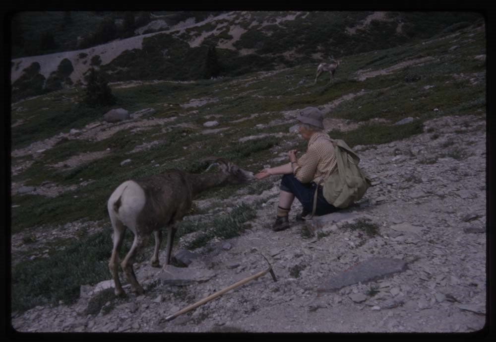
Please note: Behavior towards wildlife, primarily human proximity and feeding, is outdated and no longer tolerated throughout all National Parks - do not feed or approach wildlife.
Slides originally in Kodak Carousel 80 slide tray.
File pertains to a photo album that Includes an assortment of views of the Canadian Rockies; mainly duplicates of those images in Series I. Landscape Photographs. Item-level inventory available.
File pertains to a photo album that Includes an assortment of views of the Canadian Rockies; mainly duplicates of those images in Series I. Landscape Photographs. Item-level inventory available.
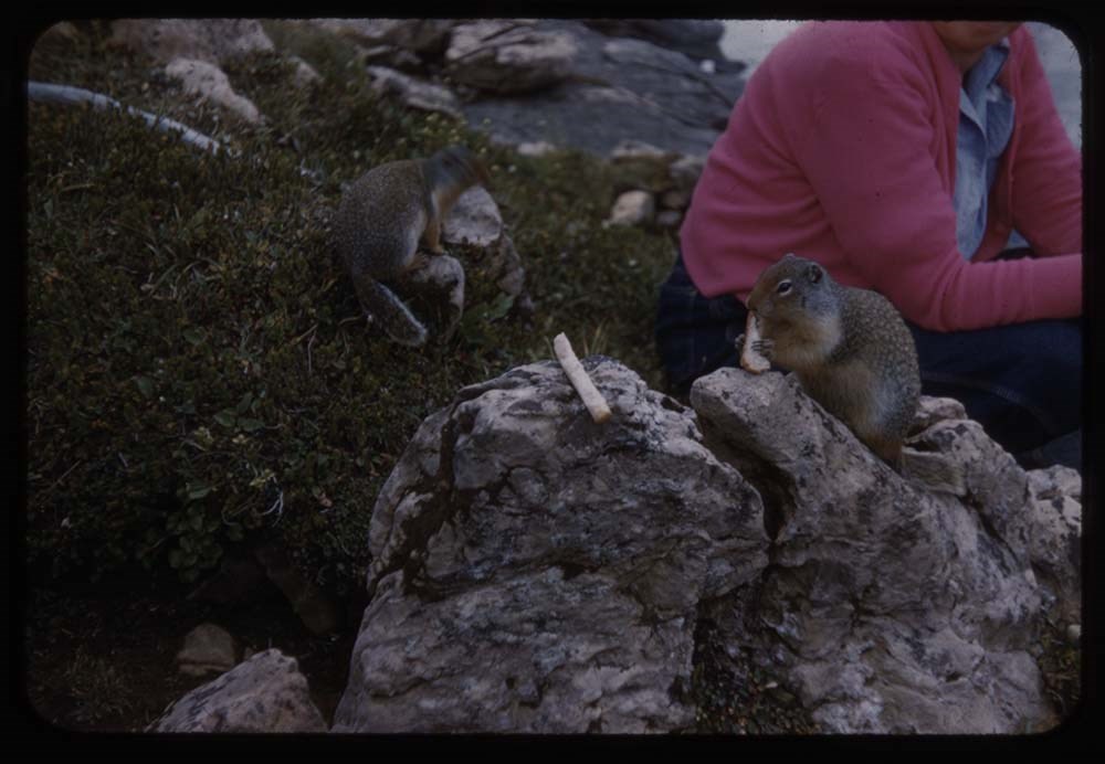
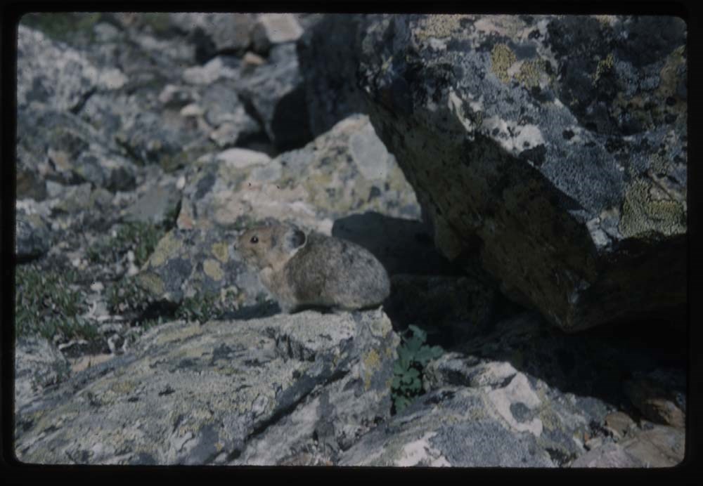
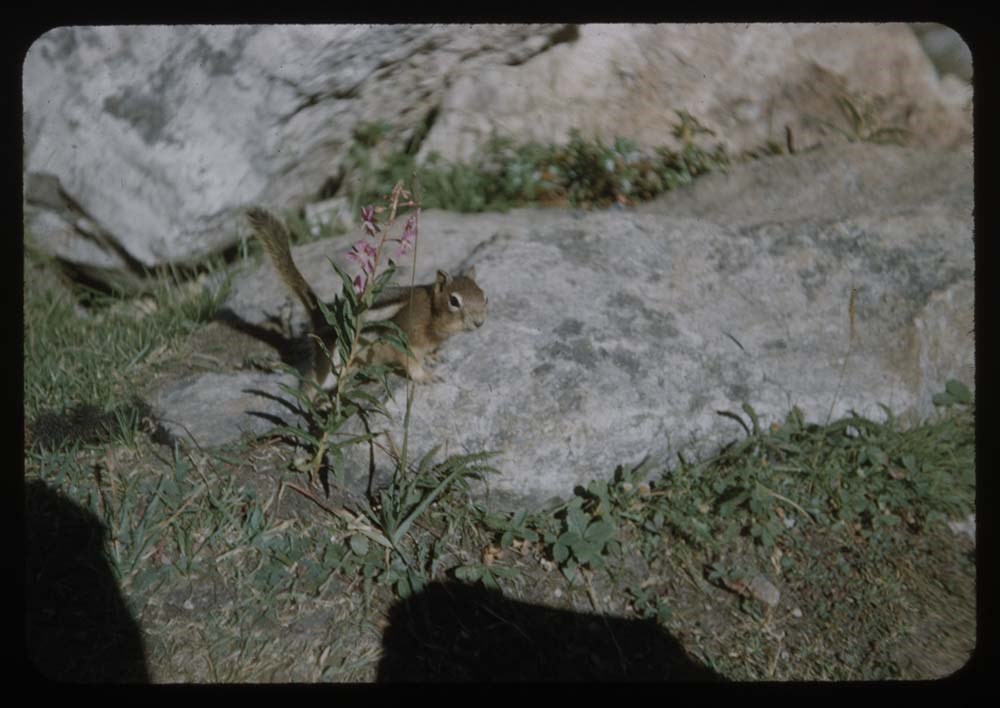
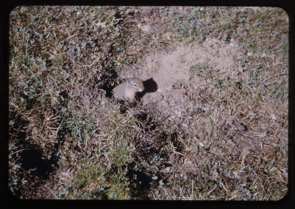
File pertains to 80 slides assembled by Lillian Gest in 1973 into a show from slides pertaining to various summertime trips to the Canadian Rockies throughout the 1960s and early 1970s. Topics include mountains, mountain views, wildflowers, wildlife [including elks, goats, pekas, ground squirrels, …
1973 Can R series IV No 1. -- [before 1973]
V225 / NS 21
Date Range
[ca. 1953-1973]
Physical Description
80 photographs : col. slides ; 35 mm
History / Biographical
See fonds level description.
Scope & Content
File pertains to 80 slides assembled by Lillian Gest in 1973 into a show from slides pertaining to various summertime trips to the Canadian Rockies throughout the 1960s and early 1970s. Topics include mountains, mountain views, wildflowers, wildlife [including elks, goats, pekas, ground squirrels, and birds], Lillian and her friends [Polly and Phyl, as well as ACC camp members], lakes, boats, fishing, hiking, camps, and various other activities.
Titles:
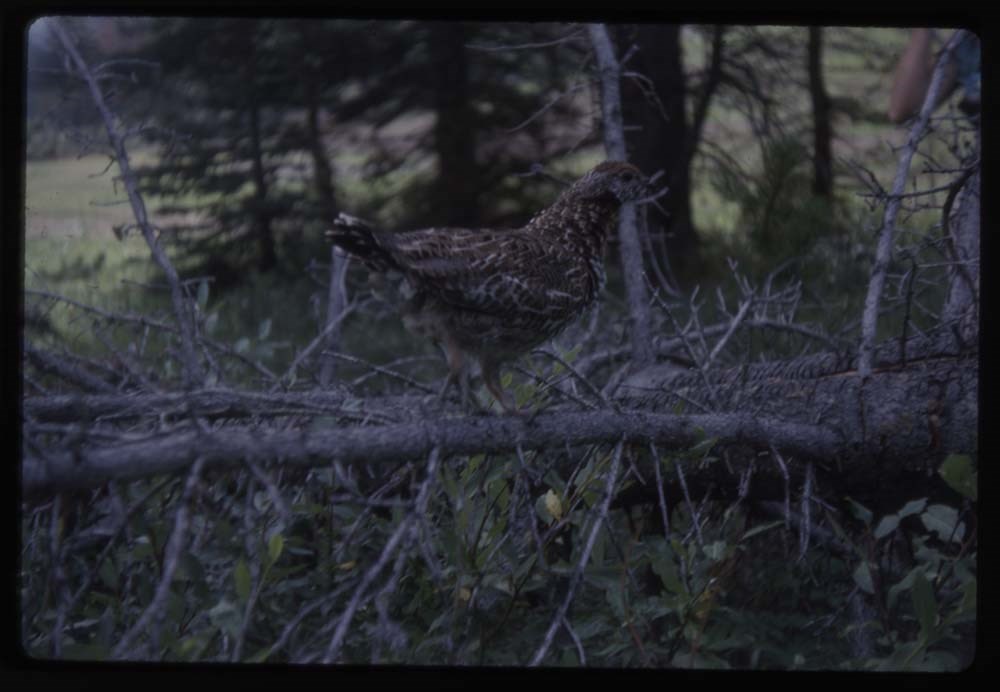
1. B55-10 Fool hen walking log 1963 40 Mile Ck.
1. B55-7 [Fool hen] nearer
3. B55-9 [Fool hen] & chick
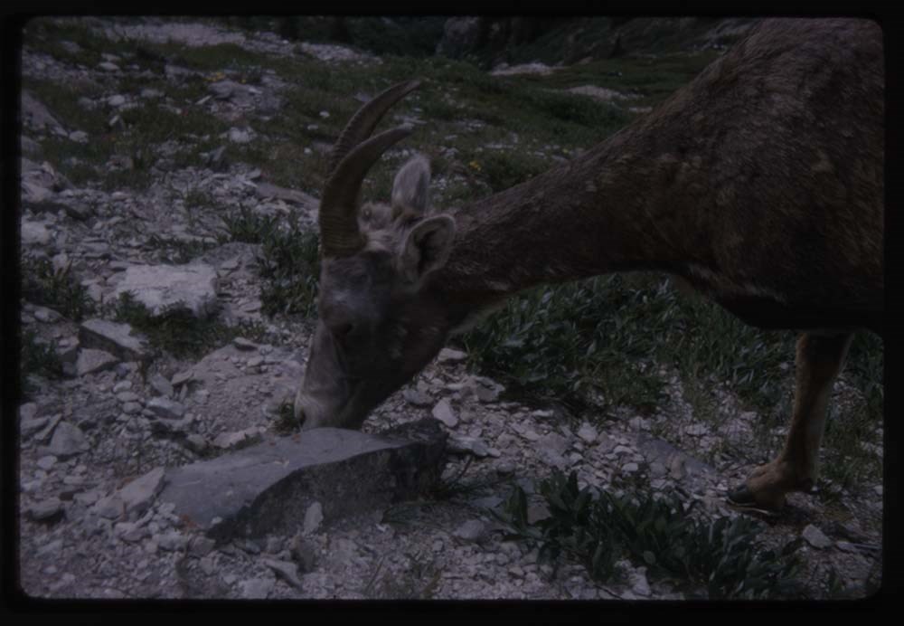
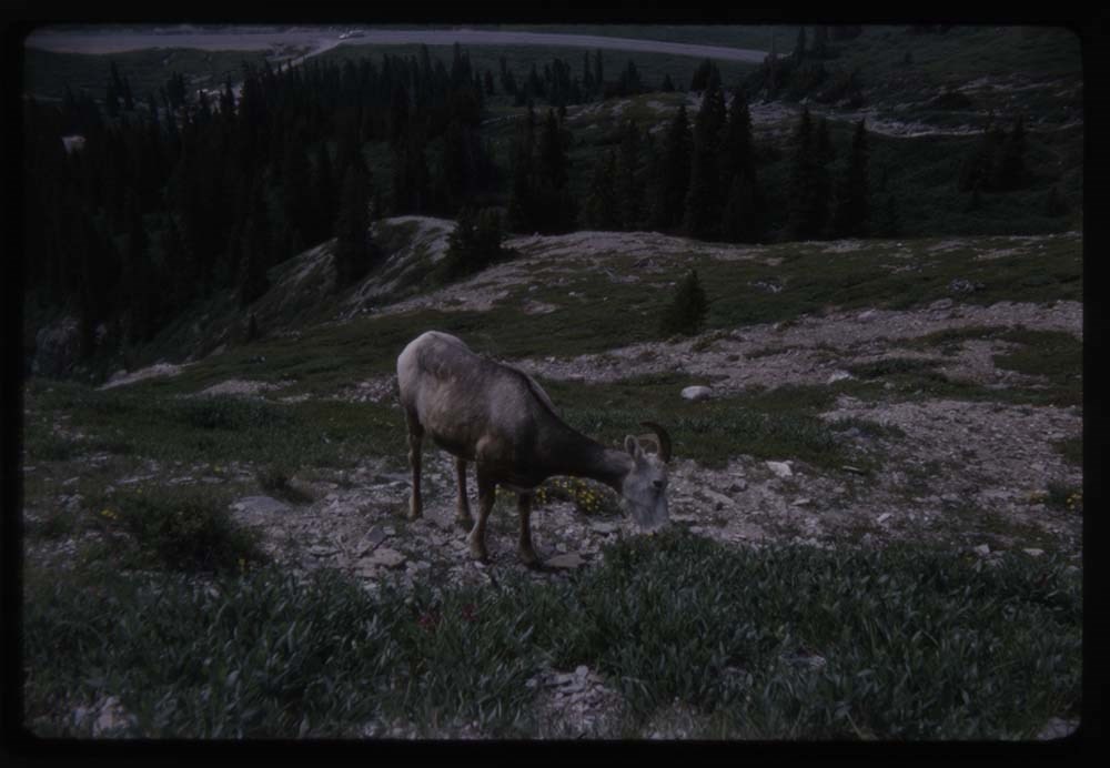
4. B71-33 Sheep close-up Wilcox Pass 65
5. B71-32 [Sheep] Wilcox Pass
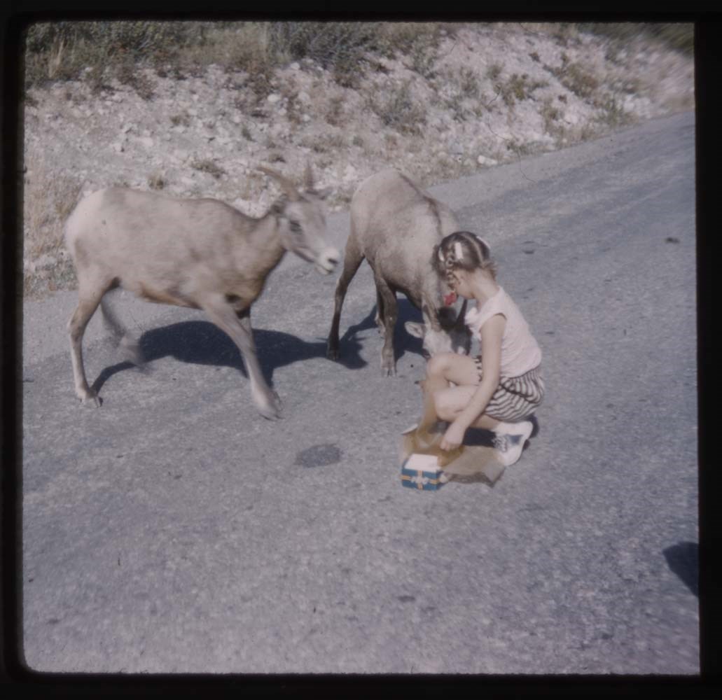
6. B27-38 Two sheep & child on raod 1959
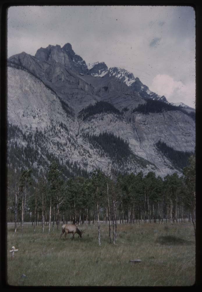
7. B22-3 Elk
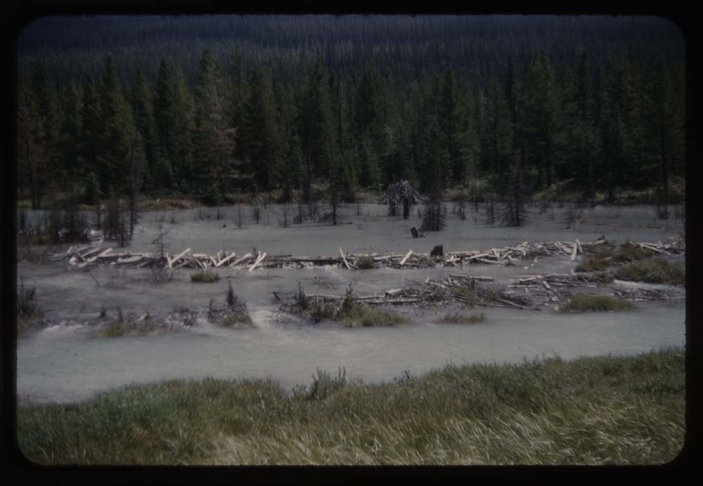
8. R183-4 Beaver dam by RR at Wapta
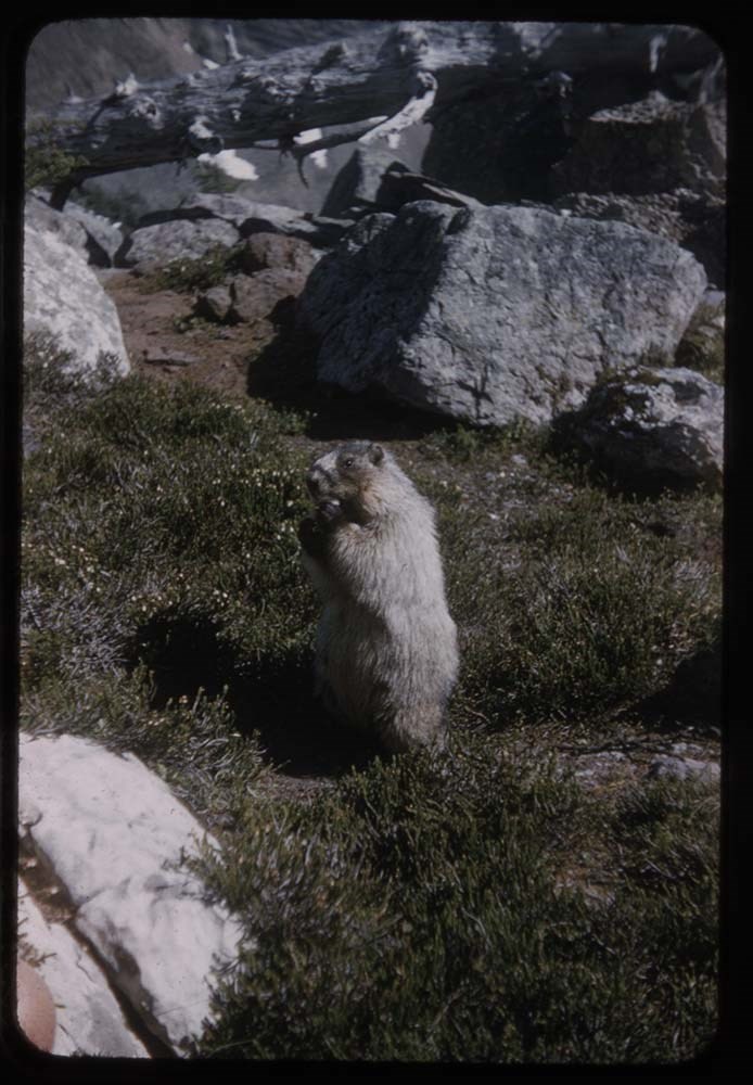
9. R199-10 Marmot
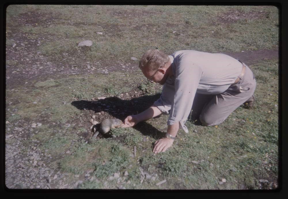
10. B20-22 Polly & gophers
11. A6-6 Two [gophers] on dead tree
12. B30-5 Peka
13. B23-6 Eagle cliff - 14 Eagle on nest (Gmoser Slide)
14. B49-16A L.G. at Moraine Lake - E. Res B Eld.[?]
15. B20-18 L.G. above Oesa
16. B6-27 L.G. & Ax[?] & Sir Donald
17. B19-37 L.G. by alpine stream
18. B6-27 L.G. on trail
19. R209-3 L.G. Cathedral Basin
20. R207-1[crossed out] LG. above O'Hara
21. R207-19 L.G. on Needles
22. R196-30 LG Aberdeen in bg
23. B51-21 Avalanche slides[?] - close-up
24. A6-5 FLower clump - phascelia
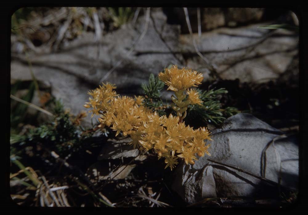
25. CH-0 Stonecrop
26. CH-0 Stonecrop
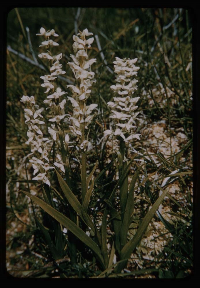
27. CH-51 White Rain orche's[?]
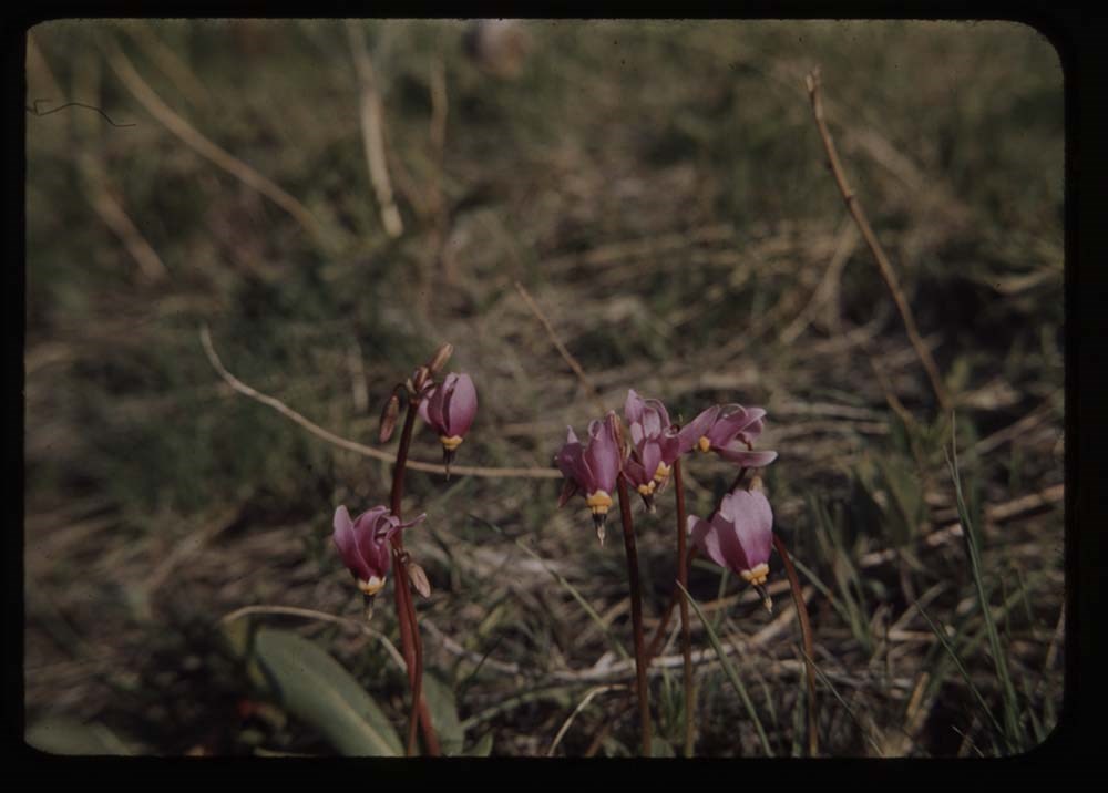
28. CH Shooting star
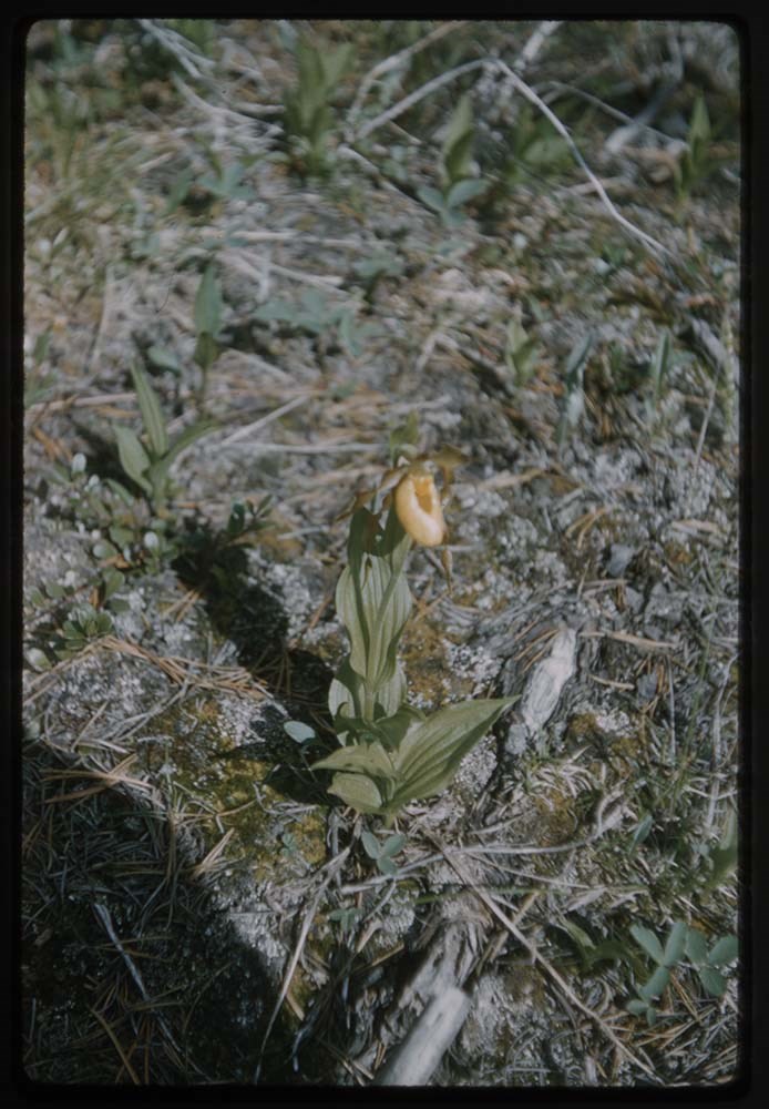
29. B28-25 Lady slippers?
30. B25-2 White heather on rock
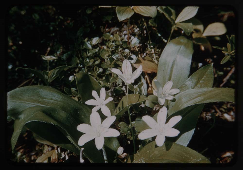
31. R69-13 Queen cup Emerald Lake
32. R175-23 Measle[?] grass of Parnassus
33. R173-22 Clobe flower
34. CH 51 Lyall's Larch in Bbone[?]
35. B69-6 Three on Schaffer L.G Trail Phyl M &
36. B28-24 Yellow flower
37. CH.0 Drunmond's Dryas
38. CH.51 Queen cup Toby Creek
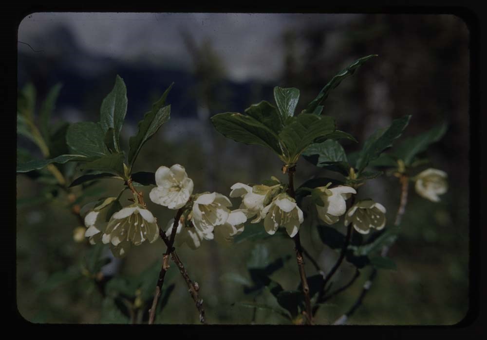
39. CH.0 Wild rhodedendrone
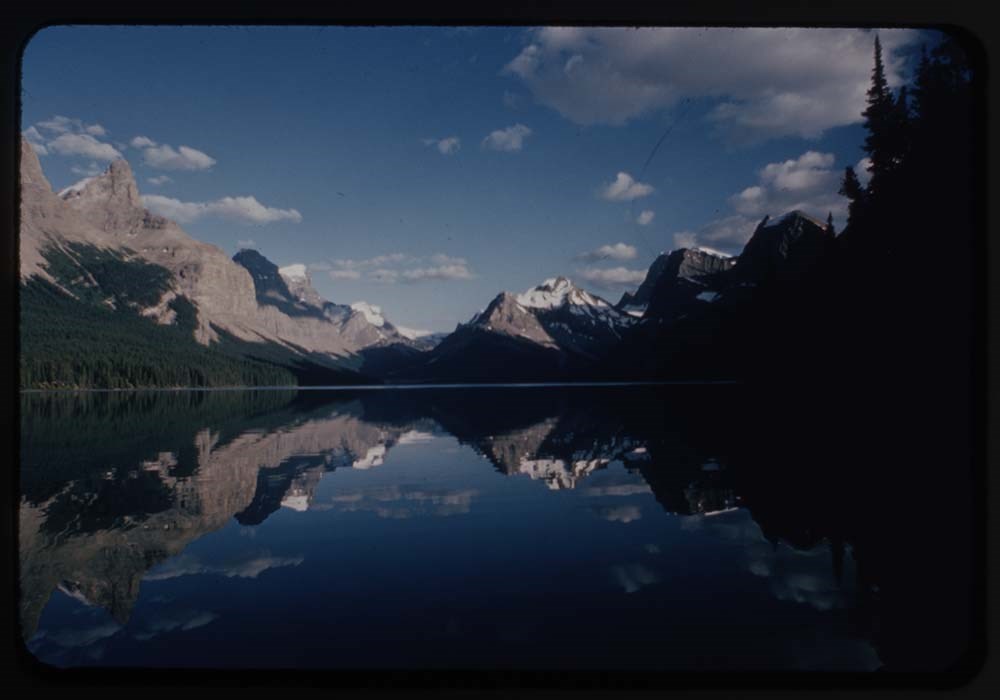
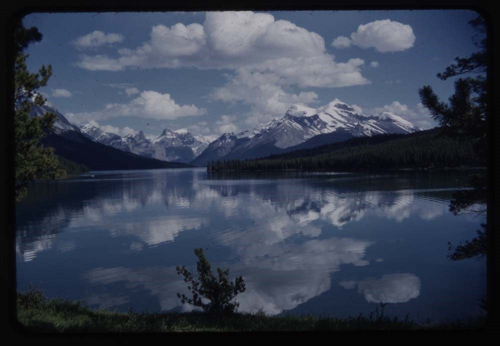
40. CH.6/70 Maligne Lake - sun & shadow & reflec.
41. CH.0 ACC camp Muligne Lake
42. R190-25 Jasper Park Lodge & Pyramid Lake
43. R190-29 Edith Cavel & Lake
44. R183-9 Elk nearest & best
45. B11-5 Goats at Jasper - good
46. B11-8 [Goats] go up bank
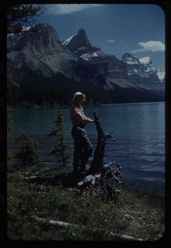
47. R185-32 Polly 1953 Maligne Lake
48. CH.0 Maligne Lake
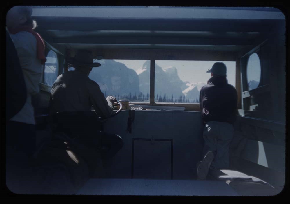
49. R185-37 View from boat
50. R186-24 Logs & back water at Narrows
51. R186-20 L.G. Narrows
52. R186-21 Boat near narrows
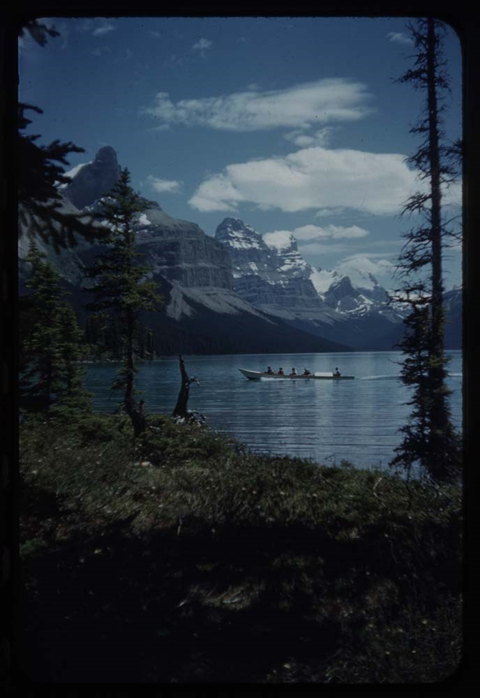
53. R206 34 Party from Lynx
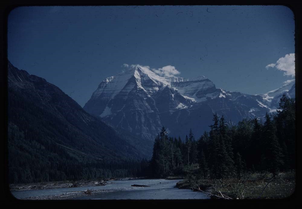
54. Pernine 35 Mt Robson
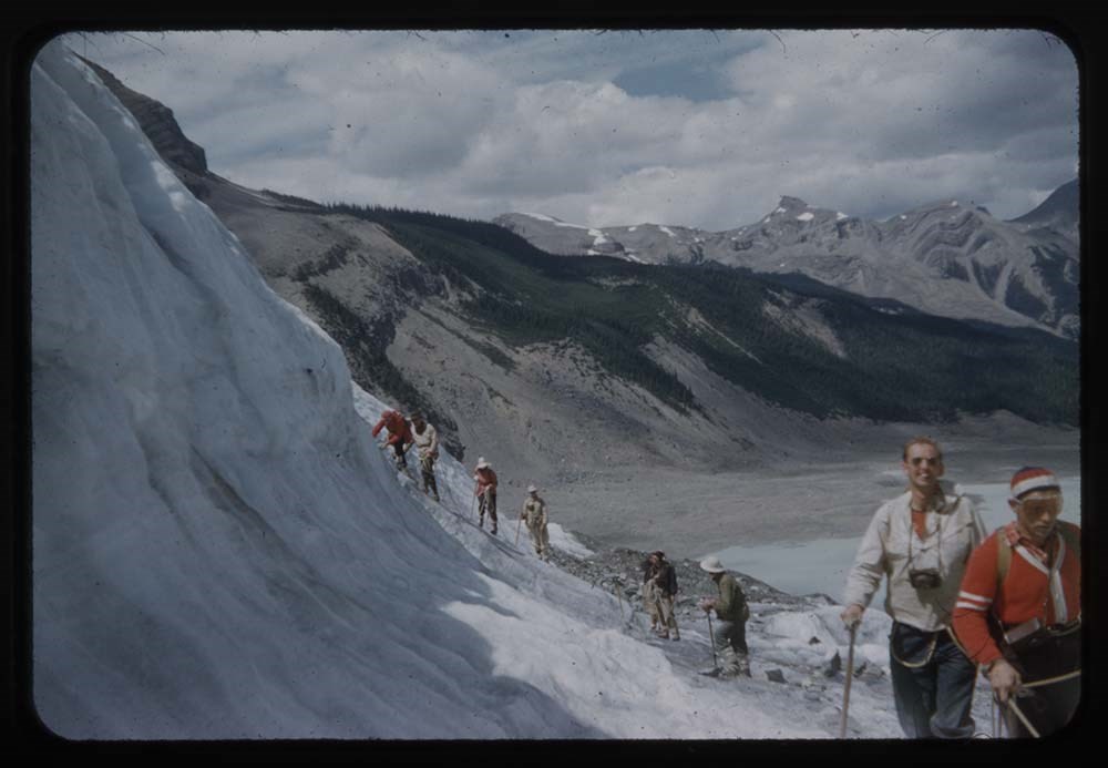
55. R189-12 Party on ice
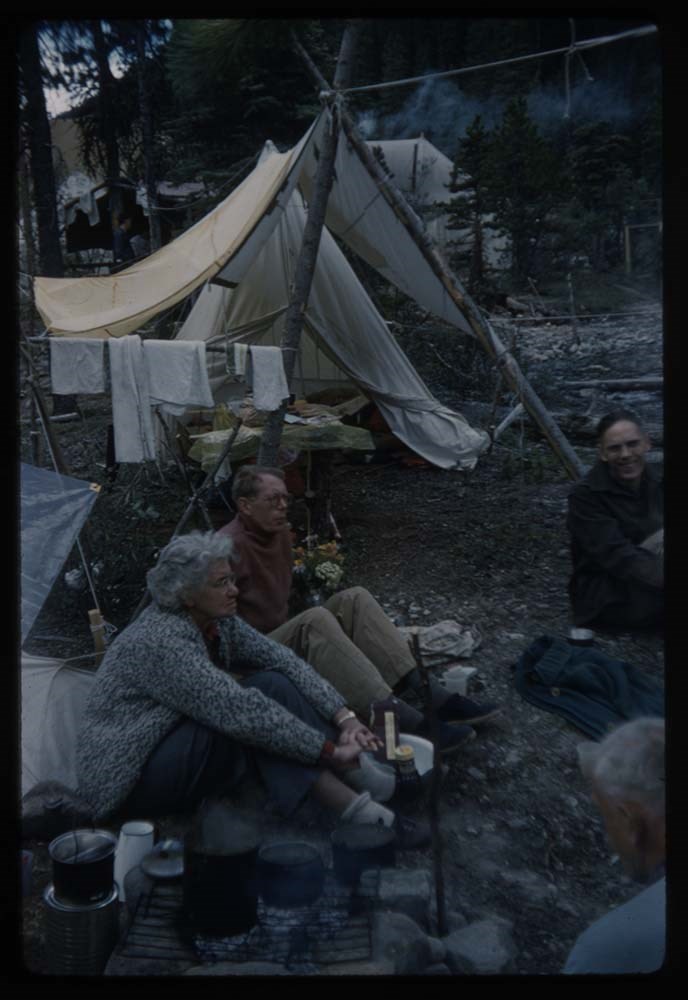
56. B30-22 Camp Phyl coffee party 1960
57. B30-21 [Camp] coffee party 1960
58. B30-23 Phyl & tent
59. B30-36 High Camp[?]
60. B30-35 Lake & reflections 1960
61. B30-34 Lake & Beth 1960
62. B30-33 Lake & Peaks 2 people
63. B30-32 Olympus & Xerxes
64. B30-31 Pack train leaving camp
65. B30-30 Phyl taking picture nest
66. B30-29 Phyl & Brussels
67. B30-28 Mt Brussels
68. B68-3 Camp & fire circle
69. B68-9 Girls camp fire
70. B14-20 Mrs Krat[?] on Verm. Lake
71. R164-25 Gr. Squirrel back of flower
72. R148-6 [Gr. Squirrel] Peyto Lake camp gr.
73. R175-2 Gopher coming out of hole
74. A10-21 Dennis feeds gopher
75. B32-1 Feeding gopher taken out 3/28/78
76. B20-20 Polly M & gopher taken out 3/28/78
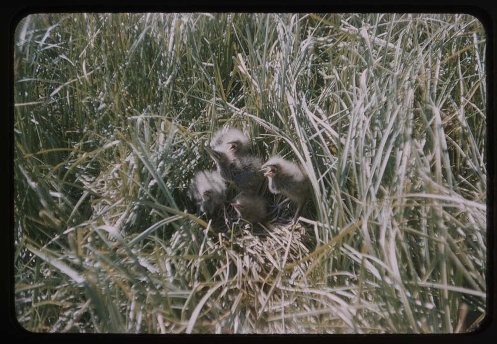
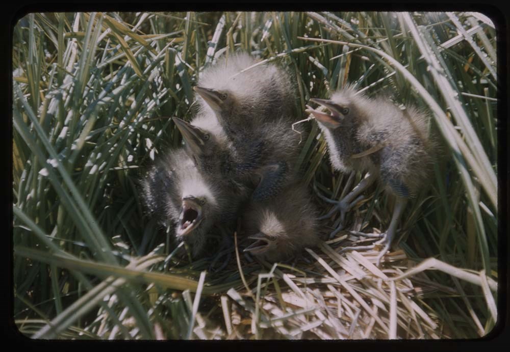
77. R202-2 Spotted Sand pipers best
78. R206-5 Baby spotted sandpiper
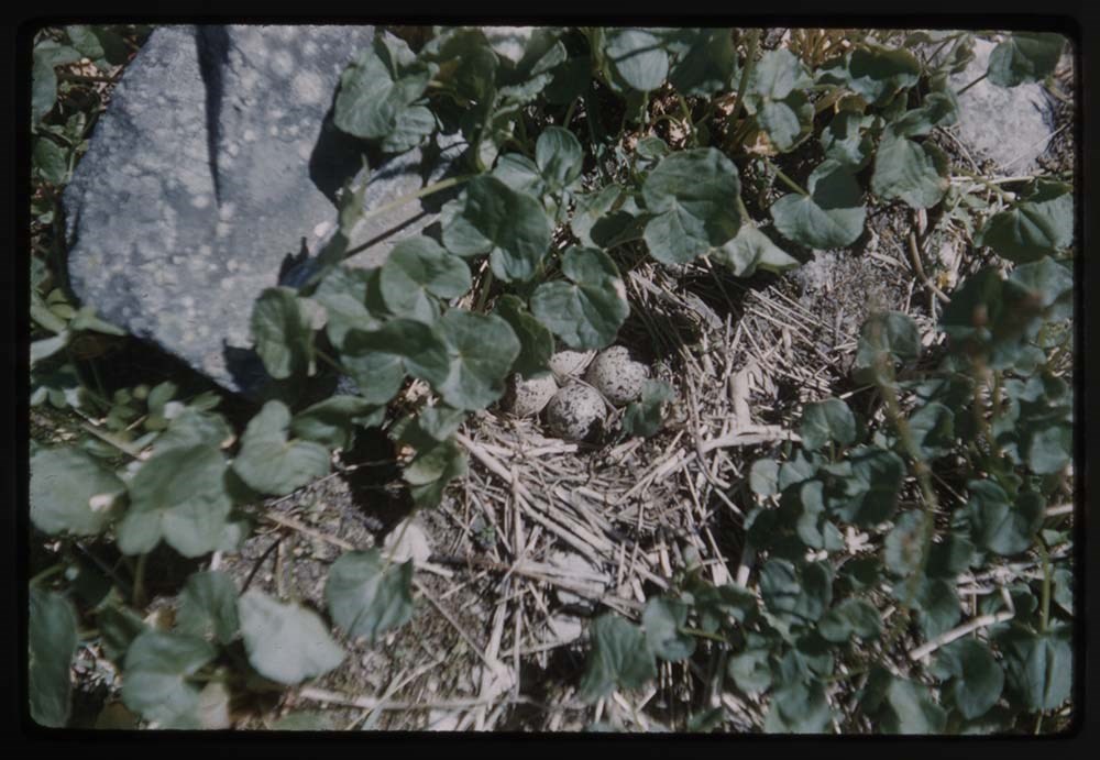
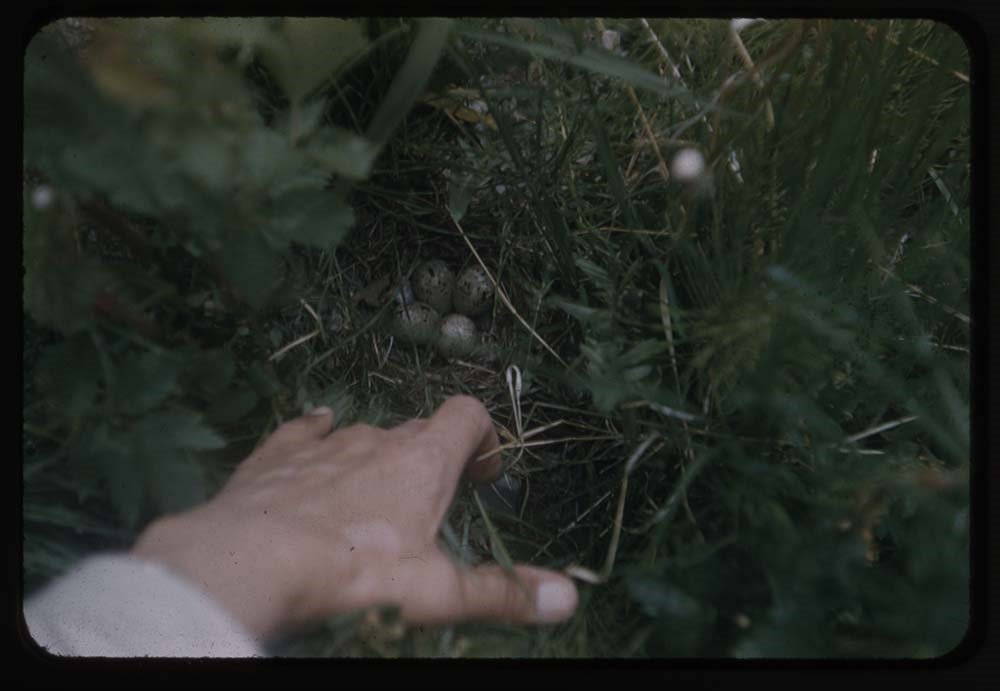
79. B15-30 Bitter's nest in [illegible]
80. B29-27 Nest w. 4 spotted eggs
B15-37 & 35 Bitterns in nest taken fr. Series I put in 79 & 80
Notes
Please note: Behavior towards wildlife, primarily human proximity and feeding, is outdated and no longer tolerated throughout all National Parks - do not feed or approach wildlife.
Slides originally in Kodak Carousel 80 slide tray.
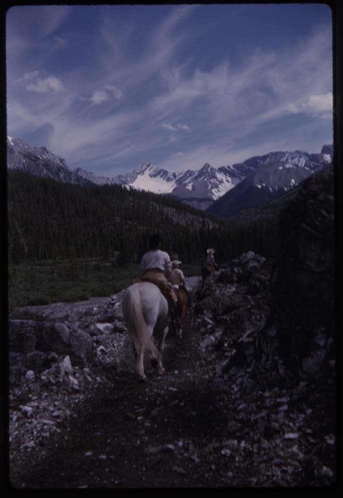
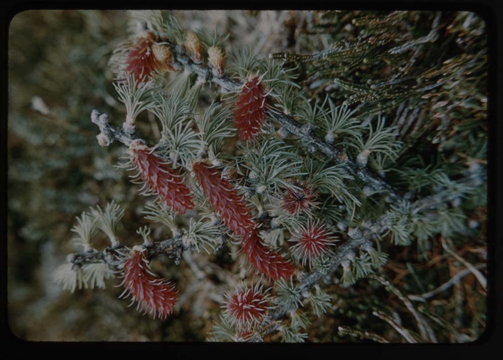
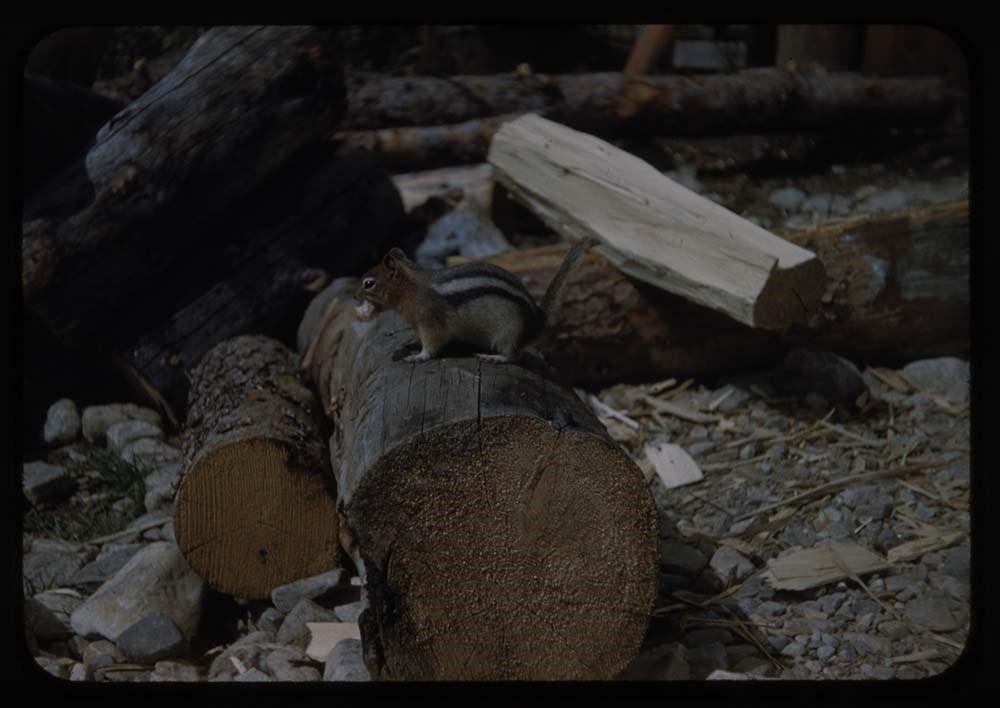
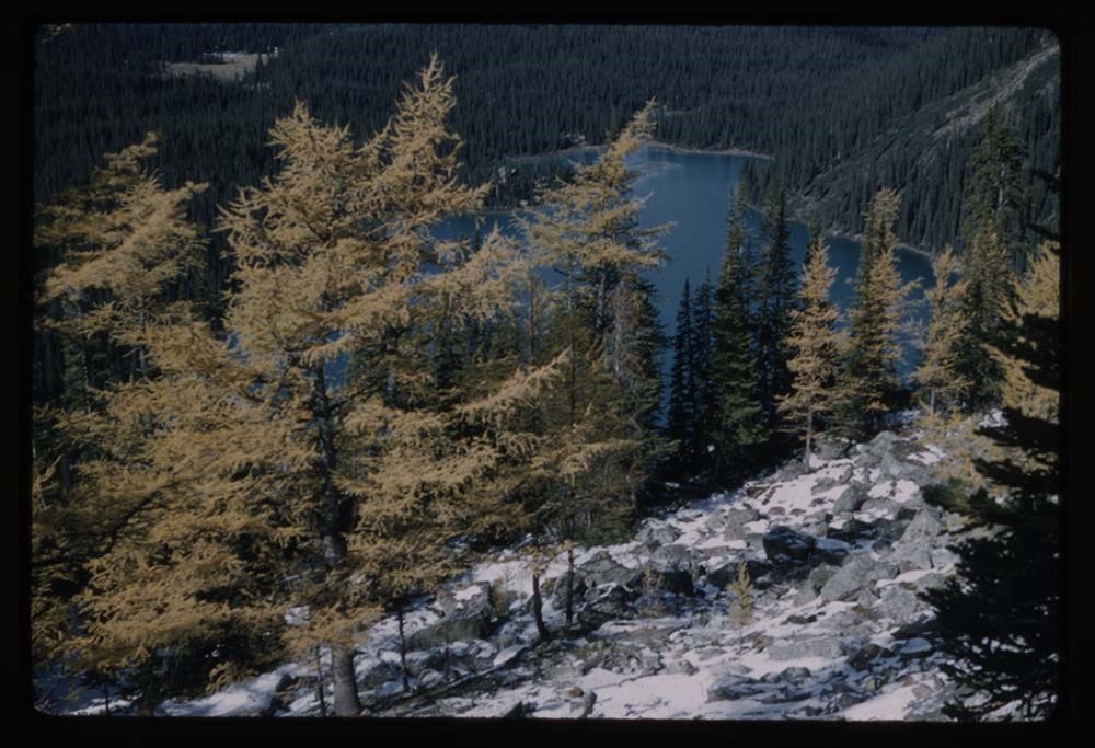
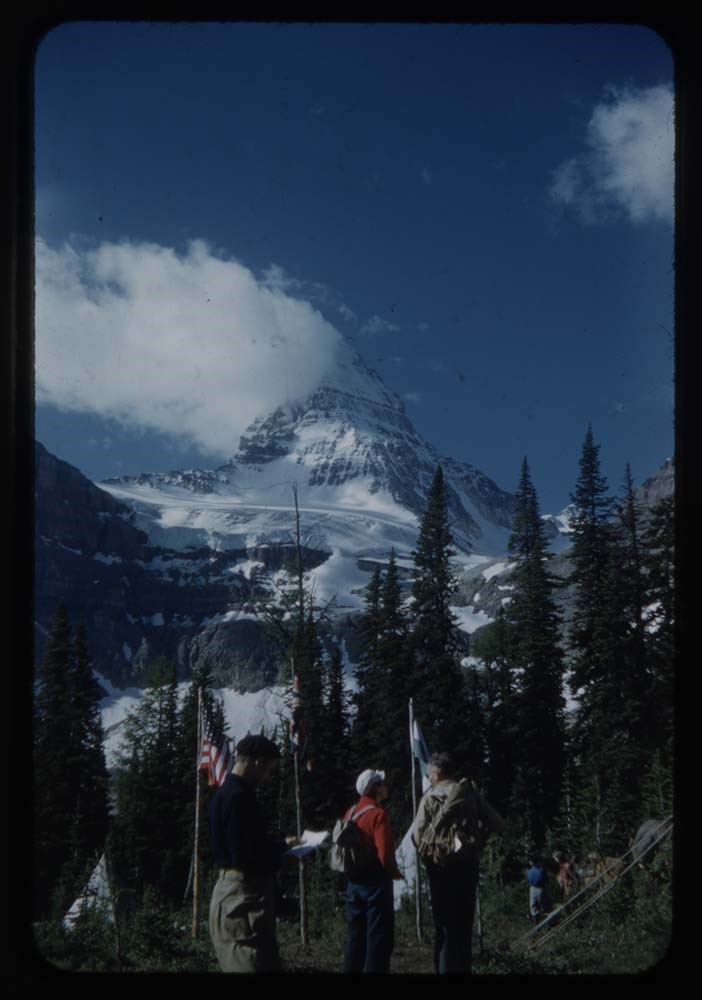
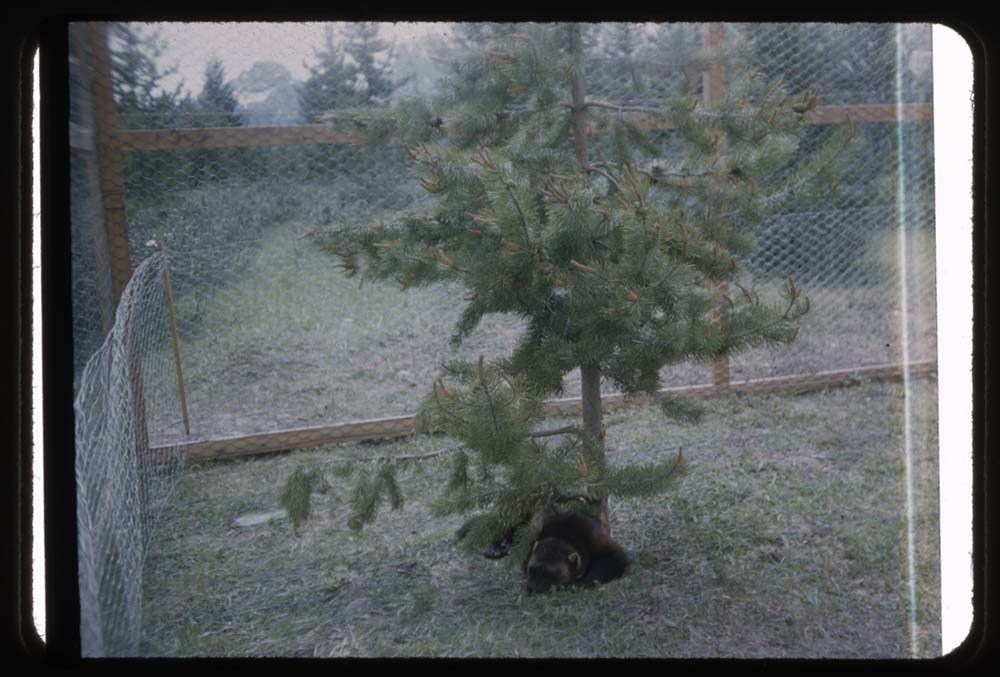
File pertains to 78 slides assembled by Lillian Gest in 1973 into a show from slides pertaining to various summertime trips to the Canadian Rockies throughout the 1950s to the early 1970s. Topics include mountains, mountain views, wildflowers, wildlife [including elks, goats, pekas, ground squirrel…
File pertains to 78 slides assembled by Lillian Gest in 1973 into a show from slides pertaining to various summertime trips to the Canadian Rockies throughout the 1950s to the early 1970s. Topics include mountains, mountain views, wildflowers, wildlife [including elks, goats, pekas, ground squirrels, and birds], Lillian and her friends [Polly and Phyl, as well as ACC camp members], lakes, boats, fishing, hiking, camps, and various other activities.
Titles:
1960 1. B31-37 Lake MacArthur - ice
2. grassi 18-59 Mt Huber & larches
1958 3. B20-24 Polly Merrick & Eileen
1951 4. R172-11 Camp & reflections - Opabin Pass in b.g.
5. R171-6 Alpine Party by lake
1963 6. B54-38 My ice ax points to glacier worm cores
1960 7. B31-35 Trail near Lake MacArthur
8. B31-36 [Trail near Lake MacArthur] different
9. B29-32 4 hikers neet John Linn on horse
10. B32-3 MacArthur Lake & reflections
11. B32-4 Big rock by MacA Lake & hikers
12. B32-8 Lake & reflections
13. B32-9 MacA Lake, Mt Biddle & reflections
14. B32-10 [MacA Lake] looking towards Biddle - Park col.
15. B32-11 Tepees in meadow at O'Hara
1963 16. B54-29 Group of hikers across lake Mt Cath in b.g naturalist group
17. B54-31 Diana Park by on Opabin Lake
18. Grassi 16 Larches at O'Hara
1959 19. B24-27 Tree with cones
1960 20. B29-14 Tree with cones - Lake O'Hara in bg
1955 21. R207-25 Abbot Pass
22. R207-24 Eileen & Edward on glacier
23. R207-36 L.G at Abbot Pass Vic ridge in b.g.
24. R208-4 Party below Pass
1951 25. R174-5 Party at Oesa - Lefroy in b.g.
26. R172-22 Edwards Party - Opabin Pass in b.g.
27. O Caroline Hinman in 1932
1953 28. R185-27 Polly Prescott & boat by lake
1952 29. R183-14 Miette Pool
30. O CH Maligne Lake
1952 31. R183-6 Lake Beauvert
1953 32. R191-4 Mt Cavel & Jasper Lodge
1951 33. R169-11 Emerald Lake & Mt President & Vice P.
34. Reel 44-9 Mt Burgess
1951 35. R169-15 Kelloggs on rock. Emerald Lake
36. R169-17 Frances on rock
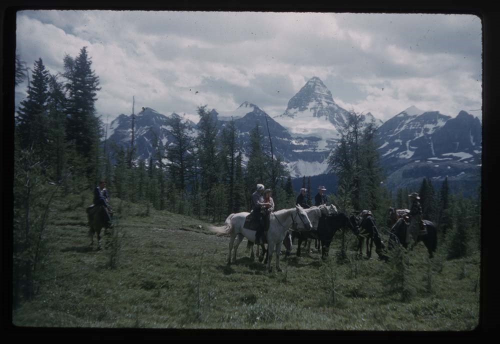
37. CH 6/70 Assiniboine
1952 38. R179-20 Mt Assiniboine w. plume [MISSING]
39. R181-29 Marg, Fleming and Muriel on horses - Mt Assiniboine [MISSING]
40. R181-31 Mt Aye & riders
41. R181-32 End of trail by dam - out of Assiniboine
42. R181-33 Spray Lake by dam
43. R179-9 Trail far side of Wonder Pass
45. R179-39 2 hikers above marvel Lake
46. R180-31 Assiniboine fr. near Sunburst Lake
47. R180-34 Wedgwood Pt.
48. R179-22 Mt Assiniboine & campers
1955 49. R202-35 Strom's Halfway camp
50. R205-21 Party on horses. Mt Assin. in bg
51. R205-10 Stroms w. corral - main Lodge
52. R203-4 L.G. - Lake Magog - Assin & Magog
53. R203-19 Elizabeth Rummel's Cabin and Sunburnt L.
1952. 54. R180.38 Mt Assin. & 2 climbers
55. R181.23 Mt Assin - hikers on Nub
56. R181.22 [Mt Assin] LG on Nub
1951 57. R170-10 Chalice cup
58. O CH Wind flower (on globe)
1952 59. R183-8 Elk - head down
1954 60. R195-39 Wolverine Disney's animal farm
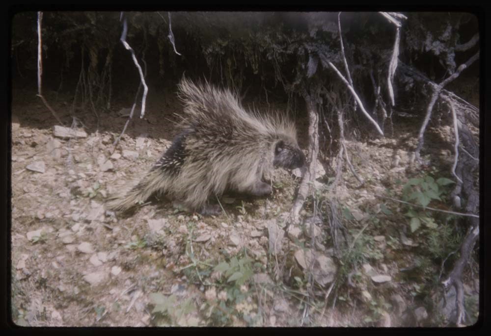
1965 61. B72-10 Porcupine
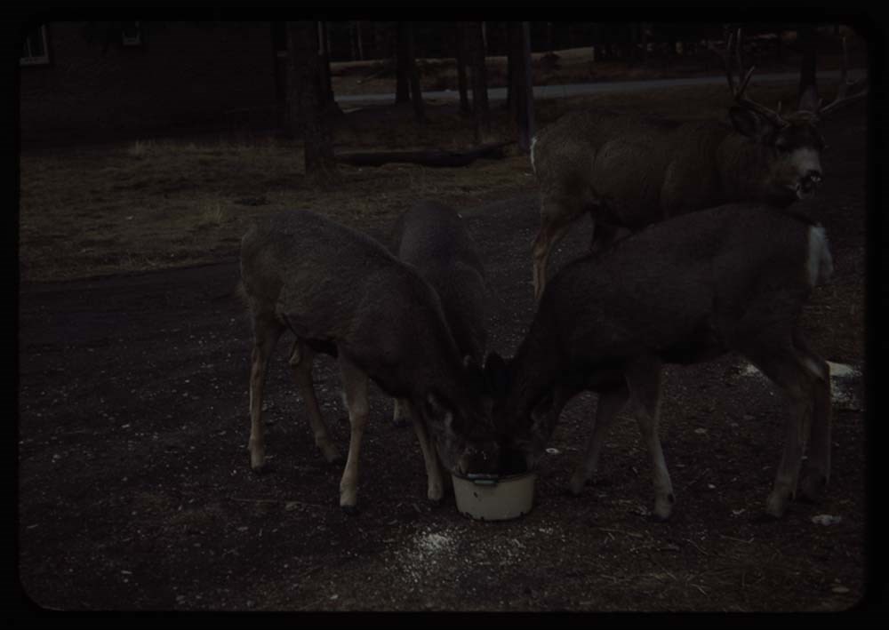
62. CH.49 3 Does & buck eating oatmeal
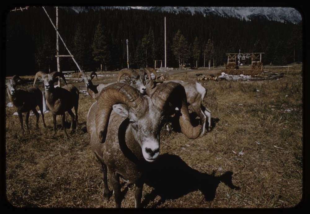
63. CH.0 Rams
1965 64. B71-34 Marg, Fleming & ewe
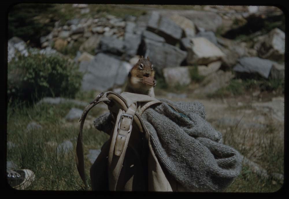
July '52 65. R178-26 Squirrel on rucksack - Lake Agnes
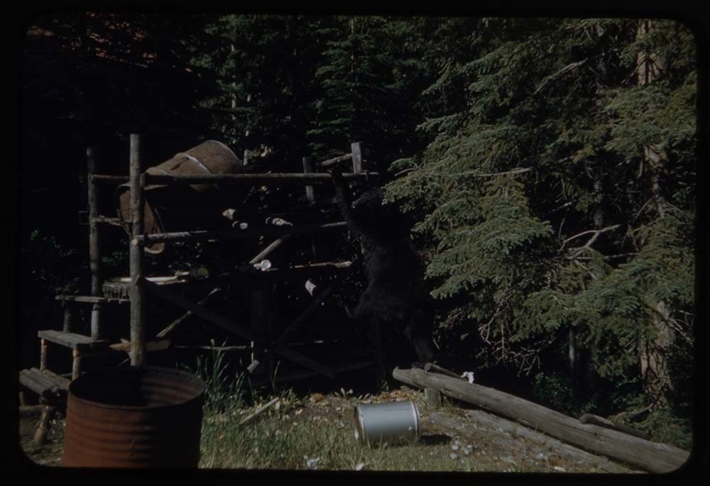
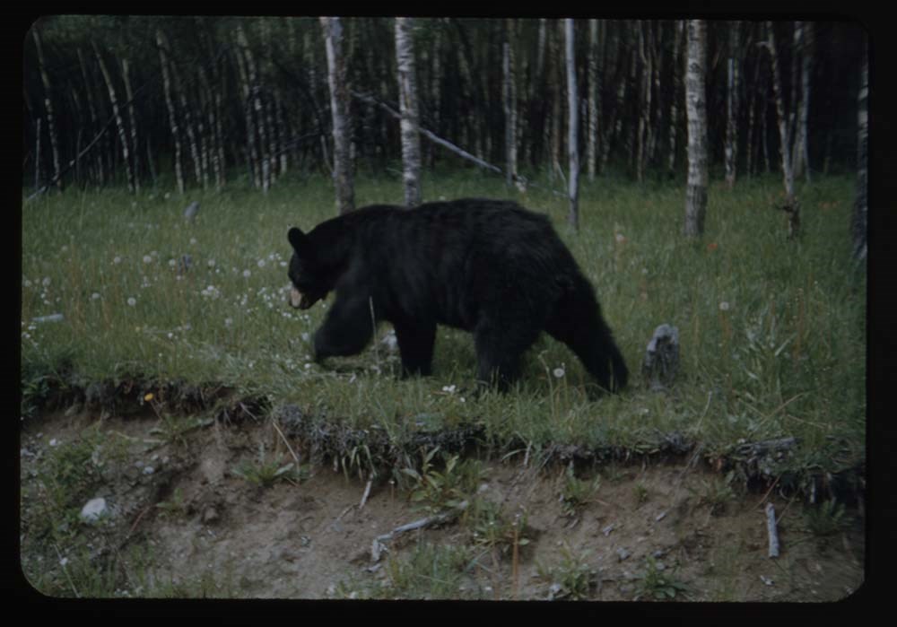
July '52 66. R178-28 Bear at the Clubhouse
1964 67. B67-15 Strom & porcupine on hitching post
68. B67-21 Porcupine on same - boy looks on
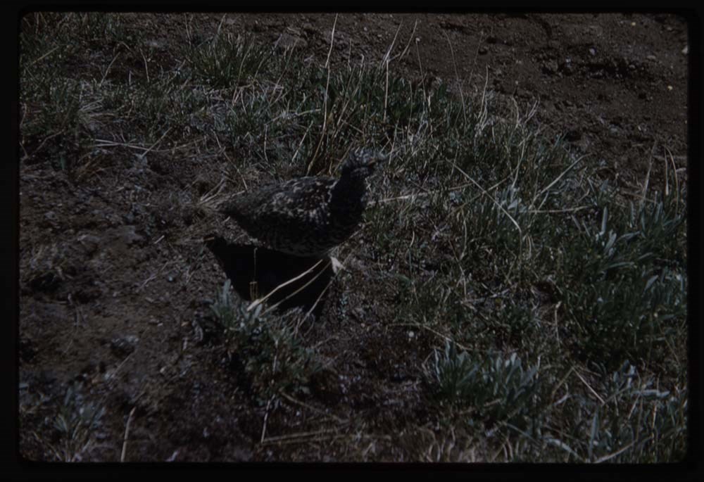
1959 69. B26-18 Ptarmigan
70. Ruth B. Water onzel[?] rock - near Assin.
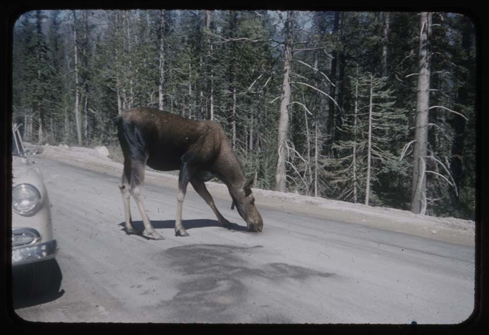
1955 71. R207-12 Cow moose on road to Moraine Lake
1957 72. B11-33 Moose moves off road - good
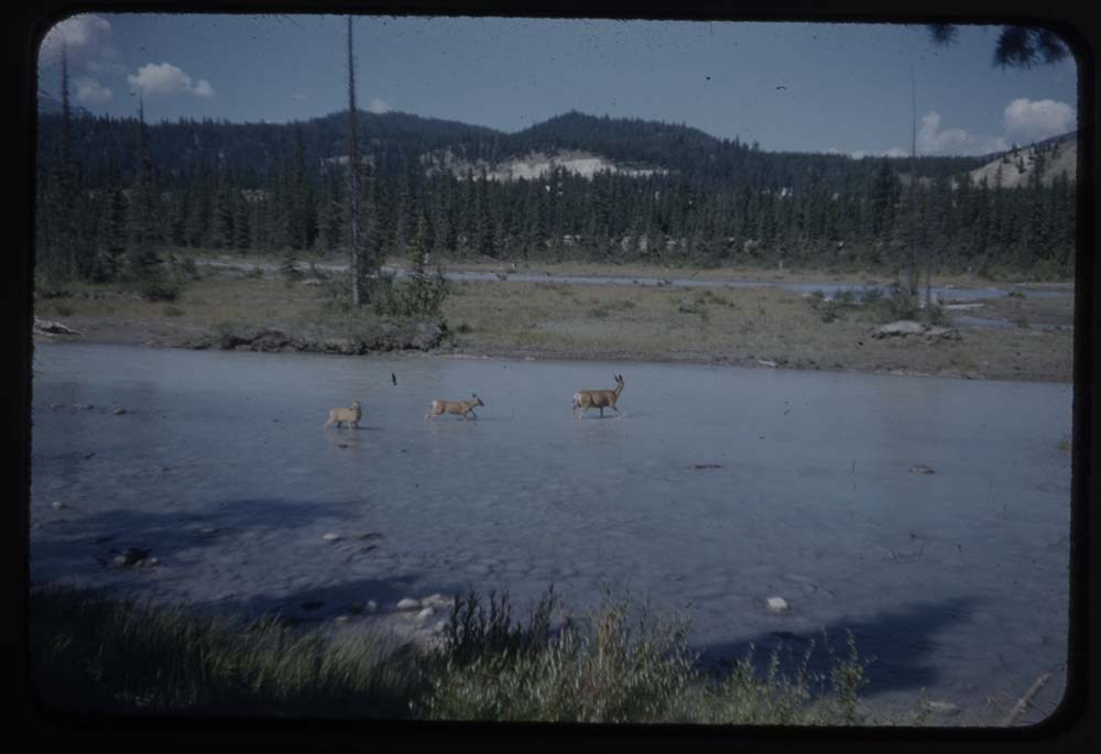
1953 73. R190-37 Deer crossing river
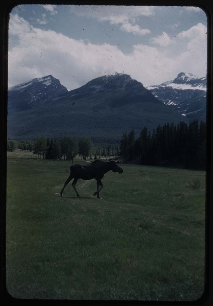
1956 74. B1-1 Moose at Hilldale
1958 75. B15-33A Phyl's bitterns
1952 76. R177-33 Bear walking back above road
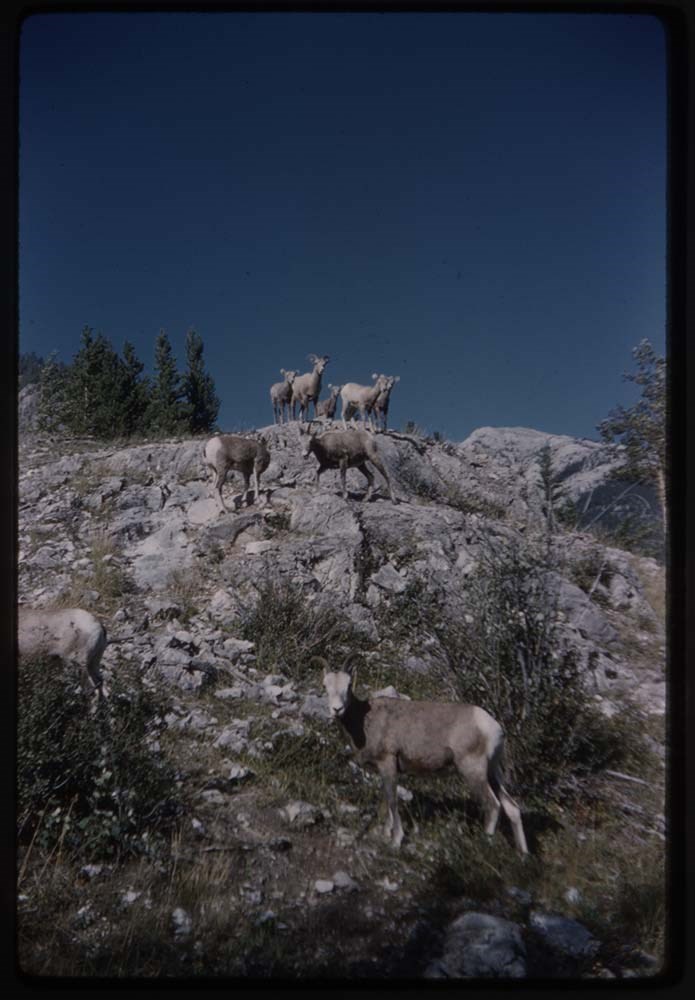
1959 77. B27-33 Sheep on rocks
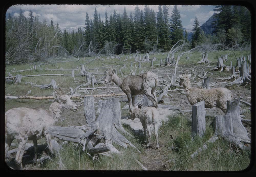
1954 78. R196-19 SHeep among dead stumps
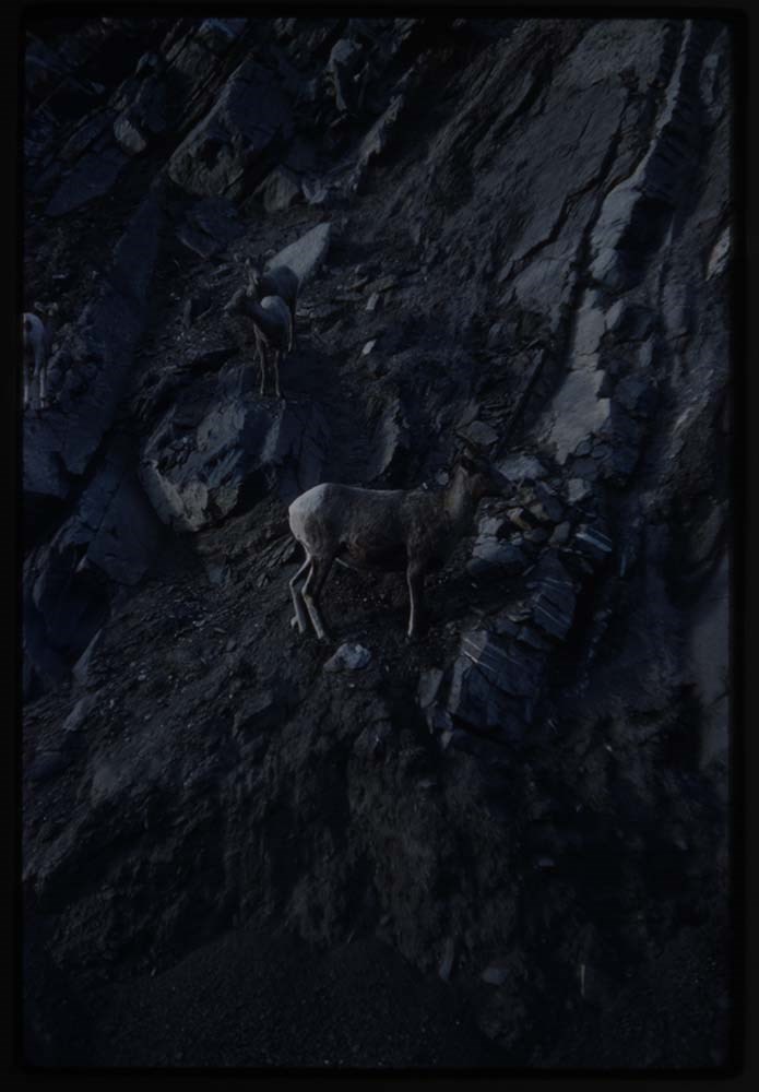
1960 79. B32-37 A sheep on cliff
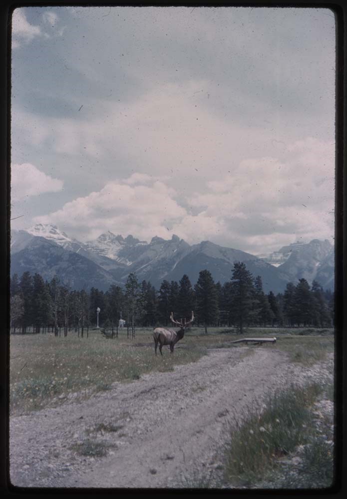
1959 80. B22-2 Elk apposite air strip
Notes
Slides 38 and 39 are missing.
Please note: Behavior towards wildlife, primarily human proximity and feeding, is outdated and no longer tolerated throughout all National Parks - do not feed or approach wildlife.
Slides originally in Kodak Carousel 80 slide tray.
Folder 1
Map on heavy paper, wrapped in plastic. “A Reconnaissance Topographic Map Suveyed and edited by Bradford Washburn” printed in Bern, Switzerland. Centred on Mt. McKinley.- From 7361.
Palliser- Kananaskis Area British Columbia and Alberta- Publication No. 1962- Reprinted by the Surveys and Mapping Branch, Department of Mines and Technical Surveys, Ottawa.
Mistaya British Columbia and Alberta- Compiled, drawn and printed at the office of the Surveyor General, Ottawa, 1931. Reprinted with corrections at the Surveys and Mapping Branch, Ottawa, 1950. National Topographic Series.
Yoho British Columbia and Alberta- Compiled, drawn and printed at the office of the Surveyor General, Ottawa, 1932. Reprinted with corrections at the Surveys and Mapping Branch, Ottawa, 1952. National Topographic Series. Price 25 cents.
Invermere British Columbia Kootenay Land District- National Topographic System- First Status Edition compiled and produced by the Geographic Division, Surveys, and Mapping Branch, Dept. of Lands, Forests and Water Resources, Victoria, BC 1964-65- annotated
Beaton British Columbia Kootenay Land District- National Topographic System- First Status Edition compiled and produced by the Geographic Division, Surveys, and Mapping Branch, Dept. of Lands, Forests and Water Resources, Victoria, BC 1964-66- annotated
Lardeau British Columbia Kootenay Land District- National Topographic System- First Status Edition compiled and produced by the Geographic Division, Surveys, and Mapping Branch, Dept. of Lands, Forests and Water Resources, Victoria, BC 1963- annotated
Mount McKinley Alaska, Published by the Museum of Science, Boston, Mass, USA and the Swiss Foundation for Alpine Research, Zurich. 1960.
Centennial Range Yukon Territory- M.C.R. 7 Edition 1- Produced and printed 1967 by the Surveys and Mapping Branch, Department of Energy, Mines and Resources- maps printed in 1961-62- annotated
British Columbia Land Recording Dists.- Land Commissioner’s Offices- Department of Lands and Forests- first published 1957- Updated Nov. 1, 1960.
Master Site Plan Bugaboo Creek Lodge Project number 6844- June 18, 1973- Cohos Delesalle & Evamy.
Folder 2
Boundary Between Alberta and BC- Athabasca Pass- Sheet No. 27A – annotated- centered on Jasper Park
Boundary Between Alberta and BC-All below Wheeler Maps (by hand) used for the Great Divide as per Chic-no topographical maps used for both Hans and similar maps were used by Chic bottom rip taped- Sheet No. 20- Drawn and printed by the Topographical Survey of Canada, Ottawa - centered on Clearwater forest and Lyell Icefield at bottom right
Boundary Between Alberta and BC- Sheet No. 15- Drawn and printed at the Surveyor General’s Office, Ottawa, Canada- centered on Rocky Mountains Park
Boundary Between Alberta and BC - Sheet No. 19- Drawn and printed at the Surveyor General’s Office, Ottawa, Canada- centered on centered on Clearwater Forest with Mt. Alan Campbell at bottom
Boundary Between Alberta and BC- Sheet No. 25- annotated- Drawn and printed by the Topographical Survey of Canada, Ottawa - centered on Jasper Park with Chisel Peak at bottom
Boundary Between Alberta and BC- Sheet No. 19- dirt and annotated- revised 1925- drawn and printed by the Topographical Survey of Canada, Ottawa- centered on Clearwater and Push Pass W.
Boundary Between Alberta and BC- annotated- Sheet 16- revised 1925- drawn and printed by the Topographical Survey of Canada, Ottawa- centered on Yoho Park and Rocky Mountains Park
Steele Glacier- Topographical Survey 1967 Arial Photography 1951
Mount St. Elias Canada- United State of America- Produced and Printed by the Surveys and Mapping Branch, Department of Mines and Technical Surveys 1962 from air photographs taken in 1951 and 1956- annotated
Woolsey Glacier- Revelstoke National Park British Columbia – Printed by the Surveys and Mapping Branch Department of Energy, Mines and Resources- 1967
Windermere Kootenay District- Map 165A Issued 1918- Reprinted by the Surveys and Mapping Branch, Department of Mines and Technical Surveys, Ottawa.
Folder 3
Boundary Between Alberta and BC- Sheet No. 20- heavily annotated- revised 1925- drawn and printed by the Topographical Survey of Canada, Ottawa- centered on Clearwater Forest, Saskatchewan Glacier at top left
Boundary Between Alberta and BC- Sheet No. 18- heavily ripped- annotated - notes on back- revised 1925- drawn and printed by the Topographical Survey of Canada, Ottawa- centered on Clearwater Forest, Mt Mummery at bottom
Boundary Between Alberta and BC- Sheet No. 17 (in pencil “A and B”)- annotated - heavily ripped- drawn and printed at the Surveyor Generals’ Office- centered on Clearwater Forest and Yoho Park
Boundary Between Alberta and BC- Sheet No. 26- annotated- revised 1925- drawn and printed by the Topographical Survey of Canada, Ottawa- centered on Jasper Park and Icefields
Boundary Between Alberta and BC- Sheet No. 17- revised 1925- drawn and printed by the Topographical Survey of Canada, Ottawa- centered on Clearwater Forest and Yoho Park
Boundary Between Alberta and BC- Sheet No. 28- stained- centered on Jasper Park
Boundary Between Alberta and BC- Sheet No. 24- annotated- revised edition, 1925- drawn and printed by the Topographical Survey of Canada, Ottawa- centered on Jasper Park
Boundary Between Alberta and BC- Sheet No. 16- annotated- revised 1925- drawn and printed by the Topographical Survey of Canada, Ottawa- centered on Yoho and Rocky Mountains Park
Interprovincial Boundary Commission Boundary Between Alberta and British Columbia. Revised edition 1925 drawn and printed by the Topographical Survey of Canada, Ottawa. Sheet No. 27. Following maps are from accession 7877.
Interprovincial Boundary Commission Boundary Between Alberta and British Columbia. Surveyed 1920. Drawn and printed by the Topographical Survey of Canada, Ottawa. Sheet No. 26.
Interprovincial Boundary Commission Boundary Between Alberta and British Columbia. Surveyed 1920, 1921. Drawn and printed by the Topographical Survey of Canada, Ottawa. Sheet No. 25.
Interprovincial Boundary Commission Boundary Between Alberta and British Columbia. Surveyed 1919, 1921. Drawn and printed by the Topographical Survey of Canada, Ottawa. Sheet No. 24.
Interprovincial Boundary Commission Boundary Between Alberta and British Columbia. Revised edition 1925 drawn and printed by the Topographical Survey of Canada, Ottawa. Sheet No. 21.
Interprovincial Boundary Commission Boundary Between Alberta and British Columbia. Revised edition 1925 drawn and printed by the Topographical Survey of Canada, Ottawa. Sheet No. 18.
Interprovincial Boundary Commission Boundary Between Alberta and British Columbia. Surveyed 1913. Drawn and printed by the Topographical Survey of Canada, Ottawa. Sheet No. 13 A.
Interprovincial Boundary Commission Boundary Between Alberta and British Columbia. Surveyed 1916. Drawn and printed by the Topographical Survey of Canada, Ottawa. Sheet No. 12 A.
Interprovincial Boundary Commission Boundary Between Alberta and British Columbia. Surveyed 1916. Drawn and printed by the Topographical Survey of Canada, Ottawa. Sheet No. 11.
Interprovincial Boundary Commission Boundary Between Alberta and British Columbia. Surveyed 1916. Drawn and printed by the Topographical Survey of Canada, Ottawa. Sheet No. 10.
Interprovincial Boundary Commission Boundary Between Alberta and British Columbia. Surveyed 1916. Drawn and printed by the Topographical Survey of Canada, Ottawa. Sheet No. 9.
Interprovincial Boundary Commission Boundary Between Alberta and British Columbia. Surveyed 1916. Drawn and printed by the Topographical Survey of Canada, Ottawa. Sheet No. 8.
Interprovincial Boundary Commission Boundary Between Alberta and British Columbia. Surveyed 1916. Drawn and printed by the Topographical Survey of Canada, Ottawa. Sheet No. 6.
Interprovincial Boundary Commission Boundary Between Alberta and British Columbia. Surveyed 1915. Drawn and printed by the Topographical Survey of Canada, Ottawa. Sheet No. 5.
Interprovincial Boundary Commission Boundary Between Alberta and British Columbia. Surveyed 1914. Drawn and printed by the Topographical Survey of Canada, Ottawa. Sheet No. 4.
Interprovincial Boundary Commission Boundary Between Alberta and British Columbia. Surveyed 1922. Drawn and printed by the Topographical Survey of Canada, Ottawa. Sheet No. 31.
Interprovincial Boundary Commission Boundary Between Alberta and British Columbia. Surveyed 1922, 1924. Drawn and printed by the Topographical Survey of Canada, Ottawa. Sheet No. 30.
Interprovincial Boundary Commission Boundary Between Alberta and British Columbia. Surveyed 1917. Drawn and printed by the Topographical Survey of Canada, Ottawa. Sheet No. 29.