File consists of one printed map on canvas depicting Rocky Mountains Park and surrounding areas, ca.1910-1930. Map is annotated with red hand-coloured markers and small notes written in black ink.
1 topographical map : hand col., annotations, on canvas ; 150 x 100 cm
History / Biographical
Rocky Mountains Park was renamed Banff National Park on May 30, 1930 as part of the National Parks Act passed by the Government of Canada.
Scope & Content
File consists of one printed map on canvas depicting Rocky Mountains Park and surrounding areas, ca.1910-1930. Map is annotated with red hand-coloured markers and small notes written in black ink.
Notes
Context of map mostly unknown. Missing title, date and other identifying information.
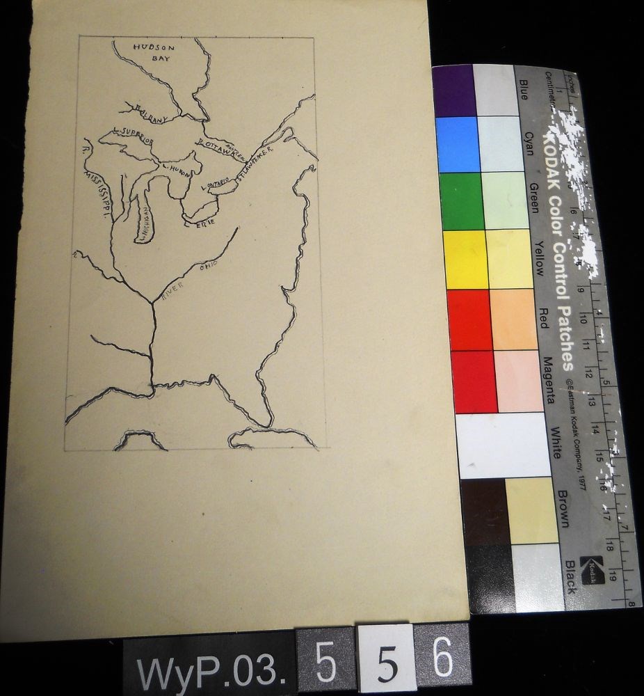
A pencil and ink drawing of a map of Hudson Bay and the river system in eastern Canada and United States. Includes Great Lakes as well. Bodies of water are labeled.
A pencil and ink drawing of a map of Hudson Bay and the river system in eastern Canada and United States. Includes Great Lakes as well. Bodies of water are labeled.
Pencil and ink drawing of Ontario, the Manitoba border, and Great Lakes with rivers and urban centres labeled.title: MAP OF ONTARIO [top left, surrounded by short marks]
Pencil and ink drawing of Ontario, the Manitoba border, and Great Lakes with rivers and urban centres labeled.title: MAP OF ONTARIO [top left, surrounded by short marks]
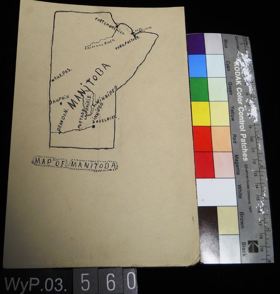
Pencil and ink drawing of a map of Manitoba with rivers, lakes and urban centres labeled. [Below drawing, surrounded by circle of short marks] MAP of MANITOBA
Pencil and ink drawing of a map of Manitoba with rivers, lakes and urban centres labeled. [Below drawing, surrounded by circle of short marks] MAP of MANITOBA
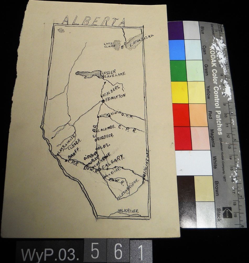
Ink and pencil drawing of a map of Alberta with lakes, rivers, CPR lines and urban centres labeled. the border is delineated by a double line. ALBERTA is written above the northern border in narrow block letters.
Ink and pencil drawing of a map of Alberta with lakes, rivers, CPR lines and urban centres labeled. the border is delineated by a double line. ALBERTA is written above the northern border in narrow block letters.
Drawings on both sides of the paper. Side 1 is a pencil drawing of a map of North America, including CANADA, US and MEXiCO all labeled.Verso is a pencil drawing of two figures in a car, facing left. Dust at tires and streak lines suggest speed. Titled in tlc as TORPEDO CAR
Drawings on both sides of the paper. Side 1 is a pencil drawing of a map of North America, including CANADA, US and MEXiCO all labeled.Verso is a pencil drawing of two figures in a car, facing left. Dust at tires and streak lines suggest speed. Titled in tlc as TORPEDO CAR
An incomplete pencil drawing of what appears to be a cartographical view of a coastline. The drawing is comprised of a line that wavers extensively and ends abruptly. Line occupies the top third of the paper.
An incomplete pencil drawing of what appears to be a cartographical view of a coastline. The drawing is comprised of a line that wavers extensively and ends abruptly. Line occupies the top third of the paper.