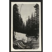
File consists of aerial photographs of terrain in British Columbia and Alberta. Includes locations such as Banff National Park and Yoho National Park with images of Glaciers, Lakes, Mountain ranges and tree lines.
File consists of aerial photographs of terrain in British Columbia and Alberta. Includes locations such as Banff National Park and Yoho National Park with images of Glaciers, Lakes, Mountain ranges and tree lines.
File consists of aerial photographs of terrain in British Columbia and Alberta. Including Banff National Park, Canmore, Kananaskis, Kootenay National Park and Jasper National Park. Images include glaciers, lakes, mountain ranges, forest, highways, and trails.
File consists of aerial photographs of terrain in British Columbia and Alberta. Including Banff National Park, Canmore, Kananaskis, Kootenay National Park and Jasper National Park. Images include glaciers, lakes, mountain ranges, forest, highways, and trails.
File consists of aerial photographs of terrain in British Columbia and Alberta. Includes photographs of Jasper National Park and Banff National Park. Images include glaciers, lakes, mountain ranges, forest, highways, and trails.
File consists of aerial photographs of terrain in British Columbia and Alberta. Includes photographs of Jasper National Park and Banff National Park. Images include glaciers, lakes, mountain ranges, forest, highways, and trails.
File consists of aerial photographs of terrain in Banff National Park, Yoho National Park, Jasper National Park. Images include glaciers, lakes, mountain ranges, forest, highways, and trails.
File consists of aerial photographs of terrain in Banff National Park, Yoho National Park, Jasper National Park. Images include glaciers, lakes, mountain ranges, forest, highways, and trails.
File consists of aerial photographs of terrain in British Columbia and Alberta. Including photographs of Kananaskis, Canmore, Invermere, Yoho National Park.
File consists of aerial photographs of terrain in British Columbia and Alberta. Including photographs of Kananaskis, Canmore, Invermere, Yoho National Park.
Fonds consists of three series, 3 cm, ca. 1938 - 1943. Series I: Photograph Albums (depicting photographs of the Skyline Hikers and Trail Riders of the Canadian Rockies trips and camps between 1938-1943 including Devil's Gap, Ghost River, Yoho Lake, Mount Assiniboine and views of the Town of Banff,…
207 photographs. -- 1 album (174 photographs : b&w ; 39 x 27.5 cm). -- 18 photographs : b&w ; 17 x 12 cm or smaller. -- 15 photographs : col. slides ; 35 mm
History / Biographical
Allan E. Crawford (1900-1989) of Calgary, Alberta and Prince Rupert, British Columbia, was a member of the Sky Line Trail Hikers from 1937 to 1946 and was the "Official Musician of the Sky Line Trail Hikers" in 1937, 1938, 1940, and 1941.
He also participated in Trail Riders of the Canadian Rockies trips from 1937, 1938, 1940, 1941 as their musician.
Allan E. Crawford appeared on Calgary radio station CFCN "The Voice of the Prairies" on a live weekly program, with the music trio "The Gamboliers" playing the accordian with Eddie Clemens on guitar and J.E. Gerke on vocals. Allan also played the organ, piano and harmonica.
Scope & Content
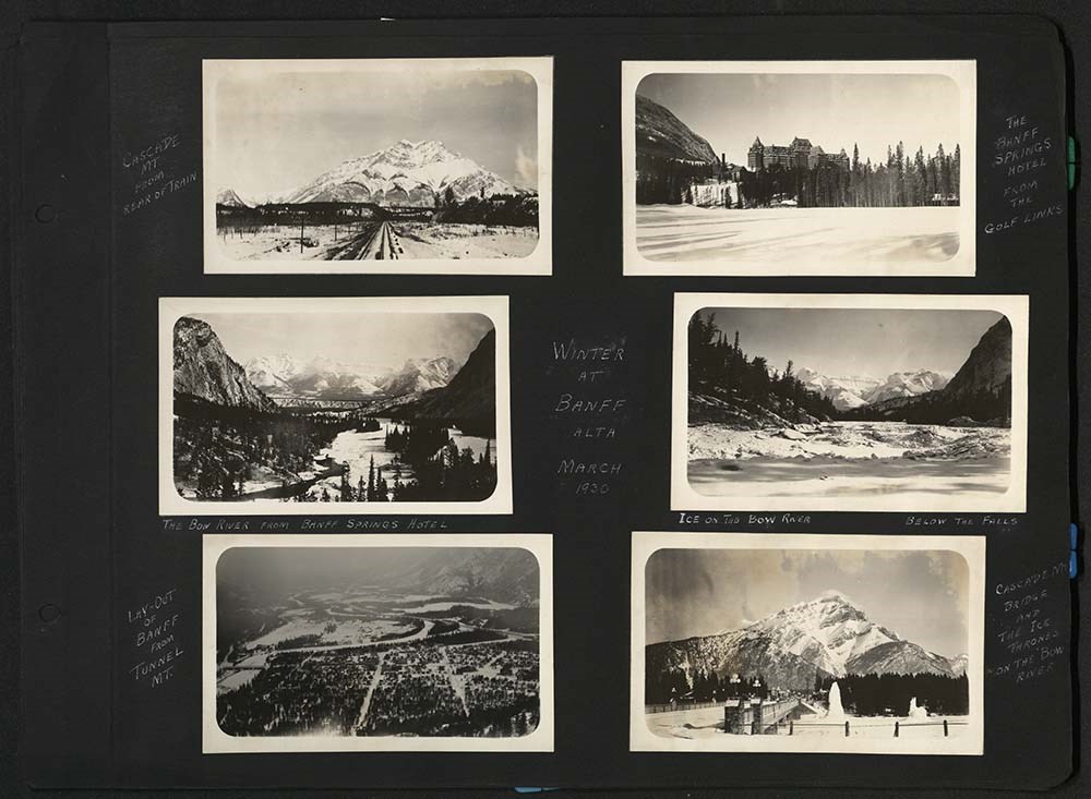
Fonds consists of three series, 3 cm, ca. 1938 - 1943. Series I: Photograph Albums (depicting photographs of the Skyline Hikers and Trail Riders of the Canadian Rockies trips and camps between 1938-1943 including Devil's Gap, Ghost River, Yoho Lake, Mount Assiniboine and views of the Town of Banff, Mount Rundle and the Banff Springs Hotel). Series II: Photograph Prints (depicting photographs of the Skyline Hikers of the Canadian Rockies trips and camps between 1938-1943 including Sunburst Lake and Mount Assiniboine with camp scenes), Series III: Transparencies (depicting the Skyline Hikers camp including Egypt Lake, Lake Louise, Pharoah Peak, Castle Mountain and Scarab Lake in 1940).
File consists of one photograph album, comprising 174 photographs. Contents pertains to the Skyline Hikers and Trail Riders of the Canadian Rockies trips and camps including 1938 trail ride to Devil's Gap and Ghost River; hike in 1938 to Yoho Lake; trail ride in 1940; hike in 1940; trail ride in 19…
File consists of one photograph album, comprising 174 photographs. Contents pertains to the Skyline Hikers and Trail Riders of the Canadian Rockies trips and camps including 1938 trail ride to Devil's Gap and Ghost River; hike in 1938 to Yoho Lake; trail ride in 1940; hike in 1940; trail ride in 1941 to Mount Assiniboine; as well as views of the Town of Banff, Mount Rundle and the Banff Springs Hotel.
File consists of a summit record from Arête Peak produced by the Alpine Club of Canada between around 1994 and 2016. Summit record includes entries from visitors to the various summits which pertain to individuals' hiking and climbing trips; details of specific events which occurred while at the su…
Summit Registers and Notes produced by Alpine Club of Canada
Date Range
ca. 1994-2016
Physical Description
0.5 cm of textual record
1 volume
History / Biographical
Arête Peak is located in Yoho National Park, British Columbia. Nearby are Mount des Poilus and Isolated Peak.
Scope & Content
File consists of a summit record from Arête Peak produced by the Alpine Club of Canada between around 1994 and 2016. Summit record includes entries from visitors to the various summits which pertain to individuals' hiking and climbing trips; details of specific events which occurred while at the summit, wildlife sightings, trail updates, and related topics.
File:
M200 / V / A / 137: ARÊTE [ca. 1994-2016]
File consists of photographs of the Banff National Park including photographs of Lake Louise, Moraine Lake and area. also included are photographs of Jasper National Park
File consists of photographs of the Banff National Park including photographs of Lake Louise, Moraine Lake and area. also included are photographs of Jasper National Park