File consists of aerial photographs of terrain in British Columbia and Alberta. Includes locations such as Banff National Park and Yoho National Park with images of Glaciers, Lakes, Mountain ranges and tree lines.
File consists of aerial photographs of terrain in British Columbia and Alberta. Includes locations such as Banff National Park and Yoho National Park with images of Glaciers, Lakes, Mountain ranges and tree lines.
File consists of the agenda for the 1998 Annual General Meeting (AGM) that took place on October 31, 1998 at Chateau Lake Louise, the meeting minutes of the AGM 1997 that took place on October 25, 1997 also at Chateau Lake Louise. Includes the ACC National Planning Calendar for November 1997 to Oct…
File consists of the agenda for the 1998 Annual General Meeting (AGM) that took place on October 31, 1998 at Chateau Lake Louise, the meeting minutes of the AGM 1997 that took place on October 25, 1997 also at Chateau Lake Louise. Includes the ACC National Planning Calendar for November 1997 to October 1998.
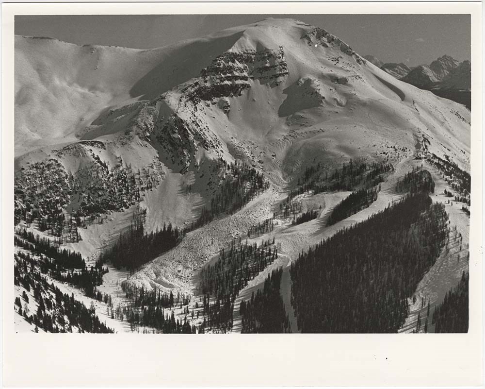
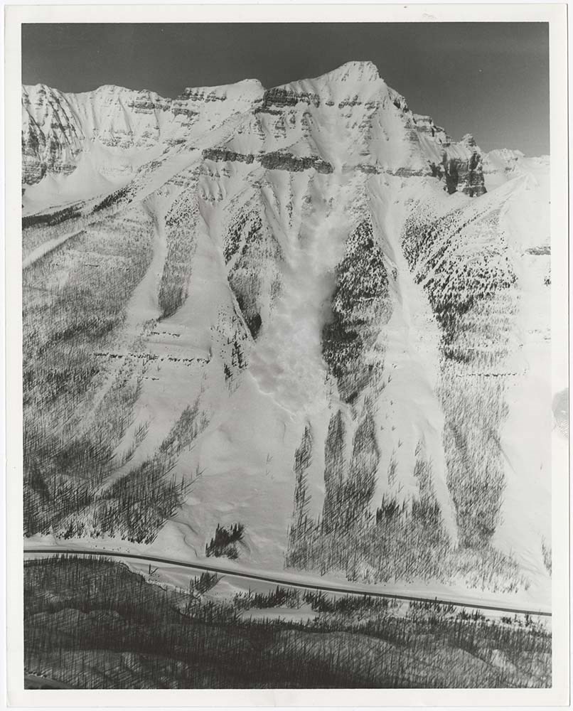
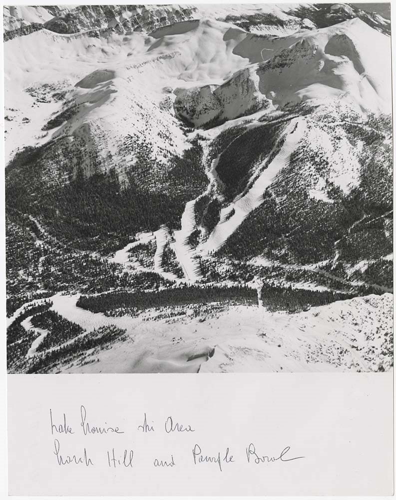
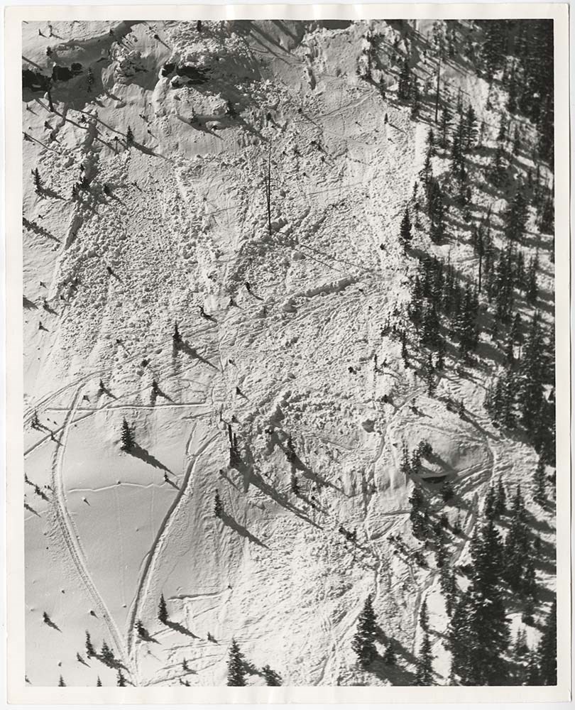
File pertains to 58 b&w prints of various avalanche areas and slides around Banff National Park, mostly focussed along stretches of highways and in and around ski areas, including backcountry ski areas like Assiniboine.
File pertains to 58 b&w prints of various avalanche areas and slides around Banff National Park, mostly focussed along stretches of highways and in and around ski areas, including backcountry ski areas like Assiniboine.
Sub-series of hut registers from the Balfour (Rob Ritchie) Hut produced by the Alpine Club of Canada between 1966 and 2019. Registers include entries from visitors to the huts which pertain to individuals' hiking and climbing trips; details of specific events which occurred while staying at the hut…
According to the Alpine Club of Canada's website:
"The Rob Ritchie Hut, also known as the Balfour Hut, is found on low, rocky hills at the toe of the Vulture Glacier, approximately 28 km northwest of the town of Lake Louise, AB. It is east of Balfour Pass and the Continental divide, just inside the Banff National Park boundary.[...]
The Rob Ritchie Hut, also known as the Balfour Hut, is found on low, rocky hills at the toe of the Vulture Glacier, approximately 28 km northwest of the town of Lake Louise, AB. It is east of Balfour Pass and the Continental divide, just inside the Banff National Park boundary.
This is the half-way mark for the Wapta Traverse and is usually used in conjunction with the other huts in this chain while attempting this classic cross-glacier ski trip. Usual approach is from Bow Hut through the Olive/St. Nicholas Col then down the gentle and pleasant Vulture Glacier to Balfour Pass, where the hut sits on a section of moraine beneath the impressive bulk of Mt. Balfour.
Though most people will spend one night at the R.J. Ritchie (Balfour) Hut before continuing on to Scott Duncan, there is potential for good skiing here, especially on the Diableret Glacier which sits northwest of Mt. Balfour and makes for a fantastic run on a clear day! There is also an optional route to the summit of Mt. Gordon from this hut, which would be an excellent loop trip if combined with the normal route back towards Bow Hut. Use your imagination and some neat trip ideas will present themselves!"
Scope & Content
Sub-series of hut registers from the Balfour (Rob Ritchie) Hut produced by the Alpine Club of Canada between 1966 and 2019. Registers include entries from visitors to the huts which pertain to individuals' hiking and climbing trips; details of specific events which occurred while staying at the hut, wildlife sightings, custodial issues and updates, and related topics.
The sub-series is separated into individual hut registers, arranged by date:
M200 / IV / I / 1: Balfour Hut [Register] [1966-1971]
M200 / IV / I / 2: Balfour Pass Hut [1971-1972]
M200 / IV / I / 3: Balfour Pass Hut Register [1973-1974]
M200 / IV / I / 4: Balfour Pass Hut [register 1974-1982]
M200 / IV / I / 5: "Balfour Hut" [register] Sept. 2, 1982 - Nov. 17, 1989
M200 / IV / I / 6: Balfour Hut Journal Nov. 22, 1989 - Apr. 25, 1997
M200 / IV / I / 7: Balfour Hut Register [1997 -2001]
M200 / IV / I / 8: Balfour Hut Register 2007 - 2015
M200 / IV / I / 9: Balfour Hut register 2011 - 2019
File consists of 4 prings : col. 35.1 x 24.8 cm or smaller and 4 maps (2 paper, 2 overlays) : col., on mylar ; 60.4 x 30. cm or smaller. File pertains to aerial views of Banff National Park, showing the towns of Banff and Lake Louise, ski hills (Norqay Ski Hill, Sunshine Village, and Lake Louise Sk…
4 maps (2 paper, 2 overlays) : col., annotations, on mylar ; 60.4 x 30. cm or smaller
Scope & Content
File consists of 4 prings : col. 35.1 x 24.8 cm or smaller and 4 maps (2 paper, 2 overlays) : col., on mylar ; 60.4 x 30. cm or smaller. File pertains to aerial views of Banff National Park, showing the towns of Banff and Lake Louise, ski hills (Norqay Ski Hill, Sunshine Village, and Lake Louise Ski Resort), as well as other georgraphic features. The mylar overlays contain various amounts of detail and annotations - one consists of a dark red sheet overlayed with place names in negative.
A dark print of Bow Lake after sunset. Bow Lake is visible in the centre of the image. In the foreground is a shadowed grassy area with trees. Mountains and Bow Glacier are behind the lake and the sky is quite light.
A dark print of Bow Lake after sunset. Bow Lake is visible in the centre of the image. In the foreground is a shadowed grassy area with trees. Mountains and Bow Glacier are behind the lake and the sky is quite light.
File consists of a 1997 Parks Canada Diving Lake Minnewanka Submerged Cultural Resources brochure, a photocopied diagram of the Department of the Interior's plan for the subdivision of villa lots at Lake Minnewanka [consisting of two pieces of paper taped together], a Calgary Power Company progress…
0.4 cm of textual records (4 volumes ; 21.3 x 27.6 cm or smaller)
History / Biographical
See fonds level description.
Scope & Content
File consists of a 1997 Parks Canada Diving Lake Minnewanka Submerged Cultural Resources brochure, a photocopied diagram of the Department of the Interior's plan for the subdivision of villa lots at Lake Minnewanka [consisting of two pieces of paper taped together], a Calgary Power Company progress pictures report pertaining to the Cascade Project - specifically the construction of the Stewart Canyon Bridge - accompanied by two printed colour maps of the details surrounding the pump house [most likely printed from a computer by Bob Smith at a later date], and three print-outs pertaining to various components of the Calgary Power Company Minnewanka Storage Dam.