Narrow Results By
Cataract Pass Summit Notes
https://archives.whyte.org/en/permalink/descriptions57776
- Part Of
- Alpine Club of Canada fonds
- Scope & Content
- File consist of summit notes from Cataract Pass produced by the Alpine Club of Canada between around 2001 and 2011. Summit records include entries from visitors to the various summits which pertain to individuals' hiking and climbing trips; details of specific events which occurred while at the sum…
- Date Range
- ca. 2001-2011
- Reference Code
- M200 / V / A / 190
- Description Level
- 5 / File
- GMD
- Textual record
- Organization record
- Part Of
- Alpine Club of Canada fonds
- Description Level
- 5 / File
- Fonds Number
- M200
- V14
- S6
- Series
- M200 / V: Summit Records
- Sous-Fonds
- M200
- Sub-Series
- M200 / V / A: Identified Summit Records
- Accession Number
- accn. 8113
- Reference Code
- M200 / V / A / 190
- Responsibility
- Summit Registers and Notes produced by Alpine Club of Canada
- Date Range
- ca. 2001-2011
- Physical Description
- 2 cm of textual records
- History / Biographical
- Cataract Pass is a mountain pass in Jasper National Park, Alberta. Nearby are Mount Stewart, Mount Athabasca, Mount Andromeda, and Highway 93.
- Scope & Content
- File consist of summit notes from Cataract Pass produced by the Alpine Club of Canada between around 2001 and 2011. Summit records include entries from visitors to the various summits which pertain to individuals' hiking and climbing trips; details of specific events which occurred while at the summit, wildlife sightings, trail updates, and related topics. File: M200 / V / A / 190: Cataract Pass Summit Notes
- Notes
- File includes 2 colour photographic prints. Prints were originally together with the summit notes in a ziplock bag.
- Name Access
- Alpine Club of Canada
- Subject Access
- Alberta
- Alpine Club of Canada
- Backpacking
- Bow Valley
- Climbing
- Club
- Description and travel
- Environment
- Environment and Nature
- Hiking
- Mountain
- Mountaineering
- Mountaineers
- Mountains
- National parks and reserves
- Record keeping
- Sports and leisure
- Sports and recreation
- Summit
- Trails
- Geographic Access
- Canada
- Canadian Rocky Mountains
- Rocky Mountains
- Alberta
- Jasper National Park
- North Saskatchewan River
- Mount Stewart
- Mount Andromeda
- Cataract Pass
- Access Restrictions
- Restrictions may apply
- Language
- English
- Conservation
- Summit notes are loose pages in folder
- Related Material
- M235
- Biographical Source Notes
- Peakery: Cataract Peak Map, Peakery: https://peakery.com/cataract-peak-alberta/map/
- Title Source
- Original title
- Processing Status
- Processed
This material is presented as originally created; it may contain outdated cultural descriptions and
potentially offensive content.
Read more.
Cirque Peak Summit Registers and Notes
https://archives.whyte.org/en/permalink/descriptions57670
- Part Of
- Alpine Club of Canada fonds
- Scope & Content
- Files consist of summit notes and summit registers from Cirque Peak produced by the Alpine Club of Canada between 1993 and 2006. Summit records include entries from visitors to the various summits which pertain to individuals' hiking and climbing trips; details of specific events which occurred whi…
- Date Range
- 1993-1996
- 1999-2000
- 2006
- Reference Code
- M200 / V / A / 40 to 42
- Description Level
- 5 / File
- GMD
- Textual record
- Organization record
- Part Of
- Alpine Club of Canada fonds
- Description Level
- 5 / File
- Fonds Number
- M200
- V14
- S6
- Series
- M200 / V: Summit Records
- Sous-Fonds
- M200
- Sub-Series
- M200 / V / A: Identified Summit Records
- Accession Number
- accn. 2023.10 accn. 7779 accn. 8002
- Reference Code
- M200 / V / A / 40 to 42
- Responsibility
- Summit Registers and Notes produced by Alpine Club of Canada
- Date Range
- 1993-1996
- 1999-2000
- 2006
- Physical Description
- 3 volumes 4 cm of textual records
- History / Biographical
- Cirque Peak is located in Banff National Park, near Dolomite Pass in the Bow Valley.
- Scope & Content
- Files consist of summit notes and summit registers from Cirque Peak produced by the Alpine Club of Canada between 1993 and 2006. Summit records include entries from visitors to the various summits which pertain to individuals' hiking and climbing trips; details of specific events which occurred while at the summit, wildlife sightings, trail updates, and related topics. Files include: M200 / V / A / 40: Cirque Peak Summit register July 3, 1993 - July 21, 1996 M200 / V / A / 41: Cirque Peak Sept, 1999 - Sept. 2000 M200 / V / A / 42: Summit Register - Cirque Peak, 2006
- Name Access
- Alpine Club of Canada
- Subject Access
- Alpine Club of Canada
- Backcountry skiing
- Backpacking
- Banff National Park
- Bow Valley
- Climbing
- Environment
- Environment and Nature
- Hiking
- Mountain
- Mountaineering
- Mountaineers
- Mountains
- National parks and reserves
- Ski mountaineering
- Skiing
- Sports and leisure
- Sports and recreation
- Summit
- Trails
- Winter sports
- Geographic Access
- Canada
- Alberta
- Bow Valley
- Dolomite Pass
- Access Restrictions
- Restrictions may apply
- Language
- English
- Italian
- German
- Mandarin
- Conservation
- Some registers have loose pages. Some registers have water damage.
- Related Material
- M235
- Title Source
- Title based on contents of file
- Processing Status
- Processed
This material is presented as originally created; it may contain outdated cultural descriptions and
potentially offensive content.
Read more.
Collected personal photographs, reference scans
https://archives.whyte.org/en/permalink/descriptions55291
- Part Of
- Chic Scott fonds
- Scope & Content
- File consists of 21 CDs containing digital image files which were collected from friends and family members of Hans Gmoser, for use in the creation of book Deep Powder and Steep Rock. Content pertains to Hans Gmoser's personal life and events with friends; skiing and other mountaineering trips; ima…
- Date Range
- 2006 - 2008
- Reference Code
- V40 / V / DF - 13 to 33
- Description Level
- 5 / File
- GMD
- Digital image
- Photograph
- Part Of
- Chic Scott fonds
- Description Level
- 5 / File
- Fonds Number
- M57
- S47
- V40
- Series
- V40 / V : Deep Powder and Steep Rock
- Sous-Fonds
- V40
- Accession Number
- .
- Reference Code
- V40 / V / DF - 13 to 33
- Date Range
- 2006 - 2008
- Physical Description
- 21 recording discs with digital files
- Scope & Content
- File consists of 21 CDs containing digital image files which were collected from friends and family members of Hans Gmoser, for use in the creation of book Deep Powder and Steep Rock. Content pertains to Hans Gmoser's personal life and events with friends; skiing and other mountaineering trips; images from a trip to Austria with Chic Scott, Margaret Gmoser and others; trips to Yoho, the Bugaboos and Mount McKinley; and other personal events.
- Notes
- Most discs in file include related handwritten notes [by Chic Scott?] and scanned paper copies of images on discs.
- Subject Access
- Skiing
- Mountains
- Mountaineering
- Winter sports
- Sports
- Recreation
- Family and personal life
- Entertainment
- Travel
- Hiking
- Geographic Access
- Canada
- Alberta
- Bugaboos
- Banff
- Canadian Rocky Mountains
- Mount McKinley
- British Columbia
- Yoho National Park
- Austria
- Reproduction Restrictions
- Restrictions apply - reference use only
- Language
- English
- Title Source
- Title based on contents of file
- Processing Status
- Processed
This material is presented as originally created; it may contain outdated cultural descriptions and
potentially offensive content.
Read more.
Collected videos
https://archives.whyte.org/en/permalink/descriptions56286
- Part Of
- Ben Gadd fonds
- Scope & Content
- File consists of five discs containing video files and three VHS tapes, which were collected by Ben Gadd. Videos pertain to mountaineering and mountain sports; documentary footage about Mount Robson and other regions in the Canadian Rockies; icebergs; ice climbing in Maligne Canyon; and a talk abou…
- Date Range
- 1988
- [ca.1990-2000]
- 2006
- 2010
- Reference Code
- V810 / I / D / NV - 1 to 8
- Description Level
- 5 / File
- GMD
- Video
- Recording disc
- Part Of
- Ben Gadd fonds
- Description Level
- 5 / File
- Fonds Number
- M590
- V810
- S61
- Series
- V810 / I : Personal records
- Sous-Fonds
- V810
- Sub-Series
- V810 / I / D : Other personal and collected
- Accession Number
- 2021.20
- Reference Code
- V810 / I / D / NV - 1 to 8
- GMD
- Video
- Recording disc
- Date Range
- 1988
- [ca.1990-2000]
- 2006
- 2010
- Physical Description
- 5 DVDs -- 3 VHS tapes
- Scope & Content
- File consists of five discs containing video files and three VHS tapes, which were collected by Ben Gadd. Videos pertain to mountaineering and mountain sports; documentary footage about Mount Robson and other regions in the Canadian Rockies; icebergs; ice climbing in Maligne Canyon; and a talk about the Association of Mountain Parks Protection and Enjoyment (AMPPE) presented in the Jasper Chamber of Commerce.
- Notes
- Individual contents in file: V810 / I / D / NV - 1 : "A Life Ascending" [produced by Stephen Grynberg] V810 / I / D / NV - 2 : "Mt. Robson: Giant of Canadian Rockies" V810 / I / D / NV - 3 : "Aweberg!" [video about icebergs, attributed to Ben Gadd] V810 / I / D / NV - 4 : "The Rockies: A two-part documentary by Stefan Tolz in cooperation with Fritz Pleitgan and Gerd Ruge" [Ben and Will Gadd appear in video] V810 / I / D / NV - 5 : "Queen of Maligne Feb. '06" [video of Ben and Will Gadd ice climbing in Maligne Canyon] V810 / I / D / NV - 6 : "Northlands 12/6/88" [wildlife footage with commentary] V810 / I / D / NV - 7 : "The Rockies - Fine Cut" [n.d., no audio; footage of wildlife, landscapes, etc.] V810 / I / D / NV - 8 : Dave Day / Jasper Chamber of Commerce [n.d.; discussing AMPPE and membership, issues in Banff National Park]
- Name Access
- Gadd, Ben
- Gadd, Will
- Morrow, Pat
- Davis, Perry
- Subject Access
- Publication
- Events
- Sports
- Recreation
- Mountains
- Skiing
- Hiking
- Climbing
- Landscape
- Films and film making
- Glaciers
- Environment
- Wildlife
- Geographic Access
- Canada
- Alberta
- Jasper National Park
- Banff National Park
- Maligne Canyon
- British Columbia
- Mount Robson
- Reproduction Restrictions
- Restrictions may apply
- Language
- English
- Title Source
- Title based on contents of file
- Processing Status
- Processed
This material is presented as originally created; it may contain outdated cultural descriptions and
potentially offensive content.
Read more.
Conrad Kain/Bugaboos Hut Registers
https://archives.whyte.org/en/permalink/descriptions57652
- Part Of
- Alpine Club of Canada fonds
- Scope & Content
- Sub-series of hut registers from the Conrad Kain/Bugaboo Hut produced by the Alpine Club of Canada between 2000 and 2017. Registers include entries from visitors to the huts which pertain to individuals' hiking and climbing trips; details of specific events which occurred while staying at the hut, …
- Date Range
- 2000-2003
- 2006-2017
- Reference Code
- M200 / IV / O
- Description Level
- 4 / Sub-series
- GMD
- Textual record
- Organization record
- Part Of
- Alpine Club of Canada fonds
- Description Level
- 4 / Sub-series
- Fonds Number
- M200
- V14
- S6
- Series
- M200 / IV: Hut Registers
- Sous-Fonds
- M200
- Sub-Series
- M200 / IV / O: Conrad Kain/Bugaboos Hut Registers
- Accession Number
- accn. 7779
- accn. 2014.8293
- accn. 2023.32
- Reference Code
- M200 / IV / O
- Responsibility
- Registers produced by Alpine Club of Canada
- Date Range
- 2000-2003
- 2006-2017
- Physical Description
- 7 cm of textual records 4 volumes
- History / Biographical
- According to the Alpine Club of Canada website, the Conrad Kain/Bugaboo hut is located in the Bugaboo Provincial Park, in British Columbia. The ACC built the hut in 1972, and named the hut after the renowned Austrian mountaineer and guide, Conrad Kain, who first visited the area in 1910. From 1972 to 2000, the hut was maintained by B.C. Parks. Today, the hut accommodates 35 people.
- Scope & Content
- Sub-series of hut registers from the Conrad Kain/Bugaboo Hut produced by the Alpine Club of Canada between 2000 and 2017. Registers include entries from visitors to the huts which pertain to individuals' hiking and climbing trips; details of specific events which occurred while staying at the hut, wildlife sightings, custodial issues and updates, and related topics. The sub-series is separated into individual hut registers, arranged by date:
- M200 / IV / O / 1: Conrad Kain Hut June 20/2000 - June 26/2003
- M200 / IV / O / 2: 2006 - 2008 Conrad Kain Hut, Bugaboos, Hut Register
- M200 / IV / O / 3: Conrad Kain Hut Register [2008 - 2012]
- M200 / IV / O / 4: Conrad Kain, Bugaboos 2012 - 2017
- Name Access
- Alpine Club of Canada
- Subject Access
- Huts
- Cabins and shelters
- Alpine Club of Canada
- Backpacking
- Backcountry skiing
- British Columbia
- Buildings
- Buildings and facilities
- Climbing
- Environment and Nature
- Guide
- Hiking
- Memorial
- Mountain guides
- Mountaineering
- Mountaineers
- Mountains
- Property
- Skiing
- Sports and recreation
- Winter sports
- Geographic Access
- Canada
- British Columbia
- Bugaboo Provincial Park
- Bugaboos
- Golden, BC
- Radium, BC
- Access Restrictions
- Restrictions may apply
- Language
- English
- French
- Japanese
- Mandarin
- Biographical Source Notes
- Alpine Club of Canada website: https://www.alpineclubofcanada.ca/conrad-kain-hut/
- Title Source
- Title based on contents of sub-series
- Processing Status
- Processed
This material is presented as originally created; it may contain outdated cultural descriptions and
potentially offensive content.
Read more.
Crown Mountain [register]
https://archives.whyte.org/en/permalink/descriptions57741
- Part Of
- Alpine Club of Canada fonds
- Scope & Content
- File consists of a summit record from Crown Mountain produced by the Alpine Club of Canada from around 1991 to 2017. Summit record includes entries from visitors to the various summits which pertain to individuals' hiking and climbing trips; details of specific events which occurred while at the su…
- Date Range
- ca. 1991-2017
- Reference Code
- M200 / V / A / 154
- Description Level
- 5 / File
- GMD
- Textual record
- Organization record
- Part Of
- Alpine Club of Canada fonds
- Description Level
- 5 / File
- Fonds Number
- M200
- V14
- S6
- Series
- M200 / V: Summit Records
- Sous-Fonds
- M200
- Sub-Series
- M200 / V / A: Identified Summit Records
- Accession Number
- accn. 2023.19
- Reference Code
- M200 / V / A / 154
- Responsibility
- Summit Registers and Notes produced by Alpine Club of Canada
- Date Range
- ca. 1991-2017
- Physical Description
- 1 volume 1 cm of textual record
- History / Biographical
- Crown Mountain is located in British Columbia near Grouse Mountain and Goat Mountain in southwestern, B.C.
- Scope & Content
- File consists of a summit record from Crown Mountain produced by the Alpine Club of Canada from around 1991 to 2017. Summit record includes entries from visitors to the various summits which pertain to individuals' hiking and climbing trips; details of specific events which occurred while at the summit, wildlife sightings, trail updates, and related topics. File: M200 / V / A / 154: Crown Mountain [register]
- Name Access
- Alpine Club of Canada
- Subject Access
- Alpine Club of Canada
- Backpacking
- British Columbia
- Climbing
- Club
- Description and travel
- Environment
- Environment and Nature
- Hiking
- Mountain
- Mountaineering
- Mountaineers
- Mountains
- Record keeping
- Sports and leisure
- Sports and recreation
- Summit
- Geographic Access
- Canada
- British Columbia
- Vancouver
- Vancouver, BC
- Access Restrictions
- Restrictions may apply
- Language
- English
- Conservation
- Register consists of loose pages. Evidence of water and rust damage throughout register.
- Related Material
- M235
- Title Source
- Title based on contents of file
- Processing Status
- Processed
This material is presented as originally created; it may contain outdated cultural descriptions and
potentially offensive content.
Read more.
Deep Powder and Steep Rock - visual
https://archives.whyte.org/en/permalink/descriptions55083
- Part Of
- Chic Scott fonds
- Scope & Content
- Photograph series consists of discs with reference scans of photographs pertaining to the research and creation of Deep Powder and Steep Rock.
- Date Range
- ca. 1950 - 2009
- Reference Code
- V40 / V
- Description Level
- 3 / Series
- GMD
- Photograph
- Part Of
- Chic Scott fonds
- Description Level
- 3 / Series
- Fonds Number
- M57 / V40 / S47
- Series
- V40 / V : Deep Powder and Steep Rock
- Sous-Fonds
- V40
- Accession Number
- 2015.8559
- Reference Code
- V40 / V
- GMD
- Photograph
- Date Range
- ca. 1950 - 2009
- Physical Description
- 53 discs with image files -- 6 cm of scanned photograph copies -- 62 reference slides : col. ; 35mm -- 27 reference photographs : col. prints
- History / Biographical
- Hans Gmoser played a major role in creating Canada’s vibrant mountain community. Although known internationally as the father of heli-skiing, he was much more than that: a talented rock climber, tireless expedition leader, a mountain guide, film maker and organizer. Deep Powder and Steep Rock presents an intimate portrait of this charismatic man. Much of the story is told in Gmoser’s own words, gleaned from his diaries, expedition journals, film commentaries and personal correspondence. It is a unique tale of adventure, hard work, perseverance and ultimate success.
- Scope & Content
- Photograph series consists of discs with reference scans of photographs pertaining to the research and creation of Deep Powder and Steep Rock.
- Name Access
- Scott, Chic
- Gmoser, Hans
- Subject Access
- Backcountry skiing
- Environment
- Landscapes
- Mountains
- Mountaineering
- Mountaineers
- Publication
- Recreation
- Research
- Skiing
- Ski mountaineering
- Sports
- Sports and recreation
- Winter sports
- Guiding
- Helicopter skiing
- Geographic Access
- Canada
- Alberta
- Banff National Park
- Canadian Rocky Mountains
- Access Restrictions
- for reference use only
- Reproduction Restrictions
- Reference only no reproductions
- Language
- English
- Related Material
- S47 / V
- M57 / V
- Category
- Sports, recreation and leisure
- Biographical Source Notes
- http://chicscott.com/books.htm
- Title Source
- Title based on contents of file
- Processing Status
- Processed / Unprocessed
This material is presented as originally created; it may contain outdated cultural descriptions and
potentially offensive content.
Read more.
Dolomite Peak July 30, 1998 - Sept. 6, 2004
https://archives.whyte.org/en/permalink/descriptions57788
- Part Of
- Alpine Club of Canada fonds
- Scope & Content
- File consists of a summit record from Dolomite Peak produced by the Alpine Club of Canada between 1998 and 2004. Summit record includes entries from visitors to the various summits which pertain to individuals' hiking and climbing trips; details of specific events which occurred while at the summit…
- Date Range
- 1998-2004
- Reference Code
- M200 / V / A / 205
- Description Level
- 5 / File
- GMD
- Textual record
- Organization record
- Part Of
- Alpine Club of Canada fonds
- Description Level
- 5 / File
- Fonds Number
- M200
- V14
- S6
- Series
- M200 / V: Summit Records
- Sous-Fonds
- M200
- Sub-Series
- M200 / V / A: Identified Summit Records
- Accession Number
- accn. 7779
- Reference Code
- M200 / V / A / 205
- Responsibility
- Summit Registers and Notes produced by Alpine Club of Canada
- Date Range
- 1998-2004
- Physical Description
- 1 volume 1 cm of textual record
- History / Biographical
- Dolomite Peak is located in the Bow Valley of Banff National Park, Alberta. It is near the Continental Divide/Great Divide, and is part of the Canadian Rockies. Nearby are Cirque Peak, Observation Peak, Peyto Lake, and Bow Lake.
- Scope & Content
- File consists of a summit record from Dolomite Peak produced by the Alpine Club of Canada between 1998 and 2004. Summit record includes entries from visitors to the various summits which pertain to individuals' hiking and climbing trips; details of specific events which occurred while at the summit, wildlife sightings, trail updates, and related topics. File: M200 / V / A / 205: Dolomite Peak July 30, 1998 - Sept. 6, 2004
- Name Access
- Alpine Club of Canada
- Subject Access
- Alberta
- Alpine Club of Canada
- Backpacking
- Banff
- Banff National Park
- Bow Valley
- British Columbia
- Climbing
- Club
- Description and travel
- Environment
- Environment and Nature
- Great Divide
- Hiking
- Mountain
- Mountaineering
- Mountaineers
- Mountains
- Record keeping
- Sports and leisure
- Sports and recreation
- Summit
- Trails
- Geographic Access
- Canada
- Canadian Rocky Mountains
- Rocky Mountains
- Continental Divide
- Great Divide
- Alberta
- British Columbia
- Banff National Park
- Bow Valley
- Peyto Lake
- Bow Lake
- Cirque Peak
- Observation Peak
- Dolomite Peak
- Access Restrictions
- Restrictions may apply
- Language
- English
- Related Material
- M235
- Title Source
- Original title
- Processing Status
- Processed
This material is presented as originally created; it may contain outdated cultural descriptions and
potentially offensive content.
Read more.
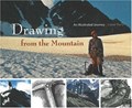
Drawing from the mountain : an illustrated journey
https://archives.whyte.org/en/permalink/catalogue24999
- Medium
- Library - Book (including soft-cover and pamphlets)
- Published Date
- 2006
- Author
- Perry, Lorne
- Publisher
- Calgary : Rocky Mountain Books
- Edition
- 1st ed.
- Call Number
- 06.1 P41d
- Author
- Perry, Lorne
- Responsibility
- Lorne Perry
- Edition
- 1st ed.
- Publisher
- Calgary : Rocky Mountain Books
- Published Date
- 2006
- Physical Description
- 141 p. : ill., ports.
- Subjects
- Art
- Trees
- Flora
- Flowers
- Geology
- Wildlife
- Mountaineering
- Equipment
- Biography
- Mountains
- Rocky Mountains
- Photography
- Wilderness
- Travel
- Abstract
- Pertains to art created by Lorne Perry during
- Contents
- Prologue
- Beginning with trees
- The limstone triangle
- A fine kind of madness
- "Real good" stories
- Lords of the dance
- The power of one
- Flesh and blood
- The gift
- Epilogue
- Acknowledgements
- Notes
- Signed by Lorne Perry
- ISBN
- 9781894765817
- Accession Number
- 2019.110
- Call Number
- 06.1 P41d
- Collection
- Archives Library
This material is presented as originally created; it may contain outdated cultural descriptions and
potentially offensive content.
Read more.
East End of Rundle (EEOR) / Mount Rundle Summit Registers and Notes
https://archives.whyte.org/en/permalink/descriptions57665
- Part Of
- Alpine Club of Canada fonds
- Scope & Content
- Files consist of summit notes and summit registers from East End of Rundle and Mount Rundle produced by the Alpine Club of Canada between around 2001 to 2017. Summit records include entries from visitors to the various summits which pertain to individuals' hiking and climbing trips; details of spec…
- Date Range
- ca. 2001-2002
- 2014-2017
- Reference Code
- M200 / V / A / 26 to 29
- Description Level
- 5 / File
- GMD
- Textual record
- Organization record
- Part Of
- Alpine Club of Canada fonds
- Description Level
- 5 / File
- Fonds Number
- M200
- V14
- S6
- Series
- M200 / V: Summit Records
- Sous-Fonds
- M200
- Sub-Series
- M200 / V / A: Identified Summit Records
- Accession Number
- accn. 8119
- accn. 7779
- accn. 2023.20
- accn. 2023.32
- Reference Code
- M200 / V / A / 26 to 29
- Responsibility
- Summit Registers and Notes produced by Alpine Club of Canada
- Date Range
- ca. 2001-2002
- 2014-2017
- Physical Description
- 4 volumes 7 cm of textual records
- History / Biographical
- The East End of Rundle is part of the eastern ridge of Mount Rundle near Canmore, AB. From the summit, views of Ha Ling Peak and Spray Valley can be seen.
- Scope & Content
- Files consist of summit notes and summit registers from East End of Rundle and Mount Rundle produced by the Alpine Club of Canada between around 2001 to 2017. Summit records include entries from visitors to the various summits which pertain to individuals' hiking and climbing trips; details of specific events which occurred while at the summit, wildlife sightings, trail updates, and related topics. Files include: M200 / V / A / 26: Mt. Rundle Register [ca. 2001] M200 / V / A / 27: Mount Rundle East June 2002 - Sep 2002 M200 / V / A / 28: EEOR Summit Register [ca. 2014 - 2015] M200 / V / A / 29: East End of Rundle Summit Log [2016-2017]
- Name Access
- Alpine Club of Canada
- Subject Access
- Alpine Club of Canada
- Backcountry skiing
- Backpacking
- Banff
- Bow Valley
- Climbing
- Club
- Environment and Nature
- Environment
- Hiking
- Kananaskis Country
- Mountain
- Mountaineering
- Mountaineers
- Mountains
- Provincial parks and reserves
- Rundle Mountain
- Sports and leisure
- Sports and recreation
- Summit
- Trails
- Winter sports
- Geographic Access
- Canada
- Alberta
- Bow Valley
- Canmore
- Banff
- Banff National Park
- Grassi Lake
- Kananaskis Country
- Mount Rundle
- Rocky Mountains
- Rundle Mountain
- Spray Lakes
- Access Restrictions
- Restrictions may apply
- Language
- English
- French
- Mandarin
- Japanese
- Spanish
- Conservation
- Some registers have water damage and rust damage.
- Related Material
- M235
- Biographical Source Notes
- All Trails East End of Rundle (EEOR) https://www.alltrails.com/trail/canada/alberta/east-end-of-rundle-eeor
- Title Source
- Title based on contents of file
- Processing Status
- Processed
This material is presented as originally created; it may contain outdated cultural descriptions and
potentially offensive content.
Read more.