Narrow Results By
Jean A. Hembroff MacDonald fonds
https://archives.whyte.org/en/permalink/descriptions54681
- Part Of
- Jean A. Hembroff MacDonald fonds
- Scope & Content
- Fonds consists of three sous-fonds: M573 / V797 / S60. M573 consists of three series, 26 cm of textual records, 1924-2005. Series I: Personal Papers, 19 cm, ca.1930-2005 (including notebooks and drafts of various talks that Jean delivered and records related to her participation in the Trail Rider…
- Date Range
- ca.1908-ca.2011
- Reference Code
- M573 / V797 / S60
- Description Level
- 1 / Fonds
- GMD
- Photograph
- Photograph print
- Private record
- Published record
- Newspaper clipping
- Transparency
- Textual record
- Sound recording
- Lantern slide
- Part Of
- Jean A. Hembroff MacDonald fonds
- Description Level
- 1 / Fonds
- Fonds Number
- M573 / V797 / S60
- Sous-Fonds
- M573
- V797
- S60
- Accession Number
- 2019.111
- Reference Code
- M573 / V797 / S60
- GMD
- Photograph
- Photograph print
- Private record
- Published record
- Newspaper clipping
- Transparency
- Textual record
- Sound recording
- Lantern slide
- Date Range
- ca.1908-ca.2011
- Physical Description
- 26 cm of textual records.-- 109 photographs (42 prints, 67 lantern slides). -- 2 sound recordings.
- History / Biographical
- Jean Alexandra Hembroff was born in Winnipeg, Manitoba on April 5, 1908 to Walter B. Hembroff (d. 1945) and Sarah Jane Hembroff (d.1952). Jean was accepted to the MacPhail School of Music and Dramatic Art at the University of Minnesota, from which she graduated in 1927. She returned to Winnipeg to begin teaching courses in speech arts and drama. To establish herself, she first volunteered as the "story lady" at the Williams Avenue Public Library and quickly became known as an excellent speaker sought by many different organizations. She taught at St. Mary's Academy and the Evening Institute at the University of Manitoba, as well as offered private sessions. Many of her students used the skills they learned from Jean as they entered radio, television, politics, and business. Jean was also very active in organizing and adjucating Speech Arts festivals in Manitoba, often going to inaccessible places to give workshops. Her teaching, broadcasting, adjucating, coaching, and speaking career spanned more than 50 years. Jean was hired by the Canadian Pacific Railway's promotions manager to give presentations and broadcast interviews across Canada and the United States. In 1937, Jean joined the Trail Riders of the Canadian Rockies and participated in their summer trail ride in the same year. For that year's issue of the Trail Rider's Bulletin Jean wrote an article - and became the first woman to ever do so. In 1938, during her lecture titled "Trail Riding in the Rockies" on January 18, 1938 at the Royal Alexandra Hotel, Jean met John David (Jack) MacDonald. Jack and Jean were married on June 18, 1938, and the couple had one son, Bruce Walter James MacDonald (August 28, 1946-August 25, 2016). Jean participated in several trail rides with the Trail Riders of the Canadian Rockies and the Sky Line Trail, and produced articles reflecting her experiences. Jean loved to travel and visited places all around Canada and the United States, Borneo, Tangier, Montevideo, Stockholm, New Delhi, and Tonga. At the age of 102, Jean passed away on February 2, 2011 and is buried in Winnipeg.
- Scope & Content
- Fonds consists of three sous-fonds: M573 / V797 / S60.
- M573 consists of three series, 26 cm of textual records, 1924-2005. Series I: Personal Papers, 19 cm, ca.1930-2005 (including notebooks and drafts of various talks that Jean delivered and records related to her participation in the Trail Riders of the Canadian Rockies and the Sky Line Hikers of the Canadian Rockies, particularly 1937-1939). Series II: Correspondence and Newspaper Clippings, 4 cm, 1924-2000 (including correspondence with John Murray Gibbon, former students, and attendees at various talks, as well as newspaper articles that Jean wrote about various subjects and articles of her achievements). Series III: Collected Materials and Ephemera, 3 cm, ca.1930-1950 (including a variety of collected poems and ephemera, as well as a copy of The Beaver Magazine from 1940, for which Jean wrote an article titled "On the Trail of Sir George").
- V797 consists of two series, 24.5 cm of visual records, ca.1928-1939. Series I: Photograph Prints, 3 cm, ca.1928-1939 (includes personal photographs of Jean and her family and friends as well as photographs of Jean and Jack's visit to Lake Louise in 1939). Series II: Lantern Slides, 21.5 cm, ca.1937-1939 (Trail Riders of the Canadian Rockies official ride of 1937 to Mt. Assiniboine; Sky Line Hikers of the Canadian Rockies official ride of 1939 to Ptarmigan Valley and Skoki; collection of trail ride songs).
- S60 consists of two sound recordings, 1 cm, 2004 and 2007 (Winnipeg at Christmas, narrated by Jean, broadcasted on the Canadian Broadcasting Corporation).
- Notes
- Lantern slides include wooden case.
- Name Access
- Hembroff MacDonald, Jean
- Subject Access
- Banff
- Banff National Park
- Camps
- Canadian Pacific Railway
- Discovery and travel
- Discovery and exploration
- Empress Hotel
- European travel
- Family and personal life
- Guides
- Hiking
- Horse packing
- Horses
- Horseback riding
- Kananaskis Ranch
- Lake Louise
- Lantern slide
- Mount Assiniboine
- Mountain
- Organizations
- Personal and Professional Life
- Photography
- Poetry
- Scenery
- Skyline Hikers of the Canadian Rockies
- Skyline Trail Hikers of the Canadian Rockies
- Sports and recreation
- Sunshine area
- Trails
- Trail guides
- Tourism
- Travel
- Travel and Exploration
- Trail Riders of the Canadian Rockies
- Women
- Geographic Access
- Assiniboine
- Alberta
- Banff
- Banff National Park
- British Columbia
- Canada
- Canadian Rocky Mountains
- Ireland
- Kananaskis Country
- Lake Louise
- Lake O'Hara
- Manitoba
- Mount Assiniboine
- Rocky Mountains
- Victoria
- West Indies
- Winnipeg
- Reproduction Restrictions
- Some restriction/s on access
- Copyright, privacy, commercial use and other restrictions may apply
- Language
- English
- Creator
- Hembroff MacDonald, Jean
- Biographical Source Notes
- Contents of the fonds
- https://www.findagrave.com/memorial/122854759/jean-alexandra-macdonald
- https://passages.winnipegfreepress.com/passage-details/id-174851/MACDONALD_JEAN
- https://www.dignitymemorial.com/obituaries/winnipeg-mb/bruce-macdonald-7064958
- Title Source
- Title based on contents of file
- Processing Status
- Processed
This material is presented as originally created; it may contain outdated cultural descriptions and
potentially offensive content.
Read more.
Jean Knox Petrie fonds
https://archives.whyte.org/en/permalink/descriptions615
- Part Of
- Jean Knox Petrie fonds
- Scope & Content
- Fonds relate to mountaineering with the Alpine Club of Canada. The fond consists of three series: I. Textual records consist of 8 newsclippings from July 1938 pertaining to the first ascent of Mount Columbia by women: Lillian Gest, Kathleen Chapman, Christine Reid, Jean McDonald, and Jean Petrie as…
- Date Range
- 1938-1940
- Reference Code
- M237 / V281
- Description Level
- 1 / Fonds
- GMD
- Photograph
- Album
- Map
- Photograph print
- Textual record
- Private record
- Published record
- Part Of
- Jean Knox Petrie fonds
- Description Level
- 1 / Fonds
- Fonds Number
- M 237
- V 281
- Sous-Fonds
- M 237
- V 281
- Accession Number
- 7694
- Reference Code
- M237 / V281
- Date Range
- 1938-1940
- Physical Description
- 1 cm textual records. -- 8 albums (257 photographs : b&w ; 25 x 20 cm or smaller). -- 4 photographs : b&w silver gelatin prints ; 20 x 25 cm or smaller.
- History / Biographical
- Dr. Jean Knox (McDonald) Petrie, born 1913, was an active member of the Alpine Club of Canada, Edmonton Section during the 1930s and 1940s, attending the Alpine Club of Canada summer camps from 1937-1940, 1942 and 1946 as well as making many weekend climbs in the Jasper area with Captain E. R. Gibson. In 1938 she was one of the four women to make a first ascent of Mount Columbia by women, as well as Mount Forbes in 1940. Married in 1960 to Robert Petrie (died 1966), Dr. Jean Petrie worked in Ottawa, Ontario (1940-1945) in munitions gauge testing for the National Research Council. Following the war, she worked as an astrophysicist for the Dominion Astrophysical Observatory in Victoria, British Columbia (1945-1966) and taught at the University of British Columbia in Vancouver, British Columbia. (1966-1971).
- Scope & Content
- Fonds relate to mountaineering with the Alpine Club of Canada. The fond consists of three series: I. Textual records consist of 8 newsclippings from July 1938 pertaining to the first ascent of Mount Columbia by women: Lillian Gest, Kathleen Chapman, Christine Reid, Jean McDonald, and Jean Petrie as well as a photocopied "Guide to the Tonquin" signed by K. G. Chapman ca.1935. II. Photographic records include an unbound album of 44 pages: 111 prints divided by the donor into 3 sections: 1. To the Tonquin Valley, July 1938; 2. Alpine Club Camp, Columbia Icefields, July 12-31, 1938; 3. Alpine Club Camp Tonquin Valley, April 1939. The album also includes artwork and map. A second unbound photograph album of 28p: 170 prints are divided into 5 sections: 1. ACC camp in the Ice River Valley, July 1939; 2. ACC ski camp in Little Yoho Valley, March 23-31, 1940; 3. Our climb of Roche Miette, May 24, 1940; 4. Our summertime journey into the Little Yoho Valley, July 1940; 5. Our climb of Mts. Fitzwilliam & Bucephelas, September 3, 1940. III. Photographic Prints consist of 4 loose prints unrelated to other contents of the fond.
- Notes
- Unbound books are numbered in pencil by the creator, pages appear to be missing due to absent page numbers.
- Name Access
- Petrie, Jean K.
- McDonald, Jean
- Gale, Ethne
- Taylor, Morris
- Cooper, Art
- Rault, Reg
- Brewster, Norman
- Cassils, Mary
- Hind, Rob
- Chapman, Kathleen
- Gibson, Rex
- Feuz, Edward
- Gest, Illian
- Walker, Hazel
- Carscallan, Alan
- McLean, Hector
- Subject Access
- Alpine Club of Canada
- Ski lodges and cabins
- Ski touring
- Skiing
- Backcountry skiing
- Banff Jasper Highway
- Cabins and shelters
- Camps
- Glaciers
- Huts
- Mountaineering
- Sunshine Lodge
- Trail guides
- Trail making
- Trails
- Winter sports
- Geographic Access
- Jasper National Park
- Yoho National Park
- Alberta
- Canada
- Banff National Park
- Language
- Language is English
- Finding Aid
- No finding aid
- Creator
- Petrie, Jean Knox
- Biographical Source Notes
- Accession record
- Donor
- Title Source
- Title based on contents of fonds
- Processing Status
- Processed
This material is presented as originally created; it may contain outdated cultural descriptions and
potentially offensive content.
Read more.
John Amatt fonds
https://archives.whyte.org/en/permalink/descriptions54114
- Part Of
- John Amatt fonds
- Scope & Content
- Fonds include three sous-fonds related to the 1982 Canadian Mount Everest Expedition : M563 - Textual; V788- Visual; S57 - Sound M563 contains ten series: A. Manuals B. Contracts C. Diaries D. Maps E. Reports F. Correspondence G. Periodicals H. Clippings I. Collected Materials O.S. J. Scrapbooks …
- Date Range
- 1981 - 1986
- Reference Code
- M563 / V788 / S57
- Description Level
- 1 / Fonds
- GMD
- Motion picture
- Recording disc
- Video
- Photograph
- Album
- Framed print
- Negative
- Photograph print
- Postcard
- Sound recording
- Cassette
- Reel to reel
- Textual record
- Diary
- Map
- Private record
- Published record
- Scrapbook
- Part Of
- John Amatt fonds
- Description Level
- 1 / Fonds
- Fonds Number
- M563 / V788 / S57
- Sous-Fonds
- M563 / V788 / S57
- Accession Number
- 2017.8659
- Reference Code
- M563 / V788 / S57
- GMD
- Motion picture
- Recording disc
- Video
- Photograph
- Album
- Framed print
- Negative
- Photograph print
- Postcard
- Sound recording
- Cassette
- Reel to reel
- Textual record
- Diary
- Map
- Private record
- Published record
- Scrapbook
- Date Range
- 1981 - 1986
- Physical Description
- 48 cm of textual records;
- 1 portfolio ; collected materials ; oversize
- 46 photographs : 38 prints ; b&w, 8 prints ; colour, 47 negatives ; b&w, 1 transparency ; colour, 1 album (42 photographs ; colour)
- 4 film reels ; 16 mm
- 2 videocassettes ; Ampex
- 7 videocassettes
- 10 DVDs
- 1 audio reel ; master
- 1 audio cassette
- History / Biographical
- John Amatt (May 19, 1945 - ) was an educator, expedition leader, public speaker, and founder of One Step Beyond WorldWide. He was a climber, business manager, spokesman and press liason for the 1982 Canadian Mount Everest Expedition.
- Scope & Content
- Fonds include three sous-fonds related to the 1982 Canadian Mount Everest Expedition : M563 - Textual; V788- Visual; S57 - Sound
- M563 contains ten series:
- A. Manuals
- B. Contracts
- C. Diaries
- D. Maps
- E. Reports
- F. Correspondence
- G. Periodicals
- H. Clippings
- I. Collected Materials O.S.
- J. Scrapbooks
- V788 contains six series:
- A. Photographs
- B. Negatives
- C. Transparencies
- D. Films
- E. Albums
- F. Framed
- S57 contains two series:
- A. Audio cassettes
- B. Audio reel
- Notes
- There are artefacts in the heritage collection associated with this fonds - logos and pins
- Name Access
- Amatt, John
- Everest '82
- Subject Access
- Alpine Club of Canada
- Avalanches
- Calgary
- Camps
- Canada
- Climbing
- Communications
- Conferences and conventions
- Daily routines
- Education
- Winter Sports
- Helicopters
- India
- Mountaineering
- Mountaineers
- Newspaper clippings
- Organizations
- Sports
- Transportation
- Travel
- Geographic Access
- Alberta
- Bangkok
- Thailand
- Kathmandu
- England
- London
- Nepal
- Access Restrictions
- Some personal mailing addresses in M563/F - Correspondence
- Language
- English
- Related Material
- Peter Spear fonds
- Creator
- John Amatt
- Biographical Source Notes
- http://www.adventureattitude.com/bio.htm
- Title Source
- Title based on contents
- Processing Status
- Processed
This material is presented as originally created; it may contain outdated cultural descriptions and
potentially offensive content.
Read more.
Margaret Oliver fonds
https://archives.whyte.org/en/permalink/descriptions55186
- Part Of
- Margaret Oliver fonds
- Scope & Content
- Fonds consists of transparency slides, maps, handwritten notes and club records, song books, and scrapbooks pertaining to Margaret Ruth Oliver and the Tuesday Hikers club.
- Date Range
- 1971-2010
- Reference Code
- M569 / V793
- Description Level
- 1 / Fonds
- GMD
- Textual record
- Photograph
- Transparency
- Published record
- Private record
- Scrapbook
- Map
- Organization record
- Part Of
- Margaret Oliver fonds
- Description Level
- 1 / Fonds
- Fonds Number
- M569 / V793
- Sous-Fonds
- M569
- V793
- Accession Number
- 2017.8656
- Reference Code
- M569 / V793
- GMD
- Textual record
- Photograph
- Transparency
- Published record
- Private record
- Scrapbook
- Map
- Organization record
- Date Range
- 1971-2010
- Physical Description
- 28 photographs : col. slides -- 1.5 m of textual records (3 binders -- 1 record book -- 10 song books -- maps, annotated -- 11 scrapbooks)
- History / Biographical
- Margaret Ruth Oliver was born on December 19, 1927 to parents Edgar and Gladys (Brazier) Hammett in Winnipeg, Manitoba. Margaret's siblings include Dorothy (1922), Muriel "Miv" (1923), John (1929), and Jean (1933). Margaret graduated from United College (Winnipeg) in 1949 with a B.Sc. degree, and worked as an Assistant Librarian at the University of Manitoba afterwards. Margaret later enrolled in a Laboratory Technician program at the University of Manitoba Medical College. Margaret married Thomas Albert Oliver, a fellow University of Manitoba alumnus, on September 25, 1954. The couple moved to Calgary for work (Thomas taught at the University of Calgary, and Margaret worked for a geophysical company). Margaret travelled extensively following the death of her husband in 1997, visiting places such as Nepal, Cambodia, Russia, Egypt and Greenland. In 1971, Margaret formed a hiking group within the University Faculty Women's Club (F.W.C.) through the University of Calgary. In 1976, this group became a private club called the Tuesday Hikers, which no longer held any affiliation to the F.W.C. Trips included weekly hikes and/or ski trips, as well as longer backpacking excursions.The club is still active as of 2022.
- Scope & Content
- Fonds consists of transparency slides, maps, handwritten notes and club records, song books, and scrapbooks pertaining to Margaret Ruth Oliver and the Tuesday Hikers club.
- Notes
- Materials are unprocessed and stored in three boxes: Box 1: 1 envelope "T. Hikers' Slides" - 28 film transparencies and printed notes; various maps with handwritten notes Box 2: 1 record book "T.H. Record Book" - handwritten lists and statistics of trips, attendance, miles; 2 binders with handwritten notes, titled "National Parks - Banff and Assiniboine" and "Nat'l Parks - Glacier + Jasper" Box 3: 1 binder titled "Tues. Hikers- Past Members and Guests"; 10 song books; trail, park and road maps; 11 scrapbooks, 1971-2010
- Name Access
- Oliver, Margaret
- Subject Access
- Hiking
- Travel
- Recreation
- Club
- Map
- Trails
- Music
- Entertainment
- Geography
- Geographic Access
- Canada
- Alberta
- Banff National Park
- Jasper National Park
- Assiniboine
- British Columbia
- Glacier National Park
- Language
- English
- Biographical Source Notes
- https://biblio.uottawa.ca/en/node/16056
- Title Source
- Title based on content in fonds
- Processing Status
- Unprocessed
This material is presented as originally created; it may contain outdated cultural descriptions and
potentially offensive content.
Read more.
Nicholas Morant fonds
https://archives.whyte.org/en/permalink/descriptions597
- Part Of
- Nicholas Morant fonds
- Scope & Content
- The Nicholas Morant fonds consists of Morant's freelance work from his early days with the Winnipeg Free Press to his retirement from the Canadian Pacific Railway in 1981. It is national in scope and also includes some international material. The fonds is comprised of three series: I. Photograp…
- Date Range
- 1892-1995, predominant 1920-1981
- Reference Code
- M300 / S20 / V500
- Description Level
- 1 / Fonds
- GMD
- Album
- Drawing
- Film
- Government record
- Map
- Blueprint
- Negative
- Photograph
- Photograph print
- Postcard
- Poster
- Private record
- Recording disc
- Scrapbook
- Sound recording
- Textual record
- Transparency
- Part Of
- Nicholas Morant fonds
- Description Level
- 1 / Fonds
- Fonds Number
- M300 / S20 / V500
- Sous-Fonds
- M300 / S20 / V500
- Accession Number
- 122, 182, 1273, 1460, 1612, 1685, 2175, 2265, 2631, 2703, 5117, 7438, 7784, 7672, 7914, 2023.01
- Reference Code
- M300 / S20 / V500
- GMD
- Album
- Drawing
- Film
- Government record
- Map
- Blueprint
- Negative
- Photograph
- Photograph print
- Postcard
- Poster
- Private record
- Recording disc
- Scrapbook
- Sound recording
- Textual record
- Transparency
- Responsibility
- Nicholas Morant, Canadian Pacific, various
- Date Range
- 1892-1995, predominant 1920-1981
- Physical Description
- ca.50,775 photographs: ca.23,795 negatives, ca.18,456 transparencies, ca.8524 prints. -- 11 photograph albums. -- 125 sound recordings
- History / Biographical
- Nicholas Everard Morant, 1910-1999, was a professional photographer based at Banff, Alberta, Canada. He was a Canadian commercial photographer of international repute and Canada's premier railway photographer of the 20th century.
- Morant was born at Kamloops, British Columbia, the son of Francis and Mollie Morant. After attending the University School at Victoria, Morant served as Special Photographer to the CPR from 1929 to 1935 and again from 1944 to 1981. From 1935 to 1939, he was a cameraman for the Winnipeg Free Press, and from 1940 to 1944 worked with the Wartime Information Branch of the federal government (later to be known as the National Film Board Stills Division).
- Morant had a prolific career as a freelance commercial, portrait, magazine, landscape and documentary photographer. His work appeared in numerous books and magazines, including Time, Life, Liberty, Saturday Evening Post, (Toronto) Star Weekly, Northern Sportsman, Reader's Digest, Country Guide, The Standard, National Home Monthly, Canadian Photography, Outdoor Canada, National Geographic, the Globe & Mail, Winnipeg Tribune, New York Daily News, and the two Canadian Pacific Railway magazines, The Spanner and Rail News.
- Two wartime images were featured on postage stamps, while three landscape views appeared on Canadian $10, $50 and $100 bills. His images were also used for corporate annual reports, postcards, brochures, calendars and advertisements. From the 1950s to 1980s Morant gave public slide shows of his work, two of the most popular being "A Talk Without Words" and "The World At Your Feet".
- Morant married Ivy May "Willie" Young in 1936 when he was a photographer with the Winnipeg Free Press. Beginning in 1929, and until the end of her life, Morant's travelling and working companion was his wife, "Willie," 1910-1986.
- Scope & Content
- The Nicholas Morant fonds consists of Morant's freelance work from his early days with the Winnipeg Free Press to his retirement from the Canadian Pacific Railway in 1981. It is national in scope and also includes some international material. The fonds is comprised of three series: I. Photography; II. Professional records; III. Personal and family records.
- I. Photography series consists of: A. Negatives and transparencies, B. Transparencies, C. Prints, D. Other photographs. II. Professional records series consists of: A. Working records, B. Career records, C. Topical files. III. Personal and family records series consists of: A. Nick and Willie Morant, B. Nick Morant funeral and memorial, C. Francis and Mollie Morant, D. Collected material
- Notes
- Full summary of sub-sub-series levels: I / A : 1) Darkroom Files [ a) Negative Albums b) Black/White Series I and II c) Colour Series I and II d) Leica Negs ] 2) GD Files I / B : 1) Presentations [ a) Topical Files b) Thematic Files ] 2) General Files 3) Other I / C : 1) Print Files I / D : 1) Exhibition and Display Prints 2) Photographs used by John Garden 3) Other Photographs II / A : 1) Log Books 2) Notebooks II / B : 1) Career Binders [ a) Postcards b) Brochures and Advertising c) clippings and articles d) Calendar Photographs ] 2) Scrapbooks [ a) Content 1933 - 1946 b) Content 1940 - 1980 ] II / C : 1) Numbered / Titled Files [ a) Group A b) Group B c) Group C d) Group D e) Group H f) Group P g) Group R ] 2) Other Topical Files [ a) Railway; i) Timetables ii) Publications iii) Other b) Photography; i) Textual Records ii) Print Material c) Travel d) Exhibitions and Galleries e)Personal f) Other ] 3) Postcards, Greeting Cards and Ephemera Collection 4) Published Images and Text 5) Professional Photography 6) Promotional Items, Awards and Correspondence 7) Presentation and Interview Materials III / A : 1) Correspondence 2) Personal Papers [ a) Personal Records b) Notes and Notebooks c) Lists and Card Files d) Awards and Retirement ] 3) Personal Photographs 4) House Records [ a) Construction b) Household Records ] 5) Business, Financial and Legal Papers 6) Interviews, Reminiscences Personal Recordings 7) Other Records (Signs, Cartoons, Drawings, etc.) 8) Personal Correspondence and Notes 9) Travel Documents and Maps III / B : 1) Nick Morant Funeral, Memorial and Estate III / C : 1) Mollie Morant Papers 2) Other Family Papers III / D : 1) Sound Recordings 2) Biographical Material 3) Other Papers and Photographs [ a) Burton Wheatley Family b) Other ] 4) Personal and Family Photography 5) Personal Interest and Gifts
- Name Access
- Morant, Nicholas
- Subject Access
- Environment
- Exploration, discovery and travel
- Transportation
- Geographic Access
- Alberta
- Banff
- British Columbia
- Peru
- Canadian Rocky Mountains
- Canada
- Manitoba
- New Brunswick
- Newfoundland and Labrador
- Nova Scotia
- Ontario
- Quebec
- Saskatchewan
- Access Restrictions
- Some restriction/s on access
- Copyright, privacy, commercial use and other restrictions may apply
- Language
- Language is English
- Finding Aid
- Finding aids and reference tools: arrangement outline
- series and file description
- electronic and online finding aids
- Creator
- Morant, Nicholas
- Biographical Source Notes
- Brock Silversides; We Live in a Postcard: Banff Family Histories (Banff: Banff History Book Committee, 2005)
- Title Source
- Title based on contents of fonds
- Processing Status
- Processed / Unprocessed
This material is presented as originally created; it may contain outdated cultural descriptions and
potentially offensive content.
Read more.
Banff National Park and Lake Louise maps
https://archives.whyte.org/en/permalink/descriptions54945
- Scope & Content
- File consists of two folded maps and a small clipping [possibly top or bottom portion from a different map or one of maps in file]. One map is of Banff National Park and one is of Lake Louise [1959]. Banff National Park map has black pencil tracings over trail section near the bottom of the map and…
- Date Range
- 1959
- [1960-1970]
- Reference Code
- M545 / V / 53
- Description Level
- 5 / File
- GMD
- Textual record
- Published record
- Map
- Description Level
- 5 / File
- Fonds Number
- M545 / V635
- Series
- M545 / V : Administrative records
- Sous-Fonds
- M545
- Accession Number
- 8235
- Reference Code
- M545 / V / 53
- Date Range
- 1959
- [1960-1970]
- Physical Description
- 0.5 cm of textual records (2 maps ; 60.5 x 57.5 and 60 x 56.5 cm)
- Scope & Content
- File consists of two folded maps and a small clipping [possibly top or bottom portion from a different map or one of maps in file]. One map is of Banff National Park and one is of Lake Louise [1959]. Banff National Park map has black pencil tracings over trail section near the bottom of the map and annotation in bottom right corner which reads "Natural Bridge". Lake Louise map produced by the Government of Canada.
- Subject Access
- Banff National Park
- Environment
- Geography
- Map
- Lake Louise
- Travel
- Government
- National parks and reserves
- Trails
- Geographic Access
- Canada
- Alberta
- Banff National Park
- Lake Louise
- Language
- English
- Conservation
- Clipping stored in mylar due to significant staining and residue from tape
- Items kept folded [not placed in mylar] due to mass production of content and minimal/no annotations
- Title Source
- Title based on contents of file
- Processing Status
- Processed
This material is presented as originally created; it may contain outdated cultural descriptions and
potentially offensive content.
Read more.
Banff National Park (general)
https://archives.whyte.org/en/permalink/descriptions55338
- Part Of
- Murray Hay fonds
- Scope & Content
- File consists of 4 prings : col. 35.1 x 24.8 cm or smaller and 4 maps (2 paper, 2 overlays) : col., on mylar ; 60.4 x 30. cm or smaller. File pertains to aerial views of Banff National Park, showing the towns of Banff and Lake Louise, ski hills (Norqay Ski Hill, Sunshine Village, and Lake Louise Sk…
- Date Range
- ca.1976-ca.2000
- Reference Code
- V795 / II / B / v / 1-2
- Description Level
- 5 / File
- GMD
- Map
- Private record
- Part Of
- Murray Hay fonds
- Description Level
- 5 / File
- Fonds Number
- M570 / V795
- Series
- V795 / II : Unpublished Material
- Sous-Fonds
- V795
- Sub-Series
- V795 / II / B : Alberta / v : Banff National Park
- Accession Number
- 2019.41
- Reference Code
- V795 / II / B / v / 1-2
- GMD
- Map
- Private record
- Date Range
- ca.1976-ca.2000
- Physical Description
- 4 prints : col. 35.1 x 24.8 cm or smaller
- 4 maps (2 paper, 2 overlays) : col., annotations, on mylar ; 60.4 x 30. cm or smaller
- Scope & Content
- File consists of 4 prings : col. 35.1 x 24.8 cm or smaller and 4 maps (2 paper, 2 overlays) : col., on mylar ; 60.4 x 30. cm or smaller. File pertains to aerial views of Banff National Park, showing the towns of Banff and Lake Louise, ski hills (Norqay Ski Hill, Sunshine Village, and Lake Louise Ski Resort), as well as other georgraphic features. The mylar overlays contain various amounts of detail and annotations - one consists of a dark red sheet overlayed with place names in negative.
- Notes
- Items not in oversize stored in downstairs vault.
- Name Access
- Hay, Murray
- Subject Access
- Advertising
- Artist
- Ski Maps
- Map
- Cartography
- Sports and recreation
- Tourism
- Tourist information
- Winter
- Winter sports
- Ski area
- Sunshine Village
- Norquay Ski Hill
- Lake Louise Ski Area
- Geographic Access
- Banff
- Lake Louise
- Banff National Park
- Alberta
- Canada
- Canadian Rocky Mountains
- Language
- English
- Creator
- Hay, Murray
- Title Source
- Title based on contents of file
- Processing Status
- Processed
This material is presented as originally created; it may contain outdated cultural descriptions and
potentially offensive content.
Read more.
Canadian Rockies
https://archives.whyte.org/en/permalink/descriptions54817
- Part Of
- Murray Hay fonds
- Scope & Content
- File consists of 1 cm of textual records, 10 x 22 cm. File pertains to tourist maps of the Canadian Rocky Mountains created by Murray Hay. File includes a brochure of titled "Canadian Rockies Access Maps" that, when unfolded, includes several maps of the various areas that make up the Canadian Rock…
- Date Range
- ca. 1990 - 1999
- 1999
- Reference Code
- M570 / III / D / i / 2
- Description Level
- 5 / File
- GMD
- Published record
- Map
- Textual record
- Part Of
- Murray Hay fonds
- Description Level
- 5 / File
- Fonds Number
- M570 / V795
- Series
- M570 / III : Murray Hay portfolio (published material)
- Sous-Fonds
- M570
- Sub-Series
- M570 / III / D : Miscellaneous / i : Canada (general)
- Accession Number
- 2019.41
- Reference Code
- M570 / III / D / i / 2
- Date Range
- ca. 1990 - 1999
- 1999
- Physical Description
- 1 cm of textual records (10 x 22 cm)
- Scope & Content
- File consists of 1 cm of textual records, 10 x 22 cm. File pertains to tourist maps of the Canadian Rocky Mountains created by Murray Hay. File includes a brochure of titled "Canadian Rockies Access Maps" that, when unfolded, includes several maps of the various areas that make up the Canadian Rocky Mountains, like Kananaskis Country, Canmore, Banff National Park, Jasper National Park, Yoho National Park, etc.
- Name Access
- Hay, Murray
- Subject Access
- Advertising
- Artist
- Banff
- Banff National Park
- Cartography
- Communications
- Lake Louise
- Kananaskis Country
- Map
- Mountains
- Tourism
- Tourist information
- Travel
- Geographic Access
- Canada
- Canadian Rocky Mountains
- Alberta
- British Columbia
- Yoho National Park
- Jasper National Park
- Banff National Park
- Glacier National Park
- Canmore
- Banff
- Jasper
- Lake Louise
- Kananaskis
- Kananaskis Country
- Kootenay National Park
- Language
- English
- Title Source
- Title based on contents of file
- Processing Status
- Processed
This material is presented as originally created; it may contain outdated cultural descriptions and
potentially offensive content.
Read more.
Canadian Rockies mountaineering trips, Alpine Club of Canada expeditions
https://archives.whyte.org/en/permalink/descriptions55242
- Part Of
- Malcolm Geddes fonds
- Scope & Content
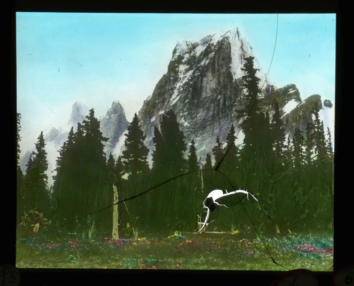
- File consists of 129 lantern slides pertaining to mountaineering expeditions and scenic views in the Canadian Rockies. Includes images of pack trips, ice climbing, hiking, and Alpine Club of Canada camps. Locations include Emperor Falls; Berg Lake; ascent of Resplendent Mountain; Mount Edith Cavell…
- Date Range
- [1913-1925]
- Reference Code
- V756 / III / A / PS - 1 to 129
- Description Level
- 5 / File
- GMD
- Photograph
- Lantern slide
1 image
- Part Of
- Malcolm Geddes fonds
- Description Level
- 5 / File
- Fonds Number
- M39
- V756
- Series
- V756 / III : Personal and family records
- Sous-Fonds
- V756
- Sub-Series
- V756 / III / A : Travel and mountain expeditions
- Accession Number
- 6504
- Reference Code
- V756 / III / A / PS - 1 to 129
- Responsibility
- Some items produced by Charles Potter and James Mahon
- Date Range
- [1913-1925]
- Physical Description
- 129 photographs : lantern slides
- Scope & Content
- File consists of 129 lantern slides pertaining to mountaineering expeditions and scenic views in the Canadian Rockies. Includes images of pack trips, ice climbing, hiking, and Alpine Club of Canada camps. Locations include Emperor Falls; Berg Lake; ascent of Resplendent Mountain; Mount Edith Cavell; Mount Maud; Mount Commander; Mount Marpole; Mount Habel; Mount Robson; Mount Temple; Mount Huber; Castle Mountain; and Wilcox Pass.
- Notes
- Some items are numbered on outer edges or otherwise labelled
- Material Details
- Some items hand-coloured
- Name Access
- Gibbon, John Murray
- Wheeler, A. O. (Arthur Oliver)
- Geddes, Malcolm
- Alpine Club of Canada
- Subject Access
- Travel
- Exploration
- Hiking
- Ice climbing
- Summit
- Mountains
- Landscapes
- Recreation
- Alpine Club of Canada
- Glaciers
- Trails
- Pack trips
- Camping
- Geographic Access
- Canada
- Alberta
- British Columbia
- Canadian Rocky Mountains
- Mount Robson
- Mount Temple
- Mount Habel
- Mount Geikie
- Mount Huber
- Castle Mountain
- Wilcox Pass
- Mount Edith Cavell
- Mount Maud
- Mount Commander
- Mount Marpole
- Access Restrictions
- Fragile - restrictions may apply
- Reproduction Restrictions
- Fragile- restrictions may apply
- Language
- N/A
- Title Source
- Title based on contents of file
- Processing Status
- Processed
Images
This material is presented as originally created; it may contain outdated cultural descriptions and
potentially offensive content.
Read more.
Canadian scenes
https://archives.whyte.org/en/permalink/descriptions14787
- Part Of
- Malcolm Geddes fonds
- Scope & Content
- File consists of 20 lantern slide photographs depicting scenes in Victoria, Vancouver and vicinity in British Columbia; Edmonton, Calgary and vicinity in Alberta; Regina and other regions in Saskatchewan; Winnipeg in Manitoba; and shipping activity on the Great Lakes.
- Date Range
- [ca.1925]
- Reference Code
- V756 / III / A / PS - 312 to 331
- Description Level
- 5 / File
- GMD
- Photograph
- Lantern slide
- Part Of
- Malcolm Geddes fonds
- Description Level
- 5 / File
- Fonds Number
- M39
- V756
- Series
- V756 / III : Personal and family records
- Sous-Fonds
- V756
- Sub-Series
- V756 / III / A : Travel and mountain expeditions
- Accession Number
- 6504
- Reference Code
- V756 / III / A / PS - 312 to 331
- Responsibility
- Most images in file issued by Department of the Interior Natural Resources Intelligence Branch
- Date Range
- [ca.1925]
- Physical Description
- 20 photographs : lantern slides
- Scope & Content
- File consists of 20 lantern slide photographs depicting scenes in Victoria, Vancouver and vicinity in British Columbia; Edmonton, Calgary and vicinity in Alberta; Regina and other regions in Saskatchewan; Winnipeg in Manitoba; and shipping activity on the Great Lakes.
- Notes
- Most items in file are captioned
- Material Details
- Items in file are hand-coloured
- Subject Access
- Scenery
- Ship
- Transportation
- Travel
- Communities
- Geographic Access
- Canada
- British Columbia
- Vancouver
- Victoria
- Alberta
- Edmonton
- Calgary
- Saskatchewan
- Regina
- Manitoba
- Winnipeg
- Great Lakes
- Access Restrictions
- Fragile- restrictions may apply
- Language
- English
- Title Source
- Title based on contents of file
- Processing Status
- Processed
This material is presented as originally created; it may contain outdated cultural descriptions and
potentially offensive content.
Read more.
Deep Powder and Steep Rock - textual
https://archives.whyte.org/en/permalink/descriptions55082
- Part Of
- Chic Scott fonds
- Scope & Content
- Series consists of textual records, including notes, manuscripts and other related materials, pertaining to the creation of the book "Deep Powder and Steep Rock".
- Date Range
- 2009
- Reference Code
- M57 / V
- Description Level
- 3 / Series
- GMD
- Textual record
- Map
- Part Of
- Chic Scott fonds
- Description Level
- 3 / Series
- Fonds Number
- M57 / V40 / S47
- Series
- M57 / V : Deep Powder and Steep Rock
- Sous-Fonds
- M57
- Accession Number
- 2014.8295
- 2015.8559
- Reference Code
- M57 / V
- GMD
- Textual record
- Map
- Date Range
- 2009
- Physical Description
- 30 cm of textual records
- History / Biographical
- Hans Gmoser played a major role in creating Canada’s vibrant mountain community. Although known internationally as the father of heli-skiing, he was much more than that: a talented rock climber, tireless expedition leader, a mountain guide, film maker and organizer. Deep Powder and Steep Rock presents an intimate portrait of this charismatic man. Much of the story is told in Gmoser’s own words, gleaned from his diaries, expedition journals, film commentaries and personal correspondence. It is a unique tale of adventure, hard work, perseverance and ultimate success.
- Scope & Content
- Series consists of textual records, including notes, manuscripts and other related materials, pertaining to the creation of the book "Deep Powder and Steep Rock".
- Notes
- Series consists of five sub-series: M57 / V / A: Research files M57 / V / B: Maps M57 / V / C: Interviews M57 / V / D: Photograph notes M57 / V / E: Draft Manuscript
- Name Access
- Scott, Chic
- Gmoser, Hans
- Subject Access
- Biography
- Personal and Professional Life
- Publication
- Research
- Geography
- Map
- Mountaineers
- Mountaineering
- Skiing
- Sports
- Recreation
- Winter sports
- Canadian Mountain Holidays
- Helicopter skiing
- Tourism
- Climbing
- Geographic Access
- Canada
- Alberta
- Banff
- Banff National Park
- Canadian Rocky Mountains
- Language
- English
- Related Material
- S47 / V
- V40 / V
- Biographical Source Notes
- http://chicscott.com/books.htm
- Title Source
- Title based on contents of file
- Processing Status
- Processed
This material is presented as originally created; it may contain outdated cultural descriptions and
potentially offensive content.
Read more.
Jasper Marmot Basin
https://archives.whyte.org/en/permalink/descriptions54813
- Part Of
- Murray Hay fonds
- Scope & Content
- File consists of 1 cm of textual records, 10 x 23.5 cm or smaller. File pertains to ski trail maps of Jasper Marmot Basin and ski area created by Murray Hay. File includes three brochures promoting the ski runs at Marmot Basin that each include a reproduced map by Hay.
- Date Range
- 2001-2003
- 2001
- 2003
- Reference Code
- M570 / III / B / iii / 1
- Description Level
- 5 / File
- GMD
- Map
- Textual record
- Published record
- Part Of
- Murray Hay fonds
- Description Level
- 5 / File
- Fonds Number
- M570 / V795
- Series
- M570 / III : Murray Hay portfolio (published material)
- Sous-Fonds
- M570
- Sub-Series
- M570 / III / B : Alberta / iii : Jasper
- Accession Number
- 2019.41
- Reference Code
- M570 / III / B / iii / 1
- Date Range
- 2001-2003
- 2001
- 2003
- Physical Description
- 1 cm of textual records (10 x 23.5 cm or smaller)
- Scope & Content
- File consists of 1 cm of textual records, 10 x 23.5 cm or smaller. File pertains to ski trail maps of Jasper Marmot Basin and ski area created by Murray Hay. File includes three brochures promoting the ski runs at Marmot Basin that each include a reproduced map by Hay.
- Name Access
- Hay, Murray
- Subject Access
- Ski Maps
- Skiing
- Ski areas
- Map
- Marmot Basin Ski Area
- Cartography
- Sports and recreation
- Tourism
- Tourist information
- Travel
- Winter
- Winter sports
- Advertising
- Artist
- Geographic Access
- Jasper
- Jasper Marmot Basin
- Jasper National Park
- Alberta
- Canada
- Canadian Rocky Mountains
- Language
- English
- Related Material
- V795 / II / B / i / 1
- Title Source
- Title based on contents of file
- Processing Status
- Processed
This material is presented as originally created; it may contain outdated cultural descriptions and
potentially offensive content.
Read more.
Kananaskis and Spray Lakes
https://archives.whyte.org/en/permalink/descriptions54802
- Part Of
- Murray Hay fonds
- Scope & Content
- File consists of 1.5 cm of textual records, 35 x 35 cm or smaller. File pertains to travel and tourism materials related to the Kananaskis-Canmore area. File includes four published Murray Hay trail maps of ski hills in Kananaskis (Nakiska, Fortress, Mount Allan) and a travel brochure relating to t…
- Date Range
- 1978 - ca.1995
- 1988
- 1978-1979
- Reference Code
- M570 / III / B / iv / 1-2
- Description Level
- 5 / File
- GMD
- Map
- Published record
- Textual record
- Poster
- Part Of
- Murray Hay fonds
- Description Level
- 5 / File
- Fonds Number
- M570 / V795
- Series
- M570 / III : Murray Hay portfolio (published material)
- Sous-Fonds
- M570
- Sub-Series
- M570 / III / B : Alberta / iv : Kananaskis
- Accession Number
- 2019.41
- Reference Code
- M570 / III / B / iv / 1-2
- Date Range
- 1978 - ca.1995
- 1988
- 1978-1979
- Physical Description
- 1.5 cm of textual records (35 x 35 cm or smaller)
- Scope & Content
- File consists of 1.5 cm of textual records, 35 x 35 cm or smaller. File pertains to travel and tourism materials related to the Kananaskis-Canmore area. File includes four published Murray Hay trail maps of ski hills in Kananaskis (Nakiska, Fortress, Mount Allan) and a travel brochure relating to the Kananaskis and Canmore area. The Mount Allan maps include recreational ski runs and Olympic ski runs.
- Notes
- M570 / III / B / iv / 2 is oversize.
- Name Access
- Hay, Murray
- Subject Access
- Ski area
- Ski Maps
- Skiing
- Cartography
- Map
- Tourism
- Travel
- Winter
- Winter sports
- Nakiska Ski Area
- Fortress Mountain
- Mount Allan
- Tourist information
- Artist
- Advertising
- Geographic Access
- Kananaskis
- Spray Valley
- Alberta
- Canada
- Canmore
- Language
- English
- Title Source
- Title based on contents of file
- Processing Status
- Processed
This material is presented as originally created; it may contain outdated cultural descriptions and
potentially offensive content.
Read more.
- Part Of
- Murray Hay fonds
- Scope & Content
- File consists of 1.5 cm of textual records, 53 x 80.5 cm and 10 x 23.5 cm. File pertains to ski trail maps of Lake Louise ski area created by Murray Hay. File includes two published reproductions of three original trail maps in a fold-out brochure (1992/1993) and in poster format. The three maps de…
- Date Range
- ca.1980 - ca. 1995
- 1992-1993
- Reference Code
- M570 / III / B / ii / 1-2
- Description Level
- 5 / File
- GMD
- Textual record
- Published record
- Map
- Poster
- Part Of
- Murray Hay fonds
- Description Level
- 5 / File
- Fonds Number
- M570 / V795
- Series
- M570 / III : Murray Hay portfolio (published material)
- Sous-Fonds
- M570
- Sub-Series
- M570 / III / B : Alberta / ii : Lake Louise
- Accession Number
- 2019.41
- Reference Code
- M570 / III / B / ii / 1-2
- Date Range
- ca.1980 - ca. 1995
- 1992-1993
- Physical Description
- 1.5 cm of textual records (53 x 80.5 cm and 10 x 23.5 cm)
- Scope & Content
- File consists of 1.5 cm of textual records, 53 x 80.5 cm and 10 x 23.5 cm. File pertains to ski trail maps of Lake Louise ski area created by Murray Hay. File includes two published reproductions of three original trail maps in a fold-out brochure (1992/1993) and in poster format. The three maps depict South Face, Back Bowls, and Larch Area.
- Name Access
- Hay, Murray
- Subject Access
- Ski area
- Ski Maps
- Skiing
- Tourism
- Cartography
- Map
- Winter
- Winter sports
- Sports and recreation
- Travel
- Lake Louise Ski Area
- Lake Louise
- Artist
- Advertising
- Geographic Access
- Lake Louise
- Alberta
- Canada
- Canadian Rocky Mountains
- Language
- English
- Related Material
- V795 / II / B / ii / 1
- Title Source
- Title based on contents of file
- Processing Status
- Processed
This material is presented as originally created; it may contain outdated cultural descriptions and
potentially offensive content.
Read more.
Lake Louise Area
https://archives.whyte.org/en/permalink/descriptions54925
- Part Of
- Murray Hay fonds
- Scope & Content
- File consists of 6 prints : col. ; 25.5 x 20 cm or smaller. File pertains to Murray Hay's renderings of the Lake Louise ski area. File includes six reproduced draft prints of original paintings of the Lake Louise ski area created by Murray Hay (different iterations).
- Date Range
- ca.1976-ca.2000
- Reference Code
- V795 / II / B / ii / 1
- Description Level
- 5 / File
- GMD
- Map
- Private record
- Part Of
- Murray Hay fonds
- Description Level
- 5 / File
- Fonds Number
- M570 / V795
- Series
- V795 / I : Unpublished Material
- Sous-Fonds
- V795
- Sub-Series
- V795 / I / B : Alberta / ii : Lake Louise
- Accession Number
- 2019.41
- Reference Code
- V795 / II / B / ii / 1
- GMD
- Map
- Private record
- Date Range
- ca.1976-ca.2000
- Physical Description
- 6 prints : col. ; 25.5 x 20 cm or smaller
- Scope & Content
- File consists of 6 prints : col. ; 25.5 x 20 cm or smaller. File pertains to Murray Hay's renderings of the Lake Louise ski area. File includes six reproduced draft prints of original paintings of the Lake Louise ski area created by Murray Hay (different iterations).
- Name Access
- Hay, Murray
- Subject Access
- Advertising
- Artist
- Ski Maps
- Map
- Cartography
- Sports and recreation
- Tourism
- Tourist information
- Winter
- Winter sports
- Ski area
- Lake Louise Ski Area
- Geographic Access
- Lake Louise
- Alberta
- Canada
- Canadian Rocky Mountains
- Language
- English
- Related Material
- M570 / III / B / ii / 1-2
- Creator
- Hay, Murray
- Title Source
- Title based on contents of file
- Processing Status
- Processed
This material is presented as originally created; it may contain outdated cultural descriptions and
potentially offensive content.
Read more.
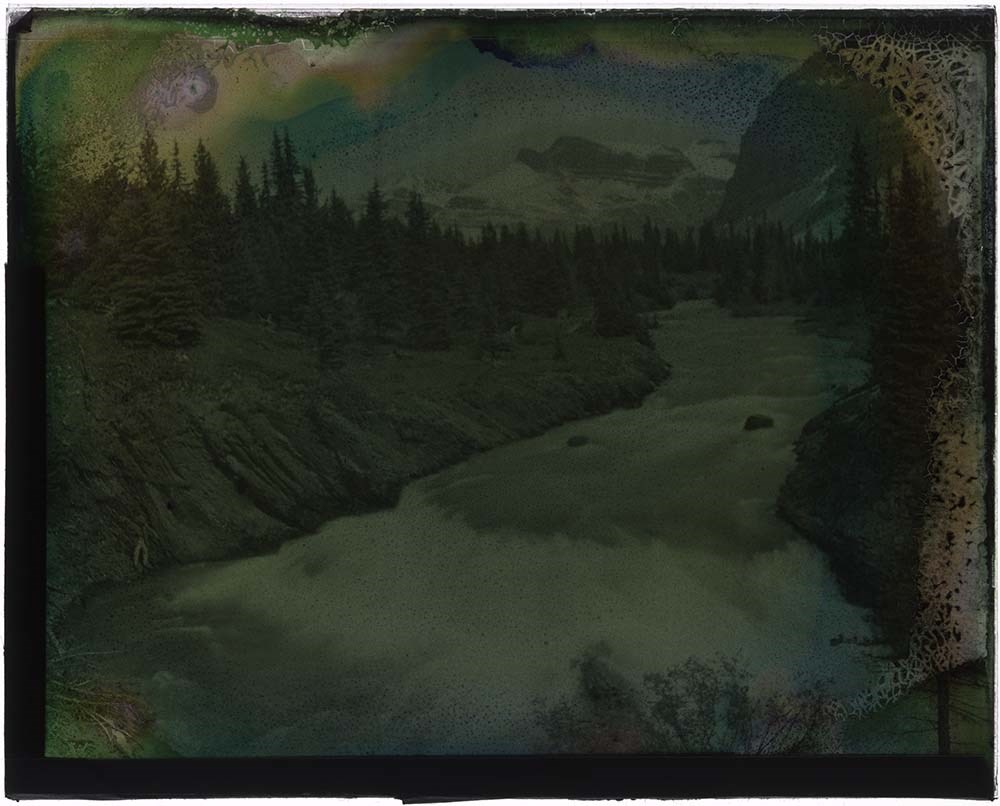
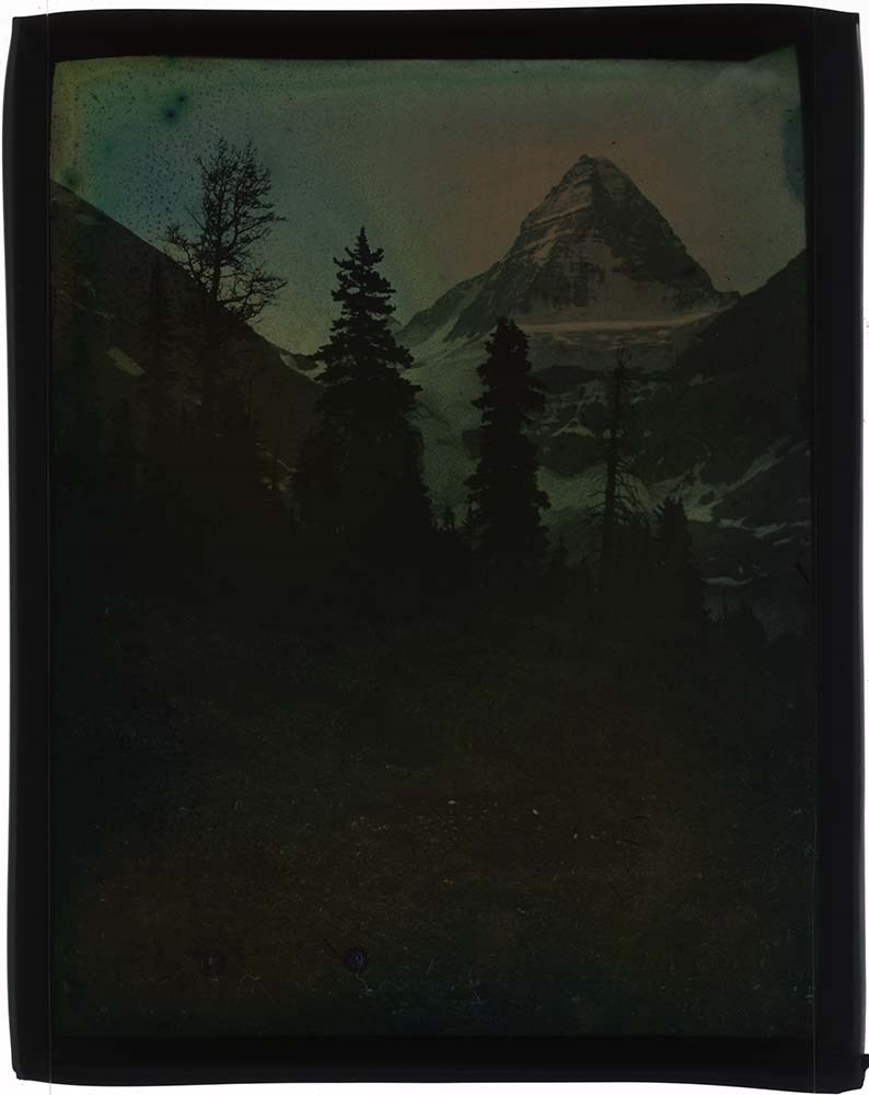
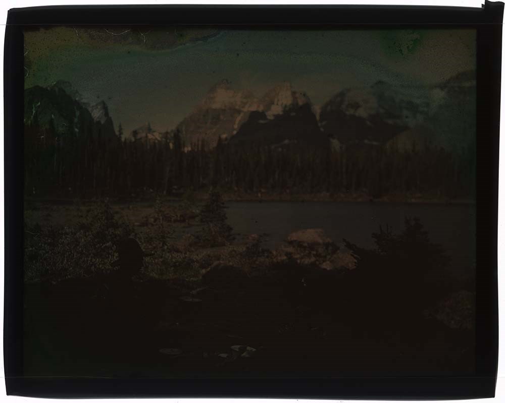
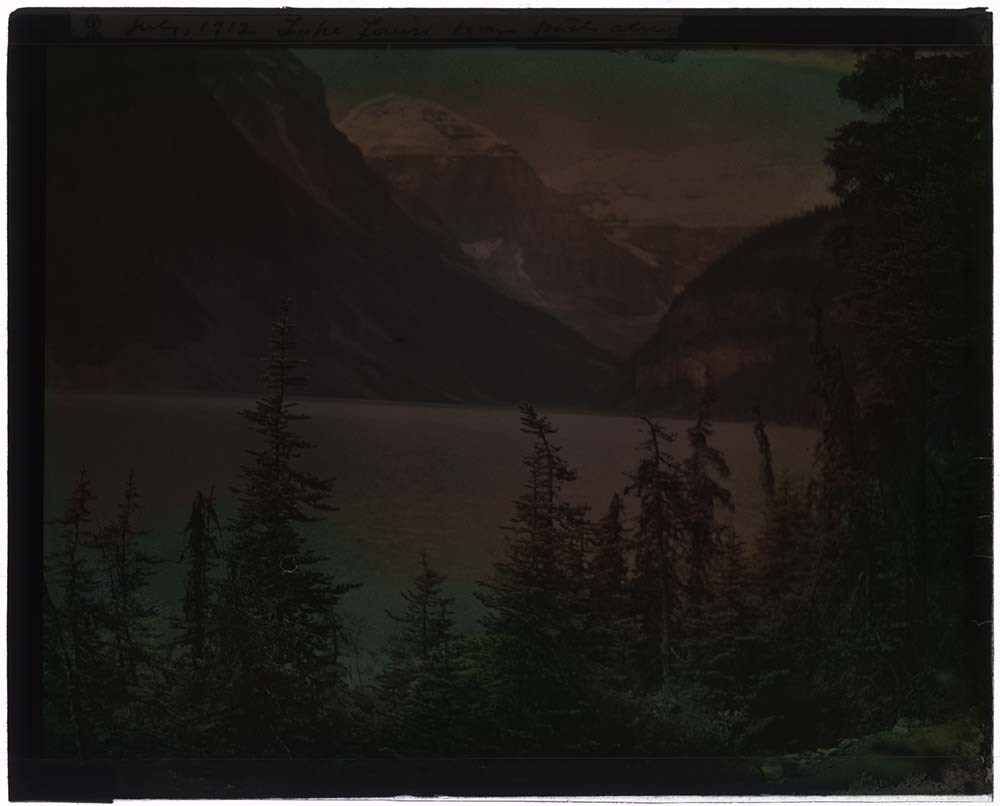
Lantern Slides
https://archives.whyte.org/en/permalink/descriptions54147
- Part Of
- Stan J. Carr fonds
- Scope & Content
- File consists of 8 colour lantern slides, some captioned. File subjects include an unidentified mountain scene, Mount Assiniboine, horse in unientified mountain scene, man posed in campsite in unidentified location, Lake Louise and Victoria Glacier, Hector Lake and Bow Peak, unidentified man in cam…
- Date Range
- ca. 1912
- Reference Code
- V127 / PS - 1 to 8
- Description Level
- 5 / File
- GMD
- Transparency
- Lantern slide
8 images
- Part Of
- Stan J. Carr fonds
- Description Level
- 5 / File
- Fonds Number
- M 179
- V 127
- Sous-Fonds
- V 127
- Accession Number
- 1072
- Reference Code
- V127 / PS - 1 to 8
- Date Range
- ca. 1912
- Physical Description
- 8 photographs : col. slides ; 10.5 x 14 cm
- History / Biographical
- Additive Colour Screen Plates, first theorized by James Clerk Maxwell in 1861, were the first forms of colour photography. Maxwell’s original process involved printing the same black and white image through different coloured screens onto transparencies and then projecting them overlapped in order to create a single full-colour image. In 1868 Louis Ducos du Hauron expanded on this method by placing a screen made up of microscopic coloured stripes in front of a light-sensitive emulsion before exposing it to light. During exposure, the colours in the screen attached to the developing picture so when viewed back through the screen in a projector the image appeared fully in colour. Neither of these methods were commercially popular during the 19th century since black and white processes were cheaper and more widely available. In 1907 the Lumiere brothers introduced the Autochrome process to wide commercial success. The Autochrome process involved a mix of tiny potato starch grains dyed green, orange-red, and blue-purple that were mixed thoroughly and applied to a glass slide coated in a sticky varnish that held the grains in an evenly-distributed layer. The grains were laminated into the varnish to make them smaller and more transparent, and then the whole thing was sealed with another layer of waterproof varnish. The entire process could be done by machines, which made the slides cheap to produce, easily available to the public and opened up the process to amateur photographers. Photographs developed on Autochrome plates created soft images with relatively natural colour rendering, making them popular with artists and photojournalists. Autochrome plates (which came to refer to all colour screen plates regardless of manufacturer) created one-of-a-kind positive images and required long exposure times. Once an image was complete, it had to be quickly covered with either a strong coating of varnish or another slide of glass and then sealed along the edges with binding tape. Because silver is an element of the sticky base varnish that holds the dyed grains, if moisture was allowed to access the image the layers of varnish could ripple or tear away from the glass, or the dye could bleed or fade. The silver base is highly sensative to oxygen and if improperly sealed images could begin to "mirror," a process in which the exposed parts of the slide become uniform and shiny, obscuring the image. Because of the random distribution of dyed colour grains throughout the image and the lines created by laminating those grains into the base varnish, Autochrome transparencies are often mistaken for hand-painted coloured slides. Autochrome can be identified by looking closely for small dots of colour in all parts of the image, rather than the solid blots of colour found on hand-painted slides.
- Scope & Content
- File consists of 8 colour lantern slides, some captioned. File subjects include an unidentified mountain scene, Mount Assiniboine, horse in unientified mountain scene, man posed in campsite in unidentified location, Lake Louise and Victoria Glacier, Hector Lake and Bow Peak, unidentified man in camp.
- Name Access
- Carr, Stan J.
- Subject Access
- Exploration
- Discovery and travel
- Lantern slide
- Geographic Access
- Mount Assiniboine
- Lake Louise
- Bow Summit
- Banff National Park
- Alberta
- Canada
- Access Restrictions
- No restrictions on access
- Language
- English
- Conservation
- Re-seal all slides appropriately; keep stored in cool, dry, dark area; refrain from exposing to further damage.
- Creator
- Carr, Stan J.
- Category
- Exploration, discovery and travel
- Biographical Source Notes
- http://www.graphicsatlas.org/identification/?process_id=286#overview
- https://psap.library.illinois.edu/collection-id-guide/slide#autochrome
- Title Source
- Title based on contents of file
- Processing Status
- Processed
Images


This material is presented as originally created; it may contain outdated cultural descriptions and
potentially offensive content.
Read more.
Maps of Banff and Western Canada
https://archives.whyte.org/en/permalink/descriptions54772
- Part Of
- Luxton family fonds
- Scope & Content
- File consists of 9 printed maps, b&w and col. [including zoning and topographical maps] depicting the Town of Banff and Banff National Park, the Rocky Mountains Forest Reserve, the Moose Mountain region, Medicine Hat, and the province of Alberta. File includes Trail Riders' Map of the Canadian Rock…
- Date Range
- 1912
- 1914
- 1924
- 1926
- 1932
- 1957
- [1970-1980]
- Reference Code
- LUX / II / C5 / 25
- Description Level
- 5 / File
- GMD
- Textual record
- Published record
- Map
- Part Of
- Luxton family fonds
- Description Level
- 5 / File
- Fonds Number
- LUX
- Series
- LUX / II / C : Personal
- Sous-Fonds
- LUX / II : Eleanor Luxton sous-fonds
- Sub-Series
- LUX / II / C5 : Other
- Accession Number
- LUX
- Reference Code
- LUX / II / C5 / 25
- Date Range
- 1912
- 1914
- 1924
- 1926
- 1932
- 1957
- [1970-1980]
- Physical Description
- 9 maps : b&w and col. ; 168 x 71 cm or smaller
- Scope & Content
- File consists of 9 printed maps, b&w and col. [including zoning and topographical maps] depicting the Town of Banff and Banff National Park, the Rocky Mountains Forest Reserve, the Moose Mountain region, Medicine Hat, and the province of Alberta. File includes Trail Riders' Map of the Canadian Rockies which has smaller maps of Waterton Lakes, Glacier, Revelstoke, and other national parks printed on the back. Map of Medicine Hat includes annotated storage envelope with dimensions written on the front.
- Subject Access
- Cartography
- Geography
- Land use
- Government
- Travel
- National parks and reserves
- Geographic Access
- Canada
- Alberta
- Banff
- Banff National Park
- Medicine Hat
- Rocky Mountains
- Glacier National Park
- Revelstoke
- Waterton Lakes National Park
- Reproduction Restrictions
- Restrictions may apply
- Language
- English
- Title Source
- Title based on contents of file
- Processing Status
- Processed
This material is presented as originally created; it may contain outdated cultural descriptions and
potentially offensive content.
Read more.
- Part Of
- Murray Hay fonds
- Scope & Content
- File consists of 2 prints : col. ; 35 x 28 cm. File pertains to Murray Hay's rendering of Marmot Basin ski area in Jasper National Park. File includes two iterations of reproduction draft prints of Hay's map of Marmot Basin.
- Date Range
- ca.1976-ca.2000
- Reference Code
- V795 / II / B / i / 1
- Description Level
- 5 / File
- GMD
- Map
- Private record
- Part Of
- Murray Hay fonds
- Description Level
- 5 / File
- Fonds Number
- M570 / V795
- Series
- V795 / II : Unpublished Material
- Sous-Fonds
- V795
- Sub-Series
- V795 / II / B : Alberta / i : Jasper National Park
- Accession Number
- 2019.41
- Reference Code
- V795 / II / B / i / 1
- GMD
- Map
- Private record
- Date Range
- ca.1976-ca.2000
- Physical Description
- 2 prints : col. ; 35 x 28 cm
- Scope & Content
- File consists of 2 prints : col. ; 35 x 28 cm. File pertains to Murray Hay's rendering of Marmot Basin ski area in Jasper National Park. File includes two iterations of reproduction draft prints of Hay's map of Marmot Basin.
- Name Access
- Hay, Murray
- Subject Access
- Advertising
- Artist
- Ski Maps
- Ski area
- Map
- Cartography
- Sports and recreation
- Tourism
- Tourist information
- Winter
- Winter sports
- Geographic Access
- Jasper Marmot Basin
- Jasper National Park
- Alberta
- Canada
- Canadian Rocky Mountains
- Language
- English
- Related Material
- M570 / III / B / iii / 1
- Creator
- Hay, Murray
- Title Source
- Title based on contents of file
- Processing Status
- Processed
This material is presented as originally created; it may contain outdated cultural descriptions and
potentially offensive content.
Read more.
National Parks - Kootenay, Yoho, Glacier, Jasper, Waterton Lakes
https://archives.whyte.org/en/permalink/descriptions55243
- Part Of
- Malcolm Geddes fonds
- Scope & Content
- File consists of 70 lantern slide images pertaining to views from Kootenay, Yoho, Glacier, Jasper and Waterton Lakes National Parks. Specific locations include: Marble Canyon and Sinclair Canyon; Mount Stephen, Lake Oesa, Lake O'Hara, Lake McArthur, Takakkaw Falls, Twin Falls and Yoho Glacier; Ille…
- Date Range
- [ca.1925]
- Reference Code
- V756 / III / A / PS - 161 to 230
- Description Level
- 5 / File
- GMD
- Photograph
- Lantern slide
- Part Of
- Malcolm Geddes fonds
- Description Level
- 5 / File
- Fonds Number
- M39
- V756
- Series
- V756 / III : Personal and family records
- Sous-Fonds
- V756
- Sub-Series
- V756 / III / A : Travel and mountain expeditions
- Accession Number
- 6504
- Reference Code
- V756 / III / A / PS - 161 to 230
- Responsibility
- Some items issued by Department of the Interior Natural Resources Intelligence Branch and by Canadian National Railways
- Date Range
- [ca.1925]
- Physical Description
- 70 photographs : lantern slides
- Scope & Content
- File consists of 70 lantern slide images pertaining to views from Kootenay, Yoho, Glacier, Jasper and Waterton Lakes National Parks. Specific locations include: Marble Canyon and Sinclair Canyon; Mount Stephen, Lake Oesa, Lake O'Hara, Lake McArthur, Takakkaw Falls, Twin Falls and Yoho Glacier; Illecillewaet Glacier and surrounding area; Jasper town and Jasper Park Lodge; Maligne Lake, Maligne Canyon, Mount Edith Cavell and Mount Robson; and Waterton Lake area. Most items are captioned.
- Notes
- Slides are organized by location: V756 / III / A / PS - 161 to 167 : Kootenay V756 / III / A / PS - 168 to 185 : Yoho V756 / III / A / PS - 186 to 194 : Glacier V756 / III / A / PS - 195 to 226 : Jasper V756 / III / A / PS - 227 to 230 : Waterton Lakes
- Subject Access
- Travel
- Exploration
- Mountains
- Landscapes
- Glaciers
- Hotels
- Waterfalls
- National parks and reserves
- Tourism
- Recreation
- Geographic Access
- Canada
- Alberta
- British Columbia
- Canadian Rocky Mountains
- Kootenay National Park
- Yoho National Park
- Glacier National Park
- Jasper National Park
- Jasper
- Waterton Lakes National Park
- Waterton
- Access Restrictions
- Fragile - restrictions may apply
- Language
- English
- Title Source
- Title based on contents of file
- Processing Status
- Processed
This material is presented as originally created; it may contain outdated cultural descriptions and
potentially offensive content.
Read more.
Published regional and trail maps
https://archives.whyte.org/en/permalink/descriptions54847
- Scope & Content
- File consists of maps depicting the Banff townsite and nearby travel routes. Includes a trail map for Banff, Yoho and Kootenay National Parks; a road map for Banff and nearby areas [1965]; a numbered townsite map of Banff marking local hotels and attractions; and a photocopied map of a trail route …
- Date Range
- [1950-1970]
- 1965
- Reference Code
- M545 / III / 29
- Description Level
- 5 / File
- GMD
- Textual record
- Published record
- Map
- Description Level
- 5 / File
- Fonds Number
- M545 / V635
- Series
- M545 / III : Published records
- Sous-Fonds
- M545
- Accession Number
- 5939
- Reference Code
- M545 / III / 29
- Date Range
- [1950-1970]
- 1965
- Physical Description
- 0.5 cm of textual records (4 maps ; 35.5 x 21.5 cm or smaller)
- Scope & Content
- File consists of maps depicting the Banff townsite and nearby travel routes. Includes a trail map for Banff, Yoho and Kootenay National Parks; a road map for Banff and nearby areas [1965]; a numbered townsite map of Banff marking local hotels and attractions; and a photocopied map of a trail route used by the Trail Riders of the Canadian Rockies [n.d.]
- Notes
- Banff townsite map has annotation marking the location of the Trail Ride Office on Caribou St.
- Subject Access
- Travel
- Trails
- Map
- Land, settlement and immigration
- Geography
- Geographic Access
- Canada
- Alberta
- Banff
- Banff National Park
- Yoho National Park
- Kootenay National Park
- Reproduction Restrictions
- Restrictions may apply
- Language
- English
- Title Source
- Title based on contents of file
- Processing Status
- Processed
This material is presented as originally created; it may contain outdated cultural descriptions and
potentially offensive content.
Read more.