Narrow Results By
Mount Victoria Summit Record
https://archives.whyte.org/en/permalink/descriptions57688
- Part Of
- Alpine Club of Canada fonds
- Scope & Content
- File consists of one summit register from Mount Victoria produced by the Alpine Club of Canada between 1998 and 2004. Summit record include entries from visitors to the various summits which pertain to individuals' hiking and climbing trips; details of specific events which occurred while at the su…
- Date Range
- September 1998 - August 2004
- Reference Code
- M200 / V / A / 81
- Description Level
- 5 / File
- GMD
- Textual record
- Organization record
- Part Of
- Alpine Club of Canada fonds
- Description Level
- 5 / File
- Fonds Number
- M200
- V14
- S6
- Series
- M200 / V: Summit Records
- Sous-Fonds
- M200
- Sub-Series
- M200 / V / A: Identified Summit Records
- Accession Number
- accn. 8002
- Reference Code
- M200 / V / A / 81
- Responsibility
- Summit Registers and Notes produced by Alpine Club of Canada
- Date Range
- September 1998 - August 2004
- Physical Description
- 1 cm of textual records 1 volume
- History / Biographical
- Mount Victoria is located in both Yoho National Park, B. C. and Banff National Park, AB in the Canadian Rockies. The mountain is part of the mountain range along the Continental Divide, between Alberta and B.C. Nearby are Lake O'Hara, Lake Louise, Abbot Pass and Mount Lefroy. Mount Victoria was named for Queen Victoria.
- Scope & Content
- File consists of one summit register from Mount Victoria produced by the Alpine Club of Canada between 1998 and 2004. Summit record include entries from visitors to the various summits which pertain to individuals' hiking and climbing trips; details of specific events which occurred while at the summit, wildlife sightings, trail updates, and related topics. File: M200 / V / A / 81: Summit - MT. Victoria, Sept. 1998 - Aug. 2004
- Name Access
- Alpine Club of Canada
- Subject Access
- Alberta
- Abbot Pass
- Alpine Club of Canada
- Backcountry skiing
- Backpacking
- Banff National Park
- Bow Valley
- British Columbia
- Climbing
- Club
- Cross-country skiing
- Description and travel
- Environment
- Environment and Nature
- Hiking
- Lake Louise
- Lake O'hara
- Mountain
- Mountaineering
- Mountaineers
- Mountains
- Parks Canada
- Record keeping
- Ski area
- Ski areas
- Ski mountaineering
- Ski touring
- Skiers
- Skiing
- Snowshoes and snowshoeing
- Sports and leisure
- Sports and recreation
- Summit
- Trails
- Winter sports
- Geographic Access
- Canada
- Alberta
- British Columbia
- Banff National Park
- Yoho National Park
- Lake O'Hara
- Lake Louise
- Lake Louise, AB
- Abbot Pass
- Abbott Pass
- Mount Lefroy
- Mount Victoria
- Access Restrictions
- Restrictions may apply
- Language
- English
- French
- German
- Japanese
- Related Material
- M235
- Biographical Source Notes
- Peak Finder: Mount Victoria, Canadian Rockies Database: https://cdnrockiesdatabases.ca/peaks/1459
- Title Source
- Title based on contents of file
- Processing Status
- Processed
This material is presented as originally created; it may contain outdated cultural descriptions and
potentially offensive content.
Read more.
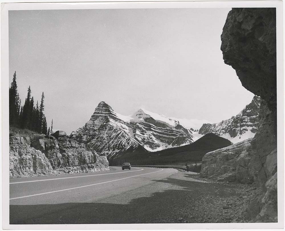
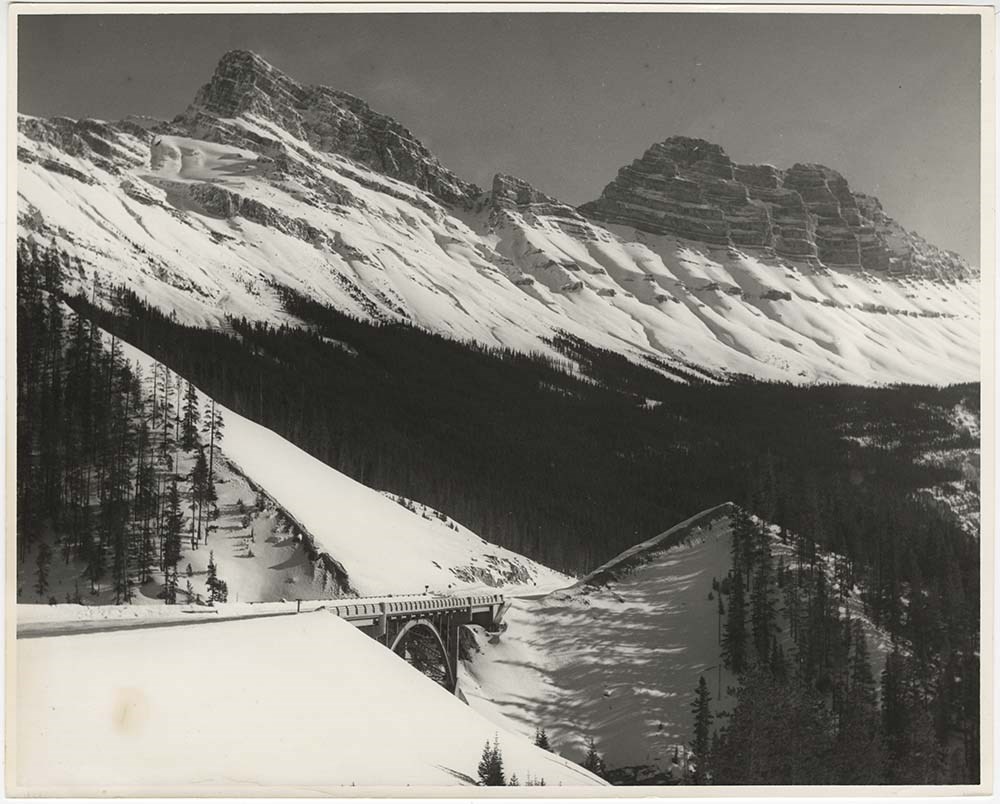
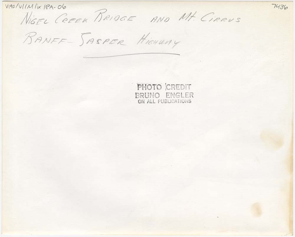
Mountain Views
https://archives.whyte.org/en/permalink/descriptions57203
- Part Of
- Bruno Engler fonds
- Scope & Content
- File pertains to 12 b&w prints of various mountain views, including summer and winter. Includes glaciers, highways, bridges, and possibly the town of Field.
- Date Range
- [ca. 1935-1975]
- Reference Code
- V190 / VI / M / ix / PA - 01 to PA - 12
- Description Level
- 5 / File
- GMD
- Photograph
5 images
- Part Of
- Bruno Engler fonds
- Description Level
- 5 / File
- Fonds Number
- M323 / S40 / V190
- Series
- VI : Retained file, M : Alphabetical order
- Sous-Fonds
- V190
- Sub-Series
- ix : Mountain Views
- Accession Number
- 7436
- Reference Code
- V190 / VI / M / ix / PA - 01 to PA - 12
- GMD
- Photograph
- Date Range
- [ca. 1935-1975]
- Physical Description
- 12 photographs : b&w ; 25.2 x 20.2 cm or smaller
- History / Biographical
- See fonds level description
- Scope & Content
- File pertains to 12 b&w prints of various mountain views, including summer and winter. Includes glaciers, highways, bridges, and possibly the town of Field.
- Subject Access
- Automobiles
- Banff-Jasper Highway
- Bridges
- Glaciers
- Mountains
- Rivers
- Roads
- scenic
- Winter
- Geographic Access
- Banff National Park
- Field
- Yoho National Park
- British Columbia
- Language
- English
- Creator
- Engler, Bruno
- Title Source
- Original title kept
- Processing Status
- Processed
Images


This material is presented as originally created; it may contain outdated cultural descriptions and
potentially offensive content.
Read more.
- Part Of
- Alpine Club of Canada fonds
- Scope & Content
- File consists of a summit record from Mount Baker produced by the Alpine Club of Canada around 1988. Summit record includes entries from visitors to the various summits which pertain to individuals' hiking and climbing trips; details of specific events which occurred while at the summit, wildlife s…
- Date Range
- ca. 1988
- Reference Code
- M200 / V / A / 120
- Description Level
- 5 / File
- GMD
- Textual record
- Organization record
- Part Of
- Alpine Club of Canada fonds
- Description Level
- 5 / File
- Fonds Number
- M200
- V14
- S6
- Series
- M200 / V: Summit Records
- Sous-Fonds
- M200
- Sub-Series
- M200 / V / A: Identified Summit Records
- Accession Number
- accn. 2023.10
- Reference Code
- M200 / V / A / 120
- Responsibility
- Summit Registers and Notes produced by Alpine Club of Canada
- Date Range
- ca. 1988
- Physical Description
- 1 volume 1 cm of textual record
- History / Biographical
- Mount Baker is located on the Continental Divide of Alberta and British Columbia. It is part of the Waputik Mountains of the Canadian Rockies. Nearby are Yoho Provincial Park, Banff National Park, Mount Freshfield, Mount Forbes, Lake Louise, AB, and Field, B.C.
- Scope & Content
- File consists of a summit record from Mount Baker produced by the Alpine Club of Canada around 1988. Summit record includes entries from visitors to the various summits which pertain to individuals' hiking and climbing trips; details of specific events which occurred while at the summit, wildlife sightings, trail updates, and related topics. File: M200 / V / A / 120: Mt. Baker
- Name Access
- Alpine Club of Canada
- Subject Access
- Alberta
- Alpine Club of Canada
- Backcountry skiing
- Backpacking
- Banff
- Banff National Park
- Bow Valley
- British Columbia
- Climbing
- Club
- Cross-country skiing
- Description and travel
- Environment
- Environment and Nature
- Hiking
- Mountain
- Mountaineering
- Mountaineers
- Mountains
- National parks and reserves
- Record keeping
- Ski area
- Ski areas
- Ski mountaineering
- Skiers
- Skiing
- Skis
- Sports and leisure
- Sports and recreation
- Summit
- Trails
- Winter sports
- Geographic Access
- Canada
- Canadian Rocky Mountains
- Rocky Mountains
- Continental Divide
- Alberta
- British Columbia
- Banff National Park
- Yoho National Park
- Mount Freshfield
- Mount Forbes
- Lake Louise
- Lake Louise, AB
- Mount Baker
- Access Restrictions
- Restrictions may apply
- Language
- English
- Conservation
- Register placed in mylar due to evidence of mold. Evidence of water damage.
- Related Material
- M235
- Title Source
- Original title used
- Processing Status
- Processed
This material is presented as originally created; it may contain outdated cultural descriptions and
potentially offensive content.
Read more.
[Mt. Field, 1994-2000]
https://archives.whyte.org/en/permalink/descriptions57708
- Part Of
- Alpine Club of Canada fonds
- Scope & Content
- File consists of a summit record from Mount Field produced by the Alpine Club of Canada between 1994 and 2000. Summit record includes entries from visitors to the various summits which pertain to individuals' hiking and climbing trips; details of specific events which occurred while at the summit, …
- Date Range
- 1994-2000
- Reference Code
- M200 / V / A / 118
- Description Level
- 5 / File
- GMD
- Textual record
- Organization record
- Part Of
- Alpine Club of Canada fonds
- Description Level
- 5 / File
- Fonds Number
- M200
- V14
- S6
- Series
- M200 / V: Summit Records
- Sous-Fonds
- M200
- Sub-Series
- M200 / V / A: Identified Summit Records
- Accession Number
- accn. 2023.10
- Reference Code
- M200 / V / A / 118
- Responsibility
- Summit Registers and Notes produced by Alpine Club of Canada
- Date Range
- 1994-2000
- Physical Description
- 1 volume 0.5 cm of textual record
- History / Biographical
- Mt. Field is located in the Canadian Rockies, in Yoho National Park near the town of Field, B.C. Nearby are Mount Burgess, Wapta Mountain, and Emerald Lake.
- Scope & Content
- File consists of a summit record from Mount Field produced by the Alpine Club of Canada between 1994 and 2000. Summit record includes entries from visitors to the various summits which pertain to individuals' hiking and climbing trips; details of specific events which occurred while at the summit, wildlife sightings, trail updates, and related topics. File: M200 / V / A / 118: [Mt. Field, 1994-2000]
- Name Access
- Alpine Club of Canada
- Subject Access
- Alpine Club of Canada
- Backcountry skiing
- Backpacking
- British Columbia
- Climbing
- Club
- Cross-country skiing
- Description and travel
- Environment
- Environment and Nature
- Hiking
- Mountain
- Mountaineering
- Mountaineers
- Mountains
- National parks and reserves
- Record keeping
- Ski areas
- Ski area
- Ski mountaineering
- Skiers
- Skiing
- Skis
- Sports and leisure
- Sports and recreation
- Summit
- Trails
- Winter sports
- Geographic Access
- Canada
- Canadian Rocky Mountains
- British Columbia
- Yoho National Park
- Field
- Mount Burgess
- Wapta Mountain
- Emerald Lake
- Mount Field, B.C.
- Access Restrictions
- Restrictions may apply
- Language
- English
- Related Material
- M235
- Title Source
- Title based on contents of file
- Processing Status
- Processed
This material is presented as originally created; it may contain outdated cultural descriptions and
potentially offensive content.
Read more.
Mt. McPhail Summit Register
https://archives.whyte.org/en/permalink/descriptions57711
- Part Of
- Alpine Club of Canada fonds
- Scope & Content
- File consists of a summit record from Mount McPhail produced by the Alpine Club of Canada around 1994. Summit record includes entries from visitors to the various summits which pertain to individuals' hiking and climbing trips; details of specific events which occurred while at the summit, wildlife…
- Date Range
- ca. 1994
- Reference Code
- M200 / V / A / 121
- Description Level
- 5 / File
- GMD
- Textual record
- Organization record
- Part Of
- Alpine Club of Canada fonds
- Description Level
- 5 / File
- Fonds Number
- M200
- V14
- S6
- Series
- M200 / V: Summit Records
- Sous-Fonds
- M200
- Sub-Series
- M200 / V / A: Identified Summit Records
- Accession Number
- accn. 2014.8293
- Reference Code
- M200 / V / A / 121
- Responsibility
- Summit Registers and Notes produced by Alpine Club of Canada
- Date Range
- ca. 1994
- Physical Description
- 1 volume 1 cm of textual record
- History / Biographical
- Mount McPhail is located in the Elk Range of the Park Ranges of the Canadian Rockies and is along the Continental Divide, between the Alberta and British Columbia border. It is within the Kananaskis Country Provincial Park boundary, Mount McPhail is also known as "The Pyramid" for its shape. The mountain was named for Corporal Norman RR. McPhail, a member of the Surveyor General staff, who fought and was killed in action in WWI.
- Scope & Content
- File consists of a summit record from Mount McPhail produced by the Alpine Club of Canada around 1994. Summit record includes entries from visitors to the various summits which pertain to individuals' hiking and climbing trips; details of specific events which occurred while at the summit, wildlife sightings, trail updates, and related topics. File: M200 / V / A / 121: Mt. McPhail Summit Register
- Name Access
- Alpine Club of Canada
- Subject Access
- Alberta
- Alpine Club of Canada
- Backcountry skiing
- Backpacking
- Banff
- Banff National Park
- Bow Valley
- British Columbia
- Climbing
- Club
- Cross-country skiing
- Description and travel
- Environment
- Environment and Nature
- Hiking
- Kananaskis Country
- Mountain
- Mountaineering
- Mountaineers
- Mountains
- National parks and reserves
- Provincial parks and reserves
- Record keeping
- Ski area
- Ski areas
- Ski mountaineering
- Skiing
- Skiers
- Sports and leisure
- Sports and recreation
- Summit
- Winter sports
- Geographic Access
- Canada
- Canadian Rocky Mountains
- Alberta
- British Columbia
- Banff National Park
- Yoho National Park
- Continental Divide
- Elk Range Mountains
- Mount McPhail
- Access Restrictions
- Restrictions may apply
- Language
- English
- Conservation
- Register contains black mold, water damage. Register is placed in mylar.
- Related Material
- M235
- Biographical Source Notes
- Peak Finder: Mount McPhail, Canadian Rockies Database: https://cdnrockiesdatabases.ca/peaks/889
- Title Source
- Original title used
- Processing Status
- Processed
This material is presented as originally created; it may contain outdated cultural descriptions and
potentially offensive content.
Read more.
Mt. Yukness Summit Records
https://archives.whyte.org/en/permalink/descriptions57687
- Part Of
- Alpine Club of Canada fonds
- Scope & Content
- Files consist of summit notes and summit registers from Mt. Yukness produced by the Alpine Club of Canada between ca. 1962 and 2003. Summit records include entries from visitors to the various summits which pertain to individuals' hiking and climbing trips; details of specific events which occurred…
- Date Range
- ca. 1962-1985
- 1994-2003
- Reference Code
- M200 / V / A / 79 to 80
- Description Level
- 5 / File
- GMD
- Textual record
- Organization record
- Part Of
- Alpine Club of Canada fonds
- Description Level
- 5 / File
- Fonds Number
- M200
- V14
- S6
- Series
- M200 / V: Summit Records
- Sous-Fonds
- M200
- Sub-Series
- M200 / V / A: Identified Summit Records
- Accession Number
- accn. 2023.32
- accn. 8002
- Reference Code
- M200 / V / A / 79 to 80
- Responsibility
- Summit Registers and Notes produced by Alpine Club of Canada
- Date Range
- ca. 1962-1985
- 1994-2003
- Physical Description
- 2 cm of textual records 2 volumes
- History / Biographical
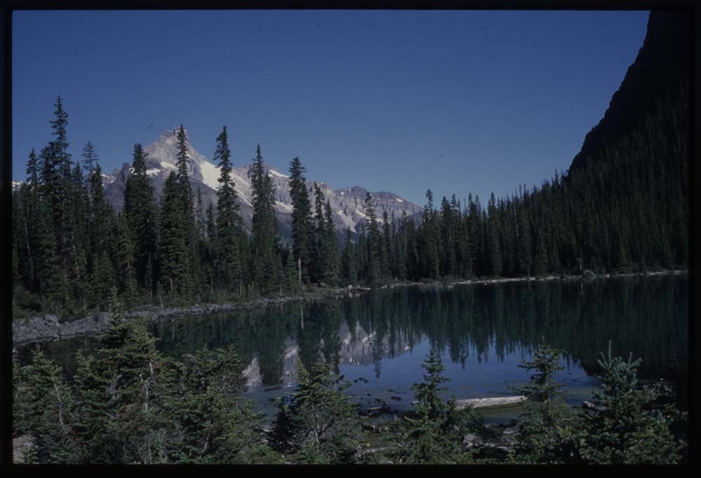
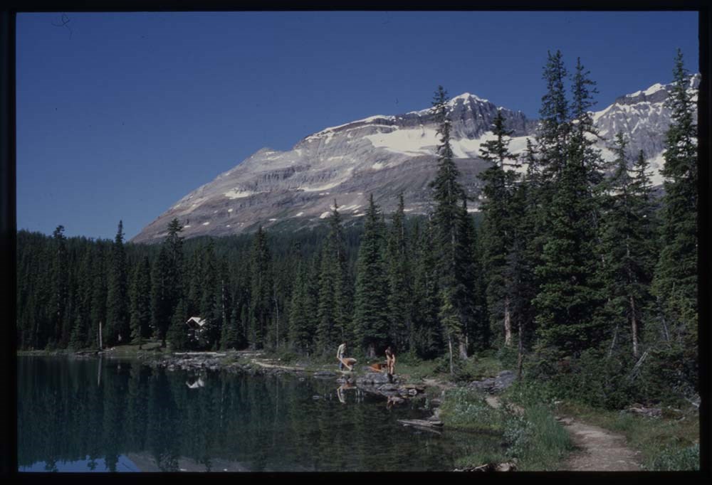
- Mt. Yukness is located near Lake O'Hara in Yoho National Park, B.C. Nearby is Ringrose Peak, Mount Huber, Mount Lefroy, Glacier Peak, and Mount Biddle.
- Scope & Content
- Files consist of summit notes and summit registers from Mt. Yukness produced by the Alpine Club of Canada between ca. 1962 and 2003. Summit records include entries from visitors to the various summits which pertain to individuals' hiking and climbing trips; details of specific events which occurred while at the summit, wildlife sightings, trail updates, and related topics. Files include: M200 / V / A / 79: Mt. Yukness [ca. 1962 - 1985] M200 / V / A / 80: Summit Register - MT. Yukness, 1994 - 2003
- Name Access
- Alpine Club of Canada
- Subject Access
- Alpine Club of Canada
- Backcountry skiing
- Backpacking
- British Columbia
- Climbing
- Cross-country skiing
- Description and travel
- Environment
- Environment and Nature
- Hiking
- Lake O'hara
- Mountain
- Mountaineering
- Mountaineers
- Mountains
- National parks and reserves
- Parks
- Record keeping
- Ski area
- Ski areas
- Ski mountaineering
- Ski touring
- Skiers
- Skiing
- Snowshoes and snowshoeing
- Sports and leisure
- Sports and recreation
- Summit
- Trails
- Winter sports
- Geographic Access
- Canada
- British Columbia
- Canadian Rocky Mountains
- Rocky Mountains
- Yoho National Park
- Lake O'Hara
- Mount Huber
- Mount Lefroy
- Ringrose Peak
- Access Restrictions
- Restrictions may apply
- Language
- English
- Conservation
- M200 / V / A / 80: Summit Register - MT. Yukness, 1994 - 2003 register is placed in mylar due to evidence of mold. This register also contains water damage.
- Related Material
- M235
- Biographical Source Notes
- Mount Yukness, Peak Finder, Canadian Rockies Database: https://cdnrockiesdatabases.ca/peaks/1559
- Title Source
- Title based on contents of file
- Processing Status
- Processed
This material is presented as originally created; it may contain outdated cultural descriptions and
potentially offensive content.
Read more.
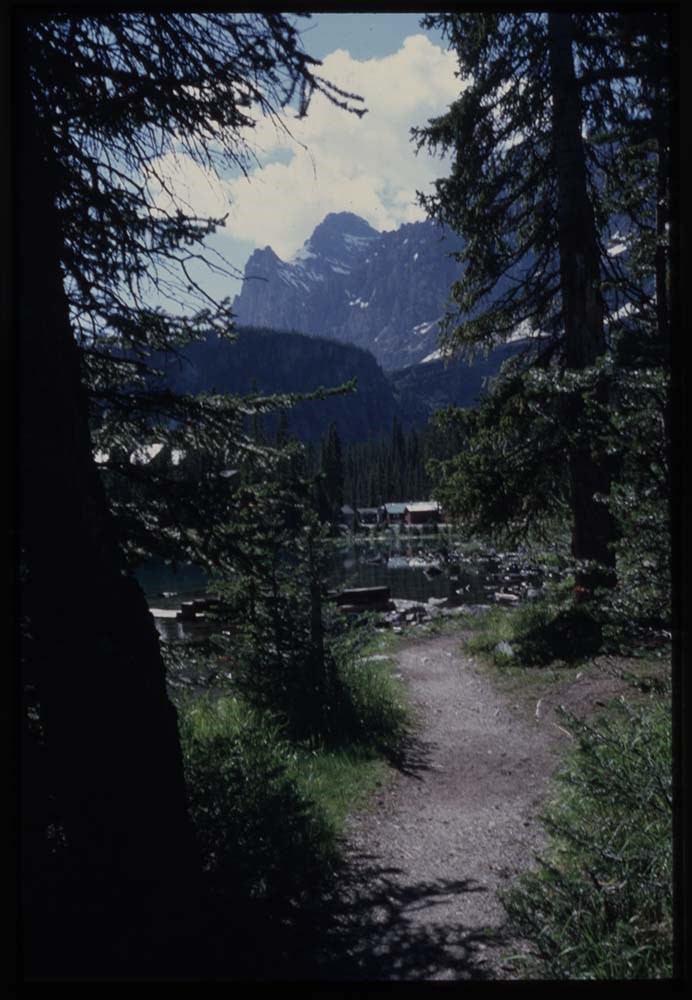
Select O'Hara Slide Show [Series V]
https://archives.whyte.org/en/permalink/descriptions1853
- Part Of
- Lillian Gest fonds
- Scope & Content
- File pertains to 79 slides assembled by Lillian Gest in 1981 into a show from slides depicting various summer to the Canadian Rockies throughout the late 1950s to 1970s with emphasis on the Lake O'Hara area of Yoho National Park. Topics include mountains and mountain views, wildflowers, wildlife, v…
- Date Range
- [ca. 1971-1981]
- Reference Code
- V225 / II / C / ii / a / ii / NS - V
- Description Level
- 5 / File
- GMD
- Film
- Transparency
79 images
1 Electronic Resource
- Part Of
- Lillian Gest fonds
- Description Level
- 5 / File
- Fonds Number
- M67 / S36 / V225
- Series
- II.C. Activities / photography
- Sous-Fonds
- V225
- Sub-Series
- ii.a.ii Photographic material / transparencies / carousels
- Accession Number
- 5142
- Reference Code
- V225 / II / C / ii / a / ii / NS - V
- GMD
- Film
- Transparency
- Parallel Title
- K38 to K41 Summer '81, latest DVS snowstorm. -- 1981
- Date Range
- [ca. 1971-1981]
- Physical Description
- 79 photographs : col. slides ; 35 mm
- History / Biographical
- See fonds level description.
- Scope & Content
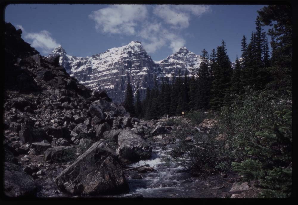
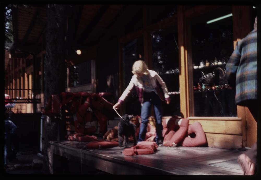
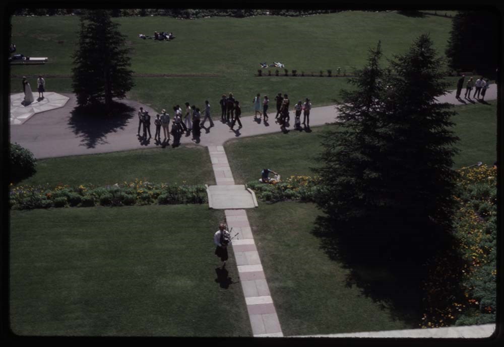
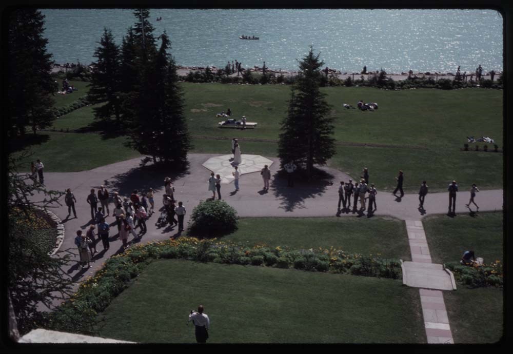
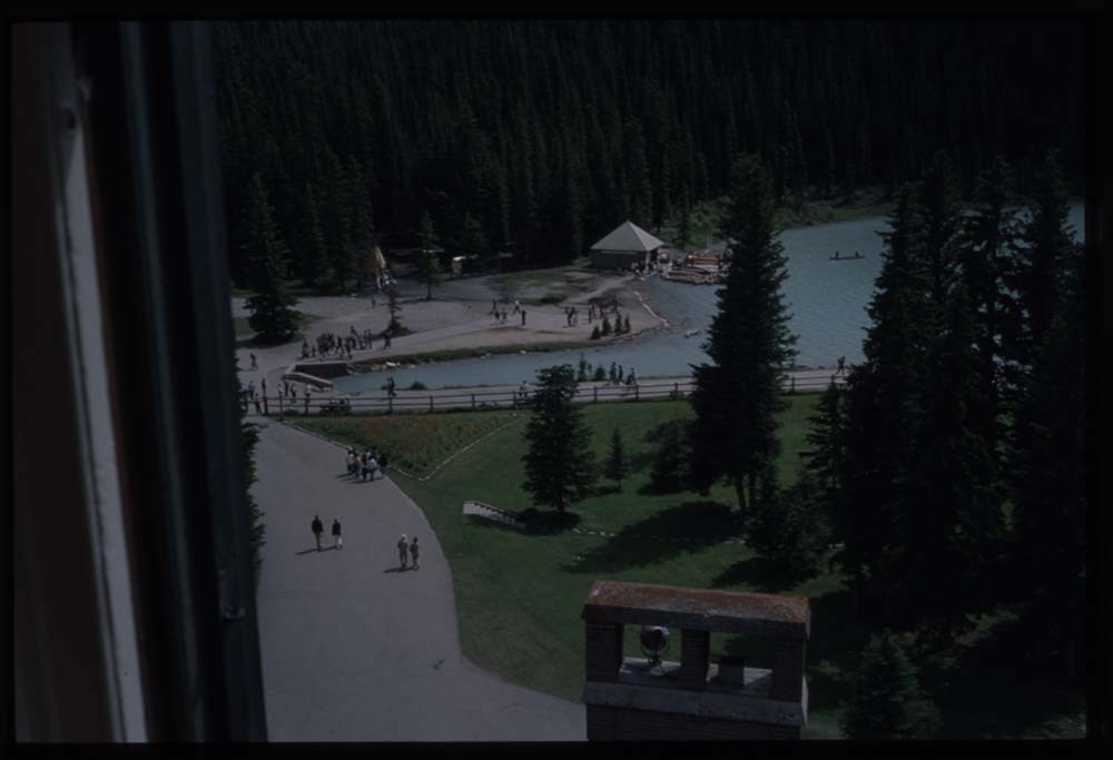
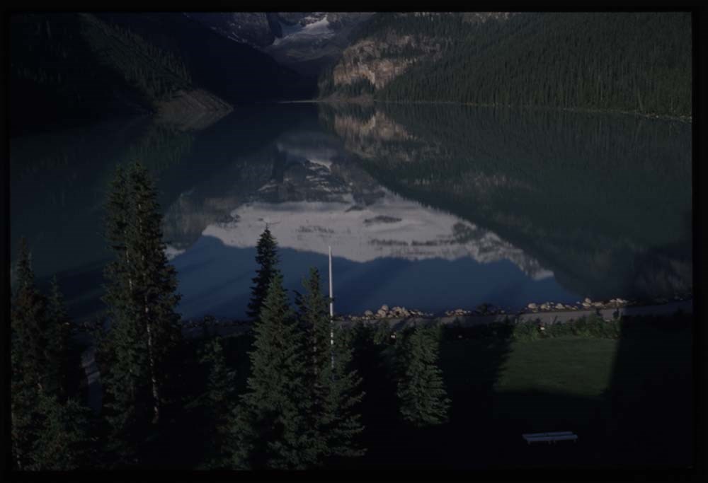
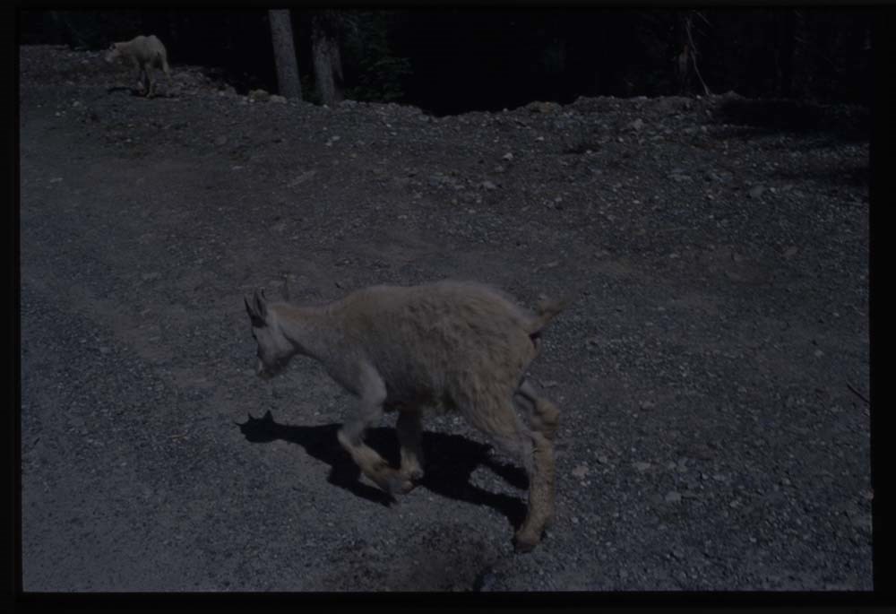
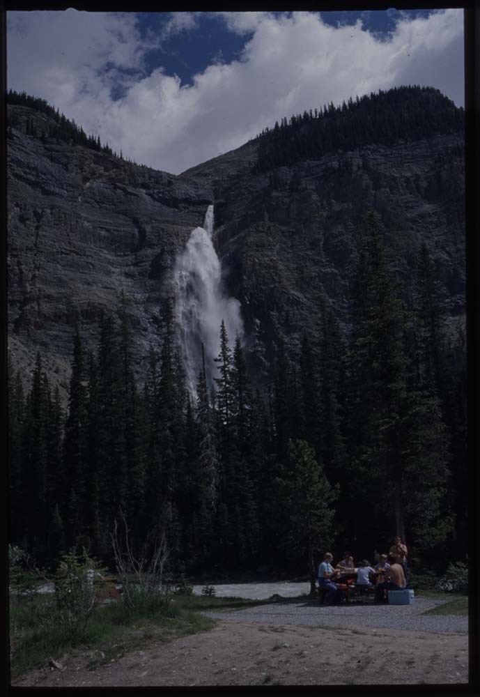
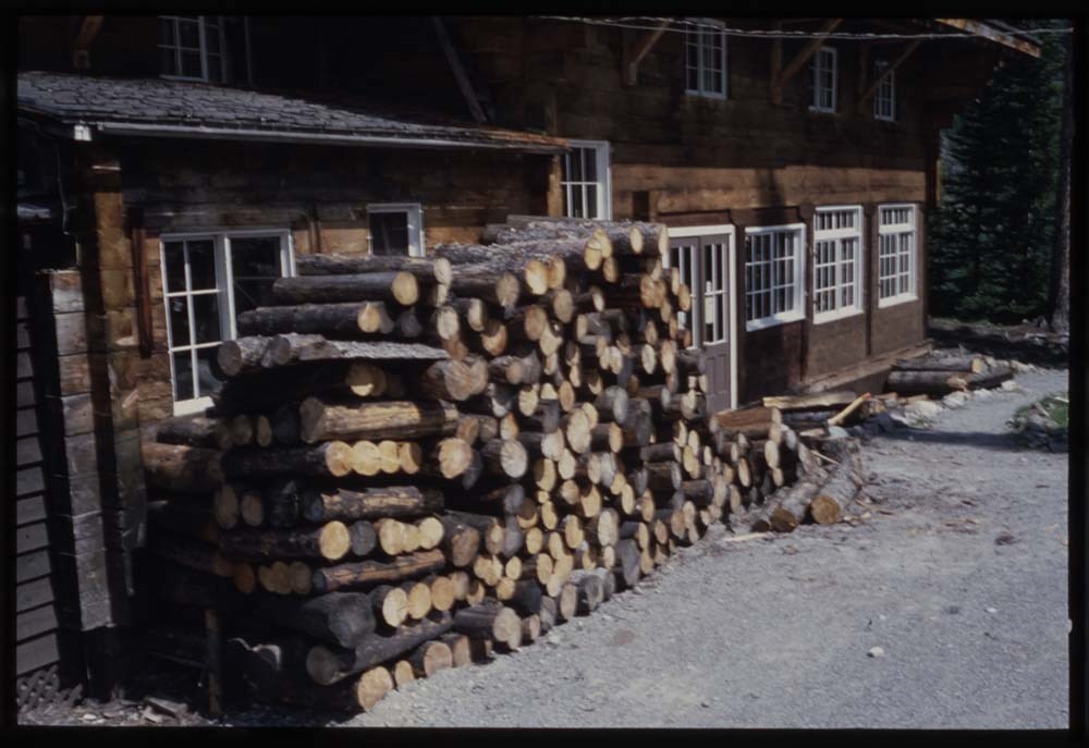
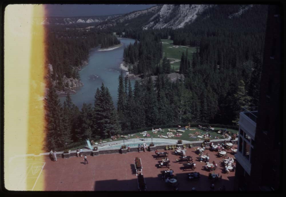
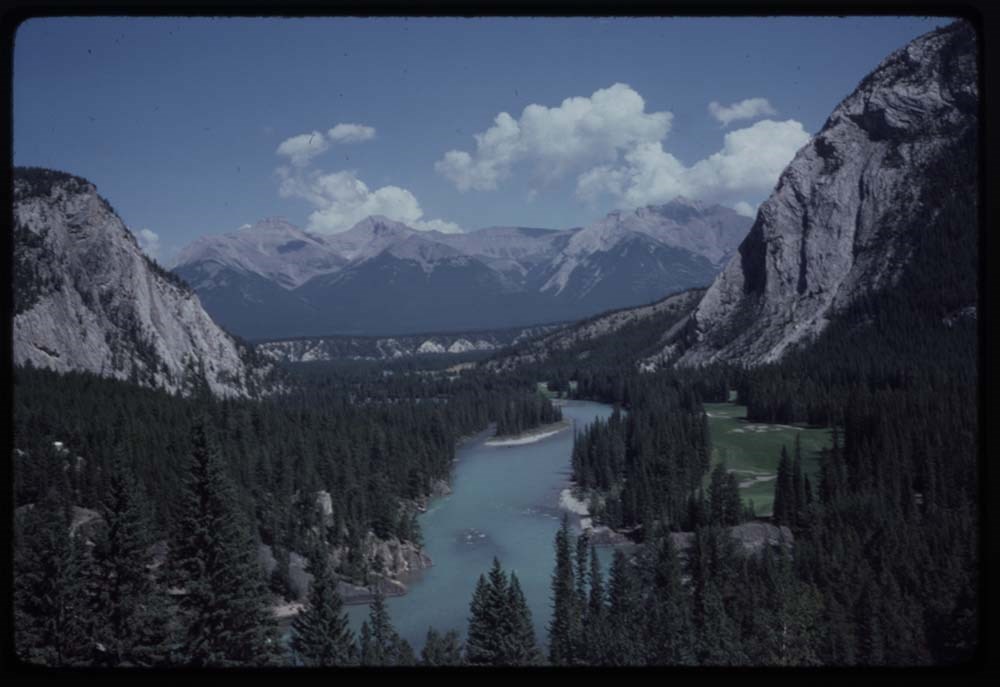
- File pertains to 79 slides assembled by Lillian Gest in 1981 into a show from slides depicting various summer to the Canadian Rockies throughout the late 1950s to 1970s with emphasis on the Lake O'Hara area of Yoho National Park. Topics include mountains and mountain views, wildflowers, wildlife, various camps [mostly Alpine Club of Canada and Trail Riders of the Canadian Rockies], Lillian and her friends, lakes, boats, fishing, hiking, and various other scenic views around Banff, Lake Louise, and Lake O'Hara. Titles: 1. 10 Peaks Moraine Lake K38-3 2. Quadra & Borgeau K38-4 3. Peaks Moraine Lake K38-5 4. Boat landing & peaks K38-6 5. [Boat landing & peaks] K38-7 6. Dead logs in stream K38-8 7. Stream below lake K38-9 8. Boulders stream & peaks K38-10 9. Life preservers – red K38-11 10. Fr. my Chateau window K38-12 11. Fr. Chateau window K38-13 12. Same K38-14 13. Lake & Mt. Vic K38-15 14. From Chateau K38-16 15. Fr. window towards staff house K38-17 16. Towards swim pool K38-18 17. View fr. my window Chateau K39-2 18. Towards Boathouse K39-3 19. View from my window K39-4 20. [View from my window] K39-5 21. [View from my window] K39-6 22. [View from my window] K39-7 23. [View from my window] K39-8 24. [View from my window] K39-9 25. [View from my window] K39-10 26. Toward boathouse K39-11 27. View from hall window – boathouse K39-12 28. AM reflections K39-13 29. Reflections AM K39-14 30. AM fr. window K39-15 31. Baby goat & mother good K39-16 32. Baby goat good K39-17 33. Ewe & baby goat w. car K39-18 34. Mama goat walks away K39-19 35. Takkakaw K39-20 36. [Takkakaw] K39-21 37. Towards swim pool K40-1 38. Towards boathouse K40-2 39. Towards Cath Mt. clouds & autoes K40-3 40. Reflections early AM K40-4 41. [Reflections early AM] K40-5 42. Outlet & stream & mt. White K40-6 43. Boathouse AND People K40-7 44. Lake shore towards staff house nearer K40-8 45. Lake shore towards staff house further K40-9 46. Hotel flower beds & people K40-10 47. Tim’s house nearer shadow on roof K40-11 48. Tim’s house further shadows on roof K40-12 49. Door to Tim’s house K40-13 50. O’Hara & Mt Cath K40-14 51. Stream O’Hara & Mt Cath K40-15 52. Little Odaray & 2 workers on trail K40-16 53. Reflections of Mt Odaray K40-17 54. Log over stream Cataract K40-18 55. From trail to Bridge K40-19 56. Mt & clouds K40-20 57. The wood pile K40-21 58. View from Banff Springs & porch K41-1 59. Same view fr. BSH & porch K41-2 60. View from BSH golf course & river K41-3 61. Dunwoody Home K41-4 62. [Dunwoody Home] flower bed in front K41-5 63. Big snow storm K41-6 64. [Big snow storm] K41-7 65. [Big snow storm] K41-8 66. [Big snow storm] K41-9 67. [Big snow storm] K41-10 68. [Big snow storm] K41-11 69. [Big snow storm] K41-12 70. [Big snow storm] K41-13 71. [Big snow storm] K41-14 72. [Big snow storm] K41-15 73. [Big snow storm] K41-16 74. [Big snow storm] K41-17 75. [Big snow storm] K41-18 76. [Big snow storm] K41-19 77. [Big snow storm] K41-20 78. [Big snow storm] K41-21 79. [Big snow storm] K41-22
- Notes
- This material is presented as originally created, it contains outdated cultural descriptions and potentially offensive content. Materials in historical collections reflect the attitudes, ideas, and norms of the era and culture in which they were created or collected. Offensive or harmful terms are retained for historical accuracy or to document the issues and social context of a specific time and the attitudes and opinions of the people who created the material. Please note: Behavior towards wildlife, primarily human proximity and feeding, is outdated and no longer tolerated throughout all National Parks - do not feed or approach wildlife. Slides originally in Kodak Carousel 80 slide tray. One slide is missing.
- Name Access
- Gest, Lillian
- Subject Access
- Activities
- Alpine Club of Canada
- Animals
- Avalanches
- Backpacking
- Banff
- Banff Indian Days
- Banff Springs Hotel
- Birds
- Boats
- Cabins and shelters
- Camps
- Camping
- Canoes and canoeing
- Chateau Lake Louise
- Climbing
- Club
- Elk
- Entertainment
- Environment
- Environment and Nature
- Flowers
- Geography
- Glaciers
- Guides
- Guiding
- Hiking
- Holidays
- Horses
- Horseback riding
- Horse packing
- Huts
- Lake O'Hara region
- Landscapes
- Leisure
- Mountain
- Mountain Goat
- Mountaineering
- Mountains
- National parks and reserves
- Outfitters, trail guides and packers
- Pack trains
- Pack trips
- Personal and Family Life
- Photography
- Portrait
- Recreation
- Scenery
- Snow
- Storm
- Tavel
- Trails
- Trains
- Travel
- Wildlife
- Winter
- Women
- Geographic Access
- Banff
- Lake Louise
- Moraine Lake
- Banff National Park
- Lake O'Hara
- Yoho National Park
- British Columbia
- Alberta
- Canada
- Language
- English
- Conservation
- Slides rehoused into protective sleeves and acid-free folders after scanning.
- Creator
- Gest, Lillian
- Title Source
- Title based on contents of file
- Processing Status
- Processed
Electronic Resources
Images


This material is presented as originally created; it may contain outdated cultural descriptions and
potentially offensive content.
Read more.
Ski Trails in the Canadian Rockies - textual
https://archives.whyte.org/en/permalink/descriptions55078
- Part Of
- Chic Scott fonds
- Scope & Content
- Series consists of research documents, published materials and maps used during the creation of the book Ski Trails in the Canadian Rockies.
- Date Range
- 1999 - 2015
- Reference Code
- M57 / VI
- Description Level
- 3 / Series
- GMD
- Textual record
- Part Of
- Chic Scott fonds
- Description Level
- 3 / Series
- Fonds Number
- M57 / V40 / S47
- Series
- M57 / VI: Ski Trails in the Canadian Rockies
- Sous-Fonds
- M57
- Sub-Series
- M57 / VI / A: Research Files
- M57 / VI / B: Collected publications
- M57 / VI / C: Maps
- Accession Number
- .
- Reference Code
- M57 / VI
- GMD
- Textual record
- Date Range
- 1999 - 2015
- Physical Description
- 18 cm of textual records
- History / Biographical
- The classic guidebook to cross country ski trails in Waterton, Banff, Kootenay, Yoho and Jasper National Parks as well as Mount Assiniboine and Mount Robson Provincial Parks and Kananaskis Country, now greatly expanded to includes ski trails in the front ranges of the Rockies, in the Crowsnest Pass and in the Columbia Valley. Jointly authored with Darren Farley. This book also covers topics such as accommodation, regulations, weather and snow conditions.
- Scope & Content
- Series consists of research documents, published materials and maps used during the creation of the book Ski Trails in the Canadian Rockies.
- Notes
- Series consists of three sub-series: M57 / VI / A: Research Files
- M57 / VI / B: Collected publications
- M57 / VI / C: Maps
- Name Access
- Scott, Chic
- Subject Access
- Activities
- Environment
- Exploration
- Geography
- Guide
- Map
- Mountaineering
- Mountains
- National parks and reserves
- Publication
- Recreation
- Ski areas
- Ski Maps
- Ski mountaineering
- Ski lodges and cabins
- Skiing
- Sports and recreation
- Sports
- Tourism
- Tourist information
- Trail guides
- Trails
- Travel
- Winter sports
- Geographic Access
- Canada
- Alberta
- British Columbia
- Canadian Rocky Mountains
- Banff National Park
- Yoho National Park
- Jasper National Park
- Waterton
- Kootenay National Park
- Rogers Pass
- Columbia Valley
- Crowsnest Pass
- Language
- English
- Related Material
- S47 / VI
- V40 / VI
- Title Source
- Title based on contents of file
- Processing Status
- Processed
This material is presented as originally created; it may contain outdated cultural descriptions and
potentially offensive content.
Read more.
Ski Trails of the Canadian Rockies - visual
https://archives.whyte.org/en/permalink/descriptions55079
- Part Of
- Chic Scott fonds
- Scope & Content
- Series consists of 3 CD's with photo scans pertaining to the creation of Ski Trails of the Canadian Rockies.
- Date Range
- 1999 - 2015
- Reference Code
- V40 / VI
- Description Level
- 3 / Series
- GMD
- Digital image
- Photograph
- Part Of
- Chic Scott fonds
- Description Level
- 3 / Series
- Fonds Number
- M57 / V40 / S47
- Series
- V40 / VI : Ski Trails of the Canadian Rockies
- Sous-Fonds
- V40
- Accession Number
- .
- Reference Code
- V40 / VI
- Date Range
- 1999 - 2015
- Physical Description
- Digital photo scans on 3 discs
- History / Biographical
- The classic guidebook to cross country ski trails in Waterton, Banff, Kootenay, Yoho and Jasper National Parks as well as Mount Assiniboine and Mount Robson Provincial Parks and Kananaskis Country, now greatly expanded to includes ski trails in the front ranges of the Rockies, in the Crowsnest Pass and in the Columbia Valley. Jointly authored with Darren Farley. This book also covers topics such as accommodation, regulations, weather and snow conditions.
- Scope & Content
- Series consists of 3 CD's with photo scans pertaining to the creation of Ski Trails of the Canadian Rockies.
- Name Access
- Scott, Chic
- Subject Access
- Activities
- Environment
- Exploration
- Geography
- Guide
- Map
- Mountaineering
- Mountains
- National parks and reserves
- Publication
- Recreation
- Ski areas
- Ski Maps
- Ski mountaineering
- Ski lodges and cabins
- Skiing
- Sports and recreation
- Sports
- Tourism
- Tourist information
- Trail guides
- Trails
- Travel
- Winter sports
- Geographic Access
- Canada
- Alberta
- British Columbia
- Canadian Rocky Mountains
- Banff National Park
- Yoho National Park
- Jasper National Park
- Waterton
- Kootenay National Park
- Mount Robson
- Columbia Valley
- Crowsnest Pass
- Access Restrictions
- Reference only
- Reproduction Restrictions
- Restricted: copyright remains with owner
- Language
- English
- Related Material
- M57 / VI
- S47 / VI
- Biographical Source Notes
- http://chicscott.com/books.htm
- Title Source
- Title based on contents of file
- Processing Status
- Processed
This material is presented as originally created; it may contain outdated cultural descriptions and
potentially offensive content.
Read more.
Stanley Mitchell Hut Registers
https://archives.whyte.org/en/permalink/descriptions57644
- Part Of
- Alpine Club of Canada fonds
- Scope & Content
- Sub-series of hut registers from the Stanley Mitchell Hut produced by the Alpine Club of Canada between 1985 and 2019. Registers include entries from visitors to the huts which pertain to individuals' hiking and climbing trips; details of specific events which occurred while staying at the hut, wil…
- Date Range
- 1985-2019
- Reference Code
- M200 / IV / G
- Description Level
- 4 / Sub-series
- GMD
- Textual record
- Organization record
- Part Of
- Alpine Club of Canada fonds
- Description Level
- 4 / Sub-series
- Fonds Number
- M200
- V14
- S6
- Series
- M200 / IV: Hut Registers
- Sous-Fonds
- M200
- Sub-Series
- M200 / IV / G: Stanley Mitchell Hut Registers
- Accession Number
- accn. 5631
- accn. 6465
- accn. 6470
- accn. 6766
- accn. 2023.10
- accn. 7779
- accn. 2014.8347
- accn. 8002
- accn. 2023.20
- accn. 2023.15
- accn. 2020.05
- Reference Code
- M200 / IV / G
- Responsibility
- Registers produced by the Alpine Club of Canada
- Date Range
- 1985-2019
- Physical Description
- 18 volumes, 38 cm
- History / Biographical
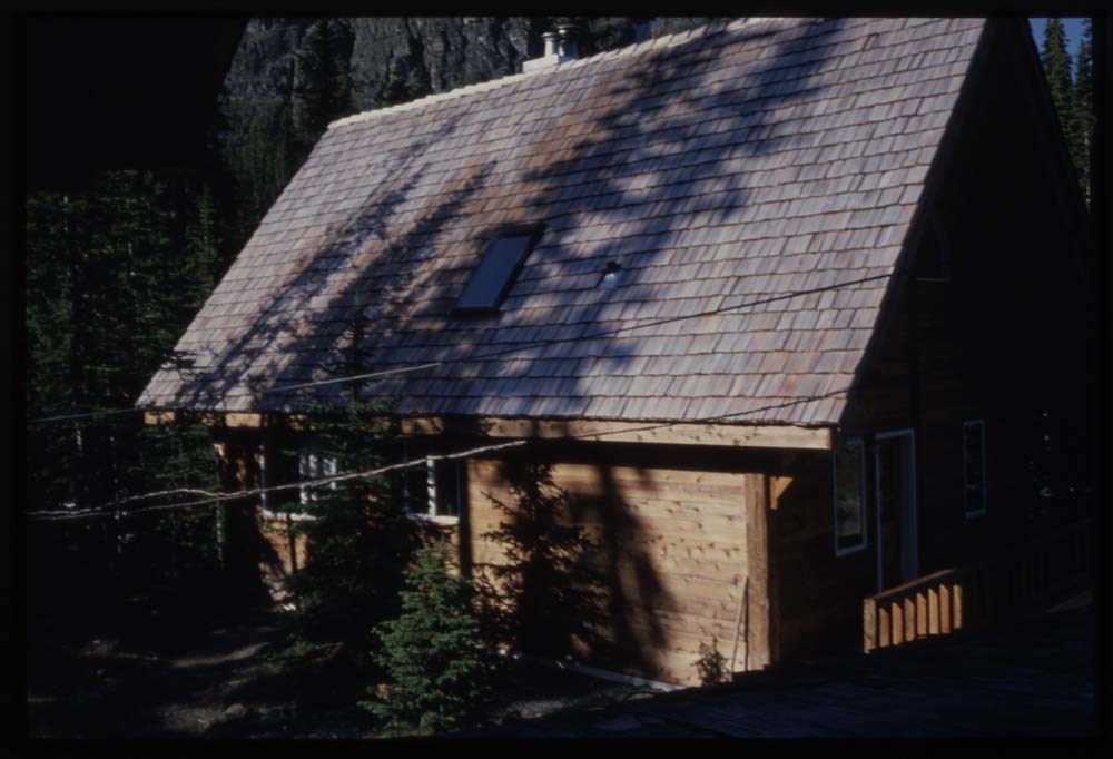
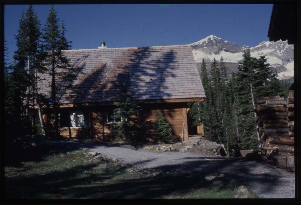
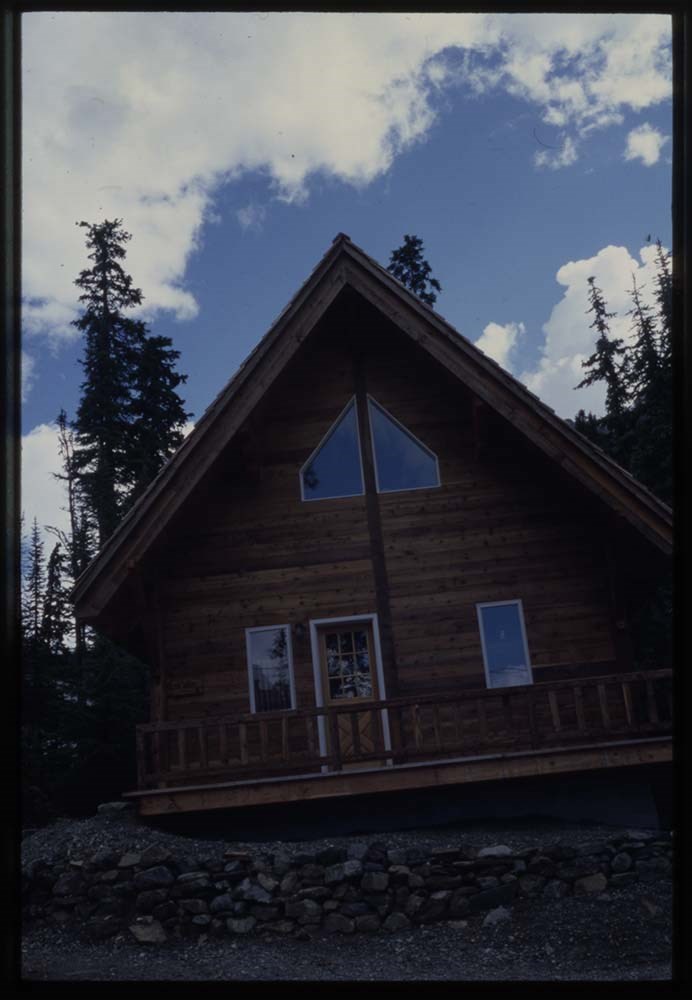
- The Stanley Mitchell Hut was constructed in 1939 and it is recognized as a Federal Heritage Building. According to the Parks Canada Directory of Federal Heritage Designations: "The Stanley Mitchell Alpine Hut is a rustic log cabin located at the edge of a forest, and enjoys scenic views across a meadow to a glacier and mountains. It is comprised of a centre section flanked by two, modest wings and features a steeply pitched gable roof. Located in the centre, the main entrance is covered by a porch gable. The designation is confined to the footprint of the building. Heritage Value The Stanley Mitchell Alpine Hut is a Recognized Federal Heritage Building because of its historical associations, and its architectural and environmental value. Historical Value The Stanley Mitchell Alpine Hut, built by the Alpine Club of Canada for the use of its members, is associated with the development of mountaineering in Canada. It is also associated with the opening up of Yoho National Park of Canada to ski mountaineering and winter recreation. Architectural Value The Stanley Mitchell Alpine Hut is a good example of rustic architecture. Its natural building materials and construction methods reflect the rustic aesthetic. It is also a very good example of functional design, to serve as a base facility for summer camp programs and winter ski touring. The Environmental Value The Stanley Mitchell Alpine Hut maintains an unchanged historical relationship with the natural character of its site at Yoho National Park of Canada. Located in an alpine meadow at the edge of a coniferous forest, it is compatible with its picturesque setting and well known by the hiking and climbing community. Character-Defining Elements The following character-defining elements of the Stanley Mitchell Alpine Hut should be respected. The rustic aesthetic, for example: the simplicity of the overall form of the building as expressed by the scale, massing and symmetrical composition of the main block, entrance porch and side wings, all sheltered by steeply pitched gable roofs; the choice of local materials, indigenous building methods and rustic design details such as the horizontally laid, peeled round logs with saddle-notched corners, the exposed rafters at the roof eaves, the random rubble masonry fireplace and chimney, the exposed beams and joists, the hardwood floor, and the inscription carved into the face of the wood mantelpiece. The unchanged historical relationship of the Stanley Mitchell Alpine Hut to its alpine meadow site, and the manner in which it is compatible to its picturesque setting which is familiar to the hiking and climbing community of Yoho National Park, as evidenced by: the building’s unchanged relationship with its natural site; the overall rustic appearance and natural building materials of the building, which harmonize with its natural environment; the building’s visible location in a meadow at the edge of a forest."
- Scope & Content
- Sub-series of hut registers from the Stanley Mitchell Hut produced by the Alpine Club of Canada between 1985 and 2019. Registers include entries from visitors to the huts which pertain to individuals' hiking and climbing trips; details of specific events which occurred while staying at the hut, wildlife sightings, custodial issues and updates, and related topics. The sub-series is separated into individual hut registers, arranged by date:
- M200 / IV / G / 1: [Stanley Mitchell Hut register 1985 - 1987]
- M200 / IV / G / 2: Stanley Mitchell Hut [1987 - 1989]
- M200 / IV / G / 3: Stanley Mitchell Hut Register [1990-92]
- M200 / IV / G / 4: [Stanley Mitchell Hut Register 1992 -1994]
- M200 / IV / G / 5: "Stanley Mitchell Hut Register" July 4, 1994 - Sept. 29, 1995
- M200 / IV / G / 6: Stanley Mitchell Hut Register Oct. 7, 1995 - Aug. 30, 1997
- M200 / IV / G / 7: "The Alpine Club of Canada Stanley Mitchel [Mitchell] Hut Register" Sept 17, 1997 - January 31, 1999
- M200 / IV / G / 8: Stanley Mitchell [1999 - 2000]
- M200 / IV / G / 9: Stanley Mitchell Hut [2000-2001]
- M200 / IV / G / 10: Stanley Mitchell Aug 31/01 - Sep 5/02
- M200 / IV / G / 11: Stanley Mitchell Sep 6/02 - Jul 1/04
- M200 / IV / G / 12: Stanley Mitchell July 14, 2004 - Apr 17, 2006
- M200 / IV / G / 13: Stanley Mitchell Hut Register 2005 - 2007
- M200 / IV / G / 14: Stanley Mitchell Hut Register 2007 - 2009
- M200 / IV / G / 15: Stanley Mitchell Hut Register, 2010-2013
- M200 / IV / G / 16: Stanley Mitchell Hut Registry [2013 - 2015]
- M200 / IV / G / 17: Stanley Mitchell Hut Register 2015 - 2018
- M200 / IV / G / 18: [Stanley Mitchell Hut Register 2017 - 2019]
- Name Access
- Alpine Club of Canada
- Subject Access
- Alpine Club of Canada
- Backcountry skiing
- Buildings and facilities
- Cabins
- Cabins and shelters
- Environment and Nature
- Log structures
- Mountaineering
- Mountains
- Parks Canada
- Sports and leisure
- Sports and recreation
- Winter sports
- Geographic Access
- Canada
- British Columbia
- Yoho National Park
- Little Yoho Valley
- Access Restrictions
- Restrictions may apply
- Language
- English
- French
- German
- Spanish
- Japanese
- Dutch
- Biographical Source Notes
- Kate MacFarlane, Stanley Mitchell Alpine Hut, Little Yoho Valley, Yoho National Park, British Columbia, Federal Heritage Building Review Office Building Report, 98-074; Stanley Mitchell Alpine Hut, Little Yoho Valley, Yoho National Park of Canada, British Columbia, Heritage Character Statement, 98-074. Parks Canada Directory of Federal Heritage Designations website: https://www.pc.gc.ca/apps/dfhd/page_fhbro_eng.aspx?id=8809 Alpine Club of Canada website: https://www.alpineclubofcanada.ca/stanley-mitchell-hut/
- Title Source
- Title based on contents of sub-series
- Processing Status
- Processed
This material is presented as originally created; it may contain outdated cultural descriptions and
potentially offensive content.
Read more.