Narrow Results By
- Peter Whyte (1905 – 1966, Canadian) 53
- Peter or Catharine Whyte 19
- Catharine Robb Whyte, O. C. (1906 – 1979, Canadian) 12
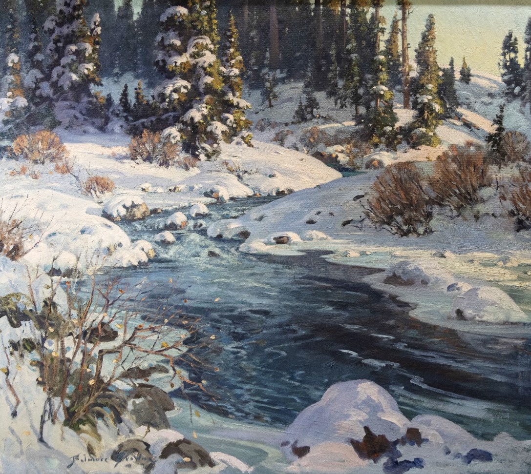
- Belmore Browne (1880 – 1954, American) 5
- Carl Clemens Moritz Rungius (1869 – 1959, American) 5
- James Edward Hervey MacDonald, R. C. A. (1873 – 1932, Canadian) 3
- Aldro T. Hibbard (1886 – 1972, American) 2
- Duncan Darroch (1888 – 1967, New Zealander) 2
- Frederick Andrew Bosley (1881 – 1942, American) 2
- George Douglas Pepper (1903 – 1962, Canadian) 2
- Harry Aiken Vincent (1864 – 1931, American) 2
- James Henderson (1871 – 1951, Canadian) 2
- Medium
- Library - Maps and blueprints (unannotated; published)
- Map
- Published Date
- 1922
- Publisher
- National Geographic Society
- Call Number
- C13-7.1
- Publisher
- National Geographic Society
- Published Date
- 1922
- Scale
- 1" = 185 miles
- Subjects
- Africa
- Notes
- there is a duplicate
- Accession Number
- 400
- 576
- Call Number
- C13-7.1
- Collection
- Archives Library
This material is presented as originally created; it may contain outdated cultural descriptions and
potentially offensive content.
Read more.
- Medium
- Library - Maps and blueprints (unannotated; published)
- Map
- Published Date
- 1927
- Publisher
- Dept. of the Interior, Ottawa
- Call Number
- C9-1.2
- Publisher
- Dept. of the Interior, Ottawa
- Published Date
- 1927
- Physical Description
- 1 map: col
- Scale
- Scale: 12 1/2 miles: 1 inch
- Subjects
- Alberta
- Accession Number
- 400
- Call Number
- C9-1.2
- Collection
- Archives Library
This material is presented as originally created; it may contain outdated cultural descriptions and
potentially offensive content.
Read more.
Alexander River
https://archives.whyte.org/en/permalink/artifactwyp.01.150
- Date
- 1929
- Medium
- oil on canvas
- Catalogue Number
- WyP.01.150
- Description
- Colour: green, purple. Across the bottom and angling up left is grass with trees, three at left and two at right, along the river's edge. The green river comes in from the right side, goes left and then up right side to disappear into the far shore of dark trees. The right shore juts in from that s…
1 image
- Title
- Alexander River
- Date
- 1929
- Medium
- oil on canvas
- Dimensions
- 30.5 x 28 cm
- Description
- Colour: green, purple. Across the bottom and angling up left is grass with trees, three at left and two at right, along the river's edge. The green river comes in from the right side, goes left and then up right side to disappear into the far shore of dark trees. The right shore juts in from that side, halfway up. In the background across the top are purple mountains. Five peaks meet a green grey sky.
- Subject
- landscape
- Canadian Rockies
- river
- Credit
- Gift of Catharine Robb Whyte, O. C., Banff, 1975
- Catalogue Number
- WyP.01.150
Images

This material is presented as originally created; it may contain outdated cultural descriptions and
potentially offensive content.
Read more.
An Outline Map of the Canadian Pacific Railway and Connecting Lines
https://archives.whyte.org/en/permalink/catalogue21429
- Medium
- Library - Maps and blueprints (unannotated; published)
- Map
- Published Date
- Checked to March 1925
- Call Number
- C11-3.2
- Published Date
- Checked to March 1925
- Subjects
- Canada
- Railway routes
- Notes
- World Cruises described on the reverse side of the map
- Accession Number
- 400
- Call Number
- C11-3.2
- Collection
- Archives Library
This material is presented as originally created; it may contain outdated cultural descriptions and
potentially offensive content.
Read more.
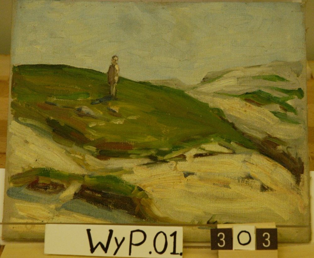
Annisqualm, Mass.
https://archives.whyte.org/en/permalink/artifactwyp.01.303
- Date
- 1929
- Medium
- oil on canvas
- Catalogue Number
- WyP.01.303
1 image
- Title
- Annisqualm, Mass.
- Date
- 1929
- Medium
- oil on canvas
- Dimensions
- 22.9 x 27.7 cm
- Subject
- landscape
- New England
- hills
- figure
- Credit
- Gift of Catharine Robb Whyte, O. C., Banff, 1979
- Catalogue Number
- WyP.01.303
Images
This material is presented as originally created; it may contain outdated cultural descriptions and
potentially offensive content.
Read more.
[Arctic Regions] Map showing position of North Pole, Siberia, Greenland, Europe, North America etc. Ellesmere Island Region, Spitsbergen and Franz Josef Land
https://archives.whyte.org/en/permalink/catalogue24379
- Medium
- Library - Maps and blueprints (unannotated; published)
- Map
- Published Date
- 1925
- Publisher
- National Geographic Society
- Call Number
- C8-5.1
- Publisher
- National Geographic Society
- Published Date
- 1925
- Scale
- Scale: 231.6 miles to 1 inch
- Subjects
- Arctic Regions
- Accession Number
- 400
- Call Number
- C8-5.1
- Collection
- Archives Library
This material is presented as originally created; it may contain outdated cultural descriptions and
potentially offensive content.
Read more.
At the Base of Cory Mountain
https://archives.whyte.org/en/permalink/artifactwyp.01.377
- Date
- 1927 – 1928
- Medium
- oil on canvas
- Catalogue Number
- WyP.01.377
1 image
- Title
- At the Base of Cory Mountain
- Date
- 1927 – 1928
- Medium
- oil on canvas
- Dimensions
- 22.0 x 27.5 cm
- Subject
- landscape
- Canadian Rockies
- mountain
- Credit
- Gift of Catharine Robb Whyte, O. C., Banff, 1979
- Catalogue Number
- WyP.01.377
Images

This material is presented as originally created; it may contain outdated cultural descriptions and
potentially offensive content.
Read more.
Athabaska Forest
https://archives.whyte.org/en/permalink/catalogue23248
- Medium
- Library - Maps and blueprints (unannotated; published)
- Map
- Published Date
- 1920 (signed Dec. 1919. Calgary/R.D.M)
- Publisher
- 1920 Forestry Branch
- Call Number
- C2-11.8
- Responsibility
- R.H. Campbell
- Publisher
- 1920 Forestry Branch
- Published Date
- 1920 (signed Dec. 1919. Calgary/R.D.M)
- Scale
- Scale: 3 miles to an inch
- Subjects
- Rocky Mountains Forest Reserve
- Notes
- Prepared under direction of R.H. Campbell Director of Forestry
- Call Number
- C2-11.8
- Collection
- Archives Library
This material is presented as originally created; it may contain outdated cultural descriptions and
potentially offensive content.
Read more.
- Date
- c. 1930
- Medium
- oil on canvas
- Catalogue Number
- BwB.02.01
- Description
- General colour: blue, purple, green. Creek is surrounded on all sides by snow covered rocks and shrubs. The water comes down from the upper right of center to the lower center and of right near the bottom. In the lower left corner is a bare branched bush. Across the top is snow covered evergreens. …
1 image
- Title
- Baker Creek
- Date
- c. 1930
- Medium
- oil on canvas
- Dimensions
- 90.2 x 100.2 cm
- Description
- General colour: blue, purple, green. Creek is surrounded on all sides by snow covered rocks and shrubs. The water comes down from the upper right of center to the lower center and of right near the bottom. In the lower left corner is a bare branched bush. Across the top is snow covered evergreens. Clear sky and a distant hill in the upper right corner.
- Subject
- landscape
- Canadian Rockies
- winter
- Baker Creek
- Credit
- Gift of Evelyn Browne, Durham, USA, 1968
- Catalogue Number
- BwB.02.01
Images
This material is presented as originally created; it may contain outdated cultural descriptions and
potentially offensive content.
Read more.
- Medium
- Library - Maps and blueprints (unannotated; published)
- Map
- Published Date
- 1925
- Revision of map November, 1915
- Publisher
- Ottawa : Topographical Survey of Canada
- Call Number
- C3-1.2a
- Publisher
- Ottawa : Topographical Survey of Canada
- Published Date
- 1925
- Revision of map November, 1915
- Physical Description
- 1 map : col
- Scale
- 1:190,080
- Subjects
- Banff region
- Call Number
- C3-1.2a
- Collection
- Archives Library
This material is presented as originally created; it may contain outdated cultural descriptions and
potentially offensive content.
Read more.