Narrow Results By
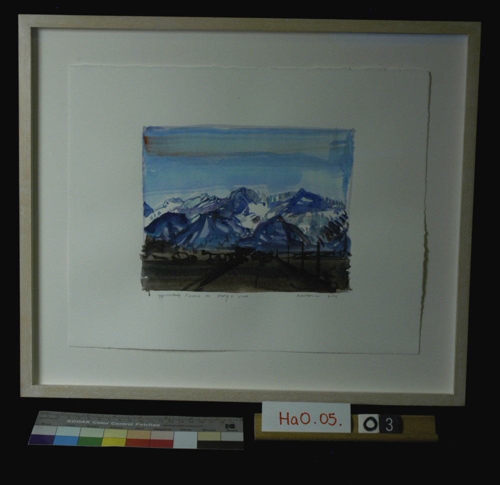
Approaching Fernie on Hwy 3 West
https://archives.whyte.org/en/permalink/artifacthao.05.03
- Date
- 2011
- Medium
- watercolour on paper
- Catalogue Number
- HaO.05.03
- Description
- Watercolour of mountains on Highway 3 West entering Fernie.
1 image
- Title
- Approaching Fernie on Hwy 3 West
- Date
- 2011
- Medium
- watercolour on paper
- Dimensions
- 28 x 35.5 cm
- Description
- Watercolour of mountains on Highway 3 West entering Fernie.
- Credit
- Gift of John Hartman, Tiny, 2014
- Catalogue Number
- HaO.05.03
Images
This material is presented as originally created; it may contain outdated cultural descriptions and
potentially offensive content.
Read more.
The bank that went bust
https://archives.whyte.org/en/permalink/catalogue12581
- Author
- Turley-Ewart, John
- Physical Description
- p.36-41 : ill
- Medium
- Library - Periodical
- Subjects
- Fernie
- Notes
- In Beaver, vol. 84, no. 4 (Aug/Sep 2004)
- Call Number
- P
- Collection
- Archives Library
This material is presented as originally created; it may contain outdated cultural descriptions and
potentially offensive content.
Read more.
Canada Land Inventory, Land capability for wildlife : ungulates : Fernie 82G
https://archives.whyte.org/en/permalink/catalogue24230
- Medium
- Library - Maps and blueprints (unannotated; published)
- Map
- Published Date
- 1973
- Publisher
- Ottawa : Environment Canada : Information Canada
- Call Number
- LICA 82G
- Publisher
- Ottawa : Environment Canada : Information Canada
- Published Date
- 1973
- Physical Description
- 1 map : col
- Scale
- Scale: 1:250,000
- Notes
- Cat. no. En64/4u-82G
- Accession Number
- 7,000
- Call Number
- LICA 82G
- Collection
- Archives Library
This material is presented as originally created; it may contain outdated cultural descriptions and
potentially offensive content.
Read more.
Canada Land Inventory map
https://archives.whyte.org/en/permalink/catalogue24047
- Medium
- Library - Maps and blueprints (unannotated; published)
- Map
- Published Date
- 1971
- Publisher
- Dept. of Energy, Mines and Resources
- Call Number
- NTS
- 82G
- Publisher
- Dept. of Energy, Mines and Resources
- Published Date
- 1971
- Physical Description
- Colour
- Scale
- 1:250,000
- Subjects
- Fernie, British Columbia/Alta
- Notes
- Land Capability for recreatioin
- Accession Number
- 4000
- Call Number
- NTS
- 82G
- Collection
- Archives Library
This material is presented as originally created; it may contain outdated cultural descriptions and
potentially offensive content.
Read more.
Canada Land Inventory Map
https://archives.whyte.org/en/permalink/catalogue24048
- Medium
- Library - Maps and blueprints (unannotated; published)
- Map
- Published Date
- 1971
- Publisher
- Dept. of Energy, Mines & Resources
- Call Number
- NTS
- 82G
- Publisher
- Dept. of Energy, Mines & Resources
- Published Date
- 1971
- Physical Description
- Colour
- Scale
- 1:250,000
- Subjects
- Fernie, Alberta
- Notes
- Land capability for forestry
- Accession Number
- 4000
- Call Number
- NTS
- 82G
- Collection
- Archives Library
This material is presented as originally created; it may contain outdated cultural descriptions and
potentially offensive content.
Read more.
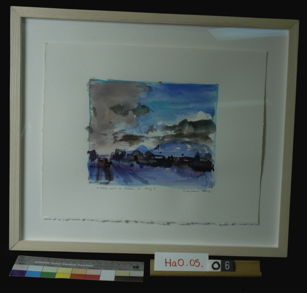
Driving East to Fernie on Hwy 3
https://archives.whyte.org/en/permalink/artifacthao.05.06
- Date
- 2012
- Medium
- watercolour on paper
- Catalogue Number
- HaO.05.06
- Description
- Watercolour of landscape driving to Fernie on Hwy 3.
1 image
- Title
- Driving East to Fernie on Hwy 3
- Date
- 2012
- Medium
- watercolour on paper
- Dimensions
- 28.5 x 35.5 cm
- Description
- Watercolour of landscape driving to Fernie on Hwy 3.
- Subject
- landscape, Fernie, Hwy 3
- Credit
- Gift of John Hartman, Tiny, 2014
- Catalogue Number
- HaO.05.06
Images
This material is presented as originally created; it may contain outdated cultural descriptions and
potentially offensive content.
Read more.
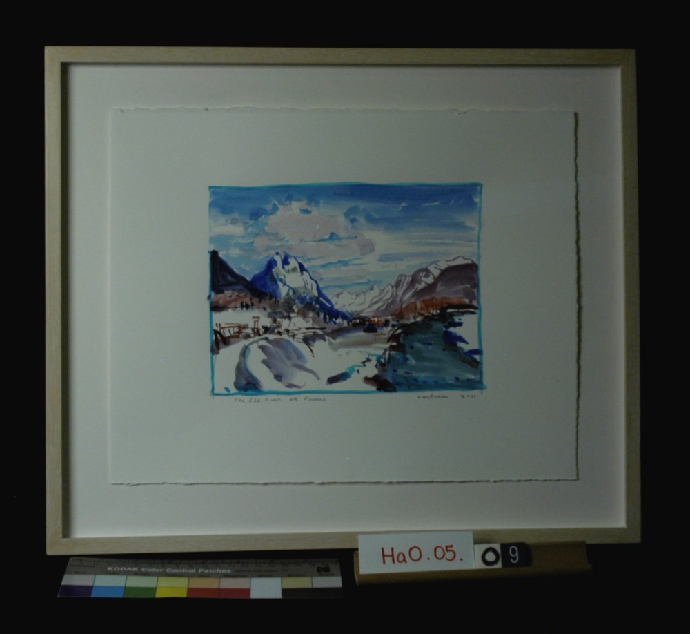
The Elk River at Fernie, B.C.
https://archives.whyte.org/en/permalink/artifacthao.05.09
- Date
- 2011
- Medium
- watercolour on paper
- Catalogue Number
- HaO.05.09
- Description
- Watercolour of Elk River at Fernie, B.C., river in bottom right corner, blue mountain at top left, mauve mountains in back right
1 image
- Title
- The Elk River at Fernie, B.C.
- Date
- 2011
- Medium
- watercolour on paper
- Dimensions
- 28.5 x 35.5 cm
- Description
- Watercolour of Elk River at Fernie, B.C., river in bottom right corner, blue mountain at top left, mauve mountains in back right
- Credit
- Gift of John Hartman, Tiny, 2014
- Catalogue Number
- HaO.05.09
Images
This material is presented as originally created; it may contain outdated cultural descriptions and
potentially offensive content.
Read more.
[Fernie 82 G B.C.-Alberta]
https://archives.whyte.org/en/permalink/catalogue24046
- Medium
- Library - Maps and blueprints (unannotated; published)
- Map
- Published Date
- 1963
- Publisher
- Dept. of Mines and Technical Surveys
- Call Number
- NTS
- 82G
- Publisher
- Dept. of Mines and Technical Surveys
- Published Date
- 1963
- Physical Description
- Colour
- Scale
- Scale: 1:250,000
- Relief: Contour Interval 500 ft.
- Subjects
- Fernie 82 G B.C.-Alberta
- Notes
- National Topographic System
- Accession Number
- 3000
- Call Number
- NTS
- 82G
- Collection
- Archives Library
This material is presented as originally created; it may contain outdated cultural descriptions and
potentially offensive content.
Read more.
[Fernie 82G/11 East, B.C.]
https://archives.whyte.org/en/permalink/catalogue23614
- Medium
- Library - Maps and blueprints (unannotated; published)
- Map
- Published Date
- 1959
- Publisher
- Dept. of Mines and Technical Surveys
- Call Number
- NTS
- 82G/11E
- Publisher
- Dept. of Mines and Technical Surveys
- Published Date
- 1959
- Physical Description
- 1 map : col
- Scale
- Scale: 1:50,000
- Relief: Contour interval 100'
- Subjects
- Fernie
- British Columbia
- Notes
- National Topographic System
- Call Number
- NTS
- 82G/11E
- Collection
- Archives Library
This material is presented as originally created; it may contain outdated cultural descriptions and
potentially offensive content.
Read more.
[Fernie 82G/11 West, B.C.]
https://archives.whyte.org/en/permalink/catalogue23615
- Medium
- Library - Maps and blueprints (unannotated; published)
- Map
- Published Date
- 1959
- Publisher
- Dept. of Mines and Technical Surveys
- Call Number
- NTS
- 82G/11W
- Publisher
- Dept. of Mines and Technical Surveys
- Published Date
- 1959
- Physical Description
- 1 map : col
- Scale
- Scale: 1:50,000
- Relief: Contour interval 100'
- Subjects
- Fernie
- British Columbia
- Notes
- National Topographic System
- Call Number
- NTS
- 82G/11W
- Collection
- Archives Library
This material is presented as originally created; it may contain outdated cultural descriptions and
potentially offensive content.
Read more.