Narrow Results By
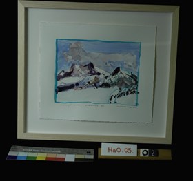
Highway 5 South, Valemount B.C.
https://archives.whyte.org/en/permalink/artifacthao.05.02
- Date
- 2005 – 2011
- Medium
- watercolour on paper
- Catalogue Number
- HaO.05.02
- Description
- Watercolour of Highway 5 South, Valemount B.C.
1 image
- Title
- Highway 5 South, Valemount B.C.
- Date
- 2005 – 2011
- Medium
- watercolour on paper
- Dimensions
- 24 x 28.5 cm
- Description
- Watercolour of Highway 5 South, Valemount B.C.
- Credit
- Gift of John Hartman, Tiny, 2014
- Catalogue Number
- HaO.05.02
Images
This material is presented as originally created; it may contain outdated cultural descriptions and
potentially offensive content.
Read more.
Treasure trails of Western Canada : a history of lost mines & buried or sunken treasure located in Western Canada
https://archives.whyte.org/en/permalink/catalogue7331
- Medium
- Library - Book (including soft-cover and pamphlets)
- Published Date
- 1972
- Author
- Lazeo, Lawrence A
- Publisher
- New Westminster : Western Heritage Supply
- Edition
- 1st ed
- Call Number
- 03.6 L45t Pam
- Author
- Lazeo, Lawrence A
- Edition
- 1st ed
- Publisher
- New Westminster : Western Heritage Supply
- Published Date
- 1972
- Physical Description
- 47p. : ill., ports
- Subjects
- Crime
- Gold
- Mining
- Valemount (B.C.)
- Accession Number
- 28500
- Call Number
- 03.6 L45t Pam
- Collection
- Archives Library
This material is presented as originally created; it may contain outdated cultural descriptions and
potentially offensive content.
Read more.
Valemount ... British Columbia
https://archives.whyte.org/en/permalink/catalogue24749
- Medium
- Library - Book (including soft-cover and pamphlets)
- Map
- Published Date
- 1990
- Author
- McDonough, M.R.
- Publisher
- Ottawa : Geological Survey of Canada
- Edition
- 3d ed.
- Call Number
- C7-3.20
- Author
- McDonough, M.R.
- Edition
- 3d ed.
- Publisher
- Ottawa : Geological Survey of Canada
- Published Date
- 1990
- Scale
- 1 map
- Notes
- 83D14
- Open file 2259
- Accession Number
- 23,000
- Call Number
- C7-3.20
- Collection
- Archives Library
This material is presented as originally created; it may contain outdated cultural descriptions and
potentially offensive content.
Read more.
[Valemount 83 D/14 East - B.C.]
https://archives.whyte.org/en/permalink/catalogue23934
- Medium
- Library - Maps and blueprints (unannotated; published)
- Map
- Published Date
- 1966
- Publisher
- Dept. of Mines and Technical Surveys
- Call Number
- NTS
- 83D/14E
- Publisher
- Dept. of Mines and Technical Surveys
- Published Date
- 1966
- Physical Description
- Colour
- Scale
- Scale: 1:50,000
- Relief: Contour Interval 100 ft.
- Subjects
- Valemount 83 D/14 East - B.C.
- Notes
- National Topographic System
- Call Number
- NTS
- 83D/14E
- Collection
- Archives Library
This material is presented as originally created; it may contain outdated cultural descriptions and
potentially offensive content.
Read more.
[Valemount 83 D/14 West - B.C.]
https://archives.whyte.org/en/permalink/catalogue23935
- Medium
- Library - Maps and blueprints (unannotated; published)
- Map
- Published Date
- 1966
- Publisher
- Dept. of Mines and Technical Surveys
- Call Number
- NTS
- 83D/14W
- Publisher
- Dept. of Mines and Technical Surveys
- Published Date
- 1966
- Physical Description
- Colour
- Scale
- Scale: 1:50,000
- Relief: Contour Interval 100 ft.
- Subjects
- Valemount 83 D/14 West - B.C.
- Notes
- National Topographic System
- Accession Number
- 7030 (dup)
- Call Number
- NTS
- 83D/14W
- Collection
- Archives Library
This material is presented as originally created; it may contain outdated cultural descriptions and
potentially offensive content.
Read more.
[Valemount 83D/14 - B.C.]
https://archives.whyte.org/en/permalink/catalogue23936
- Medium
- Library - Maps and blueprints (unannotated; published)
- Map
- Published Date
- 1986
- Publisher
- Produced by Surveys and Mapping Branch, Dept. of Energy, Mines and Resources
- Edition
- 3rd ed.
- Call Number
- NTS
- 83D/14
- Edition
- 3rd ed.
- Publisher
- Produced by Surveys and Mapping Branch, Dept. of Energy, Mines and Resources
- Published Date
- 1986
- Physical Description
- Colour
- Scale
- Scale: 1:50,000
- Relief: Contour interval 100 feet
- Subjects
- Valemount 83D/14 - B.C.
- Notes
- National Topographic System
- Accession Number
- 19,000
- Call Number
- NTS
- 83D/14
- Collection
- Archives Library
This material is presented as originally created; it may contain outdated cultural descriptions and
potentially offensive content.
Read more.


