Narrow Results By
[Athabaska Falls 83C/12, Alberta]
https://archives.whyte.org/en/permalink/catalogue23455
- Medium
- Library - Maps and blueprints (unannotated; published)
- Map
- Published Date
- 1955
- Publisher
- Dept. of National Defence
- Call Number
- NTS
- 83C/12
- Publisher
- Dept. of National Defence
- Published Date
- 1955
- Physical Description
- 1 map : col
- Scale
- Scale: 1:50,000
- Relief: Contour interval 100'
- Subjects
- Athabaska Falls
- Alberta
- Notes
- National Topographic System
- Call Number
- NTS
- 83C/12
- Collection
- Archives Library
This material is presented as originally created; it may contain outdated cultural descriptions and
potentially offensive content.
Read more.
- Part Of
- Luxton family fonds
- Scope & Content
- File consists of Eleanor Luxton's personal album which contains 195 black and white prints pasted in, most spreads are captioned. Content pertains to family and school photographs, events and travels between 1921 and 1925, in addition to potentional childhood photographs as well. Locations include …
- Date Range
- 1921 - 1925
- Reference Code
- LUX / II / E / PD / 1
- Description Level
- 5 / File
- GMD
- Photograph
- Album
1 Electronic Resource
- Part Of
- Luxton family fonds
- Description Level
- 5 / File
- Fonds Number
- LUX
- Series
- LUX / II / E : Travel and home records
- Sous-Fonds
- LUX / II : Eleanor Luxton sous-fonds
- Accession Number
- LUX
- Reference Code
- LUX / II / E / PD / 1
- GMD
- Photograph
- Album
- Date Range
- 1921 - 1925
- Physical Description
- Photograph Album: 1 image from album (195 b&w prints)
- Scope & Content
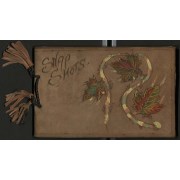
- File consists of Eleanor Luxton's personal album which contains 195 black and white prints pasted in, most spreads are captioned. Content pertains to family and school photographs, events and travels between 1921 and 1925, in addition to potentional childhood photographs as well. Locations include Banff, Lake Louise, Yoho, Marble Canyon, Takakkaw Falls, Lake Minnewanka, Summit Lake, Victoria, Vancouver, Yoho Valley Bungalow Camp and Radium Hot Springs. Events include the opening of the Banff-Wintermere Highway at Kootenay Crossing in 1921, a dog derby on frozen Lake Minnewanka, Banff Indian Days, Banff Winter Carnival. Subjects include unidentified and identified people including Norman Luxton, Georgina Luxton, Enos Hunter, Ben Kaquitts, Hector Crawler, John Englishman, Mrs. Wood, Edmée, Mrs Mitt and Miss Maemillan. Album cover is leather with burned annotation "Snap Shots" with paint and cloth leaf detailing. The album i sbound by a cord with leather tassels.
- Notes
- File consists of several loose photographs. Some photographs are detaching from the paper.
- Name Access
- Luxton, Eleanor
- Luxton, Norman
- Luxton, Georgina
- Englishman, John
- Kaquitts, Tom
- Crawler, Hector
- Hunter, Enos
- Subject Access
- Chateau Lake Louise
- Banff Indian Days
- Banff Winter Carnival
- Banff
- Banff Gun Club
- Banff National Park
- Bighorn Sheep
- Cave and Basin
- Community events
- Dogs
- Family and personal life
- Indigenous Peoples
- Parades
- Takakkaw Falls
- Twin Falls Chalet
- Winter Carnival
- Yoho Valley Bungalow Camp
- Geographic Access
- Banff
- Banff National Park
- Alberta
- British Columbia
- Victoria
- Victoria Glacier
- Vancouver
- Butchart Gardens
- Lake Louise
- Lake Minnewanka
- Radium
- Yoho National Park
- Marble Canyon
- Language
- English
- Creator
- Luxton, Eleanor
- Title Source
- Title given by Archivist based on contents of album
- Processing Status
- Processed
Electronic Resources
This material is presented as originally created; it may contain outdated cultural descriptions and
potentially offensive content.
Read more.
Geological survey [Okanagan Falls - Similkameen & Osoyoos Dist.]
https://archives.whyte.org/en/permalink/catalogue24737
- Medium
- Library - Book (including soft-cover and pamphlets)
- Map
- Published Date
- 1941
- Publisher
- Dept. of Mines and Resources
- Call Number
- C7-3.5
- Publisher
- Dept. of Mines and Resources
- Published Date
- 1941
- Physical Description
- 1 map : col
- Scale
- Scale: 1 inch to 1 mile
- Relief: Contour interval 100 ft.
- Accession Number
- 673
- Call Number
- C7-3.5
- Collection
- Archives Library
This material is presented as originally created; it may contain outdated cultural descriptions and
potentially offensive content.
Read more.
[Kakwa Falls]
https://archives.whyte.org/en/permalink/catalogue23688
- Medium
- Library - Maps and blueprints (unannotated; published)
- Map
- Published Date
- 1980
- Publisher
- Dept of Energy Mines and Resources
- Edition
- 2
- Call Number
- NTS
- 83L/4
- Edition
- 2
- Publisher
- Dept of Energy Mines and Resources
- Published Date
- 1980
- Physical Description
- Colour
- Scale
- Scale: 1:50,000
- Relief: Contour Interval 100 ft.
- Subjects
- Kakwa Falls
- Notes
- National Topographic System
- Accession Number
- 13,000
- Call Number
- NTS
- 83L/4
- Collection
- Archives Library
This material is presented as originally created; it may contain outdated cultural descriptions and
potentially offensive content.
Read more.
[Ocean Falls - Ootsa Lake 93SW, B.C.]
https://archives.whyte.org/en/permalink/catalogue24193
- Medium
- Library - Maps and blueprints (unannotated; published)
- Map
- Published Date
- 1965
- Publisher
- Dept. of Mines and Technical Surveys
- Call Number
- NTS
- 93SW
- Publisher
- Dept. of Mines and Technical Surveys
- Published Date
- 1965
- Scale
- Scale: 1:500,000
- Altitude tints
- Subjects
- Ocean Falls - Ootsa Lake
- British Columbia
- Notes
- National Topographic System
- Accession Number
- 3000
- Call Number
- NTS
- 93SW
- Collection
- Archives Library
This material is presented as originally created; it may contain outdated cultural descriptions and
potentially offensive content.
Read more.
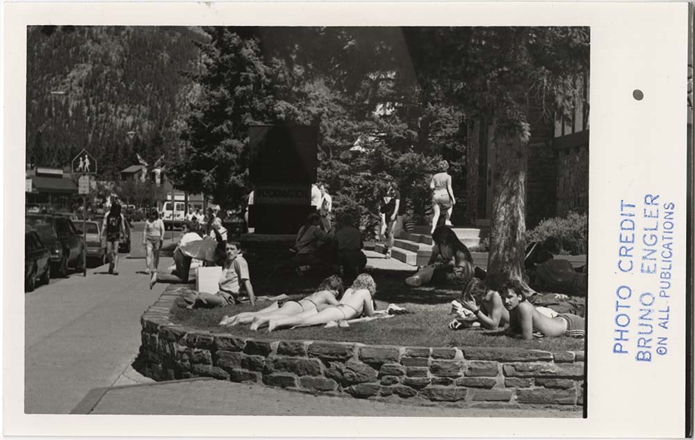
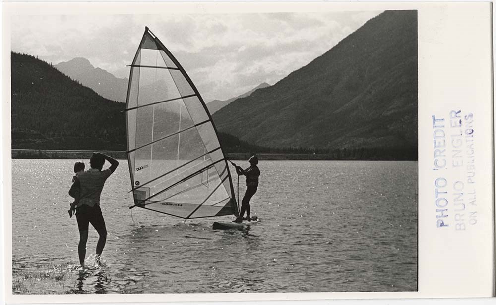
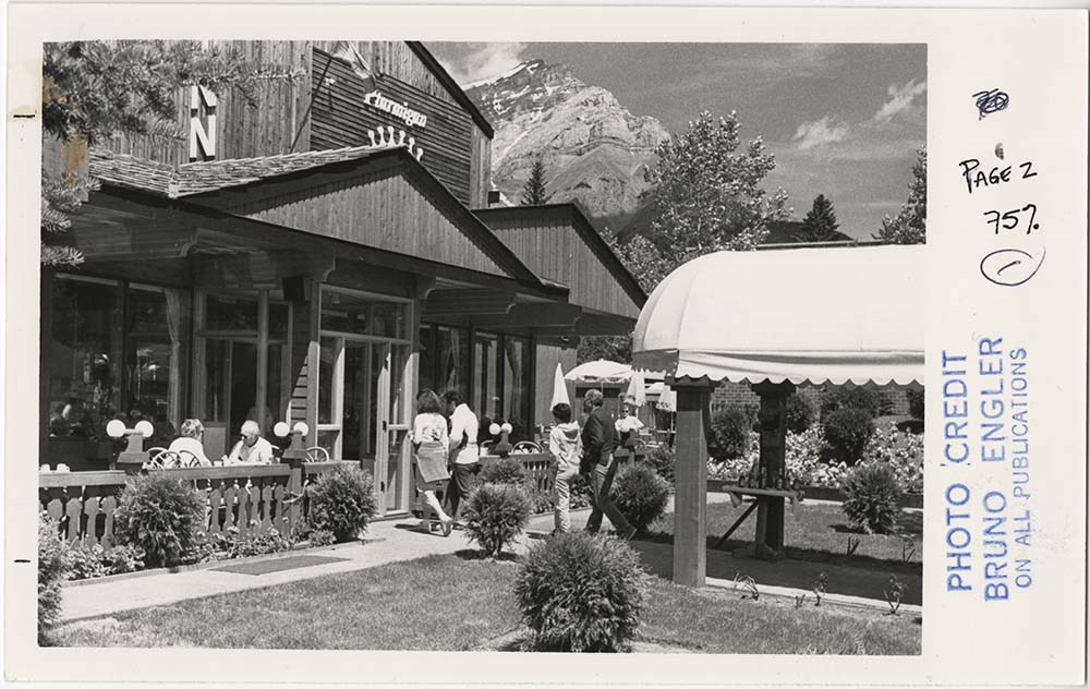
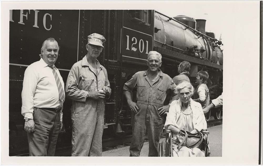
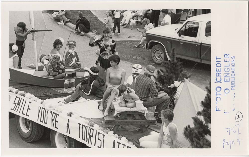
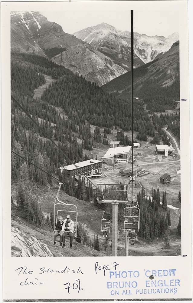
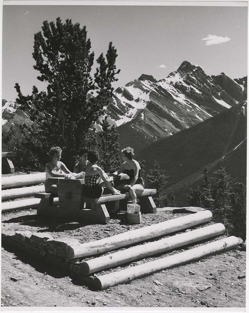
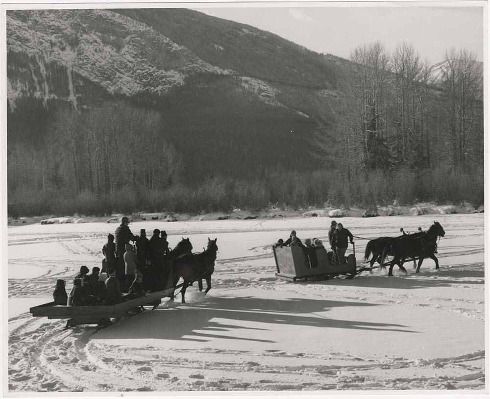
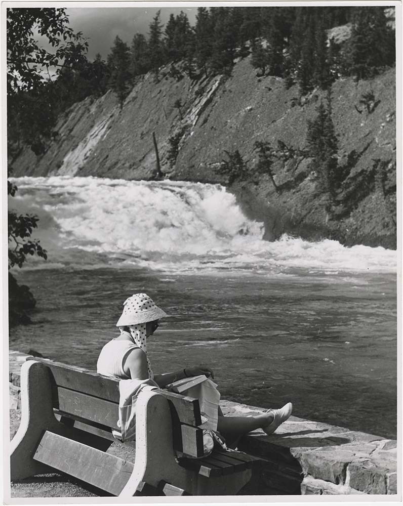
People & Recreation
https://archives.whyte.org/en/permalink/descriptions57413
- Part Of
- Bruno Engler fonds
- Scope & Content
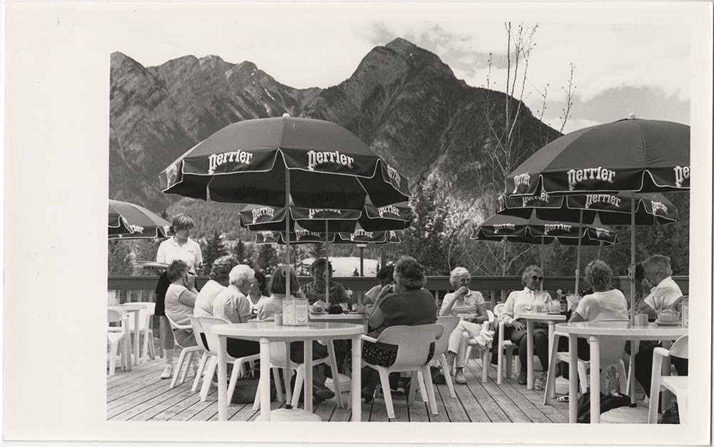
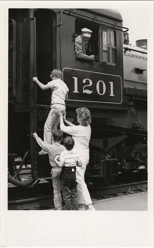
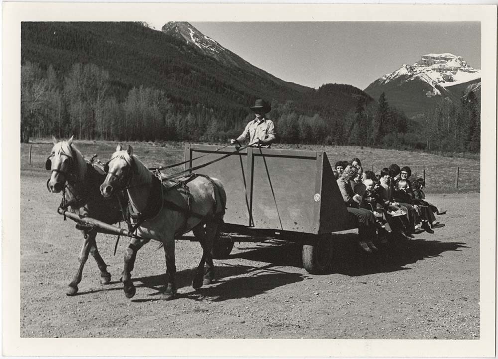
- File pertains to 69 b&w prints of people in and around the town of Banff, mostly candid shots - some portraits. Includes shots of people swimming, suntanning, skiing, wind surfing at Lake Minnewanka, canoeing at Two Jack Lake, heli-skiing, a parade in Canmore [possibly for Canada Day], and more.
- Date Range
- [ca. 1965-1993]
- Reference Code
- V190 / VI / P / ii / b / PA - 01 to PA - 69
- Description Level
- 5 / File
- GMD
- Photograph
17 images
- Part Of
- Bruno Engler fonds
- Description Level
- 5 / File
- Fonds Number
- M323 / S40 / V190
- Series
- VI : Retained file, P : Alphabetical order
- Sous-Fonds
- V190
- Sub-Series
- ii : People, b : Recreation
- Accession Number
- 7436
- Reference Code
- V190 / VI / P / ii / b / PA - 01 to PA - 69
- GMD
- Photograph
- Date Range
- [ca. 1965-1993]
- Physical Description
- 69 photographs : b&w ; 25.2 x 20.2 cm or smaller
- History / Biographical
- See fonds level description
- Scope & Content
- File pertains to 69 b&w prints of people in and around the town of Banff, mostly candid shots - some portraits. Includes shots of people swimming, suntanning, skiing, wind surfing at Lake Minnewanka, canoeing at Two Jack Lake, heli-skiing, a parade in Canmore [possibly for Canada Day], and more.
- Subject Access
- Activities
- Banff townsite
- Bow Falls
- Children
- Community events
- Community life
- Family
- Helicopters
- Hiking
- Lake Minnewanka
- Parades
- Personal and Professional Life
- Portrait
- Restaurants
- Ski areas
- Skiers
- Sulphur Mountain
- Sunshine Village
- Swimming
- Timberline Hotel
- Winter
- Geographic Access
- Banff
- Banff National Park
- Canmore
- Language
- English
- Creator
- Engler, Bruno
- Title Source
- Original title kept
- Processing Status
- Processed
Images


This material is presented as originally created; it may contain outdated cultural descriptions and
potentially offensive content.
Read more.
[Shuswap Falls 82L/7 West - B.C.]
https://archives.whyte.org/en/permalink/catalogue23883
- Medium
- Library - Maps and blueprints (unannotated; published)
- Map
- Published Date
- 1968
- Publisher
- Department of National Defense
- Call Number
- NTS
- 82L/7W
- Publisher
- Department of National Defense
- Published Date
- 1968
- Physical Description
- Colour
- Scale
- Scale: 1:50,000
- Relief: Contour interval 100 ft.
- Subjects
- Shuswap Falls 82L/7 West - B.C.
- Notes
- National Topographic System
- Accession Number
- 7000
- Call Number
- NTS
- 82L/7W
- Collection
- Archives Library
This material is presented as originally created; it may contain outdated cultural descriptions and
potentially offensive content.
Read more.
[Shuswap Falls 82L/7East - B.C.]
https://archives.whyte.org/en/permalink/catalogue23882
- Medium
- Library - Maps and blueprints (unannotated; published)
- Map
- Published Date
- 1968
- Publisher
- Department of National Defense
- Call Number
- NTS
- 82L/7E
- Publisher
- Department of National Defense
- Published Date
- 1968
- Physical Description
- Colour
- Scale
- Scale: 1:50,000
- Relief: Contour interval 100 ft.
- Subjects
- Shuswap Falls 82L/7East - B.C.
- Notes
- National Topographic System
- Accession Number
- 7000
- Call Number
- NTS
- 82L/7E
- Collection
- Archives Library
This material is presented as originally created; it may contain outdated cultural descriptions and
potentially offensive content.
Read more.
[Virginia Falls 95F, N.W.T.]
https://archives.whyte.org/en/permalink/catalogue24162
- Medium
- Library - Maps and blueprints (unannotated; published)
- Map
- Published Date
- 1960
- Publisher
- Dept. of Mines and Technical Surveys
- Call Number
- NTS
- 95F
- Publisher
- Dept. of Mines and Technical Surveys
- Published Date
- 1960
- Physical Description
- 1 map : col
- Scale
- Scale: 1:250,000
- Relief: Contour interval 500 ft.
- Subjects
- Virginia Falls
- Northwest Territories
- Notes
- National Topographic System
- Accession Number
- 3000
- Call Number
- NTS
- 95F
- Collection
- Archives Library
This material is presented as originally created; it may contain outdated cultural descriptions and
potentially offensive content.
Read more.