Narrow Results By
Personal Trip Diaries
https://archives.whyte.org/en/permalink/descriptions55197
- Part Of
- Lillian Gest fonds
- Scope & Content
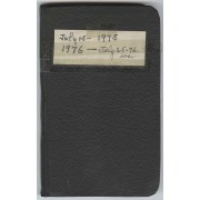
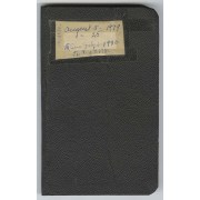
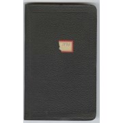
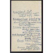
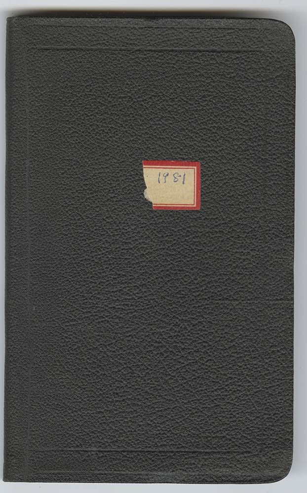
- File pertains to six diaries kept by Lillian Gest from 1968-1975 from travels throughout the Canadian Rockies. Includes: M67 / 6 - 1 : black leather diary, titled July 15 - 1975: 1976 - July 25-76 on fabric adhered to the cover with tape. Pertains to the remainder of the summer 1975 trip (carried o…
- Date Range
- 1975-1981
- Reference Code
- M67 / I / A / i / 6 - 1 to 6 - 6
- Description Level
- 5 / File
- GMD
- Diary
6 images
7 Electronic Resources
- Part Of
- Lillian Gest fonds
- Description Level
- 5 / File
- Fonds Number
- M67 / S36 / V225
- Series
- I.A. Personal papers / diaries and trip notes
- Sous-Fonds
- M67
- Sub-Series
- i. Diaries
- Accession Number
- 5142
- Reference Code
- M67 / I / A / i / 6 - 1 to 6 - 6
- GMD
- Diary
- Date Range
- 1975-1981
- Physical Description
- 7.5 cm of textual records (6 volumes ; 11 x 17.5 cm or smaller)
- History / Biographical
- See fonds level description
- Scope & Content
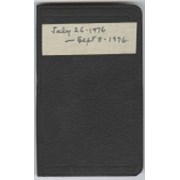
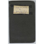
- File pertains to six diaries kept by Lillian Gest from 1968-1975 from travels throughout the Canadian Rockies. Includes: M67 / 6 - 1 : black leather diary, titled July 15 - 1975: 1976 - July 25-76 on fabric adhered to the cover with tape. Pertains to the remainder of the summer 1975 trip (carried over from M67 / 5 - 6) and the first few months of the summer 1976 trip to the Canadian Rockies. Includes stays around the Banff, Lake Louise, and Lake O'Hara areas as well as hiking trips with and without the Sky Line Trail Hikers and the Alpine Club of Canada. Also includes a list of Lake O'Hara staff for 1975, reservation details for 1976, song lyrics, and lists of people met. M67 / 6 - 2 : black leather diary, dated July 26-1976 - Sept 8-1976 on fabric tape adhered to the front cover. Pertains to the remainder of the summer 1976 trip (carried over from M67 / 6 - 1) and contains details about club activity as part of the Alpine Club of Canada, various hikes, travel around the Canadian Rockies, and travel back to Pennsylvania. Also includes reservation details for 1977, names and phone numbers, people met, and information from a letter sent to Dr. Link from Edward Feuz in 1960 that included details about the Feuz family (including when they came to Canada and when they retired) and other matters relating to Lake O'Hara. M67 / 6 - 3 : black leather diary, titled June [illegible] - Sept 2-1977 on badly damaged fabric tape adhered to the front cover. Pertains to the summer 1977 trip to the Canadian Rockies with stays around the Banff, Lake Louise, and Lake O'Hara areas, hikes with and without the Sky Line Trail Hikers and the Alpine Club of Canada, and between Banff and Pennsylvania. Also includes birds seen at Lake O'Hara, lists of staffs and people met, and events from Banff in 1977 (including the construction of the Sundance Mall and Elizabeth Rummel's 80th birthday that March). M67 / 6 - 4 : black leather diary, titled June 21, 1978 to June 26, 1979 to Aug 5, 1979 on a piece of paper taped to the front cover. Pertains to the summer trips of 1978 and 1979 to the Canadian Rockies. Summer 1978 includes stays in the Banff, Lake Louise, Lake O'Hara, and Field BC areas as well as many hiking trips with and without organizations like the Alpine Club of Canada and the Sky Line Trail Hikers. Summer 1979 includes stays in the Banff and Lake O'Hara areas, hiking trips, and travel between Banff and Pennsylvania by air. Also includes lists of staff names, phone numbers, and people met, histories and timelines for the Lake Louise area and Simpson's Ranch, distances, and events (including the marriage of Carole Harmon to Stephen Hutchings, summer 1978). M67 / 6 - 5 : black leather diary, titled August 5-25 1979 - Sun July 6-1980 to Aug 2 1980 on a piece of paper taped to the front cover. Pertains to the last few weeks of the summer 1979 trip (carried over from M67 / 6 - 4) and the summer 1980 trip. The summer 1980 trip included time spent in and around the Banff, Lake Louise, and Lake O'Hara areas, as well as hiking trips and details pertaining to travelling between Banff and Pennsylvania. Also includes detailed lists of equipment for 1980 &1981, a small list of notes (including selling prices for a book called "Mt. Assiniboine" written by Lillian Gest), and lists of people met. M67 / 6 - 6 : black leather diary, dated 1981 on an adhesive paper label torn in half. Pertains to first two weeks of July 1924 summer trip and summer 1981. Summer 1924 consists of early details for a trip organized by Caroline Hinman and mainly of lists of names of those included. Summer 1981 consists of time spent predominantly in and around the Lake Louise and Lake O'Hara areas, with shorter stays in Banff at the beginning and end of the trip. Also includes details of a climbing trip two people took over Wenkchemna Pass on Aug 9, lists of people met, staff of businesses around Banff, and telephone numbers. Also includes loose items consisting of notes to self, a postcard, a photograph, guest lists and itineraries for the Sky Line Trail Hikers, and newspaper clippings.
- Notes
- Blank pages not scanned.
- Name Access
- Alpine Club of Canada
- Feuz, Edward
- Feuz, Edward, Jr.
- Feuz, Ernest
- Harmon, Carole
- Hinman, Caroline
- Link, George K. K. (Tommy)
- Link, George K.K.
- Rummel, Elizabeth
- Gest, Lillian
- Subject Access
- Activities
- Alpine Club of Canada
- Cabins and shelters
- Camping
- Camps
- Community
- Environment and Nature
- Family and personal life
- First Nations
- Guides
- Hiking
- Horse packing
- Horseback riding
- Hotels
- Indigenous Peoples
- Lake O'Hara region
- Membership
- Mountaineering
- Mountains
- Outfitting
- Outfitters, trail guides and packers
- Off the Beaten Track
- Pack trips
- Parks Canada
- Record keeping
- Skyline Hikers of the Canadian Rockies
- Skyline Trail Hikers of the Canadian Rockies
- Sports and leisure
- Stoney Nakoda
- Tourism
- Trails
- Trail Riders of the Canadian Rockies
- Travel
- Travel and Exploration
- Geographic Access
- Banff
- Lake Louise
- Pipestone Pass
- Saskatchewan River
- Assiniboine
- Mount Assiniboine
- Jasper
- Banff National Park
- Jasper National Park
- Kootenay National Park
- Yoho National Park
- Alberta
- British Columbia
- Pennsylvania
- Canada
- United States of America
- Language
- English
- Conservation
- M67 / 6 - 1 : find alternative for adhesive tape on front cover.
- Creator
- Gest, Lillian
- Title Source
- Title based on contents of file
- Processing Status
- Processed
Electronic Resources
Images


This material is presented as originally created; it may contain outdated cultural descriptions and
potentially offensive content.
Read more.
Published regional and trail maps
https://archives.whyte.org/en/permalink/descriptions54847
- Scope & Content
- File consists of maps depicting the Banff townsite and nearby travel routes. Includes a trail map for Banff, Yoho and Kootenay National Parks; a road map for Banff and nearby areas [1965]; a numbered townsite map of Banff marking local hotels and attractions; and a photocopied map of a trail route …
- Date Range
- [1950-1970]
- 1965
- Reference Code
- M545 / III / 29
- Description Level
- 5 / File
- GMD
- Textual record
- Published record
- Map
- Description Level
- 5 / File
- Fonds Number
- M545 / V635
- Series
- M545 / III : Published records
- Sous-Fonds
- M545
- Accession Number
- 5939
- Reference Code
- M545 / III / 29
- Date Range
- [1950-1970]
- 1965
- Physical Description
- 0.5 cm of textual records (4 maps ; 35.5 x 21.5 cm or smaller)
- Scope & Content
- File consists of maps depicting the Banff townsite and nearby travel routes. Includes a trail map for Banff, Yoho and Kootenay National Parks; a road map for Banff and nearby areas [1965]; a numbered townsite map of Banff marking local hotels and attractions; and a photocopied map of a trail route used by the Trail Riders of the Canadian Rockies [n.d.]
- Notes
- Banff townsite map has annotation marking the location of the Trail Ride Office on Caribou St.
- Subject Access
- Travel
- Trails
- Map
- Land, settlement and immigration
- Geography
- Geographic Access
- Canada
- Alberta
- Banff
- Banff National Park
- Yoho National Park
- Kootenay National Park
- Reproduction Restrictions
- Restrictions may apply
- Language
- English
- Title Source
- Title based on contents of file
- Processing Status
- Processed
This material is presented as originally created; it may contain outdated cultural descriptions and
potentially offensive content.
Read more.
Ski Trails in the Canadian Rockies - textual
https://archives.whyte.org/en/permalink/descriptions55078
- Part Of
- Chic Scott fonds
- Scope & Content
- Series consists of research documents, published materials and maps used during the creation of the book Ski Trails in the Canadian Rockies.
- Date Range
- 1999 - 2015
- Reference Code
- M57 / VI
- Description Level
- 3 / Series
- GMD
- Textual record
- Part Of
- Chic Scott fonds
- Description Level
- 3 / Series
- Fonds Number
- M57 / V40 / S47
- Series
- M57 / VI: Ski Trails in the Canadian Rockies
- Sous-Fonds
- M57
- Sub-Series
- M57 / VI / A: Research Files
- M57 / VI / B: Collected publications
- M57 / VI / C: Maps
- Accession Number
- .
- Reference Code
- M57 / VI
- GMD
- Textual record
- Date Range
- 1999 - 2015
- Physical Description
- 18 cm of textual records
- History / Biographical
- The classic guidebook to cross country ski trails in Waterton, Banff, Kootenay, Yoho and Jasper National Parks as well as Mount Assiniboine and Mount Robson Provincial Parks and Kananaskis Country, now greatly expanded to includes ski trails in the front ranges of the Rockies, in the Crowsnest Pass and in the Columbia Valley. Jointly authored with Darren Farley. This book also covers topics such as accommodation, regulations, weather and snow conditions.
- Scope & Content
- Series consists of research documents, published materials and maps used during the creation of the book Ski Trails in the Canadian Rockies.
- Notes
- Series consists of three sub-series: M57 / VI / A: Research Files
- M57 / VI / B: Collected publications
- M57 / VI / C: Maps
- Name Access
- Scott, Chic
- Subject Access
- Activities
- Environment
- Exploration
- Geography
- Guide
- Map
- Mountaineering
- Mountains
- National parks and reserves
- Publication
- Recreation
- Ski areas
- Ski Maps
- Ski mountaineering
- Ski lodges and cabins
- Skiing
- Sports and recreation
- Sports
- Tourism
- Tourist information
- Trail guides
- Trails
- Travel
- Winter sports
- Geographic Access
- Canada
- Alberta
- British Columbia
- Canadian Rocky Mountains
- Banff National Park
- Yoho National Park
- Jasper National Park
- Waterton
- Kootenay National Park
- Rogers Pass
- Columbia Valley
- Crowsnest Pass
- Language
- English
- Related Material
- S47 / VI
- V40 / VI
- Title Source
- Title based on contents of file
- Processing Status
- Processed
This material is presented as originally created; it may contain outdated cultural descriptions and
potentially offensive content.
Read more.
Ski Trails of the Canadian Rockies - visual
https://archives.whyte.org/en/permalink/descriptions55079
- Part Of
- Chic Scott fonds
- Scope & Content
- Series consists of 3 CD's with photo scans pertaining to the creation of Ski Trails of the Canadian Rockies.
- Date Range
- 1999 - 2015
- Reference Code
- V40 / VI
- Description Level
- 3 / Series
- GMD
- Digital image
- Photograph
- Part Of
- Chic Scott fonds
- Description Level
- 3 / Series
- Fonds Number
- M57 / V40 / S47
- Series
- V40 / VI : Ski Trails of the Canadian Rockies
- Sous-Fonds
- V40
- Accession Number
- .
- Reference Code
- V40 / VI
- Date Range
- 1999 - 2015
- Physical Description
- Digital photo scans on 3 discs
- History / Biographical
- The classic guidebook to cross country ski trails in Waterton, Banff, Kootenay, Yoho and Jasper National Parks as well as Mount Assiniboine and Mount Robson Provincial Parks and Kananaskis Country, now greatly expanded to includes ski trails in the front ranges of the Rockies, in the Crowsnest Pass and in the Columbia Valley. Jointly authored with Darren Farley. This book also covers topics such as accommodation, regulations, weather and snow conditions.
- Scope & Content
- Series consists of 3 CD's with photo scans pertaining to the creation of Ski Trails of the Canadian Rockies.
- Name Access
- Scott, Chic
- Subject Access
- Activities
- Environment
- Exploration
- Geography
- Guide
- Map
- Mountaineering
- Mountains
- National parks and reserves
- Publication
- Recreation
- Ski areas
- Ski Maps
- Ski mountaineering
- Ski lodges and cabins
- Skiing
- Sports and recreation
- Sports
- Tourism
- Tourist information
- Trail guides
- Trails
- Travel
- Winter sports
- Geographic Access
- Canada
- Alberta
- British Columbia
- Canadian Rocky Mountains
- Banff National Park
- Yoho National Park
- Jasper National Park
- Waterton
- Kootenay National Park
- Mount Robson
- Columbia Valley
- Crowsnest Pass
- Access Restrictions
- Reference only
- Reproduction Restrictions
- Restricted: copyright remains with owner
- Language
- English
- Related Material
- M57 / VI
- S47 / VI
- Biographical Source Notes
- http://chicscott.com/books.htm
- Title Source
- Title based on contents of file
- Processing Status
- Processed
This material is presented as originally created; it may contain outdated cultural descriptions and
potentially offensive content.
Read more.
Storm Mountain Summit Records
https://archives.whyte.org/en/permalink/descriptions57676
- Part Of
- Alpine Club of Canada fonds
- Scope & Content
- Files consist of summit notes and summit registers from Storm Mountain produced by the Alpine Club of Canada between 1993 and 2009. Summit records include entries from visitors to the various summits which pertain to individuals' hiking and climbing trips; details of specific events which occurred …
- Date Range
- 1993 - 2009
- Reference Code
- M200 / V / A / 57 to 60
- Description Level
- 5 / File
- GMD
- Textual record
- Organization record
- Part Of
- Alpine Club of Canada fonds
- Description Level
- 5 / File
- Fonds Number
- M200
- V14
- S6
- Series
- M200 / V: Summit Records
- Sous-Fonds
- M200
- Sub-Series
- M200 / V / A: Identified Summit Records
- Accession Number
- accn. 8002 accn. 7779 accn. 2014.8315
- Reference Code
- M200 / V / A / 57 to 60
- Responsibility
- Summit Registers and Notes produced by Alpine Club of Canada
- Date Range
- 1993 - 2009
- Physical Description
- 4 cm of textual records 4 volumes
- History / Biographical
- Storm Mountain is located on the Continental Divide between Alberta and British Columbia, and is also on the boundary between Kootenay National Park and Banff National Park. Nearby are Castle Mountain, Vermilion Pass and Stanley Peak.
- Scope & Content
- Files consist of summit notes and summit registers from Storm Mountain produced by the Alpine Club of Canada between 1993 and 2009. Summit records include entries from visitors to the various summits which pertain to individuals' hiking and climbing trips; details of specific events which occurred while at the summit, wildlife sightings, trail updates, and related topics. Files include: M200 / V / A / 57: Summit Register - Storm Mtn., 1993 - 2009 M200 / V / A / 58: Storm Mountain July 1994 - August 2004 M200 / V / A / 59: Summit Register - MT. Storm (Banff), 2005 M200 / V / A / 60: Mt. Storm Summit Register [2005-2009]
- Name Access
- Alpine Club of Canada
- Subject Access
- Alpine Club of Canada
- Alberta
- Backcountry skiing
- Backpacking
- Banff National Park
- British Columbia
- Castle Mountain
- Climbing
- Environment
- Environment and Nature
- Hiking
- Mountain
- Mountaineering
- Mountaineers
- Mountains
- National parks and reserves
- Ski mountaineering
- Skiing
- Sports and leisure
- Sports and recreation
- Summit
- Trails
- Winter sports
- Geographic Access
- Canada
- Alberta
- British Columbia
- Banff National Park
- Kootenay National Park
- Castle Mountain
- Vermilion Pass
- Stanley Peak
- Access Restrictions
- Restrictions may apply
- Language
- English
- French
- Conservation
- Some registers contain water damage. Some registers are loose pages and have been placed in mylar.
- Related Material
- M235
- Biographical Source Notes
- Storm Mountain, North East Face, 1988, In Alpinism no.1, p.60-61, Archives Library, Call Number P
- Title Source
- Title based on contents of file
- Processing Status
- Processed
This material is presented as originally created; it may contain outdated cultural descriptions and
potentially offensive content.
Read more.
Travel guides and maps
https://archives.whyte.org/en/permalink/descriptions56361
- Part Of
- Ben Gadd fonds
- Scope & Content
- Sub-series consists of travel brochures and maps which were collected and used by Ben Gadd. Sub-series contains five sub-sub series: M590 / I / A / i : Travel guides and pocket maps M590 / I / A / ii : Topographical maps M590 / I / A / iii : Geological maps M590 / I / A / iv : Highway maps M590 / …
- Date Range
- [ca.1920-2010]
- Reference Code
- M590 / I / A
- Description Level
- 4 / Sub-series
- GMD
- Map
- Textual record
- Part Of
- Ben Gadd fonds
- Description Level
- 4 / Sub-series
- Fonds Number
- M590
- V810
- S61
- Series
- M590 / I : Personal records
- Sous-Fonds
- M590
- Sub-Series
- M590 / I / A : Travel guides and maps
- Accession Number
- 2021.20
- Reference Code
- M590 / I / A
- GMD
- Map
- Textual record
- Date Range
- [ca.1920-2010]
- Physical Description
- ca. 274 maps -- ca. 61 travel guides, brochures
- Scope & Content
- Sub-series consists of travel brochures and maps which were collected and used by Ben Gadd. Sub-series contains five sub-sub series: M590 / I / A / i : Travel guides and pocket maps M590 / I / A / ii : Topographical maps M590 / I / A / iii : Geological maps M590 / I / A / iv : Highway maps M590 / I / A / v : Index maps, other
- Notes
- Some materials in sub-series are annotated with notes by Ben Gadd
- Name Access
- Gadd, Ben
- Subject Access
- Geography
- Geology
- Environment
- Map
- Tourism
- Tourist information
- Travel
- Trails
- Roads
- Transportation
- Natural history
- National parks and reserves
- Provincial parks and reserves
- Government
- Sports
- Recreation
- Hiking
- Geographic Access
- Canada
- Alberta
- British Columbia
- Banff National Park
- Jasper National Park
- Kootenay National Park
- Yoho National Park
- Waterton Lakes National Park
- Columbia Icefields
- United States of America
- Colorado
- Montana
- Yellowstone National Park
- Access Restrictions
- Restrictions may apply - some materials are fragile
- Reproduction Restrictions
- Restrictions may apply
- Language
- English
- Conservation
- Some fragile/torn materials stored in mylar
- Category
- Environment
- Exploration, discovery and travel
- Government
- Sports, recreation and leisure
- Transportation
- Tourism
- Title Source
- Title based on contents of sub-series
- Processing Status
- Processed
This material is presented as originally created; it may contain outdated cultural descriptions and
potentially offensive content.
Read more.
Vermillion Peak Summit Register [Vermilion Peak]
https://archives.whyte.org/en/permalink/descriptions57756
- Part Of
- Alpine Club of Canada fonds
- Scope & Content
- File consists of a summit record from Vermilion Peak produced by the Alpine Club of Canada between 2008 and 2017. Summit record includes entries from visitors to the various summits which pertain to individuals' hiking and climbing trips; details of specific events which occurred while at the summi…
- Date Range
- 2008-2017
- Reference Code
- M200 / V / A / 169
- Description Level
- 5 / File
- GMD
- Textual record
- Organization record
- Part Of
- Alpine Club of Canada fonds
- Description Level
- 5 / File
- Fonds Number
- M200
- V14
- S6
- Series
- M200 / V: Summit Records
- Sous-Fonds
- M200
- Sub-Series
- M200 / V / A: Identified Summit Records
- Accession Number
- accn. 2018.9010
- Reference Code
- M200 / V / A / 169
- Responsibility
- Summit Registers and Notes produced by Alpine Club of Canada
- Date Range
- 2008-2017
- Physical Description
- 1 volume 0.5 cm of textual record
- History / Biographical
- Vermilion Peak is part of the the Ball Range of the Canadian Rockies, the Continental Divide / Great Divide, and is located in the Vermilion River Valley of Kootenay National Park, British Columbia.
- Scope & Content
- File consists of a summit record from Vermilion Peak produced by the Alpine Club of Canada between 2008 and 2017. Summit record includes entries from visitors to the various summits which pertain to individuals' hiking and climbing trips; details of specific events which occurred while at the summit, wildlife sightings, trail updates, and related topics. File: M200 / V / A / 169: Vermillion Peak Summit Register [Vermilion Peak]
- Name Access
- Alpine Club of Canada
- Subject Access
- Alpine Club of Canada
- Backpacking
- British Columbia
- Climbing
- Club
- Description and travel
- Environment
- Environment and Nature
- Great Divide
- Hiking
- Mountain
- Mountaineering
- Mountaineers
- Mountains
- National parks and reserves
- Record keeping
- Sports and leisure
- Sports and recreation
- Summit
- Trails
- Geographic Access
- Canada
- Continental Divide
- Great Divide
- Canadian Rocky Mountains
- Rocky Mountains
- Ball Range
- British Columbia
- Kootenay National Park
- Vermilion River Valley
- Vermilion Peak
- Vermillion Peak
- Access Restrictions
- Restrictions may apply
- Language
- English
- Conservation
- Some of the ink from entries has bled, making some entries illegible
- Related Material
- M235
- Biographical Source Notes
- Peak Finder: Vermilion Peak, Canadian Rockies Database: https://cdnrockiesdatabases.ca/peaks/1454
- Title Source
- Title based on contents of file
- Processing Status
- Processed
This material is presented as originally created; it may contain outdated cultural descriptions and
potentially offensive content.
Read more.