Narrow Results By
Alts Golf and Ski Resort, Japan
https://archives.whyte.org/en/permalink/descriptions54972
- Part Of
- Murray Hay fonds
- Scope & Content
- File consists of 4 prints : col. ; 22 x 15.5 cm or smaller on sheet 35 x 30 cm. FIle pertains to Murray Hay's work for Alts Golf and Ski Resort in Japan. File includes multiple prints glued/taped to a sheet of paper depicting different areas of the ski area, and is titled "Alts Golf and Ski Resort …
- Date Range
- ca. 1976 - ca. 2000
- Reference Code
- V795 / II / D / ii / 1
- Description Level
- 5 / File
- GMD
- Map
- Private record
- Part Of
- Murray Hay fonds
- Description Level
- 5 / File
- Fonds Number
- M570 / V795
- Series
- V795 / II : Unpublished Material
- Sous-Fonds
- V795
- Sub-Series
- V795 / II / D : International / ii : Miscellaneous
- Accession Number
- 2019.41
- Reference Code
- V795 / II / D / ii / 1
- GMD
- Map
- Private record
- Date Range
- ca. 1976 - ca. 2000
- Physical Description
- 4 prints : col. ; 22 x 15.5 cm or smaller on sheet 35 x 30 cm
- Scope & Content
- File consists of 4 prints : col. ; 22 x 15.5 cm or smaller on sheet 35 x 30 cm. FIle pertains to Murray Hay's work for Alts Golf and Ski Resort in Japan. File includes multiple prints glued/taped to a sheet of paper depicting different areas of the ski area, and is titled "Alts Golf and Ski Resort in the Bandai Area of Japan."
- Name Access
- Hay, Murray
- Subject Access
- Advertising
- Artist
- Ski Maps
- Map
- Cartography
- Sports and recreation
- Tourism
- Tourist information
- Travel
- Winter
- Winter sports
- Ski area
- Geographic Access
- Japan
- Language
- English
- Conservation
- Prints are taped or otherwise glued to the sheet of paper. Adhesives should be removed and alternative preservation methods used at a reasonable time to do so.
- Related Material
- M570 / III / D / ii / 2
- Creator
- Hay, Murray
- Title Source
- Title based on contents of file
- Processing Status
- Processed
This material is presented as originally created; it may contain outdated cultural descriptions and
potentially offensive content.
Read more.
Apex Mountain Ski Resort
https://archives.whyte.org/en/permalink/descriptions54875
- Part Of
- Murray Hay fonds
- Scope & Content
- File consists of 1 map (1 base, 4 overlays) : col., annotations, on mylar ; 83 x 61.5 cm, and 1 print : b&w ; 25.5 x 20.5 cm. File pertains to ski maps Murray Hay created for Apex Mountain Ski Resort in Penticton, British Columbia. File includes one oversize map with four overlays (held together wi…
- Date Range
- ca.1976-ca.2000
- Reference Code
- V795 / II / A / iv / 3-4
- Description Level
- 5 / File
- GMD
- Map
- Private record
- Part Of
- Murray Hay fonds
- Description Level
- 5 / File
- Fonds Number
- M570 / V795
- Series
- V795 / II : Unpublished Material
- Sous-Fonds
- V795
- Sub-Series
- V795 / II / A : British Columbia / iv : Okanagan Area
- Accession Number
- 2019.41
- Reference Code
- V795 / II / A / iv / 3-4
- GMD
- Map
- Private record
- Date Range
- ca.1976-ca.2000
- Physical Description
- 1 map (1 base, 4 overlays) : col., annotations, on mylar ; 83 x 61.5 cm
- 1 print : b&w ; 25.5 x 20.5 cm
- Scope & Content
- File consists of 1 map (1 base, 4 overlays) : col., annotations, on mylar ; 83 x 61.5 cm, and 1 print : b&w ; 25.5 x 20.5 cm. File pertains to ski maps Murray Hay created for Apex Mountain Ski Resort in Penticton, British Columbia. File includes one oversize map with four overlays (held together with masking tape), and one print of the general ski area.
- Notes
- V795 / II / A / iv / 4 : has "16488" and "Hold" written in pencil on the masking tape.
- Name Access
- Hay, Murray
- Subject Access
- Advertising
- Art
- Artist
- Ski Maps
- Map
- Cartography
- Sports and recreation
- Tourism
- Tourist information
- Winter
- Winter sports
- Ski area
- Apex Mountain Ski Resort
- Geographic Access
- British Columbia
- Canada
- Penticton
- Language
- English
- Conservation
- The masking tape should be removed and alternative preservation methods should be considered at a reasonable time to do so.
- Creator
- Hay, Murray
- Title Source
- Title based on contents of file
- Processing Status
- Processed
This material is presented as originally created; it may contain outdated cultural descriptions and
potentially offensive content.
Read more.
Article corrections, slide presentation notes
https://archives.whyte.org/en/permalink/descriptions54943
- Scope & Content
- File consists of scanned copies of two articles [one dated 1962] pertaining to the Trail Riders of the Canadian Rockies with corrections added in pen; and typed and written notes pertaining to a slide presentation about the history of the Trail Riders and the organization's 50th anniversary in 1973.
- Date Range
- 1962
- [ca. 1970]
- 1973
- Reference Code
- M545 / V / 42
- Description Level
- 5 / File
- GMD
- Textual record
- Published record
- Description Level
- 5 / File
- Fonds Number
- M545 / V635
- Series
- M545 / V : Administrative records
- Sous-Fonds
- M545
- Accession Number
- 5939
- Reference Code
- M545 / V / 42
- Date Range
- 1962
- [ca. 1970]
- 1973
- Physical Description
- 0.1 cm of textual records
- Scope & Content
- File consists of scanned copies of two articles [one dated 1962] pertaining to the Trail Riders of the Canadian Rockies with corrections added in pen; and typed and written notes pertaining to a slide presentation about the history of the Trail Riders and the organization's 50th anniversary in 1973.
- Name Access
- Hawkins, Linda
- Bagley, George
- Primrose, Tom
- Subject Access
- Administration
- Activities
- Community events
- Publication
- Organizations
- Poets
- Research
- Sports and recreation
- Geographic Access
- Canada
- Alberta
- Language
- English
- Title Source
- Title based on contents of file
- Processing Status
- Processed
This material is presented as originally created; it may contain outdated cultural descriptions and
potentially offensive content.
Read more.
Banff National Park (general)
https://archives.whyte.org/en/permalink/descriptions55338
- Part Of
- Murray Hay fonds
- Scope & Content
- File consists of 4 prings : col. 35.1 x 24.8 cm or smaller and 4 maps (2 paper, 2 overlays) : col., on mylar ; 60.4 x 30. cm or smaller. File pertains to aerial views of Banff National Park, showing the towns of Banff and Lake Louise, ski hills (Norqay Ski Hill, Sunshine Village, and Lake Louise Sk…
- Date Range
- ca.1976-ca.2000
- Reference Code
- V795 / II / B / v / 1-2
- Description Level
- 5 / File
- GMD
- Map
- Private record
- Part Of
- Murray Hay fonds
- Description Level
- 5 / File
- Fonds Number
- M570 / V795
- Series
- V795 / II : Unpublished Material
- Sous-Fonds
- V795
- Sub-Series
- V795 / II / B : Alberta / v : Banff National Park
- Accession Number
- 2019.41
- Reference Code
- V795 / II / B / v / 1-2
- GMD
- Map
- Private record
- Date Range
- ca.1976-ca.2000
- Physical Description
- 4 prints : col. 35.1 x 24.8 cm or smaller
- 4 maps (2 paper, 2 overlays) : col., annotations, on mylar ; 60.4 x 30. cm or smaller
- Scope & Content
- File consists of 4 prings : col. 35.1 x 24.8 cm or smaller and 4 maps (2 paper, 2 overlays) : col., on mylar ; 60.4 x 30. cm or smaller. File pertains to aerial views of Banff National Park, showing the towns of Banff and Lake Louise, ski hills (Norqay Ski Hill, Sunshine Village, and Lake Louise Ski Resort), as well as other georgraphic features. The mylar overlays contain various amounts of detail and annotations - one consists of a dark red sheet overlayed with place names in negative.
- Notes
- Items not in oversize stored in downstairs vault.
- Name Access
- Hay, Murray
- Subject Access
- Advertising
- Artist
- Ski Maps
- Map
- Cartography
- Sports and recreation
- Tourism
- Tourist information
- Winter
- Winter sports
- Ski area
- Sunshine Village
- Norquay Ski Hill
- Lake Louise Ski Area
- Geographic Access
- Banff
- Lake Louise
- Banff National Park
- Alberta
- Canada
- Canadian Rocky Mountains
- Language
- English
- Creator
- Hay, Murray
- Title Source
- Title based on contents of file
- Processing Status
- Processed
This material is presented as originally created; it may contain outdated cultural descriptions and
potentially offensive content.
Read more.
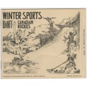
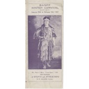
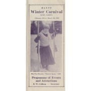
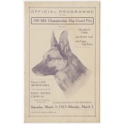
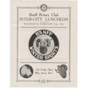
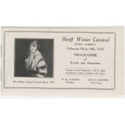
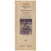
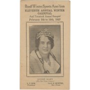
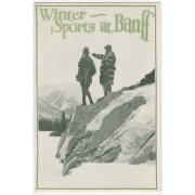
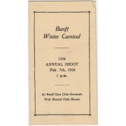
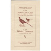
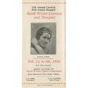
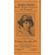
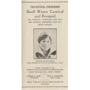
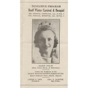
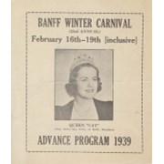
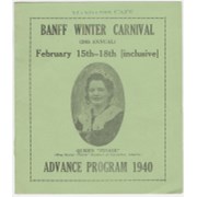
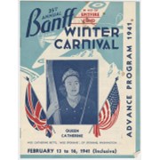
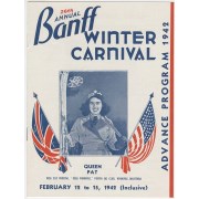
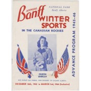
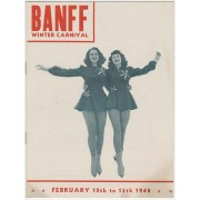
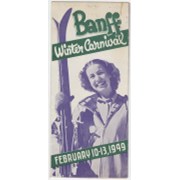
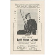
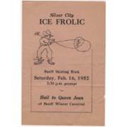
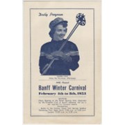
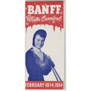
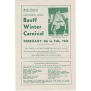
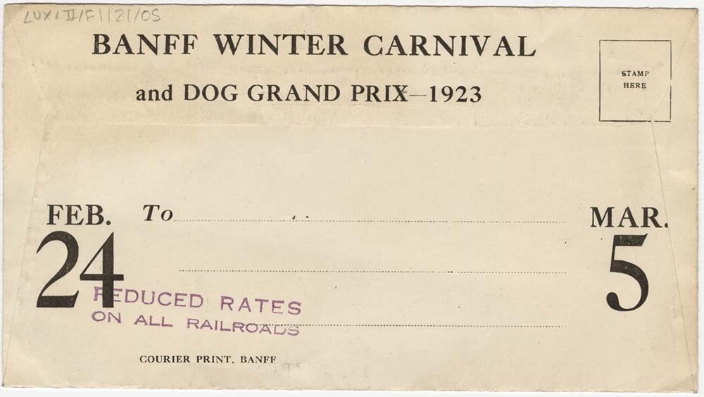
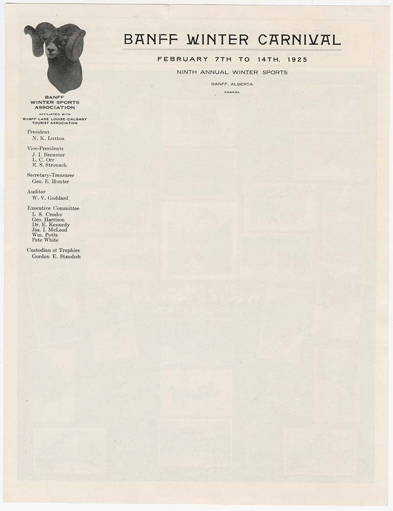
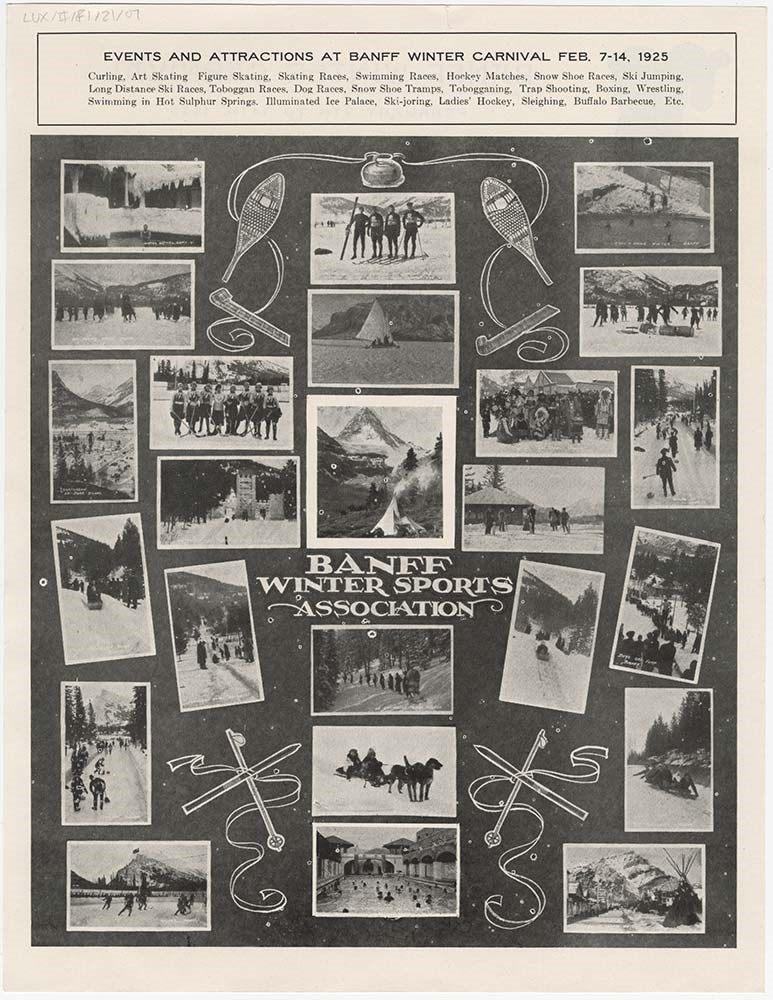
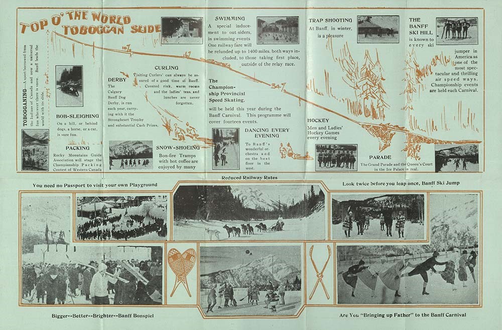
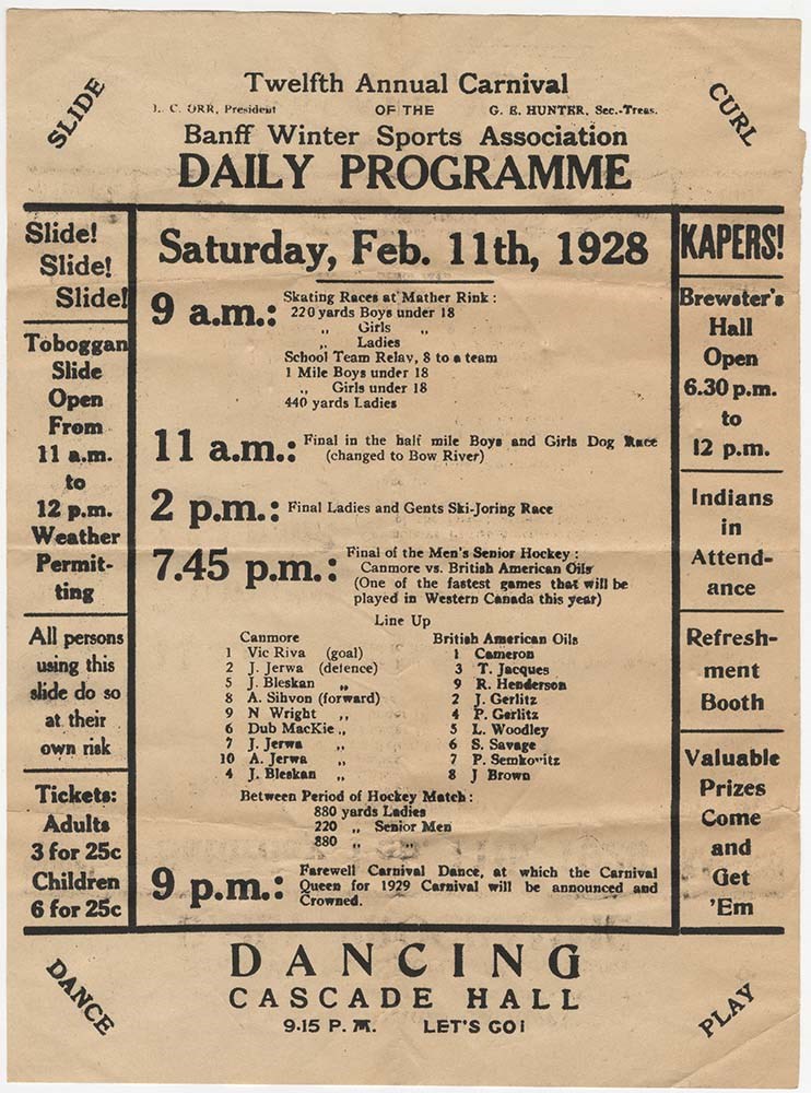
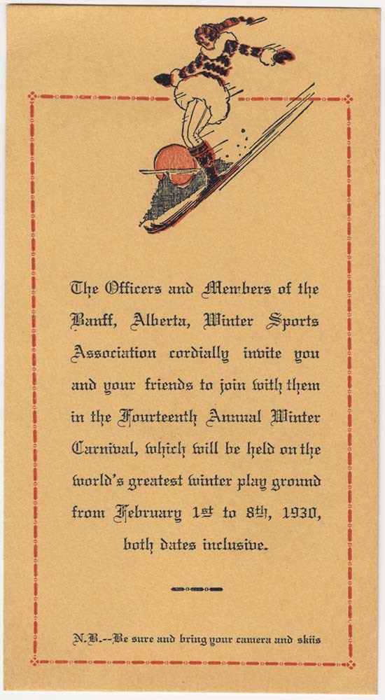
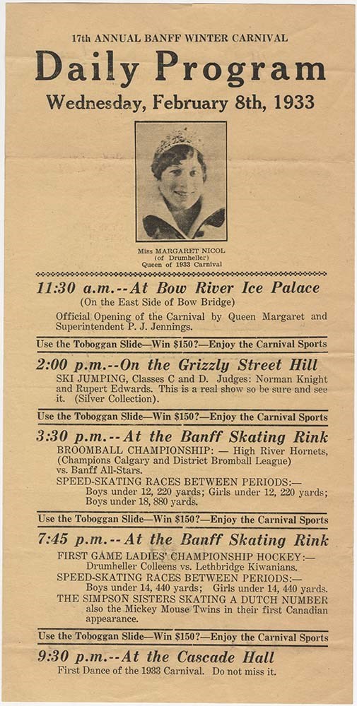
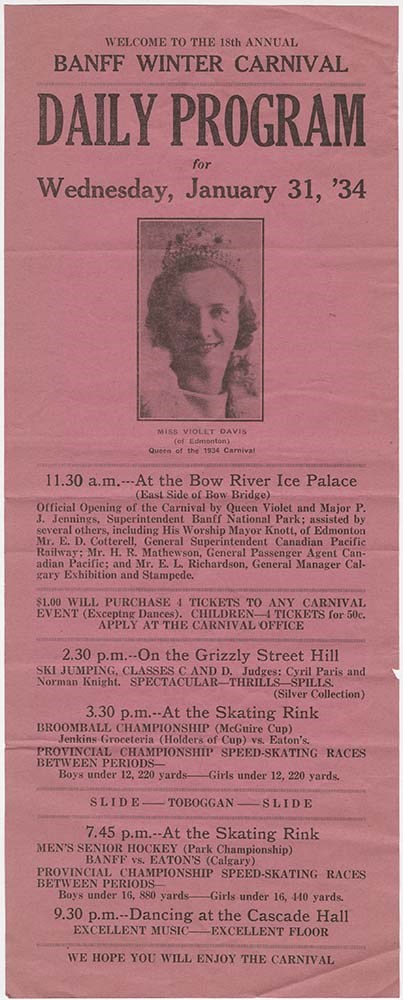
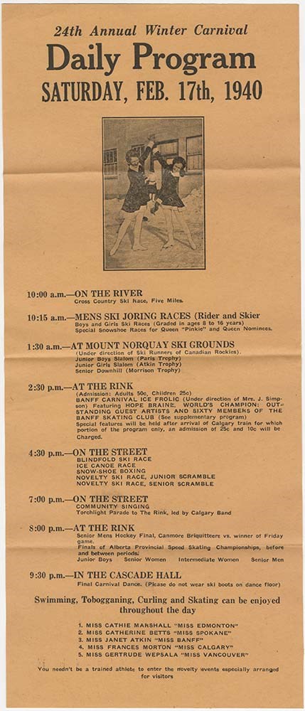
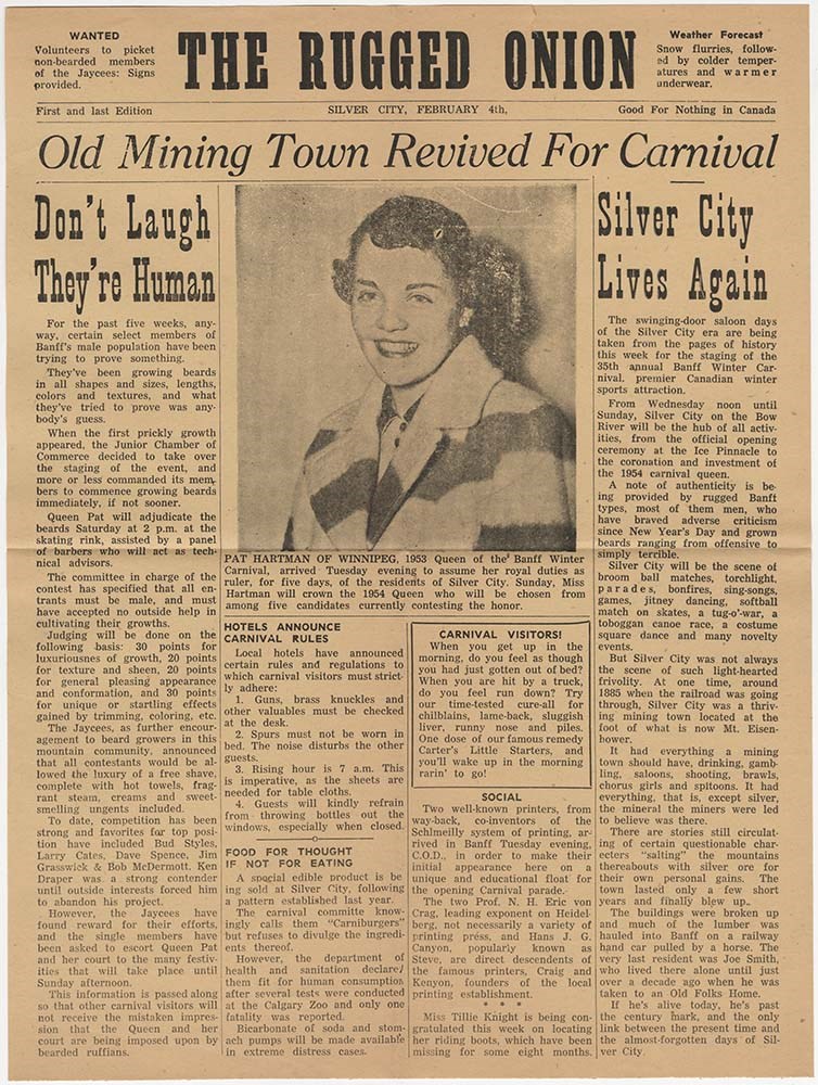
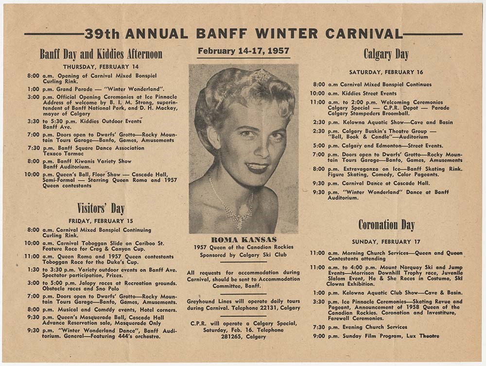
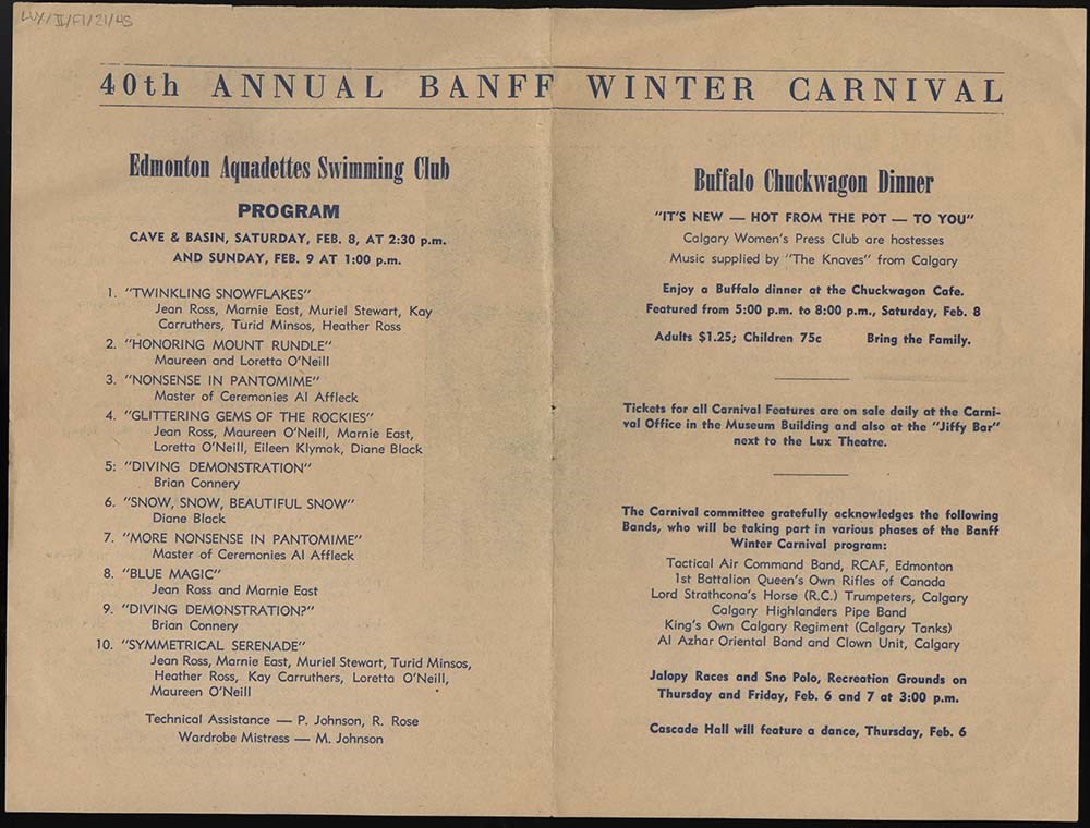
Banff Winter Carnival
https://archives.whyte.org/en/permalink/descriptions54715
- Part Of
- Luxton family fonds
- Scope & Content
- File consists of advertisements, programs, itineraries, information booklets and brochures pertaining to Banff Winter Carnival events held between 1921 and 1958, and an affiliated "Grand Prix" dog racing event in 1923. File also includes an invitation to a Banff Winter Carnival Homecoming Reunion e…
- Date Range
- 1921
- 1923
- 1925-1931
- 1933-1934
- 1939-1942
- 1944
- 1945
- 1946
- 1948-1958
- 1980
- Reference Code
- LUX / II / F1 / 21
- Description Level
- 5 / File
- GMD
- Textual record
- Published record
33 images
28 Electronic Resources
- Part Of
- Luxton family fonds
- Description Level
- 5 / File
- Fonds Number
- LUX
- Series
- LUX / II / F : Collected material
- Sous-Fonds
- LUX / II : Eleanor Luxton sous-fonds
- Sub-Series
- LUX / II / F1 : Textual
- Accession Number
- LUX
- Reference Code
- LUX / II / F1 / 21
- Date Range
- 1921
- 1923
- 1925-1931
- 1933-1934
- 1939-1942
- 1944
- 1945
- 1946
- 1948-1958
- 1980
- Physical Description
- 3 cm of textual records : 46 texts
- Scope & Content
- File consists of advertisements, programs, itineraries, information booklets and brochures pertaining to Banff Winter Carnival events held between 1921 and 1958, and an affiliated "Grand Prix" dog racing event in 1923. File also includes an invitation to a Banff Winter Carnival Homecoming Reunion event [1980].
- Notes
- Items in file are arranged chronologically
- File contains numerous duplicates, some of which have been temporarily removed from file
- Subject Access
- Advertising
- Banff Winter Carnival
- Community events
- Dogs
- Events
- Winter sports
- Sports and recreation
- Tourism
- Snowshoes and snowshoeing
- Skiing
- Ski racing
- Ski jumping
- Ice sculpture
- Skating
- Hunting
- Geographic Access
- Canada
- Alberta
- Banff
- Reproduction Restrictions
- Restrictions may apply
- Language
- English
- Conservation
- Some items in file have been placed in mylar
- Category
- Sports, recreation and leisure
- Title Source
- Title based on contents of file
- Processing Status
- Processed
Electronic Resources
Images


This material is presented as originally created; it may contain outdated cultural descriptions and
potentially offensive content.
Read more.
Big White Ski Resort
https://archives.whyte.org/en/permalink/descriptions54877
- Part Of
- Murray Hay fonds
- Scope & Content
- File consists of 2 prints : col ; 35 x 28 cm. File pertains to Murray Hay's rendering of the ski area at Big White Ski Resort in Kelowna, British Columbia. File includes two unlabelled, draft print reproductions of original paintings.
- Date Range
- ca.1976-ca.2000
- Reference Code
- V795 / II / A / iv / 5
- Description Level
- 5 / File
- GMD
- Map
- Private record
- Part Of
- Murray Hay fonds
- Description Level
- 5 / File
- Fonds Number
- M570 / V795
- Series
- V795 / II : Unpublished Material
- Sous-Fonds
- V795
- Sub-Series
- V795 / II / A : British Columbia / iv : Okanagan Area
- Accession Number
- 2019.41
- Reference Code
- V795 / II / A / iv / 5
- GMD
- Map
- Private record
- Date Range
- ca.1976-ca.2000
- Physical Description
- 2 prints : col. ; 35 x 28 cm
- Scope & Content
- File consists of 2 prints : col ; 35 x 28 cm. File pertains to Murray Hay's rendering of the ski area at Big White Ski Resort in Kelowna, British Columbia. File includes two unlabelled, draft print reproductions of original paintings.
- Name Access
- Hay, Murray
- Subject Access
- Ski Maps
- Map
- Cartography
- Ski area
- Tourism
- Tourist information
- Winter
- Winter sports
- Sports and recreation
- Big White Ski Area
- Art
- Artist
- Geographic Access
- Kelowna
- British Columbia
- Canada
- Language
- English
- Related Material
- M570 / III / A / v / 1
- Creator
- Hay, Murray
- Category
- Sports, recreation and leisure
- Title Source
- Title based on contents of file
- Processing Status
- Processed
This material is presented as originally created; it may contain outdated cultural descriptions and
potentially offensive content.
Read more.
Calgary Exhibition and Stampede
https://archives.whyte.org/en/permalink/descriptions54716
- Part Of
- Luxton family fonds
- Scope & Content
- File consists of published textual materials pertaining to Calgary Exhibition and Stampede events between 1912 and 1972. File includes cutout paper logos, books, brochures and pamphlets, "prize list and rules" booklets, informational content mailed to Eleanor Luxton [1928] empty branded Stampede en…
- Date Range
- 1912
- [1920-1930]
- 1924-1925
- 1927-1933
- 1935
- 1939
- 1943-1946
- [1945-1950]
- 1949
- 1951
- 1953
- 1955
- 1957-1959
- 1964
- 1972
- Reference Code
- LUX / II / F1 / 22
- Description Level
- 5 / File
- GMD
- Textual record
- Published record
- Postcard
- Organization record
- Part Of
- Luxton family fonds
- Description Level
- 5 / File
- Fonds Number
- LUX
- Series
- LUX / II / F : Collected material
- Sous-Fonds
- LUX / II : Eleanor Luxton sous-fonds
- Sub-Series
- LUX / II / F1 : Textual
- Accession Number
- LUX
- Reference Code
- LUX / II / F1 / 22
- Date Range
- 1912
- [1920-1930]
- 1924-1925
- 1927-1933
- 1935
- 1939
- 1943-1946
- [1945-1950]
- 1949
- 1951
- 1953
- 1955
- 1957-1959
- 1964
- 1972
- Physical Description
- 4 cm of textual records ; 6 cloth ribbons
- Scope & Content
- File consists of published textual materials pertaining to Calgary Exhibition and Stampede events between 1912 and 1972. File includes cutout paper logos, books, brochures and pamphlets, "prize list and rules" booklets, informational content mailed to Eleanor Luxton [1928] empty branded Stampede envelopes, blank pages with Stampede letterhead, and 6 cloth ribbons labelled "Native Daughter", "Pioneer" and "Pioneer Son" [n.d.].
- Notes
- File contains duplicates
- Some excess duplicates have been temporarily moved and may be de-accessioned in the future
- Name Access
- Luxton, Norman
- Luxton, Eleanor
- Subject Access
- Calgary Stampede
- Sports and recreation
- Souvenir
- Events
- Horses
- Horseback riding
- Hotel
- Anniversary
- Entertainment
- Advertising
- Parades
- Geographic Access
- Canada
- Alberta
- Calgary
- Reproduction Restrictions
- Restrictions may apply
- Language
- English
- Conservation
- One creased paper logo and all cloth ribbons from file have been placed in mylar sleeves
- Title Source
- Title based on contents of file
- Processing Status
- Processed
This material is presented as originally created; it may contain outdated cultural descriptions and
potentially offensive content.
Read more.
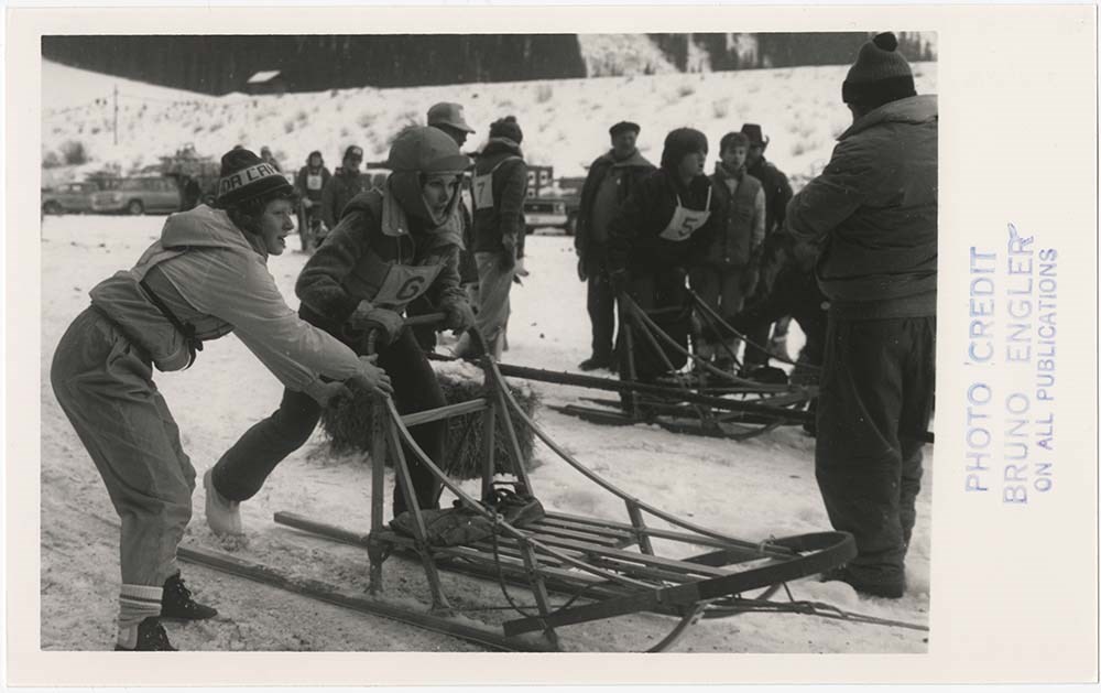
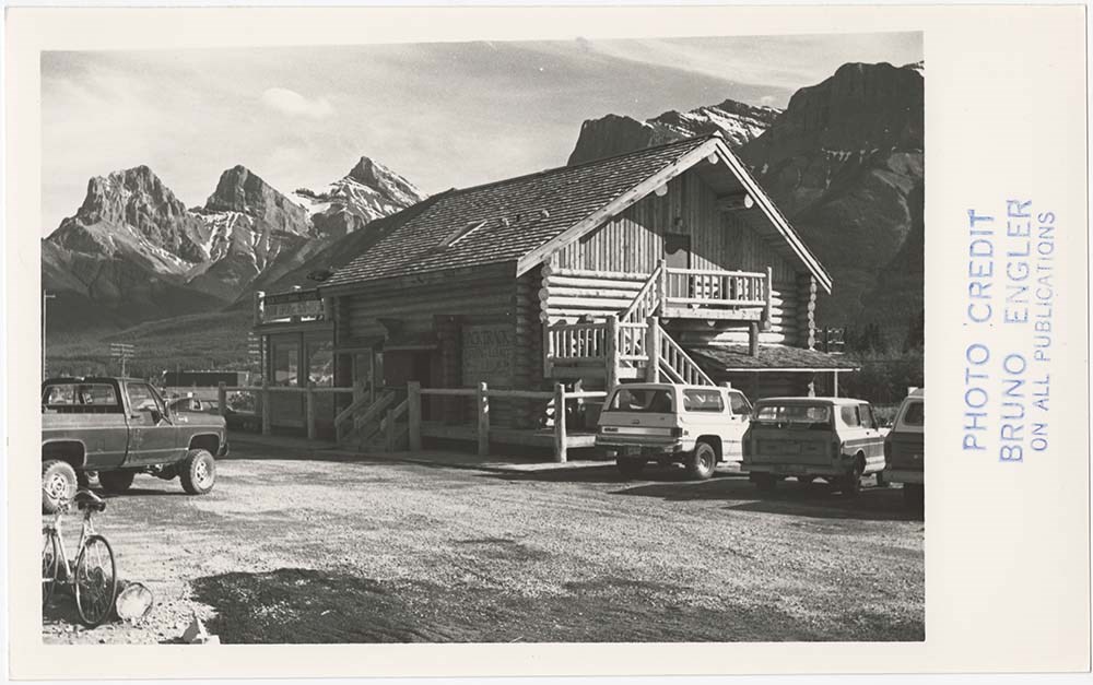
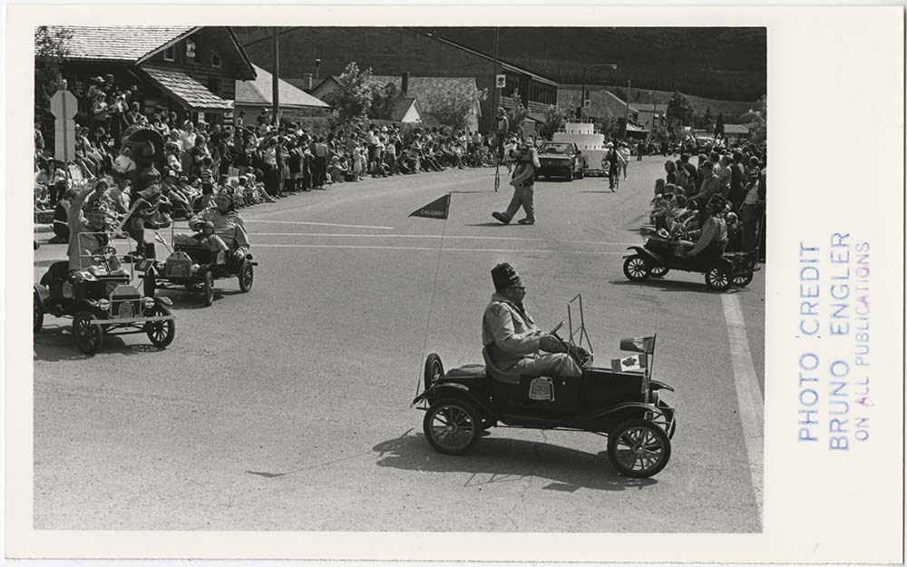
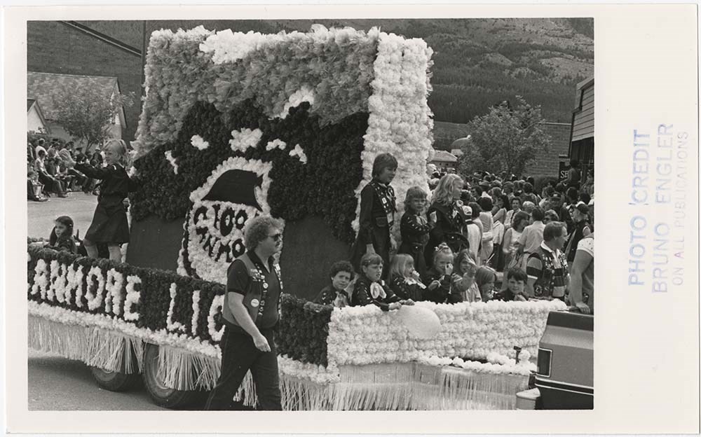
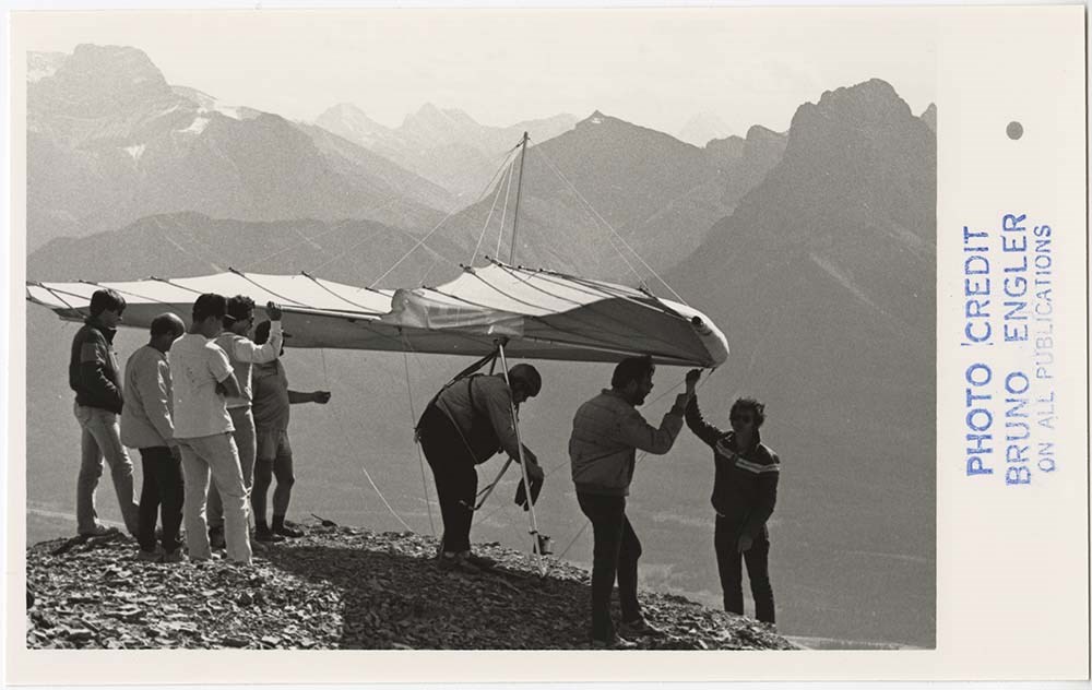
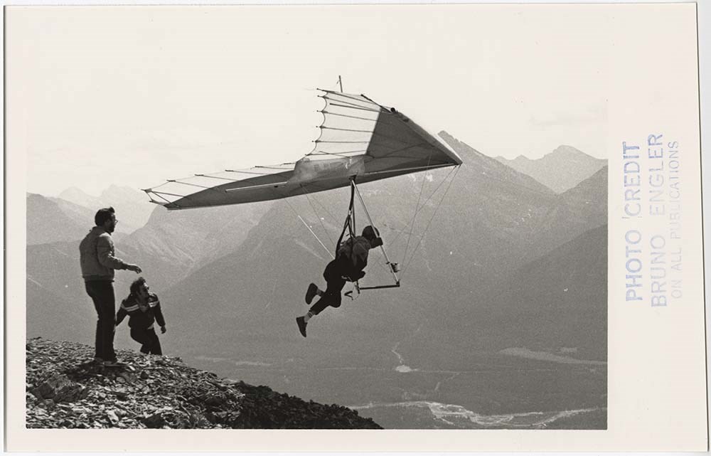
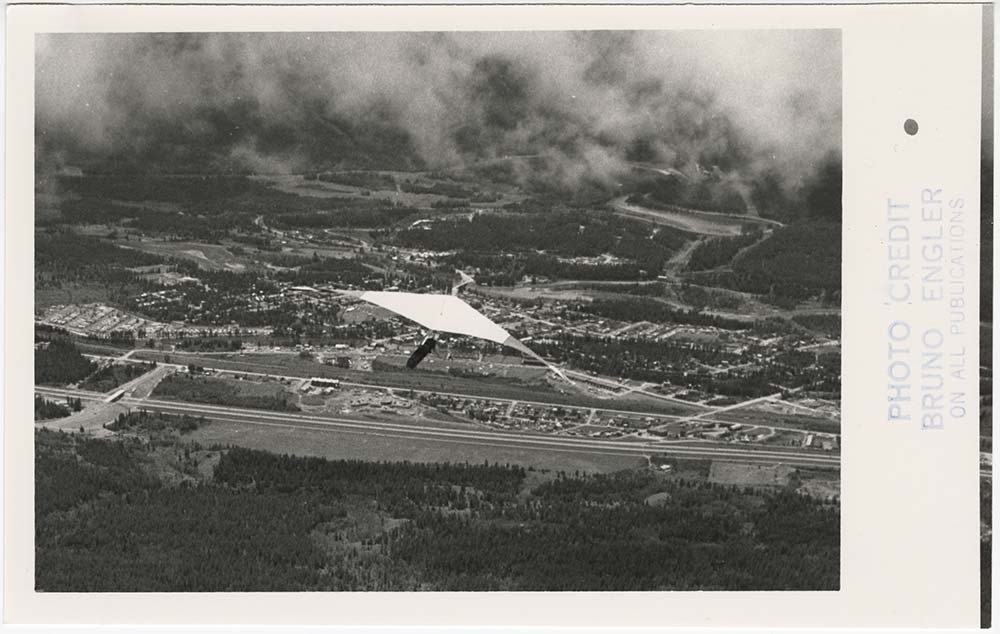
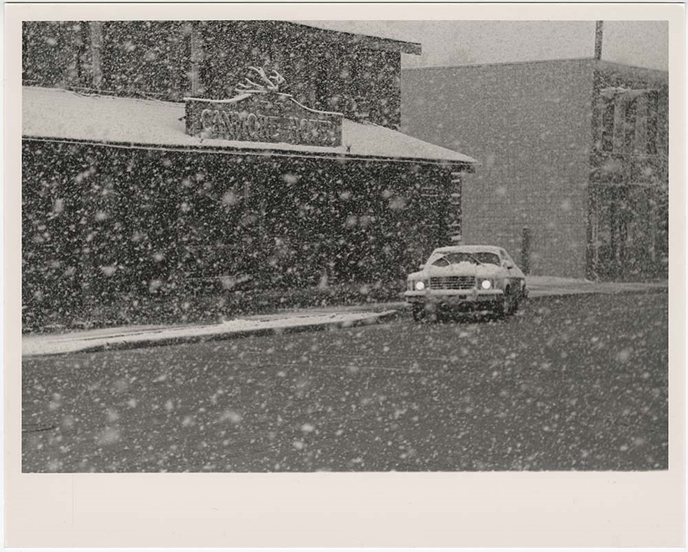
Canmore Events
https://archives.whyte.org/en/permalink/descriptions56875
- Part Of
- Bruno Engler fonds
- Scope & Content
- File pertains to 129 b&w prints of various Canmore events. Includes parades, dogsledding, biathlons, rodeos, various races, a man paragliding, various fires, the Canmore Centennial celebrations, Grassi Lakes, and interior shots of a building, possibly a new hospital.
- Date Range
- 1974-1992
- Reference Code
- V190 / VI / C / iii / PA - 01 to PA - 129
- Description Level
- 5 / File
- GMD
- Photograph
16 images
- Part Of
- Bruno Engler fonds
- Description Level
- 5 / File
- Fonds Number
- M323 / S40 / V190
- Series
- VI : Retained file, C : Alphabetical order
- Sous-Fonds
- V190
- Sub-Series
- iii : Canmore Events
- Accession Number
- 7436
- Reference Code
- V190 / VI / C / iii / PA - 01 to PA - 129
- GMD
- Photograph
- Date Range
- 1974-1992
- Physical Description
- 129 photographs : b&w ; 25.2 x 20.2 cm or smaller
- History / Biographical
- See fonds level description
- Scope & Content
- File pertains to 129 b&w prints of various Canmore events. Includes parades, dogsledding, biathlons, rodeos, various races, a man paragliding, various fires, the Canmore Centennial celebrations, Grassi Lakes, and interior shots of a building, possibly a new hospital.
- Subject Access
- Activities
- Airplanes
- Aerial photography
- Animals
- Automobiles
- Buildings
- Businesses
- Ceremony
- Children
- Community events
- Community life
- Cowboys
- Cross-country skiing
- Dog Teams
- Dogs
- Dogsledding
- Ducks
- Entertainment
- Family and personal life
- Fire
- Grassi Lakes
- Horses
- Mountains
- Olympic Games (Winter)
- Parade
- Public entertainment
- Public events
- Race
- Recreation
- Rodeo
- Scenery
- Ski areas
- Ski racing
- Sled dogs
- Sports and recreation
- Weather
- Winter
- Geographic Access
- Canmore
- Alberta
- Language
- English
- Creator
- Engler, Bruno
- Title Source
- Original title kept
- Processing Status
- Processed
Images


This material is presented as originally created; it may contain outdated cultural descriptions and
potentially offensive content.
Read more.
Cariboo Monashee Heli-Skiing
https://archives.whyte.org/en/permalink/descriptions54812
- Part Of
- Murray Hay fonds
- Scope & Content
- File consists of 1 cm of textual records, 28 x 21.5 cm. File pertains to maps related to the ski areas utilized by Helicopter Skiing Canada in Cariboo Monashee Country, created by Murray Hay. File includes reproductions of the maps in an individual promotional map with information on the back and a…
- Date Range
- ca. 1978 - ca. 1979
- Reference Code
- M570 / III / A / vii / 1
- Description Level
- 5 / File
- GMD
- Map
- Published record
- Textual record
- Part Of
- Murray Hay fonds
- Description Level
- 5 / File
- Fonds Number
- M570 / V795
- Series
- M570 / III : Murray Hay portfolio (published material)
- Sous-Fonds
- M570
- Sub-Series
- M570 / III / A : British Columbia / vii : Cariboo Monashee
- Accession Number
- 2019.41
- Reference Code
- M570 / III / A / vii / 1
- Date Range
- ca. 1978 - ca. 1979
- Physical Description
- 1 cm of textual records (28 x 21.5 cm)
- Scope & Content
- File consists of 1 cm of textual records, 28 x 21.5 cm. File pertains to maps related to the ski areas utilized by Helicopter Skiing Canada in Cariboo Monashee Country, created by Murray Hay. File includes reproductions of the maps in an individual promotional map with information on the back and a bound brochure (which also includes the map) promoting helicopter skiing.
- Notes
- Dates are approximate based on the ages of the daughter of Mike Wiegele (owner of Cariboo Monashee Helicopter Skiing Canada), who was born in 1970 and is aged 8 in the photographs included in the booklet.
- Name Access
- Hay, Murray
- Subject Access
- Ski Maps
- Skiing
- Ski touring
- Ski areas
- Helicopter skiing
- Cartography
- Tourism
- Tourist information
- Sports and recreation
- Travel
- Winter
- Winter sports
- Advertising
- Artist
- Geographic Access
- British Columbia
- Canada
- Monashee Mountains
- Cariboo Mountains
- Language
- English
- Title Source
- Title based on contents of file
- Processing Status
- Processed
This material is presented as originally created; it may contain outdated cultural descriptions and
potentially offensive content.
Read more.
Cartographic Materials
https://archives.whyte.org/en/permalink/descriptions23065
- Part Of
- Hans Gmoser fonds
- Scope & Content
- Cartographic materials in these four oversized files consist of the following:
- Date Range
- 1914-1973
- Reference Code
- M224 / O.S. Cartographic
- Description Level
- 5 / File
- Part Of
- Hans Gmoser fonds
- Description Level
- 5 / File
- Series
- IV.C. Textual records: Cartographic records
- Accession Number
- 7361, 7877, 8111
- Reference Code
- M224 / O.S. Cartographic
- Date Range
- 1914-1973
- Physical Description
- 48 cartographic records.
- Scope & Content
- Cartographic materials in these four oversized files consist of the following:
- Subject Access
- Discovery and Exploration
- Environment and Nature
- Family and personal life
- Sports and Recreation
- Title Source
- Title based on contents.
- Content Details
- Folder 1 Map on heavy paper, wrapped in plastic. “A Reconnaissance Topographic Map Suveyed and edited by Bradford Washburn” printed in Bern, Switzerland. Centred on Mt. McKinley.- From 7361. Palliser- Kananaskis Area British Columbia and Alberta- Publication No. 1962- Reprinted by the Surveys and Mapping Branch, Department of Mines and Technical Surveys, Ottawa. Mistaya British Columbia and Alberta- Compiled, drawn and printed at the office of the Surveyor General, Ottawa, 1931. Reprinted with corrections at the Surveys and Mapping Branch, Ottawa, 1950. National Topographic Series. Yoho British Columbia and Alberta- Compiled, drawn and printed at the office of the Surveyor General, Ottawa, 1932. Reprinted with corrections at the Surveys and Mapping Branch, Ottawa, 1952. National Topographic Series. Price 25 cents. Invermere British Columbia Kootenay Land District- National Topographic System- First Status Edition compiled and produced by the Geographic Division, Surveys, and Mapping Branch, Dept. of Lands, Forests and Water Resources, Victoria, BC 1964-65- annotated Beaton British Columbia Kootenay Land District- National Topographic System- First Status Edition compiled and produced by the Geographic Division, Surveys, and Mapping Branch, Dept. of Lands, Forests and Water Resources, Victoria, BC 1964-66- annotated Lardeau British Columbia Kootenay Land District- National Topographic System- First Status Edition compiled and produced by the Geographic Division, Surveys, and Mapping Branch, Dept. of Lands, Forests and Water Resources, Victoria, BC 1963- annotated Mount McKinley Alaska, Published by the Museum of Science, Boston, Mass, USA and the Swiss Foundation for Alpine Research, Zurich. 1960. Centennial Range Yukon Territory- M.C.R. 7 Edition 1- Produced and printed 1967 by the Surveys and Mapping Branch, Department of Energy, Mines and Resources- maps printed in 1961-62- annotated British Columbia Land Recording Dists.- Land Commissioner’s Offices- Department of Lands and Forests- first published 1957- Updated Nov. 1, 1960. Master Site Plan Bugaboo Creek Lodge Project number 6844- June 18, 1973- Cohos Delesalle & Evamy. Folder 2 Boundary Between Alberta and BC- Athabasca Pass- Sheet No. 27A – annotated- centered on Jasper Park Boundary Between Alberta and BC-All below Wheeler Maps (by hand) used for the Great Divide as per Chic-no topographical maps used for both Hans and similar maps were used by Chic bottom rip taped- Sheet No. 20- Drawn and printed by the Topographical Survey of Canada, Ottawa - centered on Clearwater forest and Lyell Icefield at bottom right Boundary Between Alberta and BC- Sheet No. 15- Drawn and printed at the Surveyor General’s Office, Ottawa, Canada- centered on Rocky Mountains Park Boundary Between Alberta and BC - Sheet No. 19- Drawn and printed at the Surveyor General’s Office, Ottawa, Canada- centered on centered on Clearwater Forest with Mt. Alan Campbell at bottom Boundary Between Alberta and BC- Sheet No. 25- annotated- Drawn and printed by the Topographical Survey of Canada, Ottawa - centered on Jasper Park with Chisel Peak at bottom Boundary Between Alberta and BC- Sheet No. 19- dirt and annotated- revised 1925- drawn and printed by the Topographical Survey of Canada, Ottawa- centered on Clearwater and Push Pass W. Boundary Between Alberta and BC- annotated- Sheet 16- revised 1925- drawn and printed by the Topographical Survey of Canada, Ottawa- centered on Yoho Park and Rocky Mountains Park Steele Glacier- Topographical Survey 1967 Arial Photography 1951 Mount St. Elias Canada- United State of America- Produced and Printed by the Surveys and Mapping Branch, Department of Mines and Technical Surveys 1962 from air photographs taken in 1951 and 1956- annotated Woolsey Glacier- Revelstoke National Park British Columbia – Printed by the Surveys and Mapping Branch Department of Energy, Mines and Resources- 1967 Windermere Kootenay District- Map 165A Issued 1918- Reprinted by the Surveys and Mapping Branch, Department of Mines and Technical Surveys, Ottawa. Folder 3 Boundary Between Alberta and BC- Sheet No. 20- heavily annotated- revised 1925- drawn and printed by the Topographical Survey of Canada, Ottawa- centered on Clearwater Forest, Saskatchewan Glacier at top left Boundary Between Alberta and BC- Sheet No. 18- heavily ripped- annotated - notes on back- revised 1925- drawn and printed by the Topographical Survey of Canada, Ottawa- centered on Clearwater Forest, Mt Mummery at bottom Boundary Between Alberta and BC- Sheet No. 17 (in pencil “A and B”)- annotated - heavily ripped- drawn and printed at the Surveyor Generals’ Office- centered on Clearwater Forest and Yoho Park Boundary Between Alberta and BC- Sheet No. 26- annotated- revised 1925- drawn and printed by the Topographical Survey of Canada, Ottawa- centered on Jasper Park and Icefields Boundary Between Alberta and BC- Sheet No. 17- revised 1925- drawn and printed by the Topographical Survey of Canada, Ottawa- centered on Clearwater Forest and Yoho Park Boundary Between Alberta and BC- Sheet No. 28- stained- centered on Jasper Park Boundary Between Alberta and BC- Sheet No. 24- annotated- revised edition, 1925- drawn and printed by the Topographical Survey of Canada, Ottawa- centered on Jasper Park Boundary Between Alberta and BC- Sheet No. 16- annotated- revised 1925- drawn and printed by the Topographical Survey of Canada, Ottawa- centered on Yoho and Rocky Mountains Park Interprovincial Boundary Commission Boundary Between Alberta and British Columbia. Revised edition 1925 drawn and printed by the Topographical Survey of Canada, Ottawa. Sheet No. 27. Following maps are from accession 7877. Interprovincial Boundary Commission Boundary Between Alberta and British Columbia. Surveyed 1920. Drawn and printed by the Topographical Survey of Canada, Ottawa. Sheet No. 26. Interprovincial Boundary Commission Boundary Between Alberta and British Columbia. Surveyed 1920, 1921. Drawn and printed by the Topographical Survey of Canada, Ottawa. Sheet No. 25. Interprovincial Boundary Commission Boundary Between Alberta and British Columbia. Surveyed 1919, 1921. Drawn and printed by the Topographical Survey of Canada, Ottawa. Sheet No. 24. Interprovincial Boundary Commission Boundary Between Alberta and British Columbia. Revised edition 1925 drawn and printed by the Topographical Survey of Canada, Ottawa. Sheet No. 21. Interprovincial Boundary Commission Boundary Between Alberta and British Columbia. Revised edition 1925 drawn and printed by the Topographical Survey of Canada, Ottawa. Sheet No. 18. Interprovincial Boundary Commission Boundary Between Alberta and British Columbia. Surveyed 1913. Drawn and printed by the Topographical Survey of Canada, Ottawa. Sheet No. 13 A. Interprovincial Boundary Commission Boundary Between Alberta and British Columbia. Surveyed 1916. Drawn and printed by the Topographical Survey of Canada, Ottawa. Sheet No. 12 A. Interprovincial Boundary Commission Boundary Between Alberta and British Columbia. Surveyed 1916. Drawn and printed by the Topographical Survey of Canada, Ottawa. Sheet No. 11. Interprovincial Boundary Commission Boundary Between Alberta and British Columbia. Surveyed 1916. Drawn and printed by the Topographical Survey of Canada, Ottawa. Sheet No. 10. Interprovincial Boundary Commission Boundary Between Alberta and British Columbia. Surveyed 1916. Drawn and printed by the Topographical Survey of Canada, Ottawa. Sheet No. 9. Interprovincial Boundary Commission Boundary Between Alberta and British Columbia. Surveyed 1916. Drawn and printed by the Topographical Survey of Canada, Ottawa. Sheet No. 8. Interprovincial Boundary Commission Boundary Between Alberta and British Columbia. Surveyed 1916. Drawn and printed by the Topographical Survey of Canada, Ottawa. Sheet No. 6. Interprovincial Boundary Commission Boundary Between Alberta and British Columbia. Surveyed 1915. Drawn and printed by the Topographical Survey of Canada, Ottawa. Sheet No. 5. Interprovincial Boundary Commission Boundary Between Alberta and British Columbia. Surveyed 1914. Drawn and printed by the Topographical Survey of Canada, Ottawa. Sheet No. 4. Interprovincial Boundary Commission Boundary Between Alberta and British Columbia. Surveyed 1922. Drawn and printed by the Topographical Survey of Canada, Ottawa. Sheet No. 31. Interprovincial Boundary Commission Boundary Between Alberta and British Columbia. Surveyed 1922, 1924. Drawn and printed by the Topographical Survey of Canada, Ottawa. Sheet No. 30. Interprovincial Boundary Commission Boundary Between Alberta and British Columbia. Surveyed 1917. Drawn and printed by the Topographical Survey of Canada, Ottawa. Sheet No. 29.
- Processing Status
- Processed
This material is presented as originally created; it may contain outdated cultural descriptions and
potentially offensive content.
Read more.